Wildfires in Canada
Alberta, Prairie Provinces | Western Canada
Dates of acquisition:
September 22nd, 2023 | 19:18:25 UTC
September 23rd, 2023 | 18:43:15 UTC
Sensors: Sentinel-2A L2A, Sentinel-3A OLCI, Sentinel-5P AER_AI
Coordinates: ca. 58°N, 118°W
We already reported on forest fires in Canada in May and June. In September, the wildfires in the border area between Alberta, British Columbia, and the Northeast Territories (Figure 1) continued to spread over large areas.
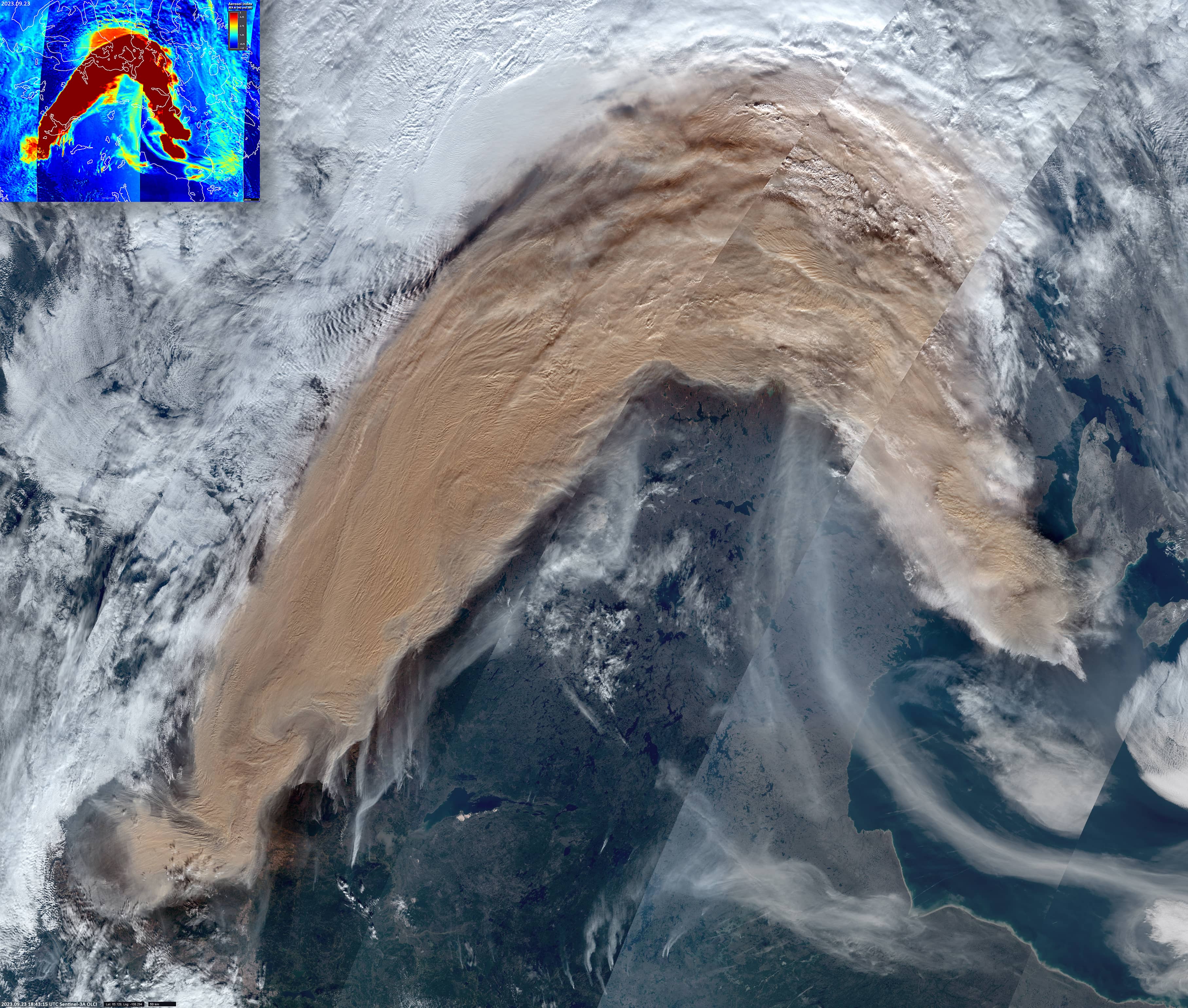
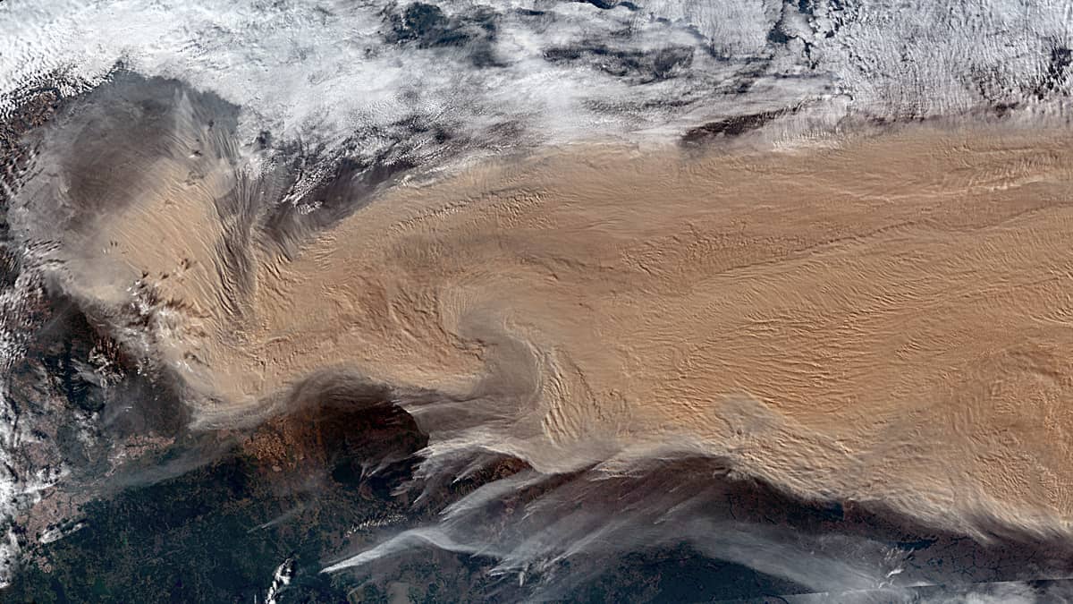
On September 23, an arc-shaped smoke plume more than 3,600 km long and covering an area of more than 1.3 million km2 was observed (Figure 2). This plume is larger than the territories of the UK, France and Germany combined. On September 24, the plume extended more than 7,200 kilometers eastwards, covering an area of about 3 million km2 (slightly more than the entire territory of Argentina).
The cloud of black carbon particles, known as soot, continued to move eastwards without losing any of its density, crossing the Atlantic Ocean and reaching Western Europe on September 27 and 28. By October 2, it had already reached the Urals, where it dissipated.
During this time, it was transported more than 6,600 km in a straight line, carrying a huge amount of aerosol across the Atlantic to Europe (Figure 3, animation).
Fig. 1
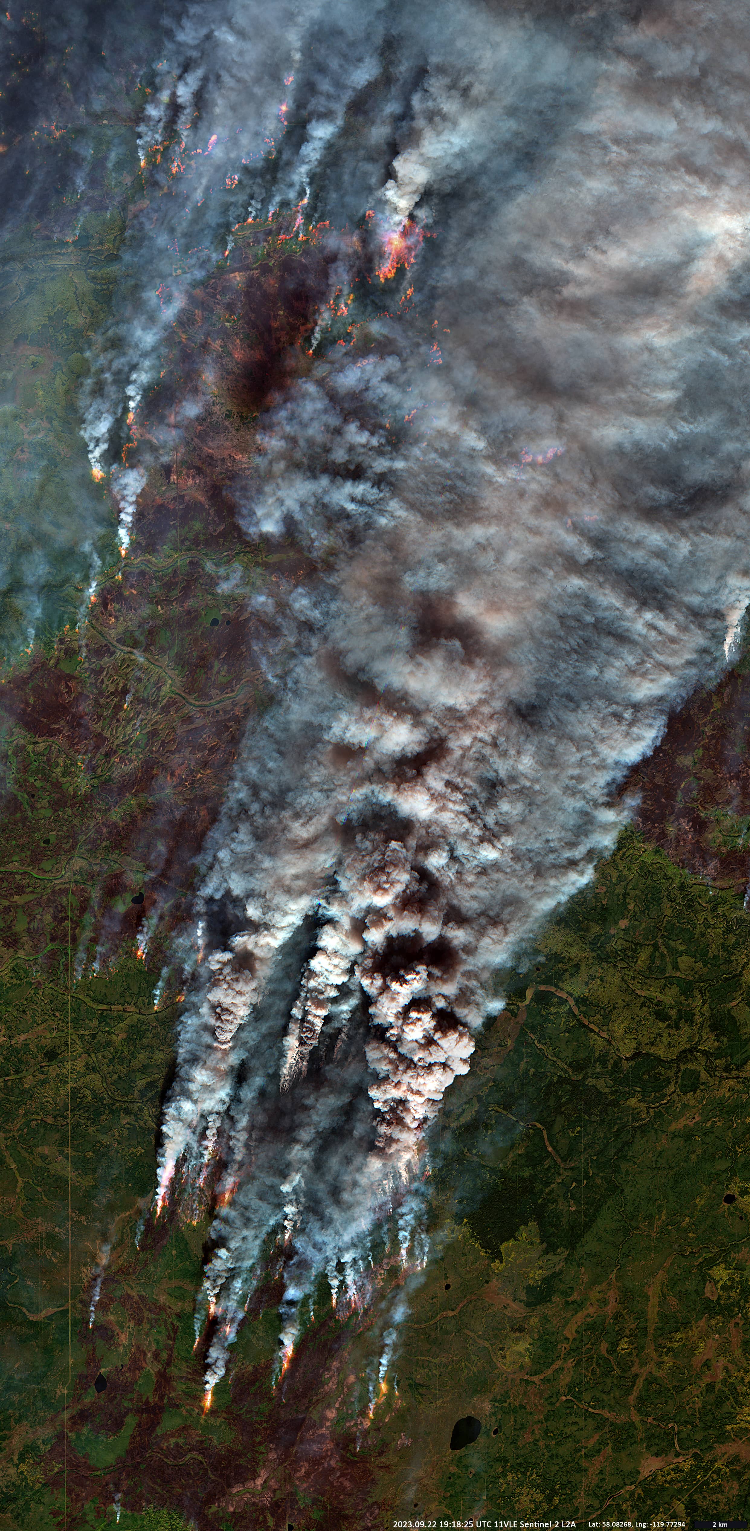
Fig. 2