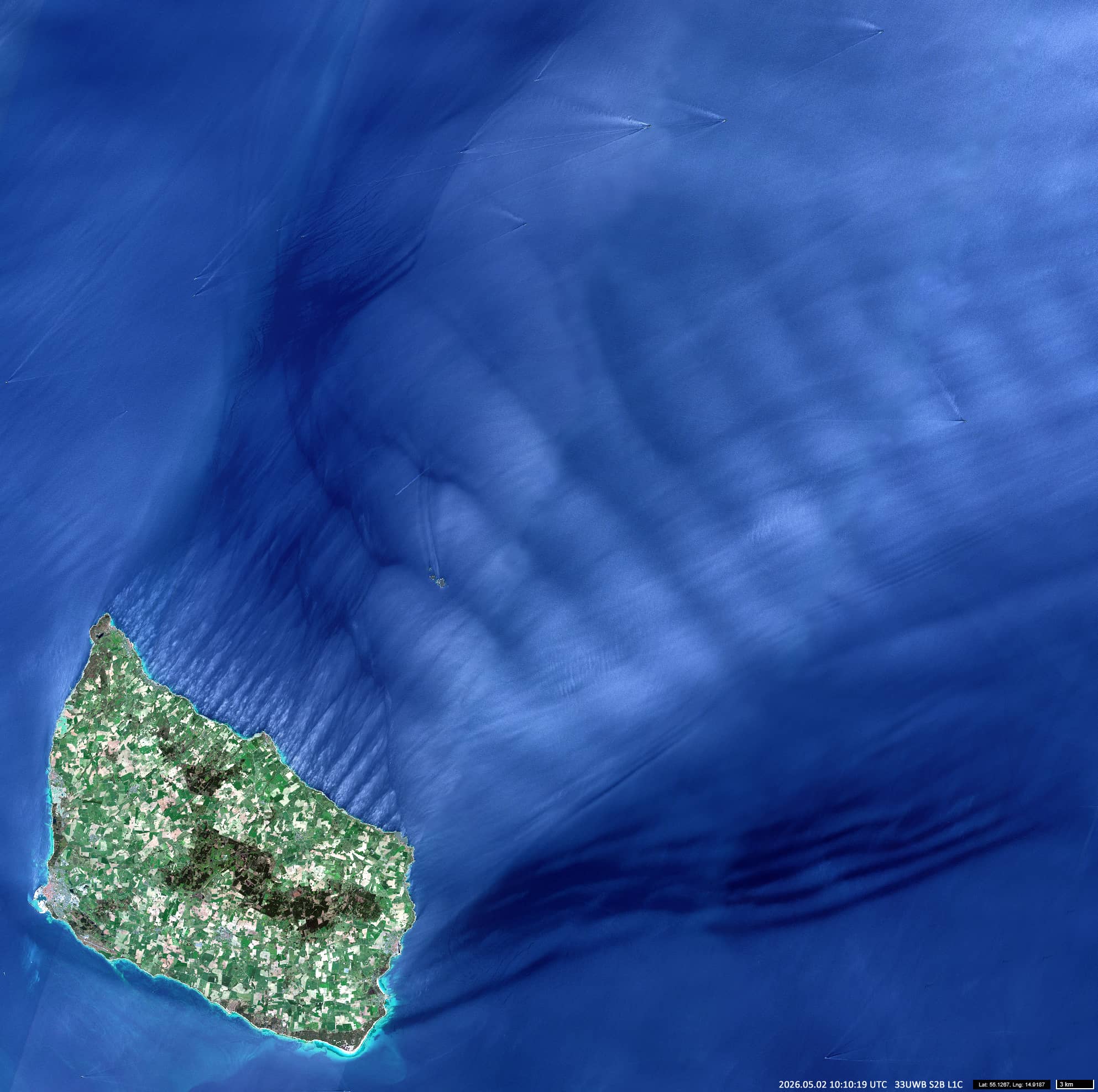
Wind over Bornholm
Western Baltic Sea
Date of acquisition: May 02nd, 2026 | 10:10:19 UTC
Sensors: Sentinel-2B L1C
Coordinates: ca. 55.1°N, 14.9°E
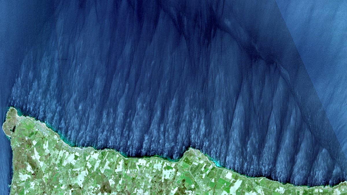
The Danish Island of Bornholm is located in the western Baltic Sea. The north-eastern and central parts of the island are formed by a plateau reaching heights of up to 160 metres, rising above the south-western lowlands and sloping steeply down towards the northern coast.
On 2 May, a steady south-westerly wind blew over the island at a speed of around 20(±5) km/h. As the air mass rose over the plateau, which acted as an orographic barrier, the disturbed flow generated atmospheric gravity waves over the sea downstream, with wave fronts running parallel to the coastline. At the wave troughs, where the oscillatory motion approached the sea surface, local disturbances led to slight roughening of the surface (waves formation).
In addition, the air currents cooled slightly as they crossed the island and were then transported out to sea, where they entered a comparatively warmer marine boundary layer. In this environment, the vertical transport of heat and moisture favoured the formation of relatively stable longitudinal vortices within the atmospheric boundary layer. These vortex structures ran approximately perpendicular to the coastline and therefore perpendicular to the gravity wave fronts. Circulating near the surface, they also modulated the roughness of the sea surface.
The combination of these two processes resulted in a distinctive, quasi-checkerboard pattern of surface wave modulation, resembling an arrangement of tightly packed cushions, which was clearly visible detectable in satellite observations.
Further reading
Bornholm (Wikipedia)
Bornholm topographic map (topographic-map.com)
Gravity Waves (Cloud Description, Brockmann Consult)
Convection Cells Streets (Cloud Structures, Brockmann Consult)