Golfo de Morrosquillo
Northern Colombia
Date of acquisition: March 26th, 2026 | 15:36:29 UTC
Sensor: Sentinel-2B L2A
Coordinates: ca. 9.5°N, 75.75°W
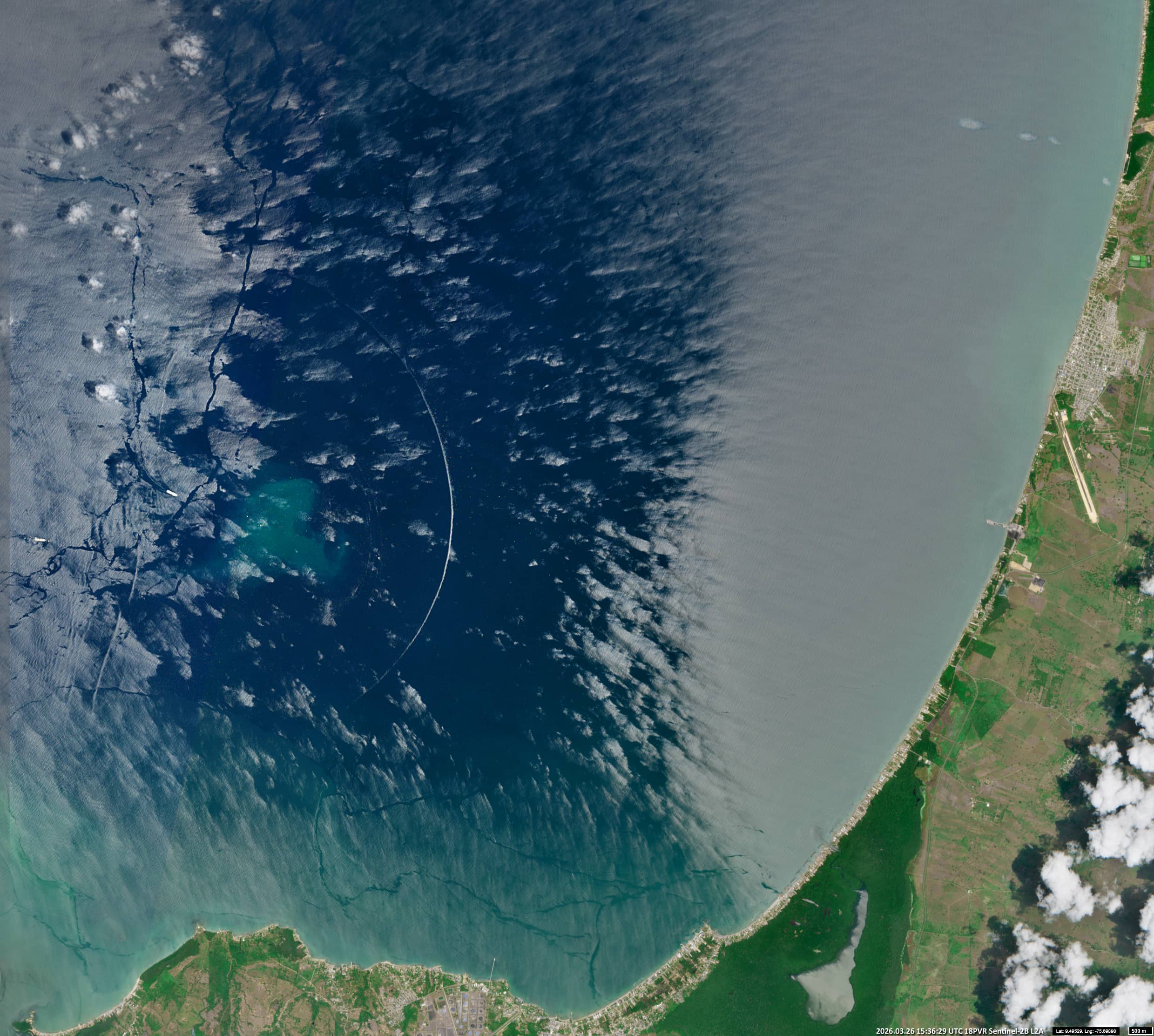
An interesting event took place at the end of March in the Golfo de Morrosquillo, which is located off the north coast of Colombia in the southern Caribbean, between the departments of Sucre and Córdoba.
At this time of year, the region lies within a sunglint area – an optical phenomenon in which sunlight is reflected directly from the water’s surface into a satellite sensor. Under light wind conditions, this creates bright, mirror-like patches on the water.
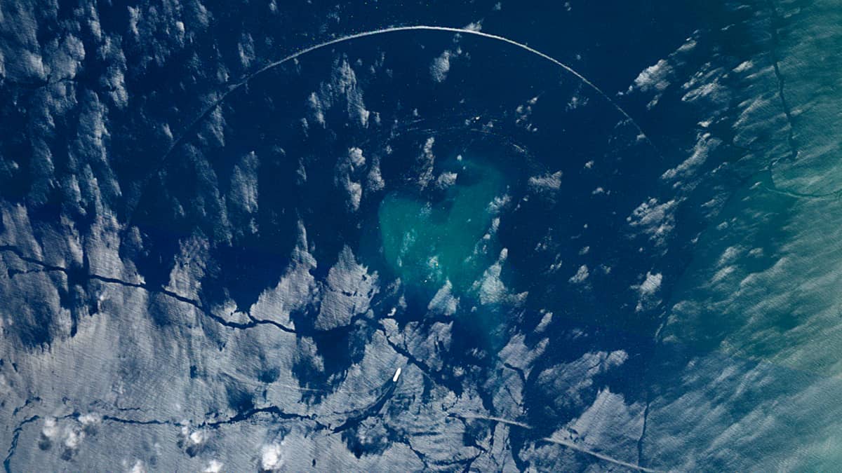
In the situation shown in the image, a layer of cold air lying above a warmer layer broke through the lower boundary and spread across the sea surface toward the coast of the bay. This was accompanied by strong winds. These gusts caused waves on the sea surface, altering the angle of the sun’s reflection and “neutralizing” the glare, thereby revealing a broad strip of blue seawater.
At the same time, a single, almost perfectly spherical wave (with a wavefront radius of approximately 5.3 km and a wavefront length of around 12.3 km) became visible in this area. Its narrow surface, located within the sunglint zone, reflected the sunlight, making it stand out clearly against the darker ocean background.
So where did such a perfect wave come from?
It turns out that the centre of the wave’s arc coincides almost perfectly with “Monoboya TLU 1” – a mooring buoy for tanker terminals used by cargo ships (bulk carriers and tankers) arriving at the nearby ports in the bay. This point (TLU 1: 9.4961°N, 75.7375°W) is locaed directly in front of the bow of a 215-metre long ship, which is clearly visible in the image. The cause of this unique wave is, of course, to be found here.
Further reading
Gulf of Morrosquillo (Wikipedia)
Numerical modeling of oil spills in the Gulf of Morrosquillo, Colombian Caribbean (Research Gate)
Monoboya TLU 1/ (CaribBSA)
Offshore Monobuoy Maintenance (Buzca)