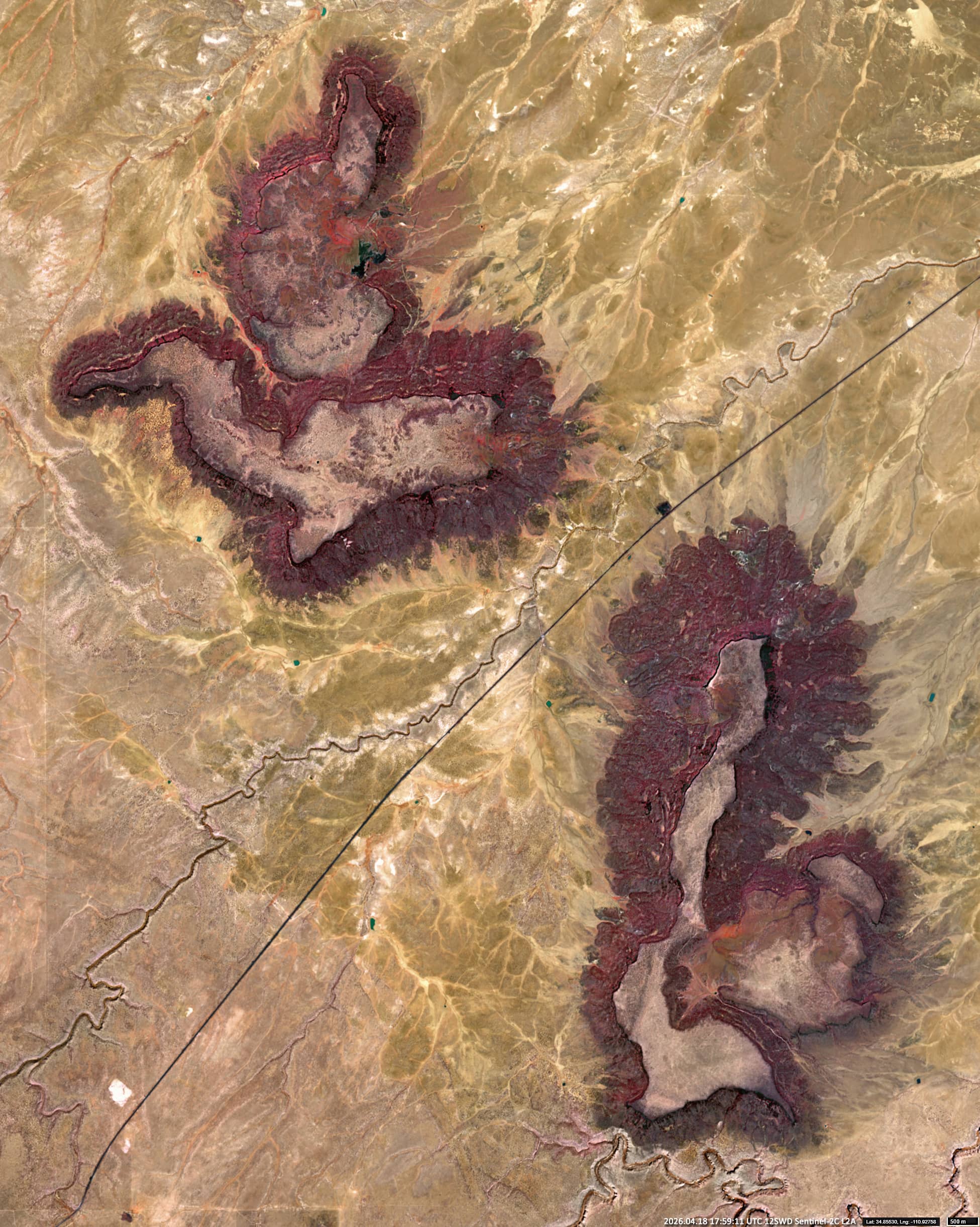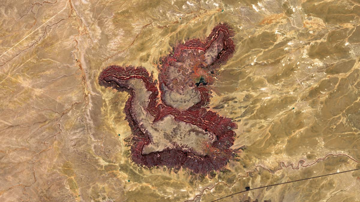
The Sunset Mountains
Coconino County | Arizona, USA
Sensor: Sentinel-2C L2A
The Sunset Mountains comprise two small plateaus in the US state of Arizona: East Sunset Mountain (2,089 m) and West Sunset Mountain (2,013 m). They lie along the Little Colorado River valley. With their reddish-brown layers of siltstone and sandstone indicating a high concentration of iron oxides (haematite and limonite), these mountains form striking topographical features on the Colorado Plateau. They are the eroded remains of ancient plateaus, shaped by long-term weathering and the erosion of sedimentary layers by wind and water.
The red, purple and yellow hues, reminiscent of a sunset, are particularly visible on eroded surfaces, creating striking silhouettes and enhancing the impression of a sunset, especially in low sunlight. The basalt-covered peaks, remnants of Miocene volcanic activity, provide structural contrast to the surrounding plains.
Remote sensing images reveal that the erosion morphology of these plateaus produces pareidolic patterns. From space, they resemble images of mysterious, almost mythical creatures. The western Sunset Formation, in particular, resembles a horse with outstretched wings.
Further reading
Sunset Mountains (Arizona) (Wikipedia)
Sunset Mountains (Arizona) (Grokipedia)
West Sunset Mountain (PeakVisor)
West Sunset Mountain (Peakery)