The collapse of the iceberg A-76A
Drake Passage – Weddell Sea | Antarctica
Date of acquisition: June 3rd, 2023 | 11:57:03 UTC
Sensors. Sentinel-3B SLSTR, MODIS AQUA
Coordinates: 55.15°S, 37.6°’W
A-76 was the world’s largest iceberg in 2021-2022. It broke off from the Filchner Ice Shelf in West Antarctica in late spring 2021 and was identified as iceberg A-76 in mid-May. Its original surface was 4,320 km². After hitting the Weddell Sea, the iceberg almost immediately split into 3 parts, with the largest A-76A measuring approximately 135 × 26 km and covering an area roughly twice the size of London. Despite the long journey, the size of the iceberg did not change significantly throughout its existence.
Finally, the iceberg passed the east coast of the Antarctic Peninsula and entered the Drake Passage and thus the Circumpolar Current. Once an iceberg enters the Antarctic Circumpolar Current, it tends to move eastwards, driven by both the current and the wind. In addition, the Coriolis force pushes the iceberg slightly northwards. Iceberg A-76A thus rotated in a horizontal plane and began to approach the island of South Georgia, southwest of which it broke into several relatively small pieces within a week about 100 nautical miles from the coast. In other words, it existed as a single entity for exactly two years.
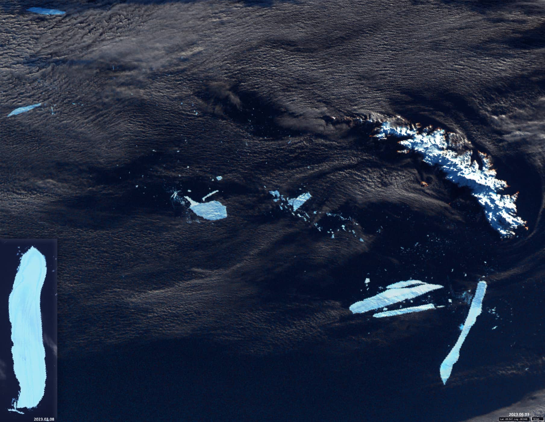
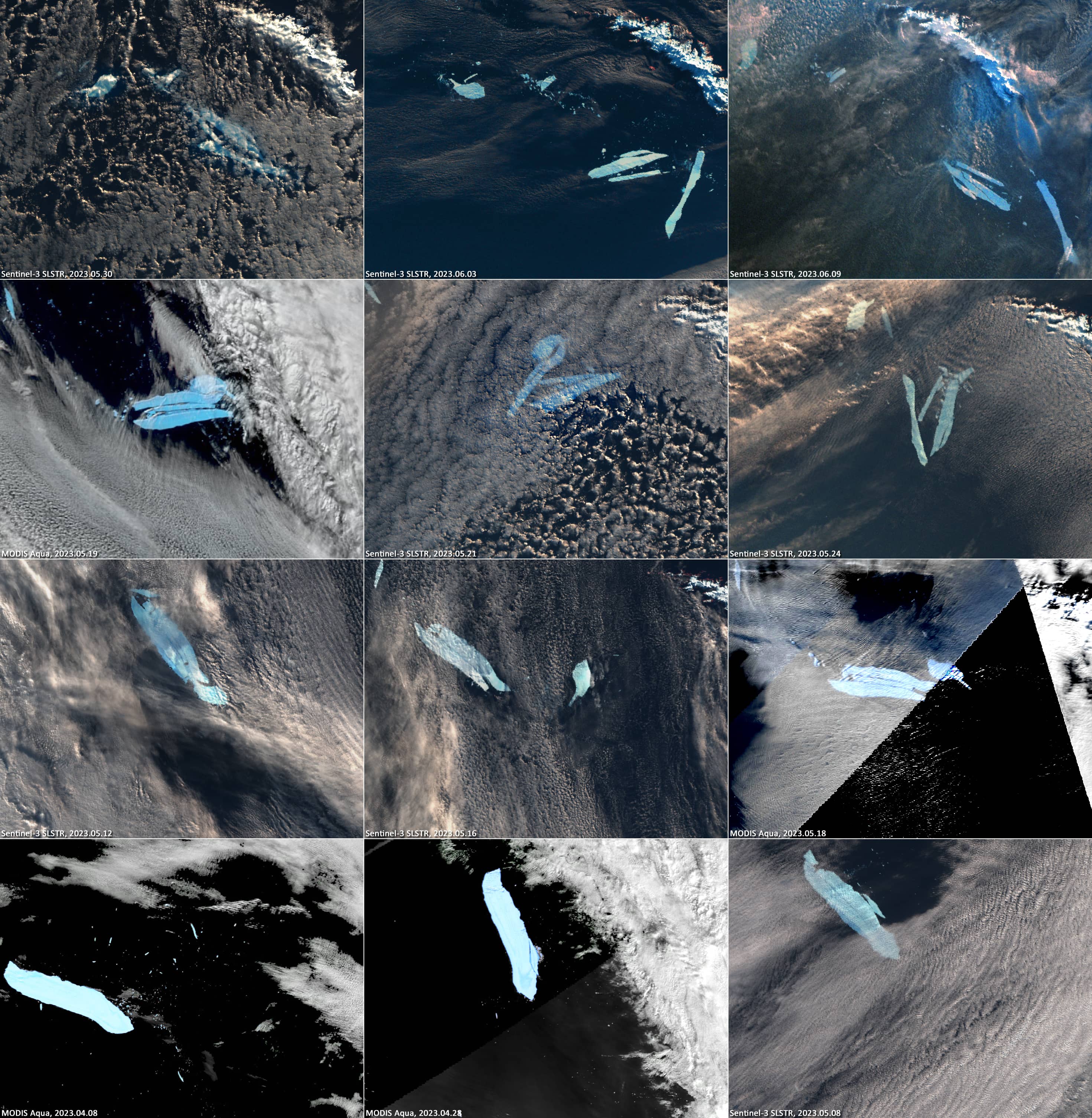
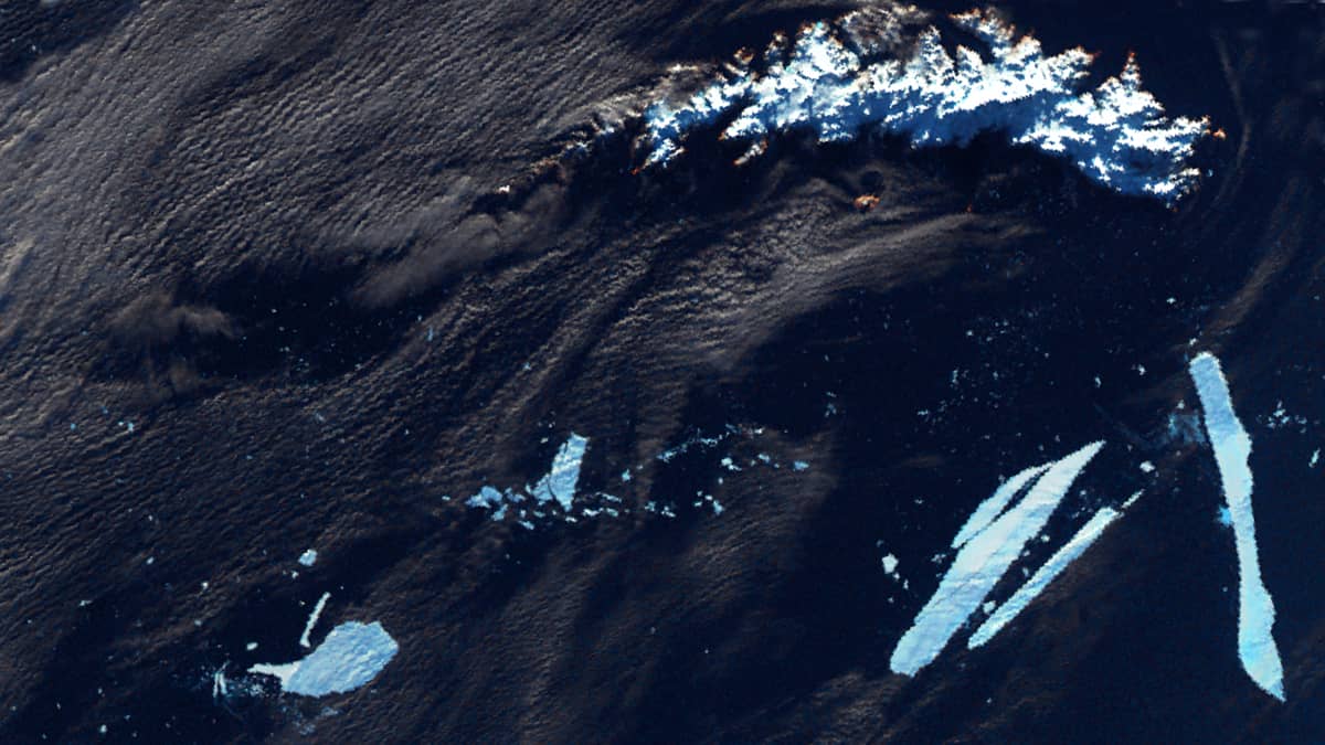
The Sentinel-3 SLSTR image presented here shows the moment of passage of the remains of the collapsed iceberg A-76A southwest of South Georgia. The shape of the iceberg two months ago can be seen In the lower left corner of the image (for comparison). Also shown are 12 images of the disintegration process of A-76A (132 × 25km → 78 × 11km) during the last 1.5 months of its existence are shown (from left to right, bottom to top). The images were acquired by the Sentinel-3 SLSTR and MODIS AQUA satellites. Despite the presence of clouds, the decay process can be followed with sufficient accuracy.
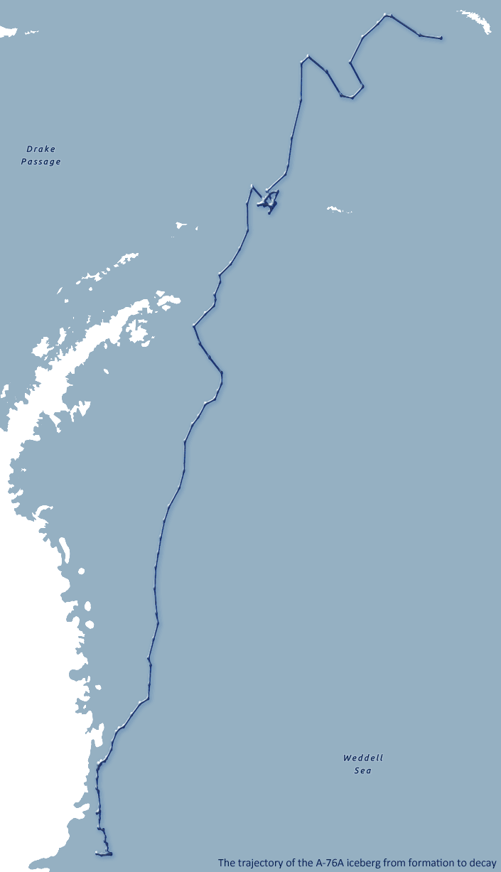
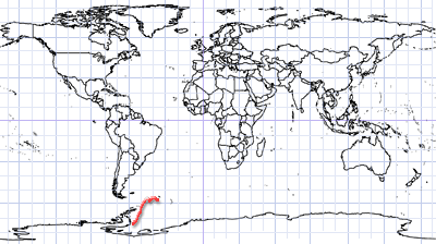
The trajectory of the A-76A iceberg from birth to collapse is also shown. The graphic is based on numerical data from the US National Ice Center (USNIC).