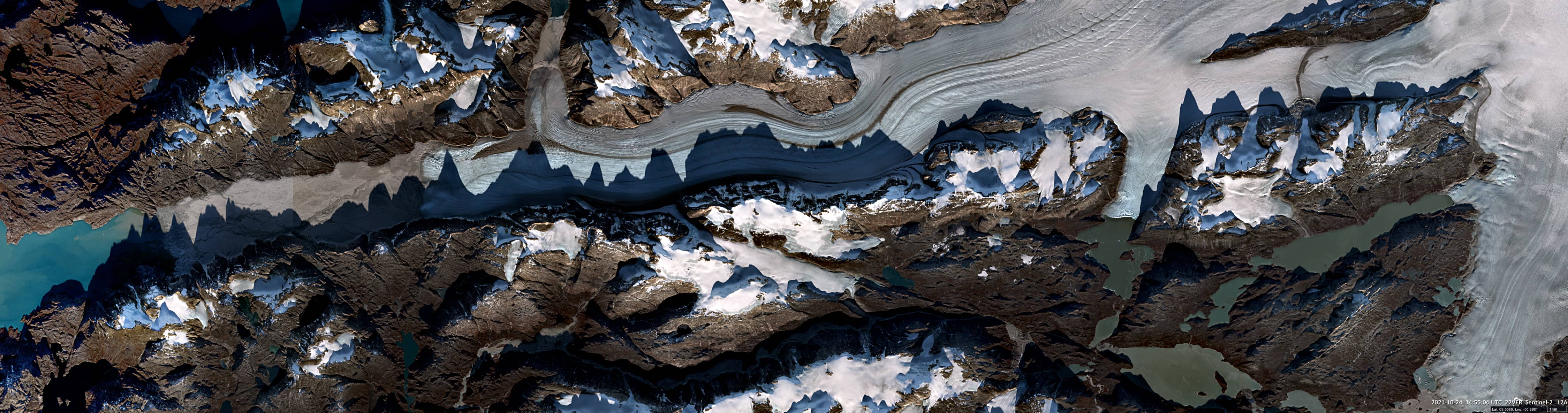
Razor-edge sharp mountain shadows
Sermeq Glacier | Sermilik Icefjord | Greenland
Date of acquisition: October 24th, 2021 | 14:55:04 UTC
Sensor: Sentinel-2A L2A
Coordinates: 63.55°N, 50.57°W
Razor-edge sharp the shadows of the mountains are cast by the low sun onto the ice of the glacier and reveal the ragged relief of the rocky ridge on the southern side of the valley.
The Sermeq glacier flows about 80 km south of Nuuk, the capital and largest city of Greenland, into the Labrador Sea. Today, the melting glacier still extends over 65 – 70 km and is between 3.5 and 5 km wide. A tidal flat, which has been covered by the glacier in past decades, stretches over 5 km from the glacier front to the fjord. About 6 km east of the present front, the glacier sends a branch northwards towards Alanngorlia fjord with the highest mountain in the area, Iviangiusarssuit Akilâ, 1,490 m.