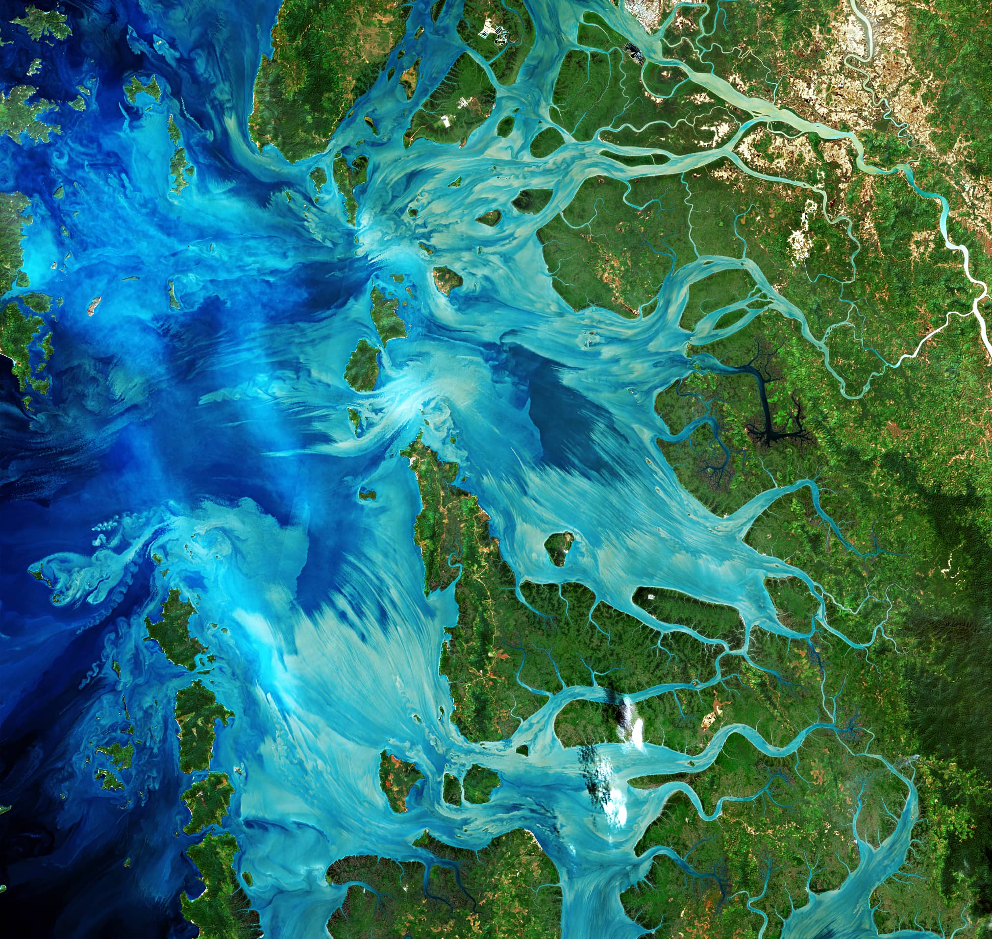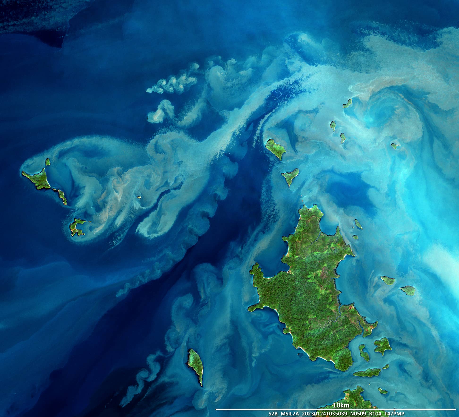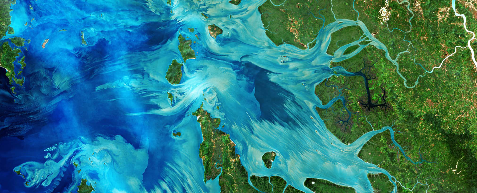
Mergui Archipelago
Southern Myanmar | Andaman Sea
Date of acquisition: January 24th, 2023 | 04:04:54 UTC
Sensor: Sentinel-2B L2A
Coordinates: 12.038°N, 98.192°E
The Mergui Archipelago is a cluster of over 800 islands that are almost entirely uninhabited. The archipelago is located in southern Myanmar, in the Andaman Sea.
The Taninthari River flows into the Andaman Sea in the surroundings of the city of Mergui. This is one of the largest rivers in the southeast of Burma; it is originating from a mountain range at an altitude of more than 2,000 m.
Soil erosion takes place along the banks of the river, which is associated with gold mining and deforestation along its banks and mountain slopes. This is especially noticed after heavy rainfall associated with the monsoons. Since the sea in the region of the archipelago is quite shallow (approx. 30m and less), the sediment brought by the river can be easily raised to the surface of the water and then can be clearly visible from space.
The image presented shows many ‘Kármán vortex street’ phenomena around some of the islands and islets. They are caused by the tide. Ocean water flowing around small obstacles causes turbulence, stable eddies appear, they raise to the surface, they are carried away by the current, they interact with one another creating “vortex streets”. Eddies in the northwest, west and southwest of Parker Island (12.038°N, 98.192°E) are especially impressive in the image shown.