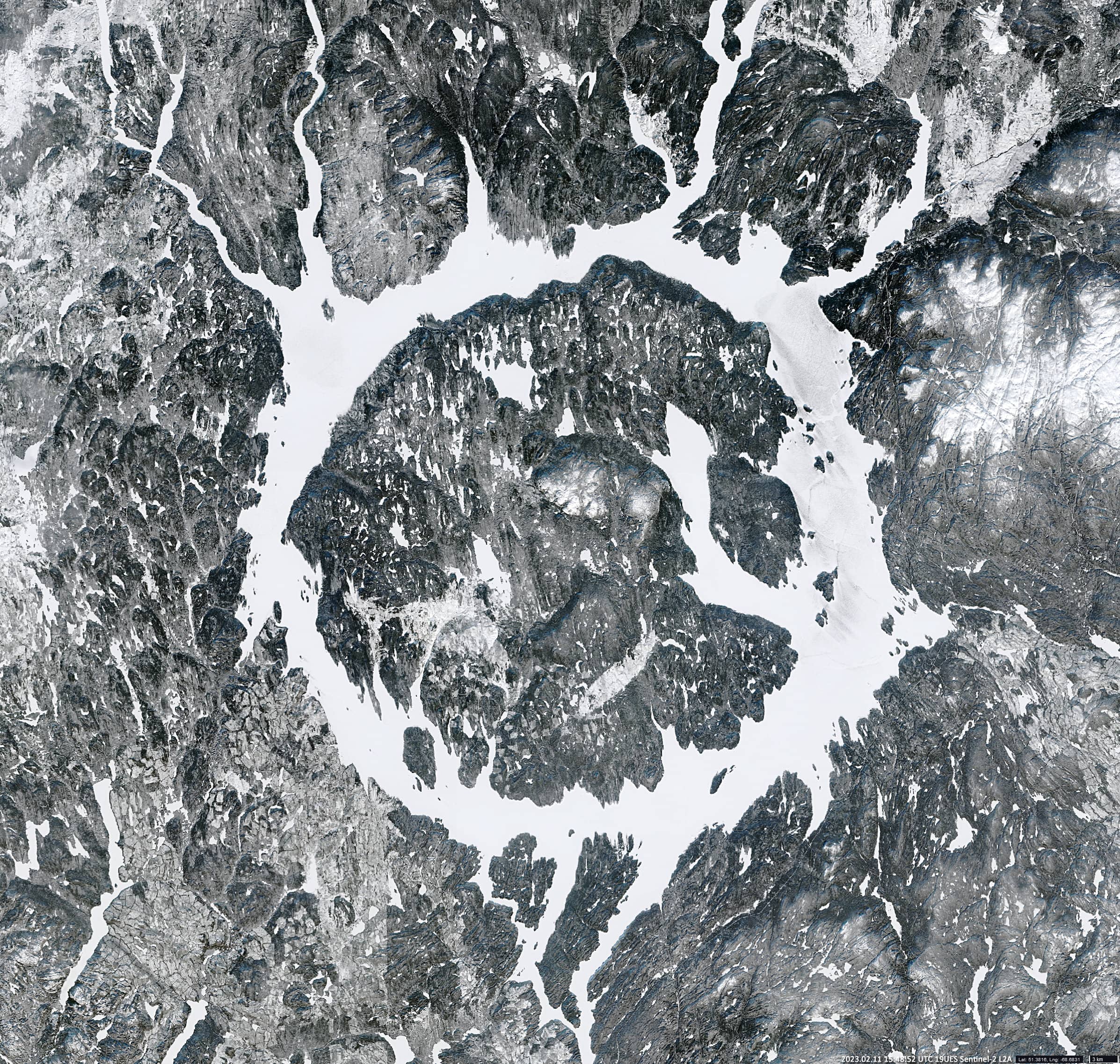
Manicouagan Crater
Québec| Canada
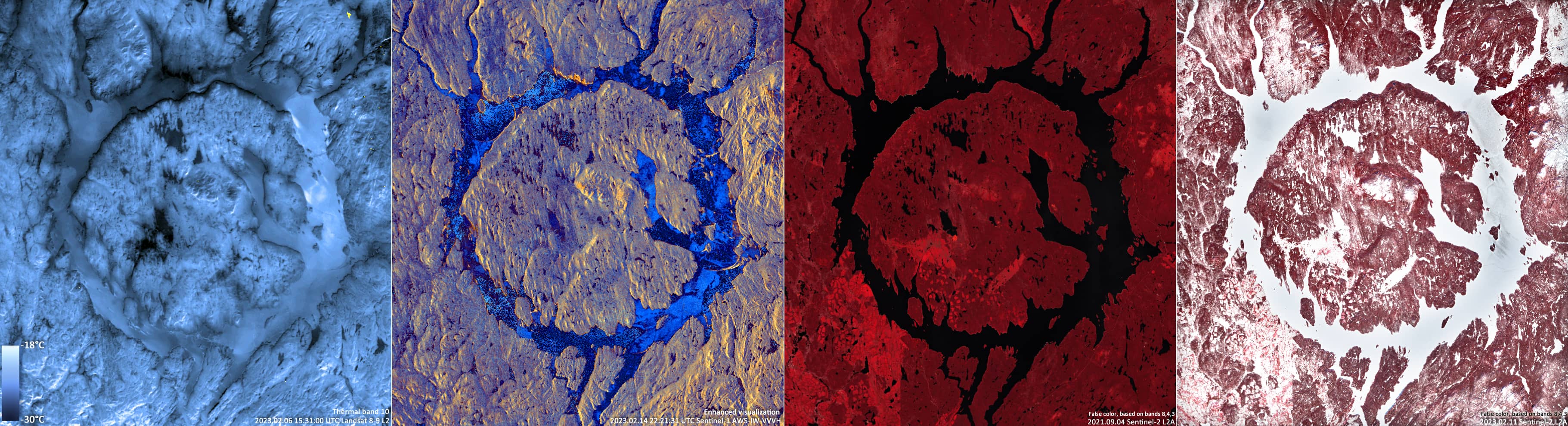
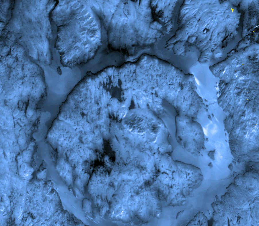
Date of acquisition: February 6th | 15:31:00 UTC, 11th | 15:48:52 UTC & 14th, 2023 | 22:21:31 UTC
Sensor: Sentinel-2A L2A, UTC Landsat 8-9 L2, Sentinel-1 AWS-IW-VVVH
Coordinates: 51.4°N, 68.7°W
The Manicouagan meteorite Crater, located in Quebec, Canada, is the fifth largest crater in the world. The impact occurred about 215 million years ago and was caused by an asteroid that was up to 5 km in size and was moving at 12 and 30 km/s. It is assumed that this catastrophe led to the complete extinction of Triassic-Jurassic animals. Over millions of years, erosion has significantly changed the shape of the crater. Today, the visible diameter of the crater is just over 70 km. Mount Babel (Mont Babel) (952 m) is considered the central highest point of it.
After the construction of a dam on the Manicouagan River in the south of the crater, two crescent-shaped lakes, Mushalagan and Manicouagan, which lay along the crater rim, were flooded in 1970 and now form the ring-shaped reservoir Manicouagan. At its centre, the “artificial” island of René-Levasseur (Île René-Levasseur) was formed, with a diameter of about 50 km and an area of about 2,000 km². The island is the second largest lake island in the world (after Manitoulin Island in Lake Huron) andlarger than the surrounding lake.
René-Levasseur-Island is mostly covered with virgin forest, lakes, and uplands. The “Réserve écologique Louis-Babel” occupies the northern part of the island. Only in the south and southwest of the island are deforestations, clearings, and other traces of human activity visible. Although the snow cover of the forest floor is even thicker in winter than in open terrain (due to the lack of strong winds in the forest), the forest does not look white from above, which often confuses human perception and can lead to errors in automatically snow detection using satellite data. The reason for this is the high density of trees in the forest and their contribution to the spectral signal. These conifers, which almost completely obscure the snow cover on the forest floor, but also deciduous trees, which shield the snow with their bare dark branches for an observer from above and “convert” the colour of the snow from white to grey in the optical wavelength range. Due to high reflectance in the near-infrared range, the forest remains red in false-colour images even in winter, but less intensive than in summer.