Storm Dennis on Halligen
Halligen islands | German Wadden Sea
Dates of acquisition:
February 17th, 2020 | 10:41:11 UTC
February 14th, 2020 | 10:35:43 UTC
February 19th, 2020 | 10:35:46 UTC
Sensor: Sentinel-2B L2A
Coordinates: ca. 54.6°N, 8.6°E
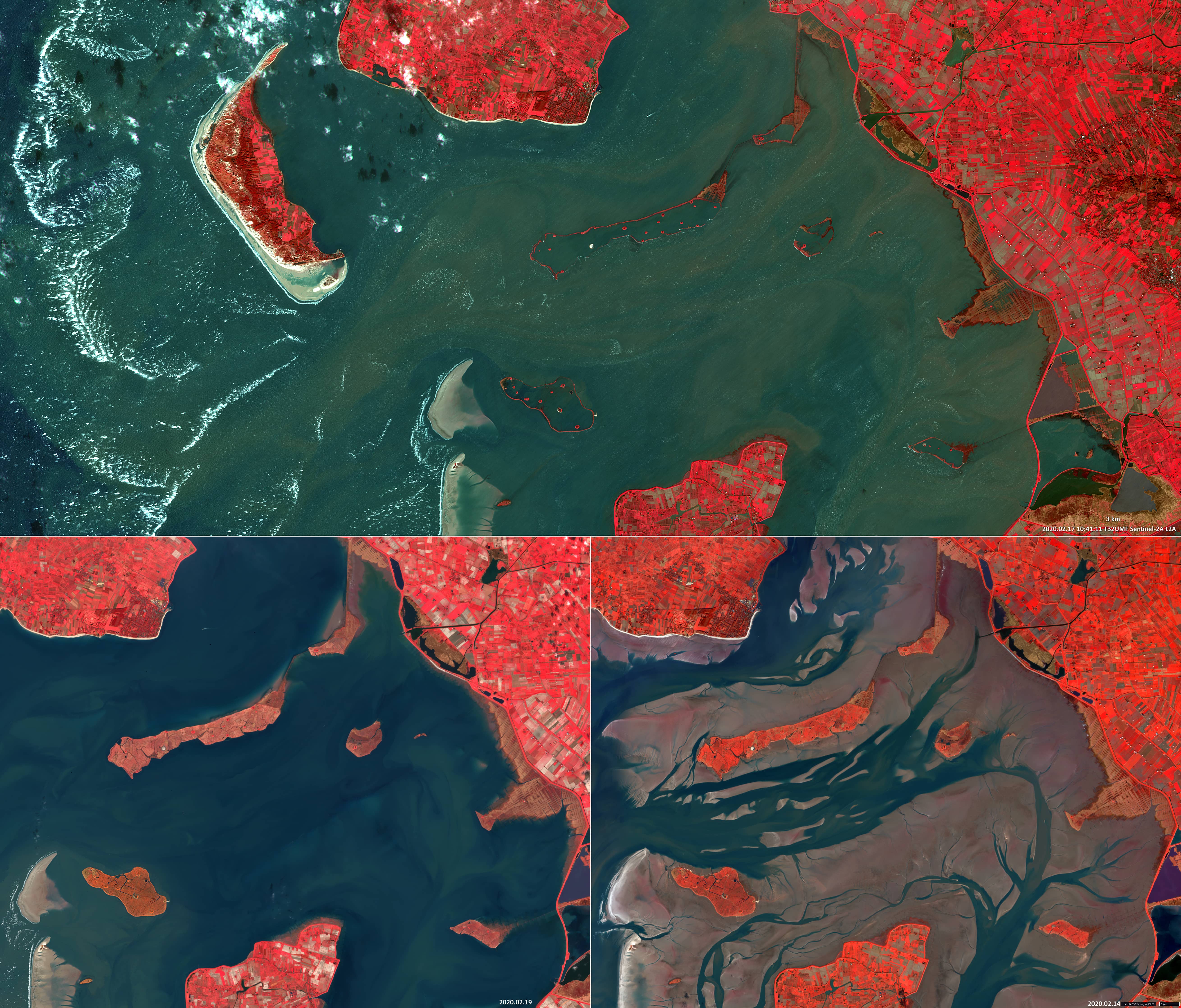
Storm Dennis (in Germany “Sturmtief Victoria”) was a European hurricane that passed in the second decade of February 2020. It became one of the strongest extra-tropical cyclones ever recorded. It developed off Newfoundland, just like Storm Ciara (in Germany “Orkan Sabine”) before it. Soon it entered the sphere of influence of the jet stream, which reached enormous speeds of up to 400 km/h. Low-pressure areas developed with the lowest air pressure ever measured outside the tropics: 914 hectopascals and peak winds over the Atlantic up to 220 km/h. The waters of the North Sea in the area of the Halligen, small, poorly protected marshland islands off the North Frisian coast, rose and almost completely flooded the islands. The German Federal Maritime and Hydrographic Agency (BSH) has reported a water level of 2.5m – 3.0m above mean high tide.
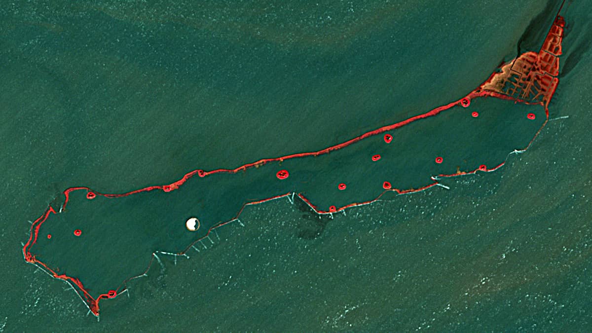
The satellite image taken from Sentinel-2 on February 17, between 10 and 11UTC a.m. under “favourable” circumstances (almost cloudless sky), shows the situation of temporary flooding of the islands of Langeneß (54.6°N, 8.6°E), Hallig Hooge and Gröde, Nordstrandischmoor and partially Oland. Only the dikes, that border the islands, and Terps still rise out of the water as small ring-shaped formations on the surface. In demonstrates how Terps – a very old way of coastal protection measure – save the houses on the islands from being flooded. By February 19 at the latest, the situation had returned to normal.
A false colour composite (R:B8, G:B4, B:B3), in which the colours of vegetation (red) and water (blue-green) contrast with each other, is very well suited for detailed observation in this case. White dots on the water are strong ripple and sea foam on the waves – a sign of the strong wind and the roughness of the sea. In addition, two images of the region are shown during the usual high and low tide conditions. The Halligen Islands show the typical non-flooded vegetation (mainly meadows and salt marshes) and the dry-fallen sediment flats of the Wadden Sea during low tide (bottom right image). In between are numerous tidal creeks.