Lake Vostok
Antarctica
Date of acquisition: January 19th, 2023 | 23:42:59 UTC
Sensor: Sentinel-3 SLSTR
Coordinates: ca. 77.5°S, 106°E
Lake Vostok lies north of the Russian Vostok Antarctic station (77°S, 105°E, minimum temperature –89.2°C, average –55.1°C) under a 3700 to 4100 m thick ice layer. The lake has an area of 12.5 thousand km². It has 11 islands with a total area of 365 km². The water volume is about 5400 km³. An underwater ridge divides the lake into 2 parts, the depth of the northern part of the lake is up to 400 m, that of the southern part is up to 800 m (in some places up to 1200 m), on average about 300 m. This is the largest of the 145 known sub glacial lakes in Antarctica and the sixth lake in the world in terms of water volume. It was “closed” by an ice sheet about 15 million years ago.
Studies show that the surface of the ice sheet over Lake Vostok has a difference in elevation of about 50 m from one end to the other. For the lake to be in hydrostatic equilibrium with the ice sheet above it, the slope of the ice-water interface must be about ten times greater and opposite to the slope of the ice surface. Therefore, the ice at the northern end of Lake Vostok is about 500 m thicker than that at the southern end: 4200–3730 m. The glacier covering the lake moves at a slow speed from west to east, bringing sediments into the lake. Two factors prevent the lake’s water from freezing: geothermal heating from below and high ice pressure from above. The water temperature is-2.65°С, the pressure is about 400 atmospheres.
The water of Lake Vostok is characterized by oxygen content, that is about 50 times higher than in “normal” fresh water. The reason for this is the high pressure in the lake and the presence of gaseous oxygen in the overlying ice structure. If some microorganisms survive in such conditions, they are forced to adapt to the extreme oxygen stress.
Water samples obtained by Russian specialists from ice drilling in the southern part of the lake were heavily contaminated with drilling fluid and it was reported in May 2017 that it is currently impossible to obtain reliable data on the actual chemical and biological composition of the lake water.
Already in the late 1950s, the thesis about the existence of a lake under the Vostok station emerged. The lake was finally discovered in 1993 by an English research team through the analysis of radar data from the European satellite ERS-1 (launched in 1991).
SLSTR, a scanning radiometer for measuring surface temperatures, has thermal infrared (TIR) spectral bands at 3.74 μm, 10.8 μm and 12 μm with detectors cooled to 87K.
| Band | Central Wavelength | Bandwidth | Function |
|---|---|---|---|
| S7 | 3.700 μm | 0.380 μm | Night-time dual-view SST, Active Fire |
| S8 | 10.850 μm | 0.900 μm | Dual-view SST/LST, Active Fire |
| S9 | 12.000 μm | 1.000 μm | Dual-view SST/LST |
Spatial Resolution at Nadir: 1.0 km
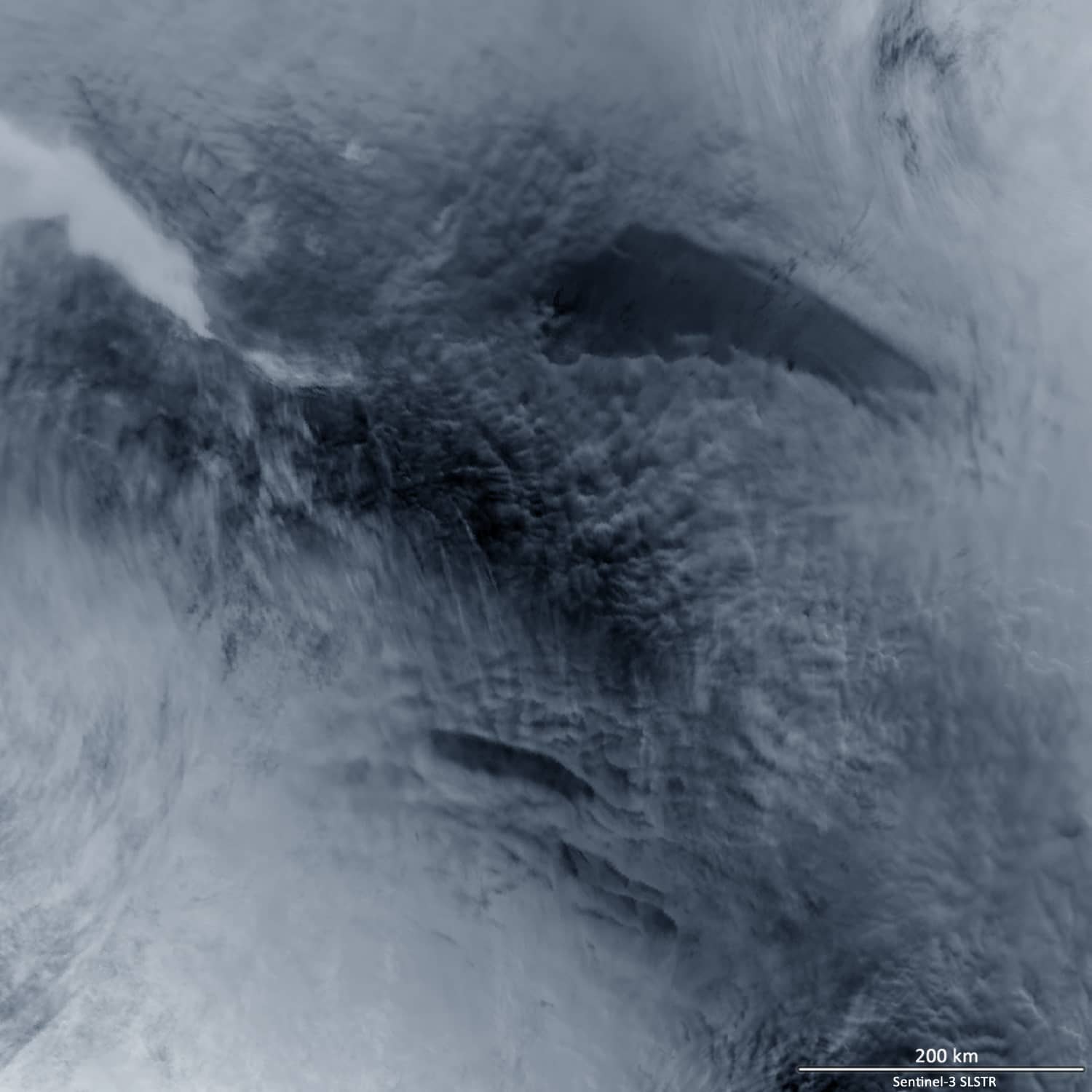
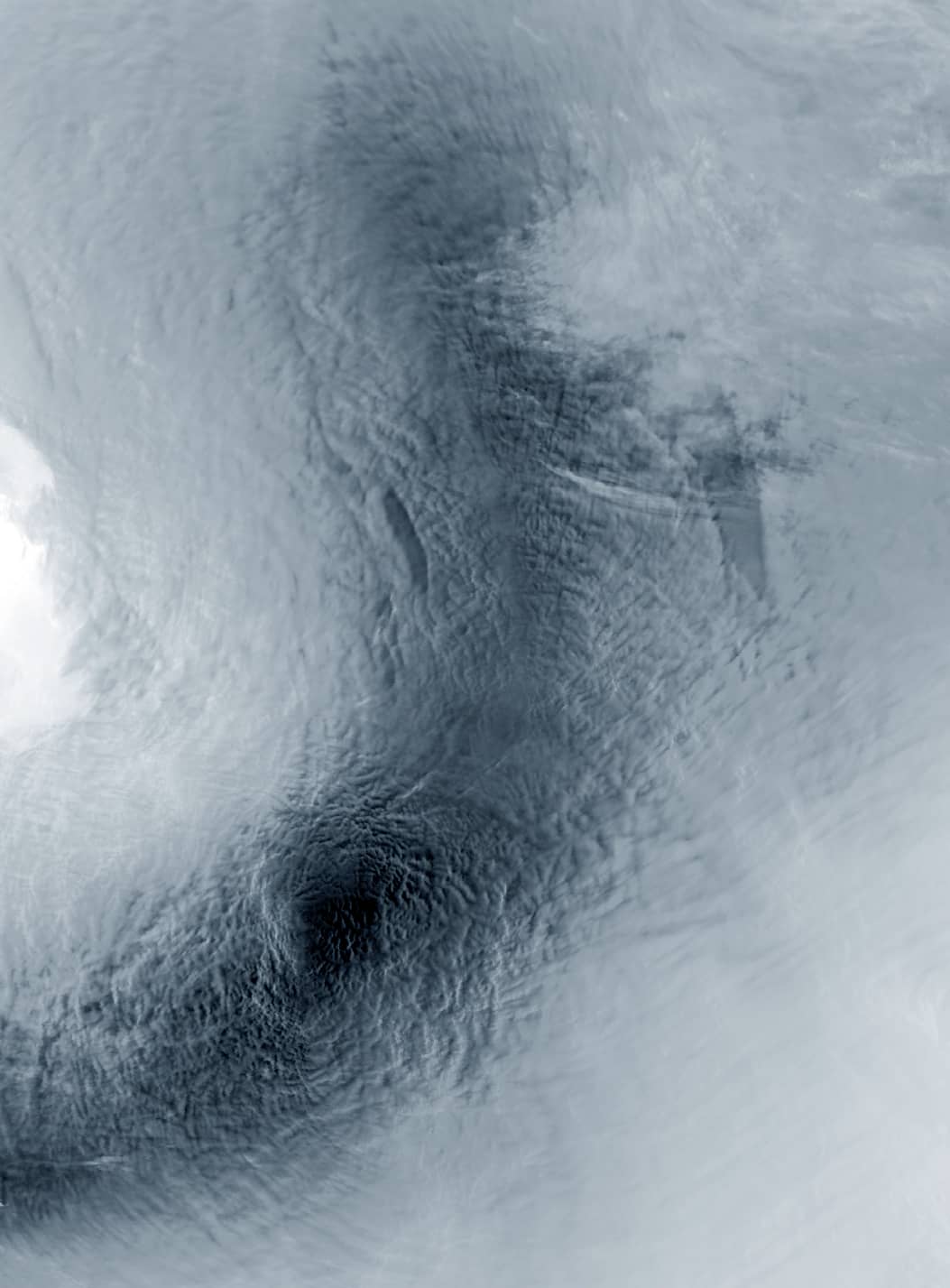
We did some investigations using the brightness temperature of the thermal bands of SLSTR onboard Sentinel-3 and made some interesting observations.
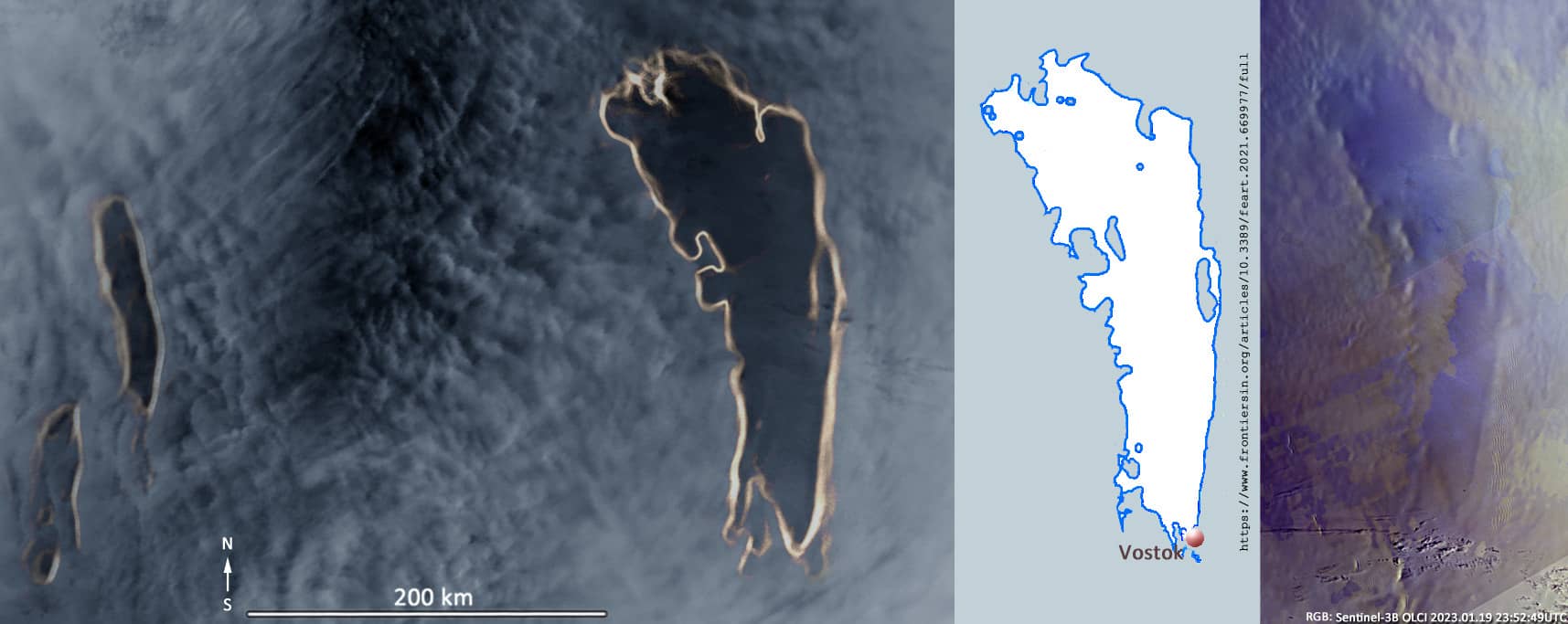
Several satellite data from the Lake Vostok region for the current January were combined to a cloudfree image. It turned out that by colour contrasting the images obtained from the thermal bands (S7, S8, S9) , the position of the lake can be found and even its coastline can be approximately determined. This is best visible in S8.
Interestingly, the temperature of the ice above the surface of the lake is always lower than the temperature of the surroundings. In band S8 the brightness temperature is 1-3°K lower over the lake. At the same time, the temperature of snow/ice over the northern part of lake is often approx. 2-4°K lower than over the southern part.
The presence of the lake can also be “suspected” in the images of the optical channels (Sentinel-3, OLCI) based on the colour contrast.
Another interesting observation was made concerning two elongated objects to the west of Lake Vostok. Their positions remain constant and their temperature is always lower than that of the surrounding area in all observations.
To the southwest of lake Vostok, a flat, cold region can be seen. This is Dome A or Dome Argus, the highest ice dome on the Antarctic Plateau. It is the highest snow elevation in Antarctica and consists of a dome of ice 4093 m above sea level (80.37°S, 77.35°E). And it is believed to be the coldest naturally occurring place on Earth, with temperatures as low as −98 °C. This place is also one of the driest places on Earth, with 1 to 3 cm of snow falling per year.
The Chinese Kunlun Station was built in 2009 just 7.3 km southwest of Dome Argus.