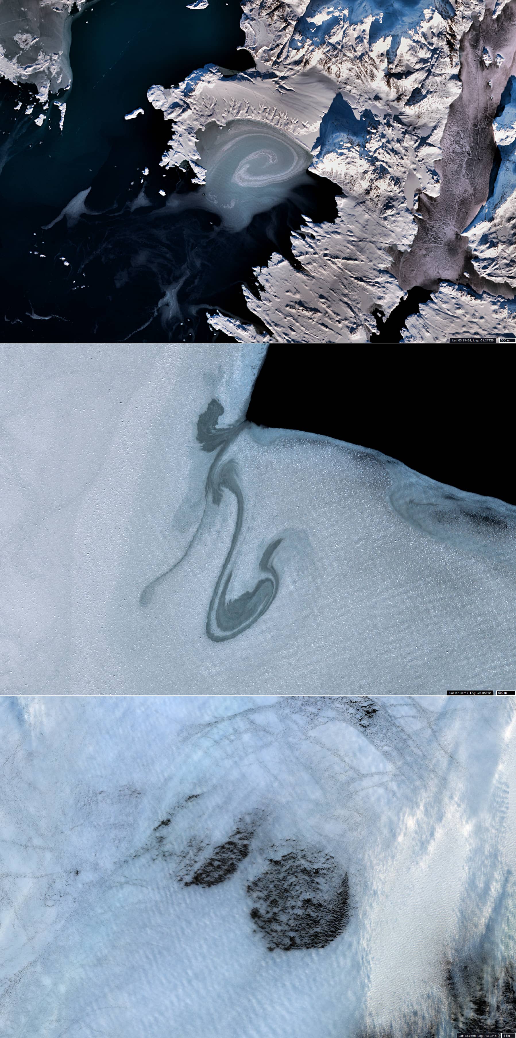
Frozen Vortex
Greenland Coastal Waters
Date of acquisition: February 16th, 2021 | 14:55:02 UTC
Sensor: Sentinel-2 L2A
Coordinates: tbd
The commonality in the satellite images displayed here is that they all capture waters close to the coast of Greenland and that the likelihood of seeing the structures depicted within the floating brash sea ice twice in the same locations is extremely low. These structures reflect the processes taking place in the surface layer of water.
The first one (from top to bottom), the area south of Saneraata Timaa Island, shows a vortex associated, with the shape of the shoreline. The second vortex is probably caused by the East Greenland Current in the Danish strait. The cause of the fleeting appearance of two almost identical round (diameter ca. 7 km) polynyas located side by side (like two eyes) 120 km east of Shannon Island is not obviously explainable.