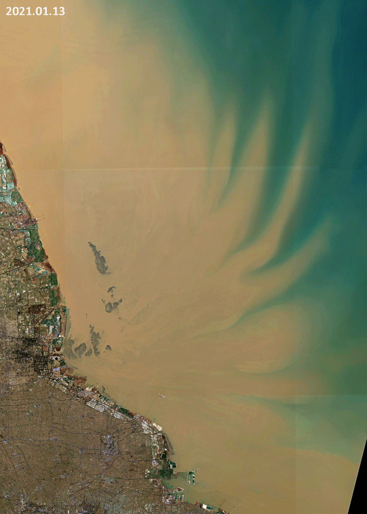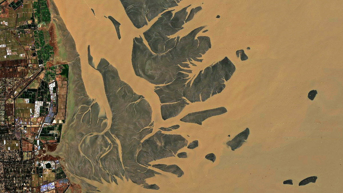
Subei Bank
Yellow Sea, just north of the estuary of the Yangtze River(長)
Date of acquisition: January 13th and 18th, 2021 | 02:48:36 UTC
Sensor: Sentinel-2 L2A
Coordinates: ca. 33.1°N, 121.1°E
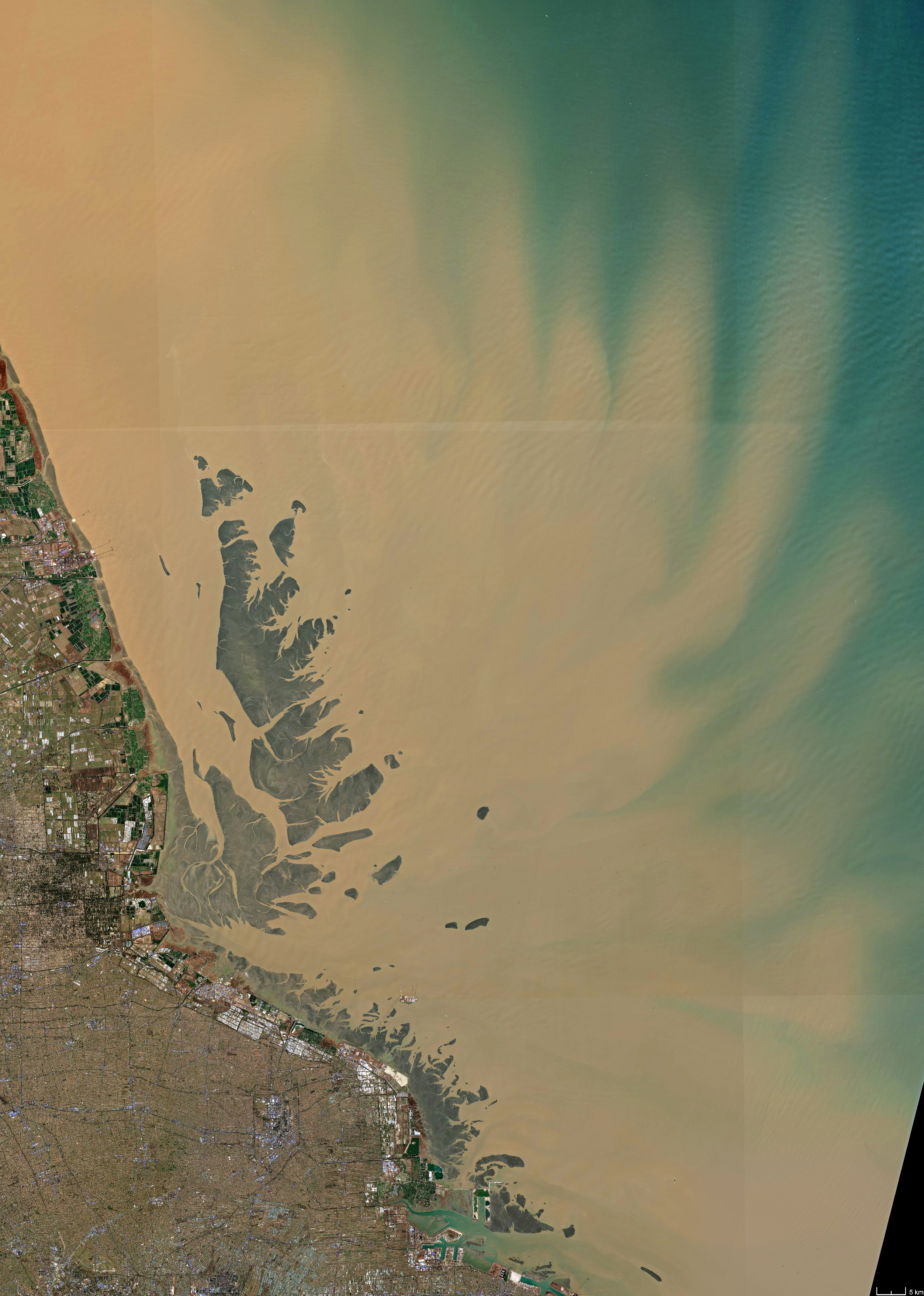
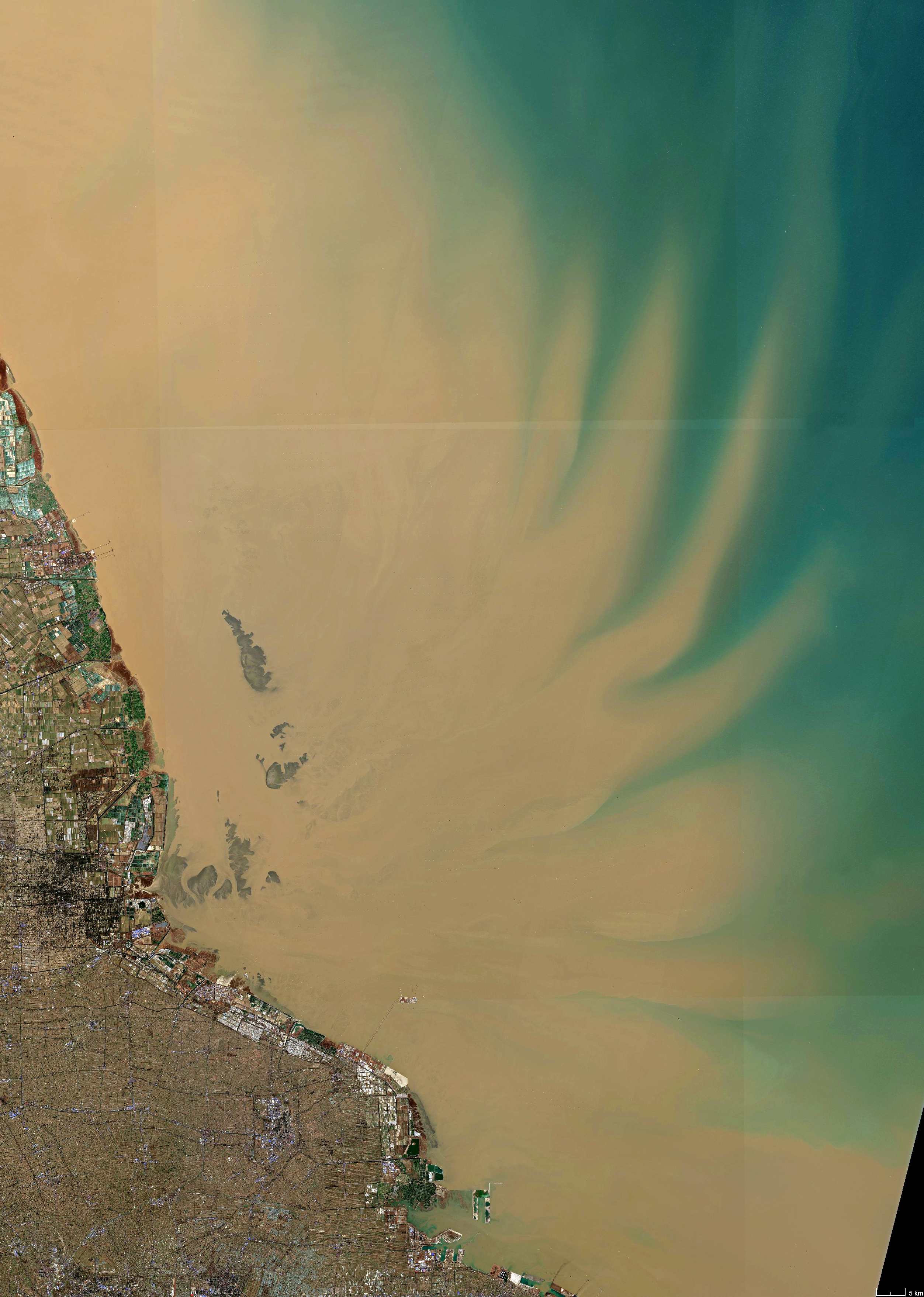
The images shown in this example illustrate impressively the differences during high tide and low tide in an intertidal flat region. The open Subei Bank, located in the Yellow Sea just north of the estuary of the Yangtze River (長江), is vast and shallow. For the greater part, its depth does not exceed five meters and only on the edges and ravines it can reach about 10 – 20 m. During low tide, dry fallen sediment areas are visible which are covered with brown-yellow coloured water. The colour of water is determined by suspended sediments in the water.
Additional note: A high number of wind turbines can be observed off the shore (see header picture at the top of this page).