
High Lee Cloudiness over Alberta
Central Alberta | United States of America
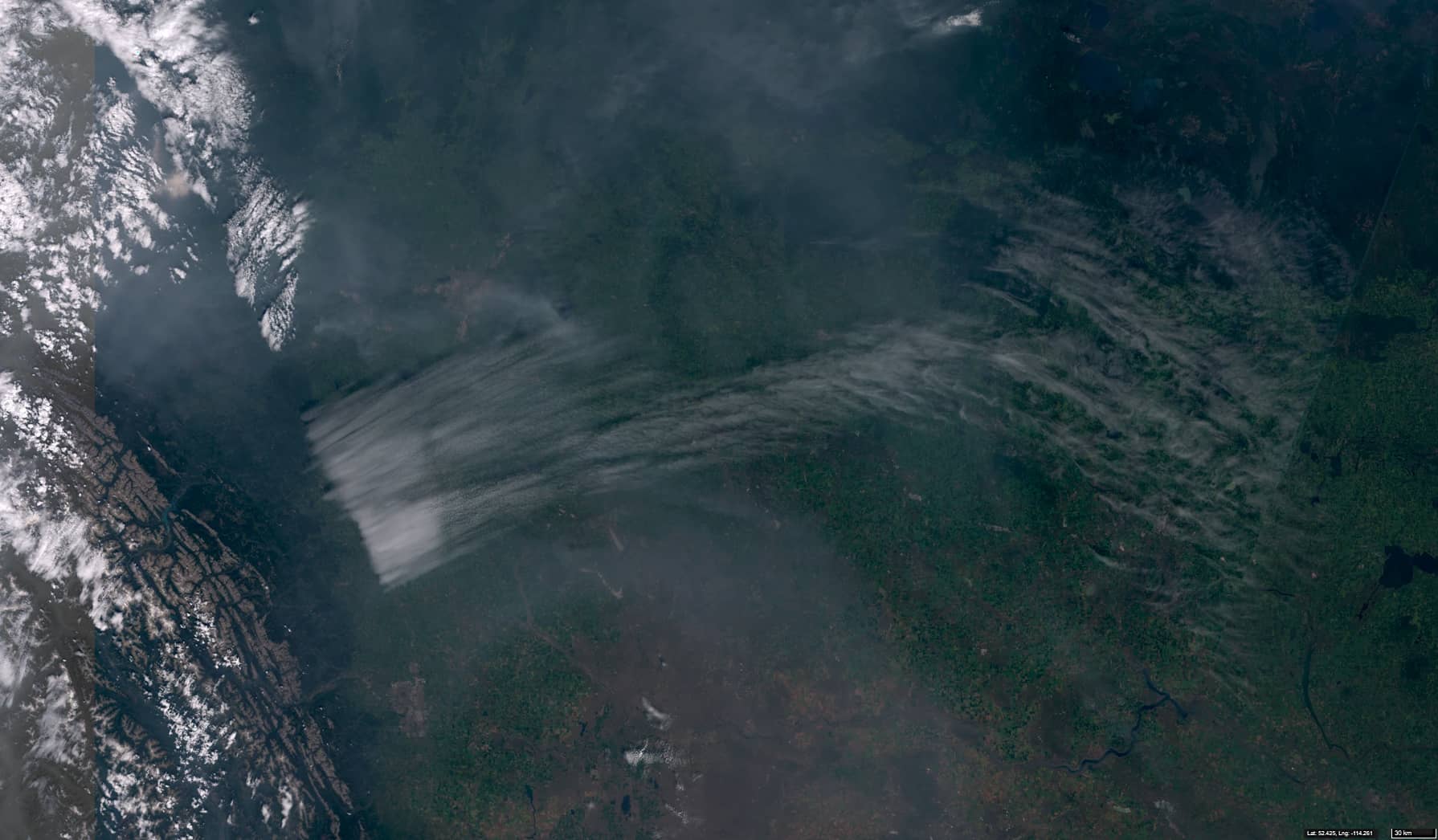
• 2026.08.01 | 18:05:23 UTC – Sentinel-3A OLCI
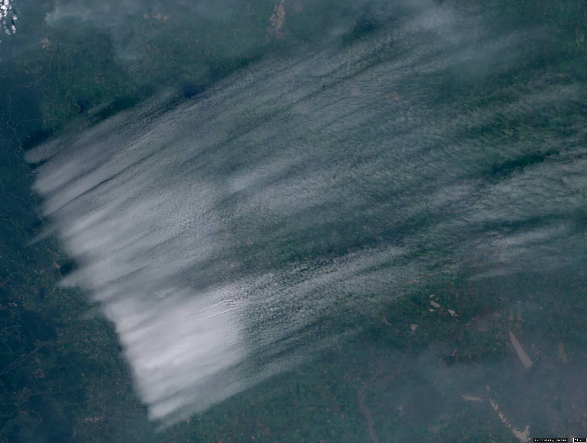
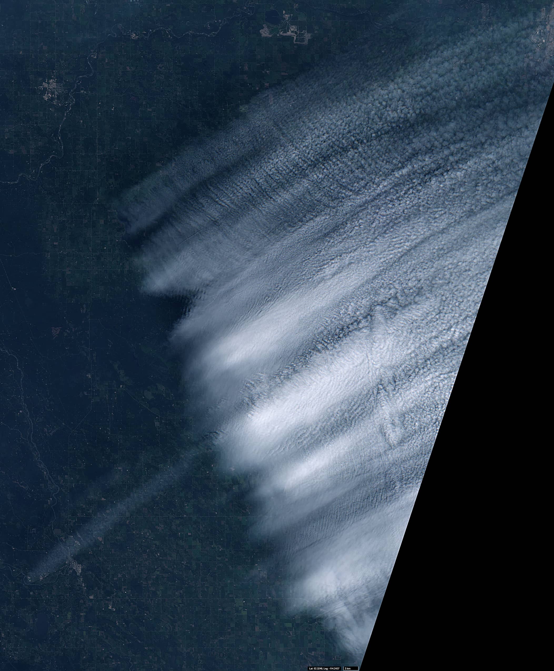
• 2026.08.01 | 18:49:21 UTC – Sentinel-2C L2A
The term ‘High Lee Cloudiness’ refers to cloud formations that extend from a mountain range across its leeward side, stretching for hundreds of kilometres. These formations occur when stable, moist air flows over a mountain range, generating large-scale atmospheric gravity waves that propagate downstream. As these air masses rise and cool in the upper troposphere, they condense, resulting in the formation of extensive cloud fields on the leeward side of the mountains. These gravity waves generally run perpendicular to the wind direction. Less commonly, bands of clouds running parallel to the wind can be observed.
In strong winds, High Lee Clouds can detach from the mountain range, giving the impression that cloud formation has begun at a considerable distance from the orographic barrier. High Lee Clouds are characterised by low temperatures and usually last only a few hours.
At higher altitudes, the lower air density leads to an increase in wavelength and wave amplitude. The wavelength also depends on the shape of the underlying terrain and wind speed. In strong winds, at sufficient altitude and with sufficient humidity, bands of clouds can develop that run parallel to one another and are aligned with the wind direction. Such clouds are often characterised by a sharp boundary running parallel to the mountain range.
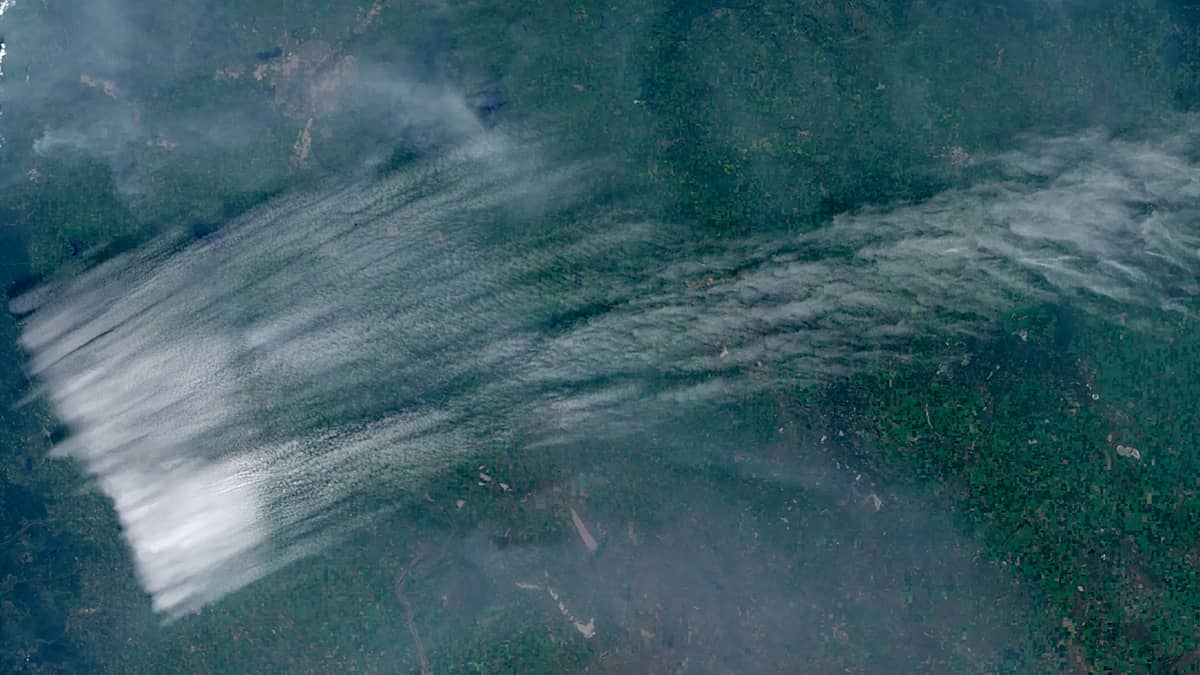
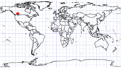
Figures 1, 2 and 3 show Sentinel-3 and Sentinel-2 images of a system of High Lee Clouds that has formed east of the Canadian Rocky Mountains in the Edmonton–Calgary region of Alberta, Canada.
The entire area is heavily affected by smoke from forest fires to the west and south-west, while strong winds blow over and above the mountain range. This cloud formation is located well above the smoke layer and its sharp western edge casts a visible shadow onto the smoke below.
Formation of the structure began at around 04:00 local time while it was still dark, and it had developed well by 06:30, covering an area of approximately 46,000 km². Its sharp western edge was approximately 260 km long. The structure subsequently changed shape and moved in a north-easterly direction. By 15:00, it had moved approximately 190 km from its starting position, after which it disappeared.
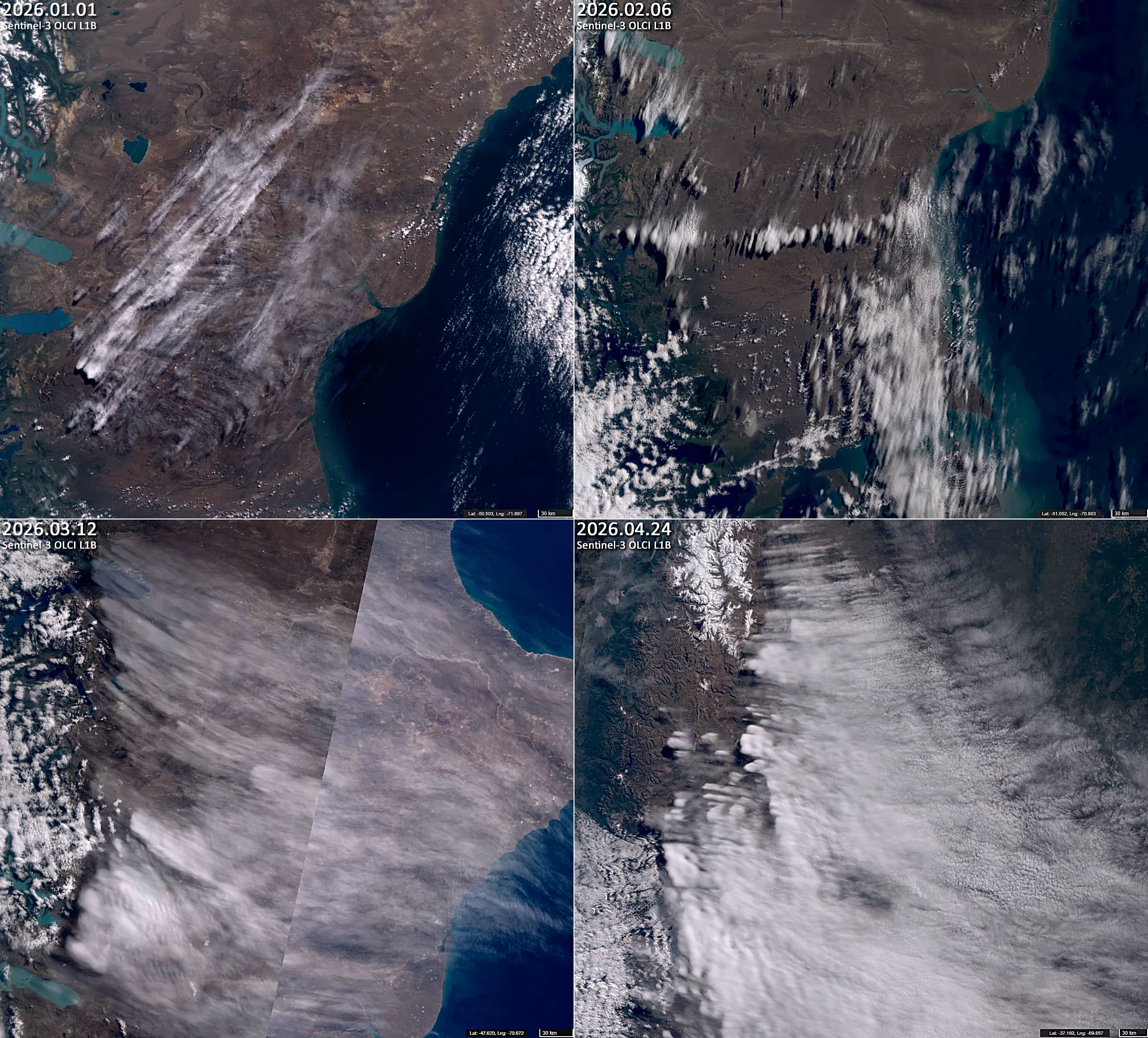
Additionally, we provide some similar cases observed over Patagonia (Figure 4).
Further reading
Lee Cloudiness (Eumetrain)
Lee Cyclogenesis (Science Direct)
High Level Lee Clouds (Eumetrain)
Lee Clouds in Russia’s Ural Mountains (NASA Science)