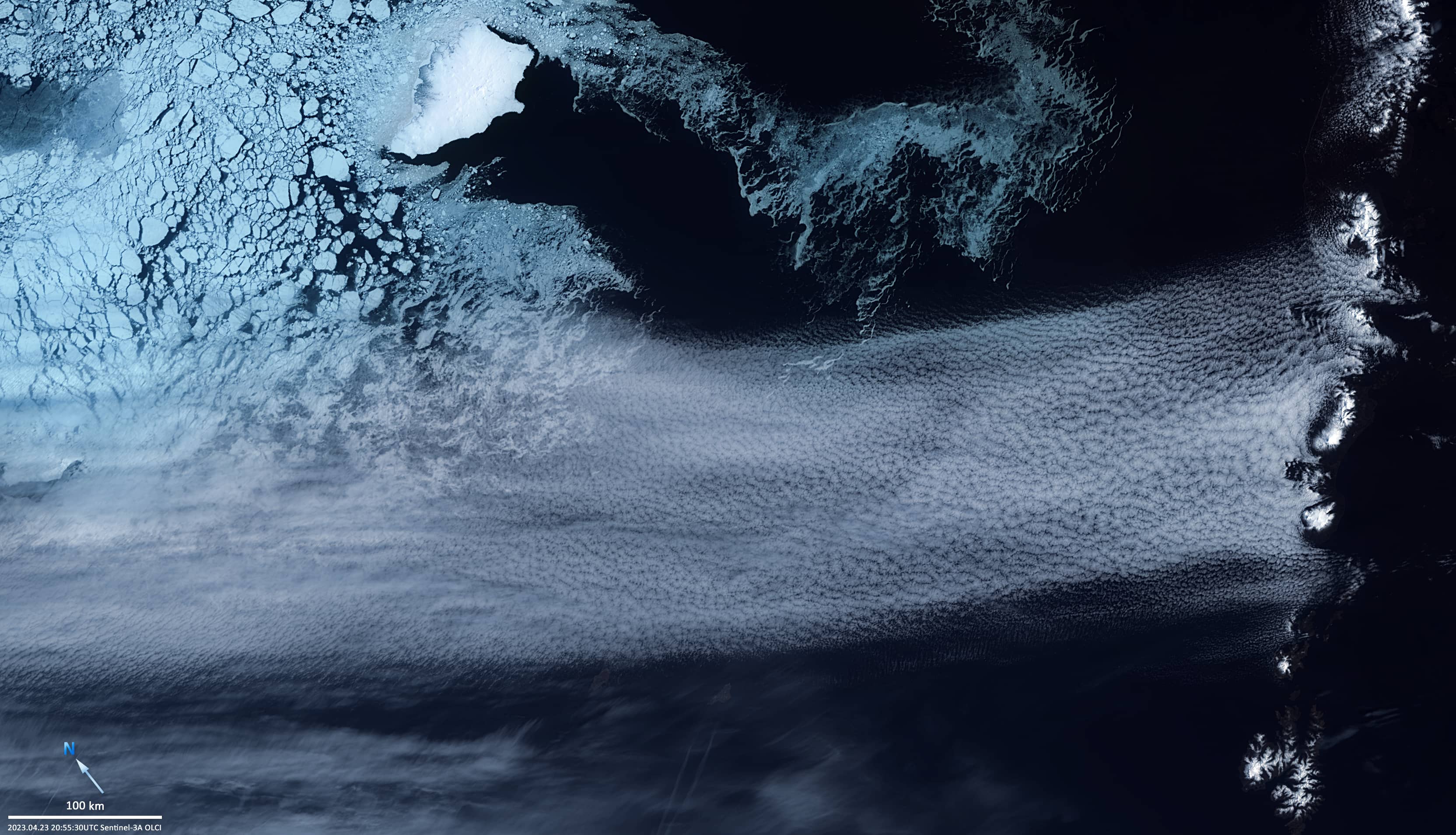
Convective clouds over the Bering Sea
Bering Sea
Date of acquisition: April 23rd, 2023 | 20:55:30 UTC
Sensor: Sentinel-3A OLCI
Coordinates: 55°N, 164°W
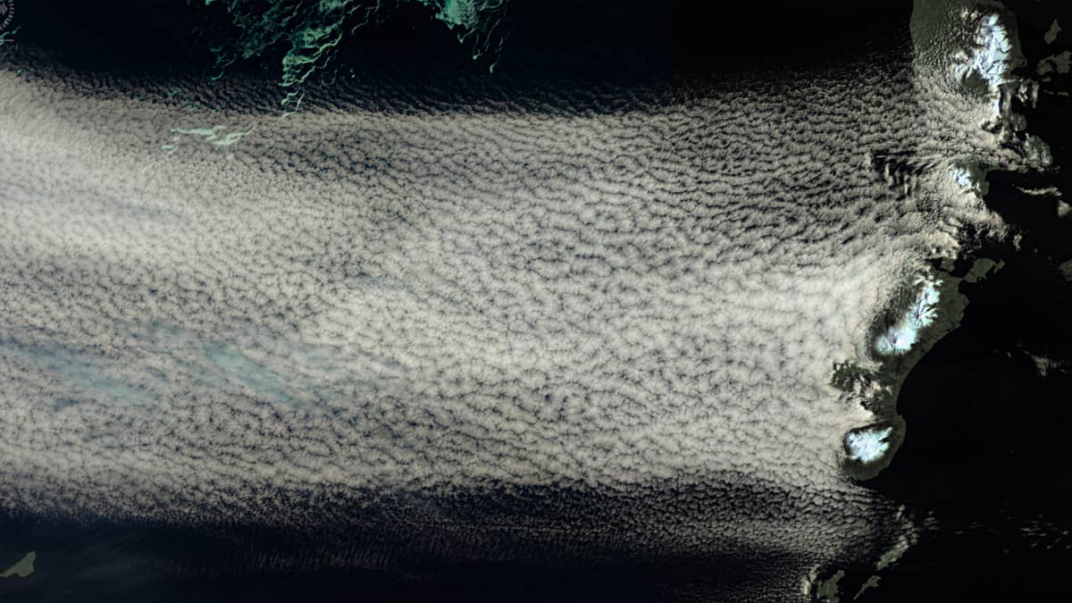
The Sentinel-3 image shown here illustrates a particular cloud structure in the western Bering Sea. A strong flow of relatively cold air from the northeast, about 300 km wide, moved about 1,400 km over the sea from the coast of Chukotka, picked up moisture and approached the eastern Aleutian Islands.
The current brought clouds in the form of a structure of dense, closed convection cloud cells to the Alaska Peninsula and Unimak Island with its high volcanoes (from west to east: Akutan Island – Mt. Akutan, 1,303m; Unimak Island – Mt. Westdahl, 1,654m; Mt. Shishaldin 2,857m, this is the highest point of the Aleutian Islands; Mts. around Fisher Caldera, ca. 1,100m; Isanotski Peaks, 2,446m; Alaska Peninsula – Frosty Peak 1,920m; Mt. Dutton, 1,473m; Mt. Emmons, ca.1,305m; Mt. Pavlof, 2,518m; with its „Sister“ 2,142m).
Since the upper limit of the cloud structure was below the summits of the volcanoes, the clouds could not cross the islands, so that the sea surface south of the islands in this area turned out to be almost completely free of clouds.
At the same time, a floating sea ice field about 450km long and more than 36,000km2 in size is approaching this region from north through Etolin Strait, which separates Nunivak Island from Nelson Island. Its front is already 140km away from the islands.