Wildfire in Canada
Northwest Territories | Canada
Dates of acquisition:
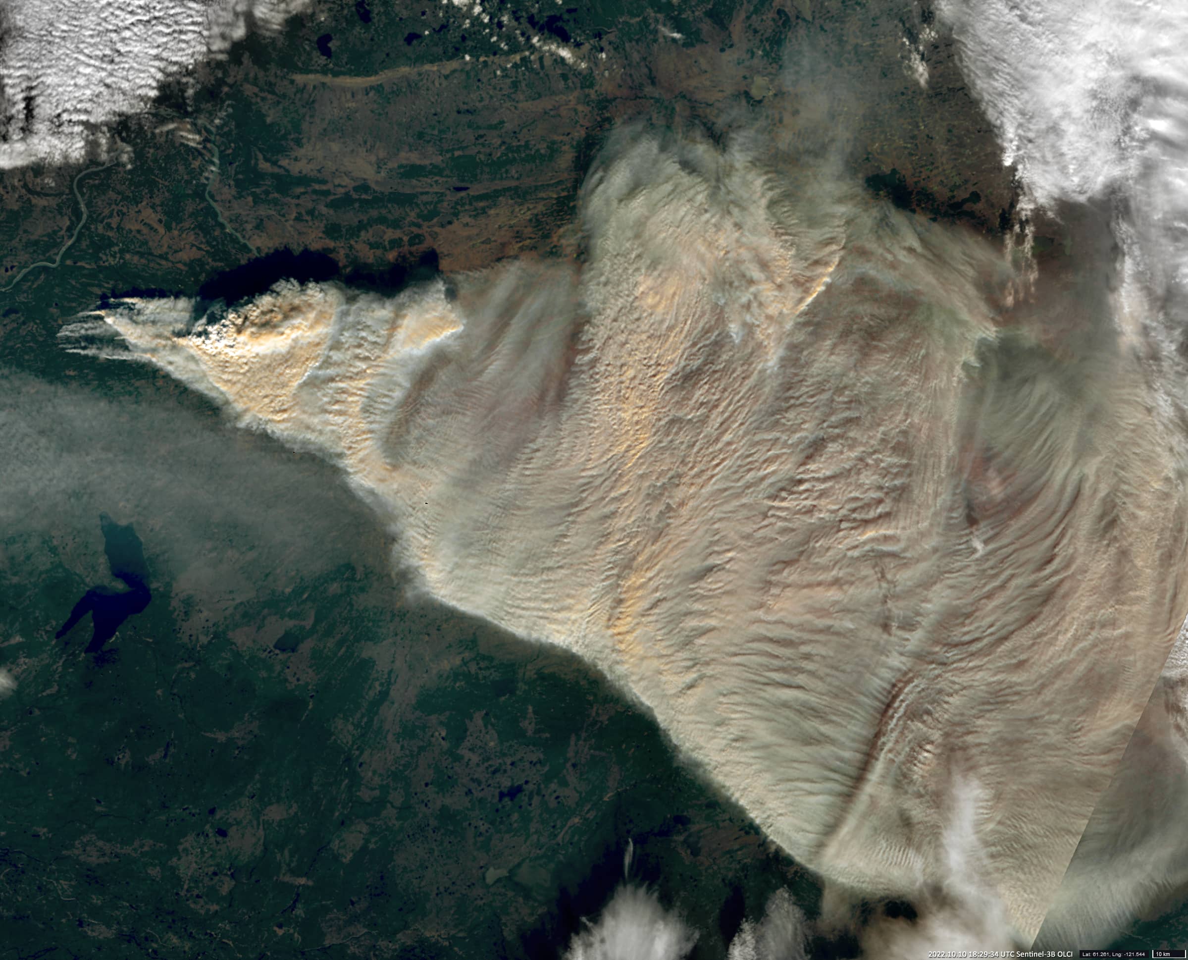
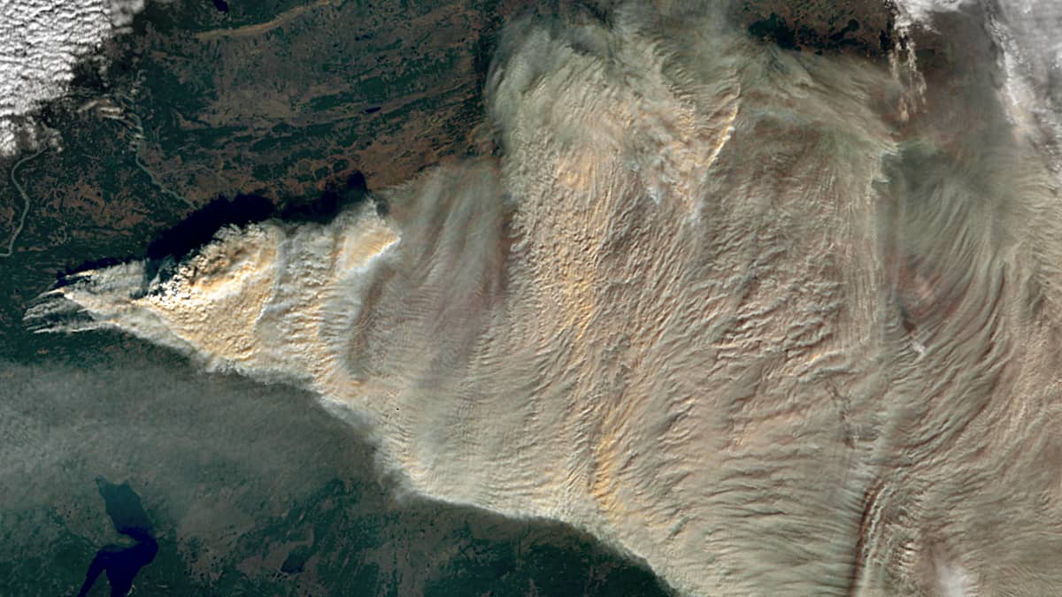
October 10th, 2022 | 18:29:34 UTC (S3-B)
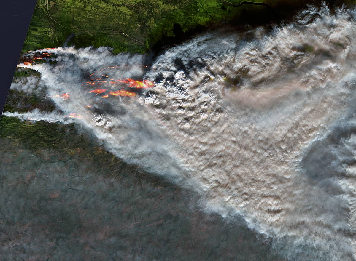
October 10th, 2022 | 19:27:45 UTC (S2)
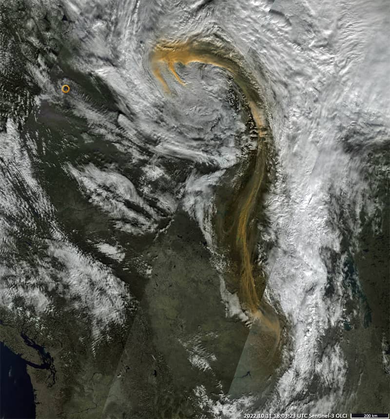
October 11th, 2022 | 18:03:23 UTC (S3-B)
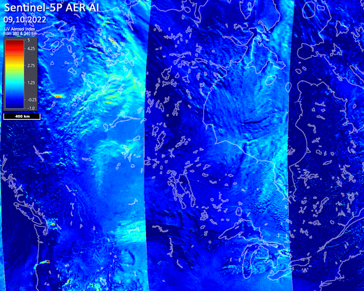
Oct. 9th – 15th, 2022: Sentinel-5P-AER_AI (Animation)
Sensors: Sentinel-3B OLCI, Sentinel-2 L2A, Sentinel-5P AER-AI
Coordinates: ca. 61.18622°N, 121.24468°W
Because Sentinel-3 “covers” the Earth’s surface almost completely every day, it can be used to monitor the evolution and precise location of many events on the Earth’s surface. For example, to monitor the spread of forest fires.
The whole incident that is shown here took place in the Canadian Northwest Territories, southwest of the Poplar River, a relatively small tributary of the Liard River. While on September 8th no fires could be observed yet, smaller fires developed into a large wildfire from September 11th onwards, which quickly spread eastwards and became a really large fire on October 8th.
In the following we show the progression of such a relatively short but intense fire using three S-3B/S-2 L2A images taken in quick succession and an animation of images over a week from the Sentinel-5 Precursor Level 2 Ultraviolet Aerosol Index:
| Date | Fires extent | Images |
|---|---|---|
| Oct. 10th, 2022 | The emergence of many large fires; the formation of flame fronts of several kilometers (up to 30 km), the spread of the fire to the east beyond the McGill Lake – Jean Mary River – Deep Lake water system. The smoky area is at least 50,000 km². |
1. Oct. 10th, 2022 18:29:34 UTC: Sentinel-3B OLCI 2. Oct. 10th, 2022 19:27:45 UTC: Sentinel-2 L2A |
| Oct. 11th, 2022 | Termination of a fire. A plume of smoke that extends a little more than 2000 km to the south. |
3. Oct. 11th, 2022 18:03:23 UTC: Sentinel-3B OLCI |
| Oct. 9th – 15th, 2022 | Animation | 4. Sentinel-5P-AER_AI |
On October 16th, only small localized fires remain in the Lake McGill area after the rain, but there is still a lot of smoke.