White-capped Waves
Frisian Islands | North Sea
Date of acquisition: January 24th, 2024 | 10:45:47 UTC
Sensor: Sentinel-2B L2A
Coordinates: ca. 54°N, 8°E
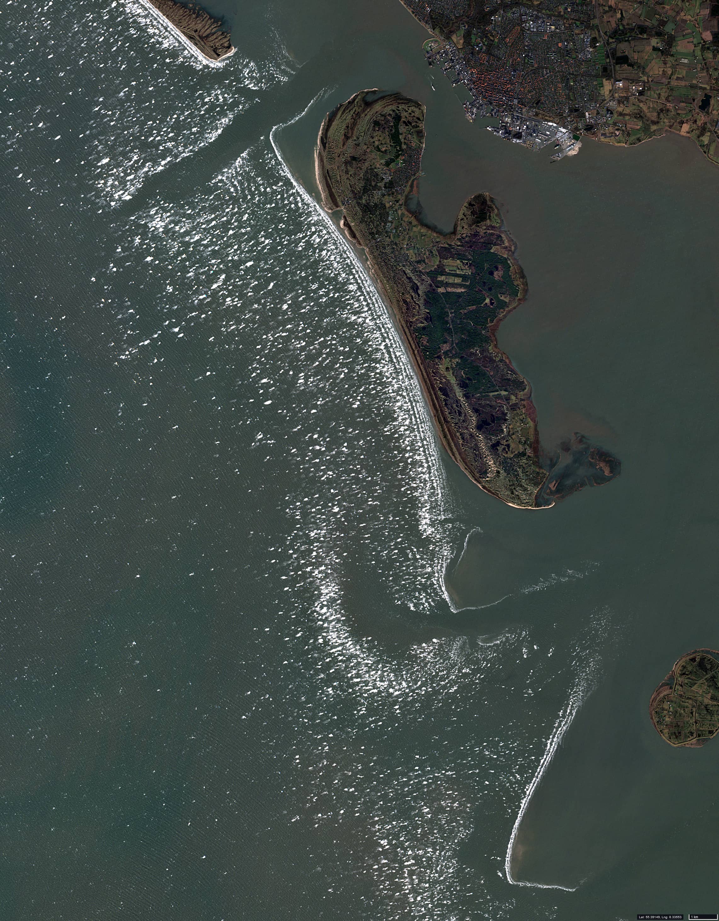
At the beginning of the last week of January 2024, the low pressure area IRIS dominated over northwestern Europe, resulting in stormy winds over the North Sea. Maximum wind gusts exceeded 100 km/h (10 on the Beaufort scale) at List (Sylt) and 85-90 km/h at Helgoland. Strong winds and the resulting rough seas led to the formation of foam fields to the west of the East and North Frisian islands (Figure 1).
The depth of the sea decreases towards the coast and the waves become steeper. This increases the amount of water that is stirred up by the wind and waves and blown off the crests of the waves, resulting in the formation of sea foam, also known as whitecaps. Whitecaps area mixture of air and sea water and appears white to an observer from the coast or from space.
This phenomenon is not unusual in this region. In this case, the image shows an almost cloudless sky.
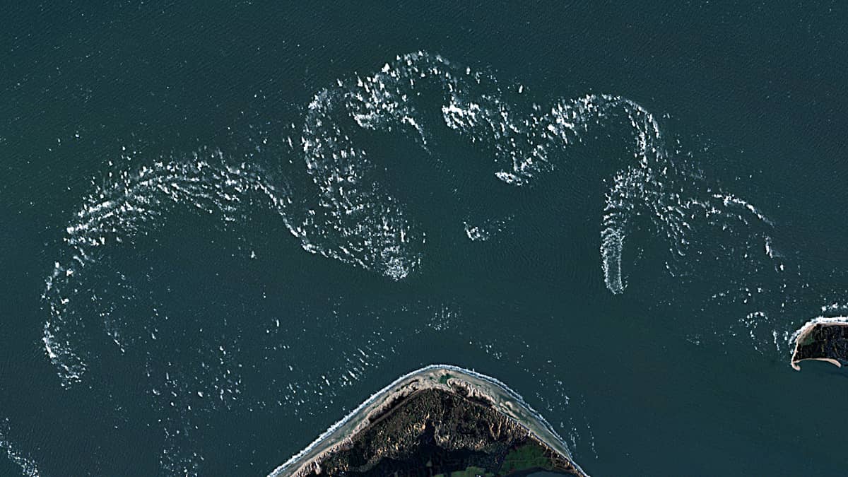
Using the surf strip west of the island of Amrum as an example, several cases of white capsformation are shown in the interval 2017-2024 (Figure 2 – animation).
It can be clearly seen that the position of white caps quite stable; it has the same shape and width (slight variations are associated with changes in wind and wave propagation direction). This indicates that the position of the white water field is dependent on the bottom topography.
It can be also seen that the position of the individual foam strips hardly changes over the years, and that the distance between them remains constant at around 200-300 meters (seee.g. 2022.01.27 or 2020.11.23, in Figure 2).
Figure 2a and Figure 3 provide an explanation for this phenomenon.
The left tile in Figure 2a, labelled ’a’, (2018.01.08), shows a case where underwater dunes were exposed at low tide south-west of the small sandbank of Jungnamensand. They are normally found in shallow water.
If we superimpose on this image an image that contains the foam of the white-capped waves: the middle tile in Figure 2a, ’b’, (2017.12.09), we see that the position and shape of the white caps correspond to the side of the underwater sandbanks from which the waves are coming: the right tile in Figure 2a, ’c’.
Finally, two regions from Figure 1 are shown enlarged: the region around the island of Heligoland Figure 4) and the region west of the island of Fanø (Figure 5).
Fig. 1
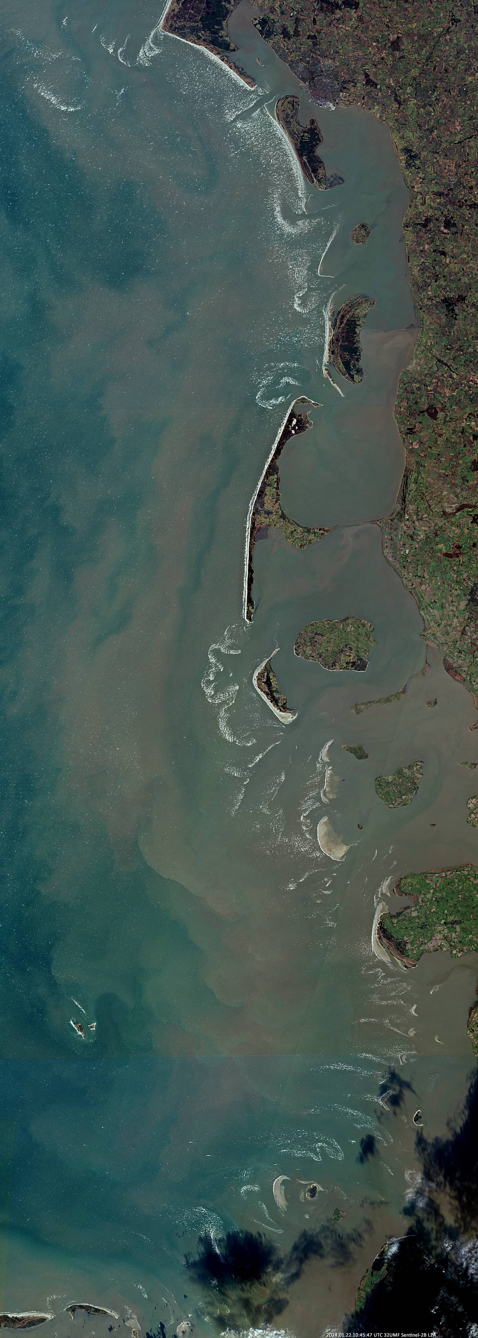
Fig. 2
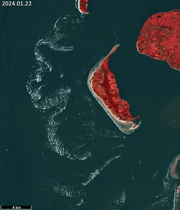
Fig. 2a
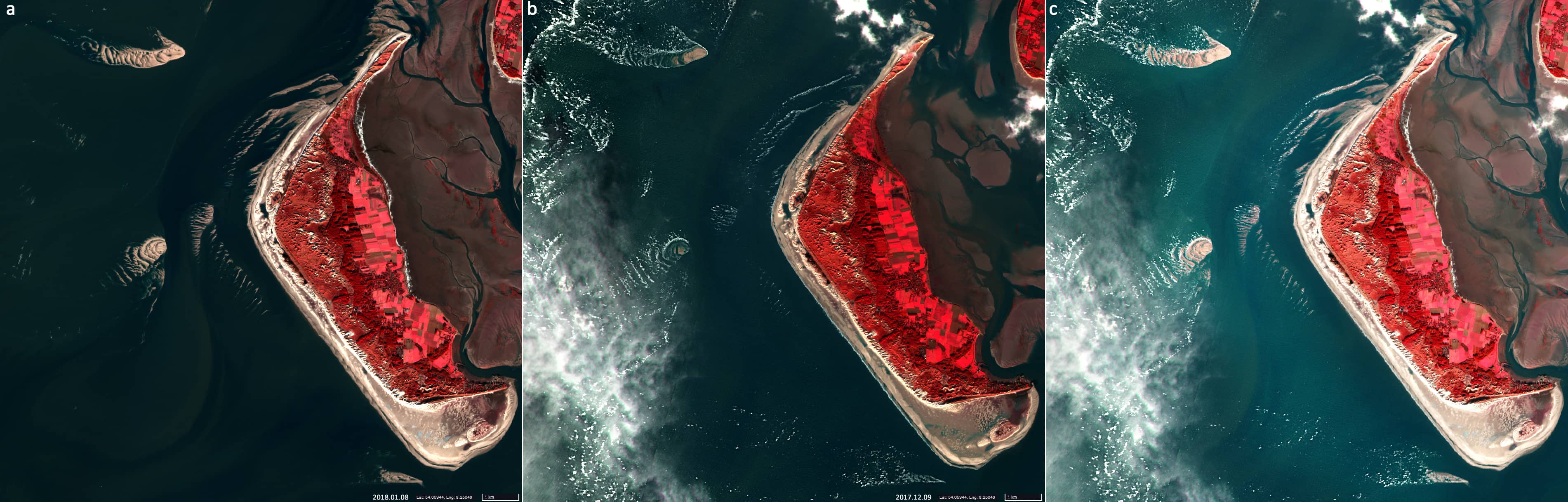
Fig. 3
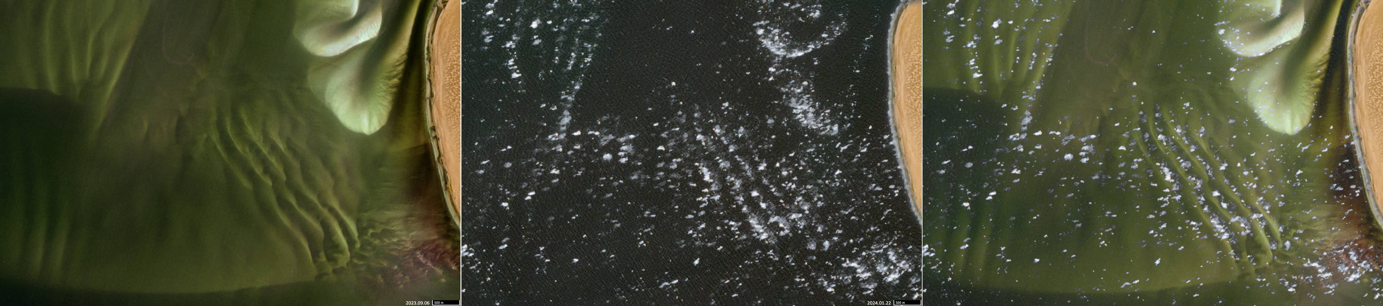
Fig. 4
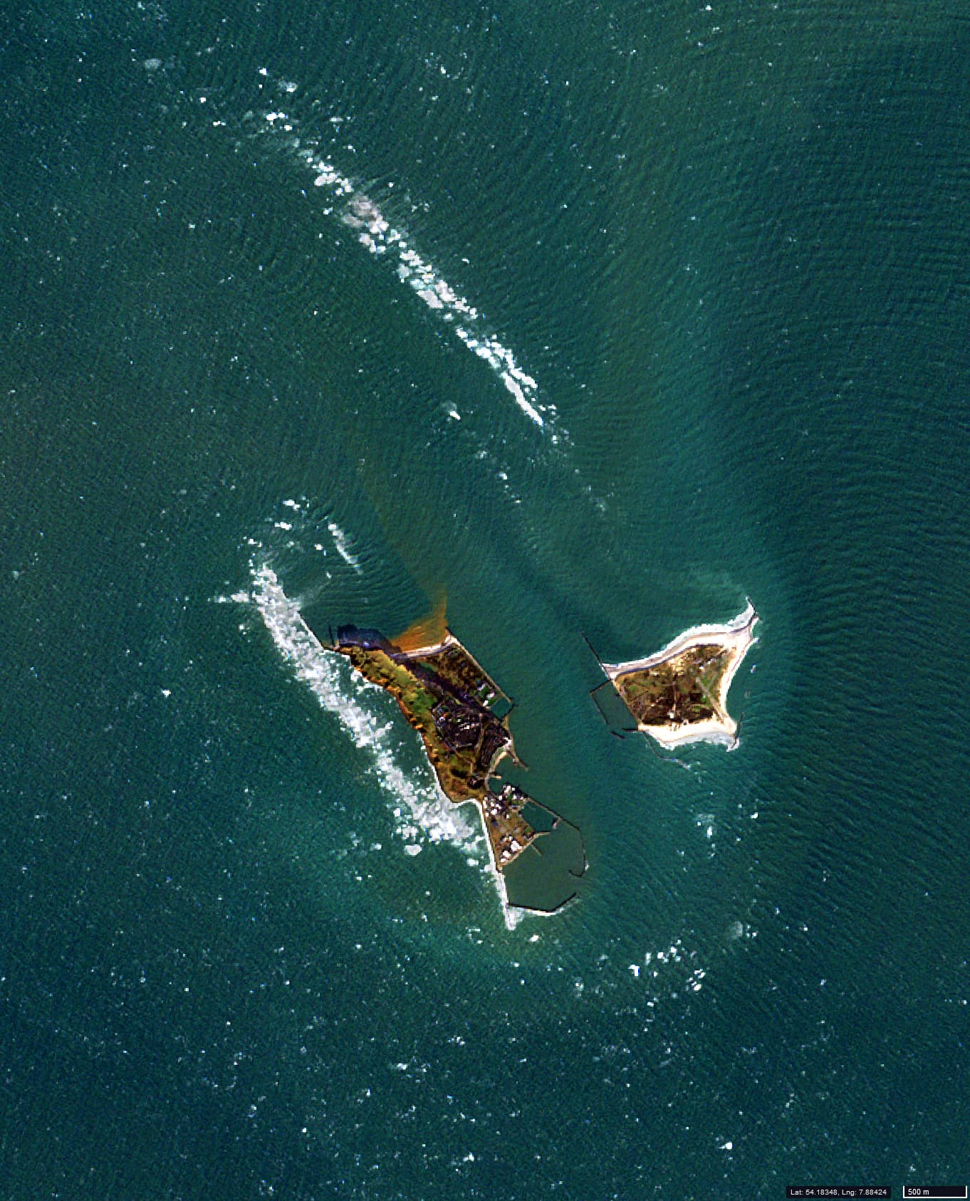
Fig. 5