Volcano eruption near Grindavík
Reykjanes Peninsula | Iceland
Date of acquisition: February 8th, 2024 | 13:04:07 UTC, 12:23:49 UTC
Sensosr: Sentinel-2A L2A, Sentinel-3A OLCI
Coordinates: ca. 63.9°N, 22.4°W
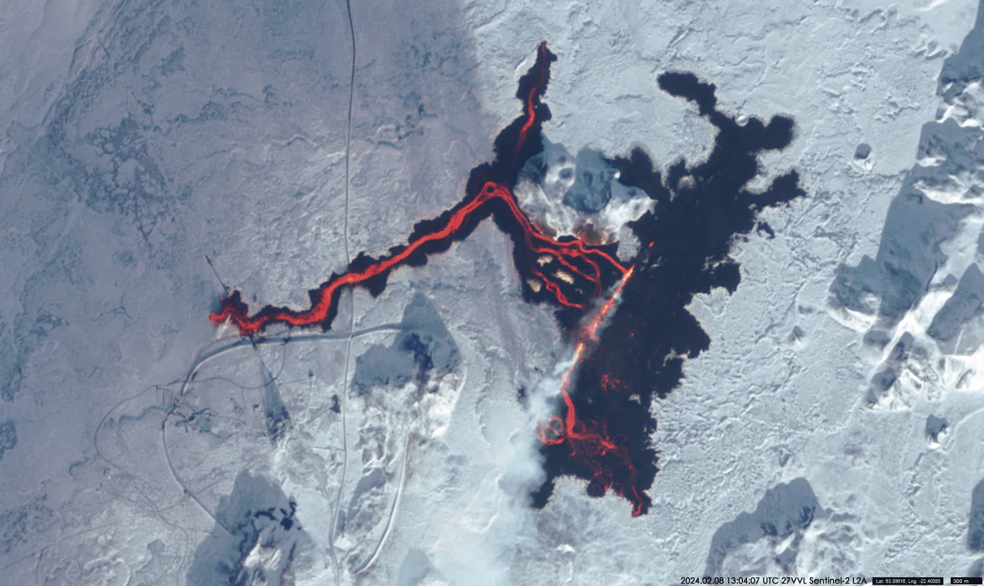
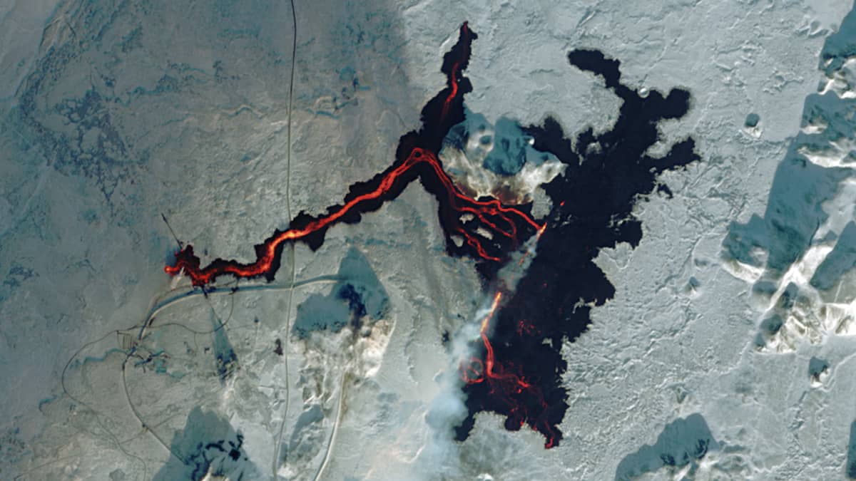
On the morning of 8 February 2024, a volcanic eruption began on the Reykjanes Peninsula in Iceland. After a brief earthquake, a 3 km long fissure opened about 6 km north-north-east of the fishing village of Grindavík (Figure 1, RGB colour composite based on bands 8, 4, 3, 2).
he volcanic activity is a result of Iceland’s location at the top of the mantle plume, which is a particularly hot section of the Earth’s mantle. The mantle plume interacts with the tectonic boundary between North America and Eurasia called the Mid-Atlantic Ridge. The continental plates slowly move away from each other and hot mantle rock rises to the surface. A section of the Mid-Atlantic Ridge is located along Reykjanes, a peninsula in southwest Iceland, a few miles northeast of Grindavik and is closest to the surface near the Sundnukur craters.
The current phase of volcanic activity at Reykjanes began in March 2021. Since then, there have been several more eruptions in the region.
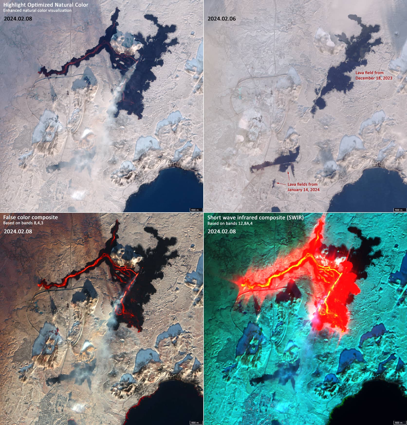
On the evening of 18 December 2023, a volcano erupted along a several kilometre long fissure a few kilometres northeast of Grindavík. The size of the lava field is about 2.8km2 (there were no Sentinel-2 images over Iceland in December).
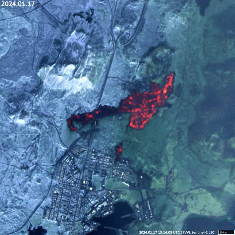
During the eruption on 14 January 2024, the lava field only reached an area of about 0.7 km², but the lava destroyed some houses in Grindavík (Figure 4).
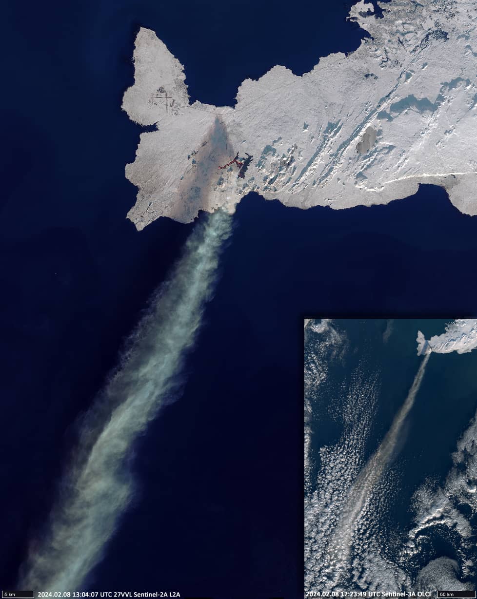
On 8 February 2024, a spectacular volcanic eruption took place in the northeast of Sylingarfell (highest elevation 197m) around Stora-Skogfell (highest elevation 189m) – for the third time in only eight weeks. The lava flow was about 9 km long and covered an area of about 3 km². This lava field partially overlapped with the lava field of the 18 December eruption. The lava fountains reached a height of about 50 to 80 metres northeast of Sylingarfell. The smoke plume reached a height of around 3 km and stretched southwest for about 300 km (Figure 2). It is interesting to note that this plume originated from only one small spot with coordinates 63.8922°N, 22.3679°W.
Figure 3 shows the situation on 8 Februaryin different band combinations. It also shows the situation before the last eruption (6 February). By the evening of the same day, the eruption had subsided significantly.
It is really rare to see the lava flow so clearly on the visible and near-infrared satellite image. The existence of the image in Figure 1 (and largely in Figure 3) is due to a fortunate and rare coincidence of circumstances: Sentinel-2 was flying over the volcano at the time of its spectacular eruption, the sky was clear, and the wind was blowing in a direction that prevented the volcanic cloud of ash, gases and steam from obscuring what was happening on the Earth’s surface.