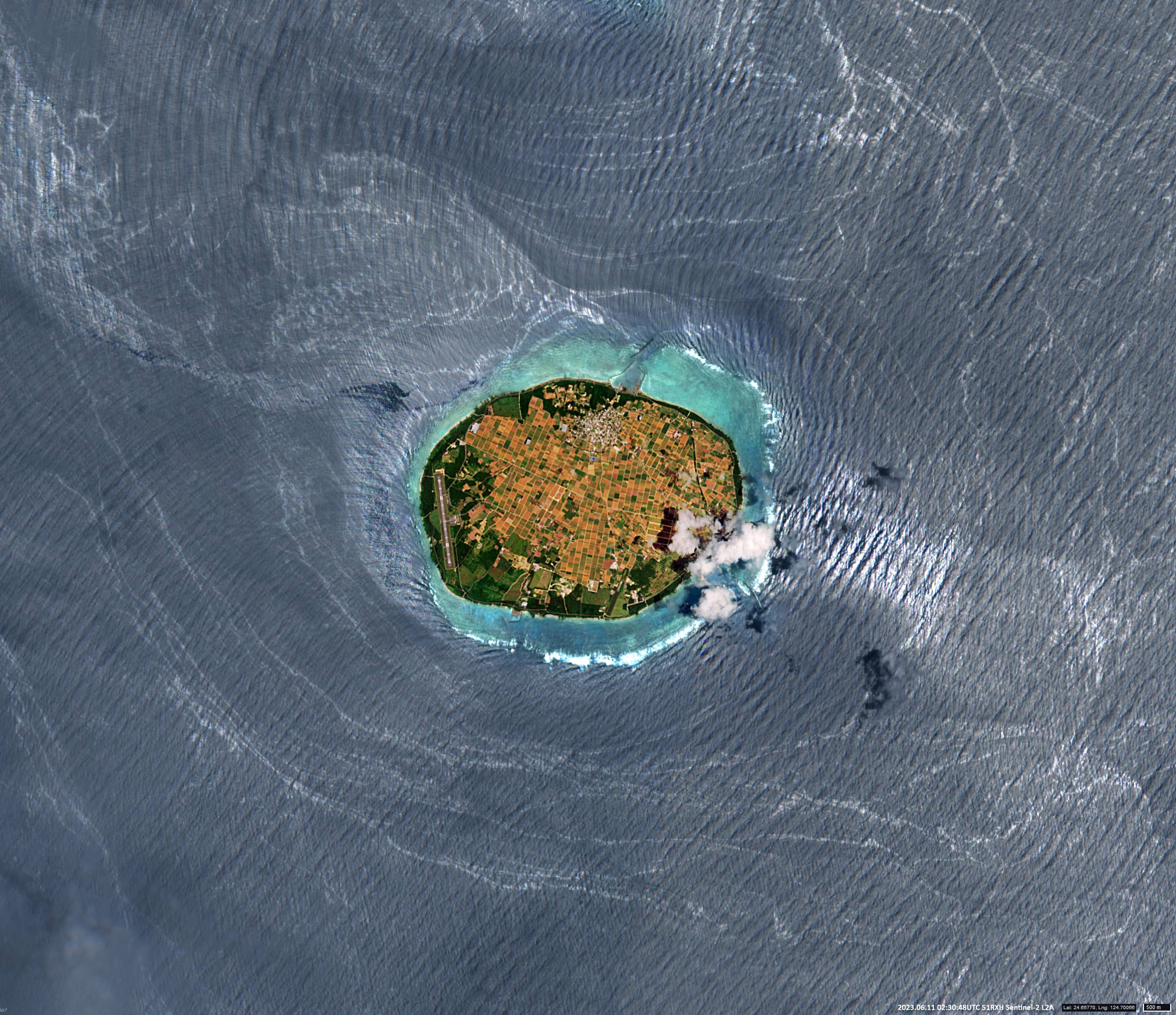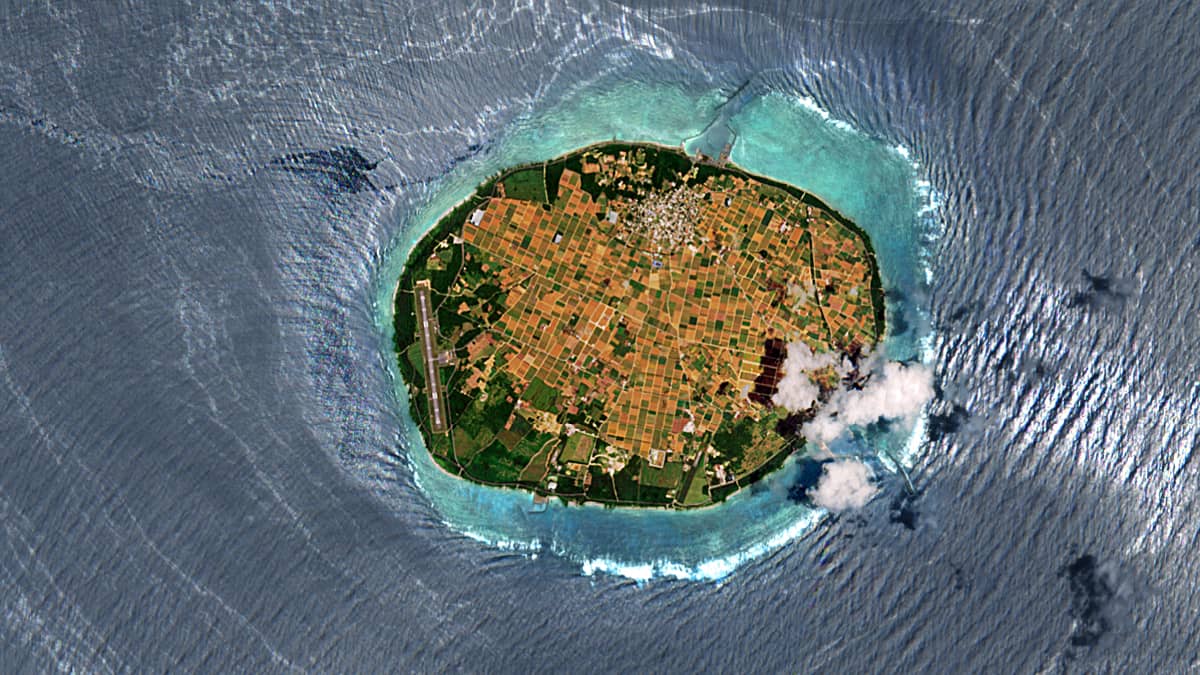
Waves interference around Tarama Island
Between Ishigaki and Miyakojima | Okinawa Prefecture, Japan
Date of acquisition: June 11th, 2023 | 02:30:48 UTC
Sensor: Sentinel-2A L2A
Coordinates: ca. 24.67°N, 124.70°E
Interesting things can often be seen in the Sunglint area.
Sunglint is an optical phenomenon that occurs when sunlight reflects off the surface of water at the same angle at which the satellite is observing it. The result is a mirror-like reflection.
In this Sentinel-2 image, the wave interference can be detected northwest of Tarama Island (多良間島). Tarama Island (shaped like an ellipse with dimensions of approximately 5.8km x 4.3km) is located in the Pacific Ocean between the islands of Ishigaki and Miyakojima, in the Okinawa Prefecture, Japan. As of 2013, 1276 people lived in the village of the same name on the island which even has an airport.
Waves influenced by the southeastern wind pass around a small island and overlap to the northwest of it, creating a clearly visible interference pattern. Wave interference is a mutual increase or decrease in the resulting amplitude of two or more coherent waves when they are superimposed on each other. The resulting wave may have larger or smaller amplitude if the two waves are in phase or out of phase.