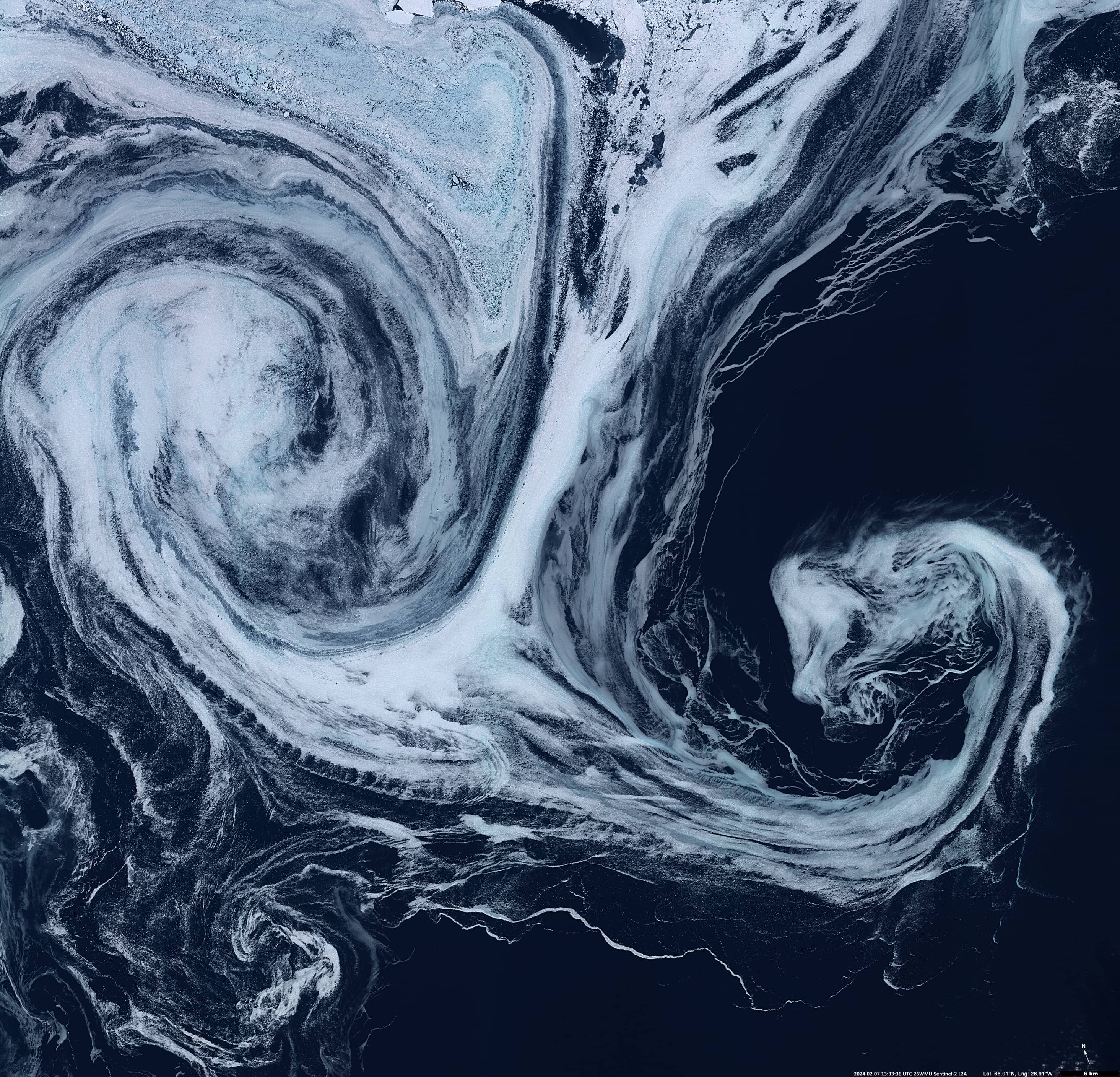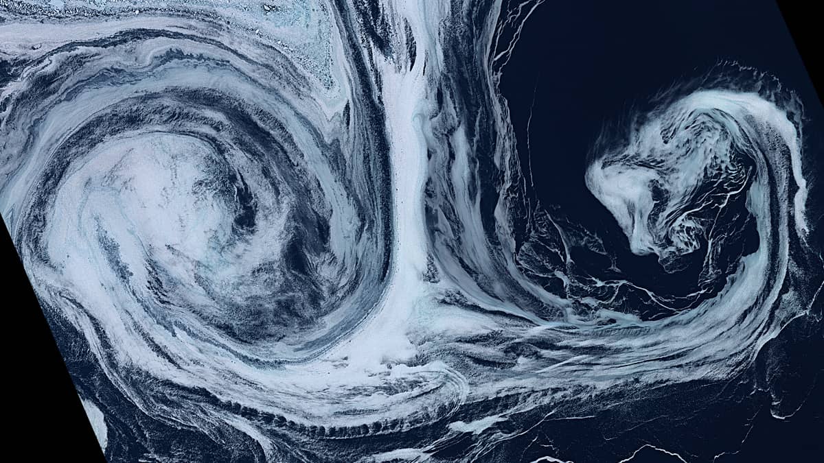
Vortex in Denmark Strait
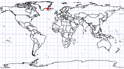
Between Greenland and Iceland | Greenland Sea
Date of acquisition: February 7th, 2024 | 13:33:36, 13:49:59 UTC
Sensors: Sentinel-2 L2A, Sentinel-3B SLSTR
Coordinates: ca. 66°N, 28.5°W
Melted sea ice is transported out of the Arctic through the Fram Strait – a strait between the northeastern tip of Greenland and the Svalbard archipelago that connects the Arctic Ocean to the Greenland Sea. The East Greenland Current (EGC) originates north of the Fram Strait and pushes water southwards to the southern tip of Greenland.
The currents are quite strong: the average annual velocity is 6–12 cm/s (1) in the near-surface part of the EGC with maximum values up to 20–30 cm/s (2). The current is also unstable and tends to form eddies that extend out to sea.
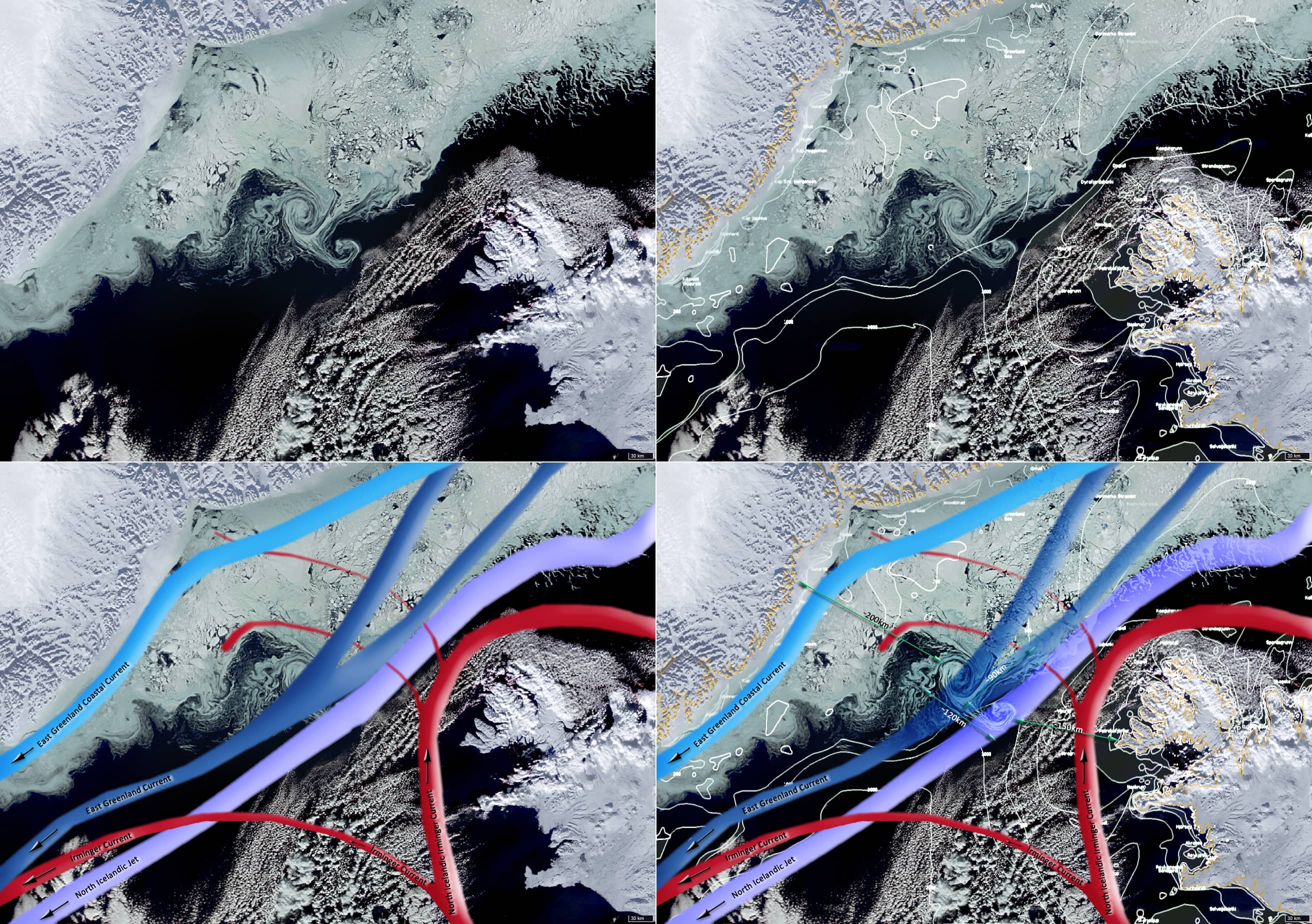
In the Denmark Strait, lying between Greenland and Iceland, the situation is complicated by several ocean currents coming together: the cold East Greenland Current and the East Greenland Coastal Current which flow northeast to southwest, the warm North Icelandic Irminger Current which flows in the opposite direction and branches off to the west; and the North Icelandic Jet, which lies at a depth of 600 m and also flows southwest (Figure 2).It should also be noted that the bottom in this area rises from -700m to -300m. The depth of the Blosseville Basin to the north is about -1500m and the depth of the Irminger Sea in this area is -2500m and deeper. The vortex shown in Figure 1 is located at the point where the sea depth is only between -350 to -470 meters (66.4°N, 27.7°W – 66°N, 28.5°W).
This structure consists of a laminar flow about 90 km long collapsing to form two differently oriented vortices to the right and left of itself, with the flow velocity significantly decreasing towards the southwest, an anticyclonic eddy to the northwest (∅~50km) and a cyclonic one to the southeast (∅~45km). The total length of the turbulent part of the structure reaches 120 km.
What can interrupt the current?
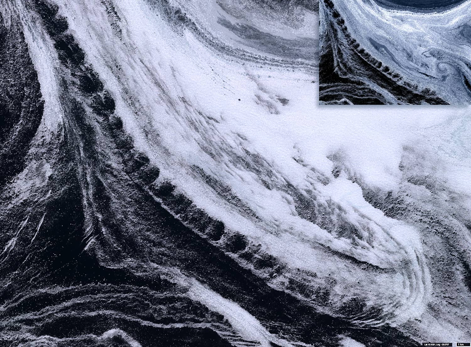
A keen observer will easily notice an extremely interesting structure (Figure 3) that looks like a comet passing close to the sun. It is a stream of water carrying the mushy floating sea ice, moving from north-west to south-east in front of the two eddies. It passes very close to the front of the anticyclonic vortex and moves in the opposite direction(!). At its widest point, it is about 45 km long and 8 km wide.
Its structure is very complex and interesting. Waves are visible in the front part, possibly caused by the wind or from the friction of water layers flowing over each other at different speeds. Along its right edge (from the south) you can see the periodic repetition of elliptical sections of ice-free water. They have approximately the same dimensions (about 1 km).
The formation of this structure indicates the presence of a local disturbance in space and time that can disrupt the laminar character of the global flow thus promoting the formation of vortices. It is also likely to influence the presence of turbulence a little further west.
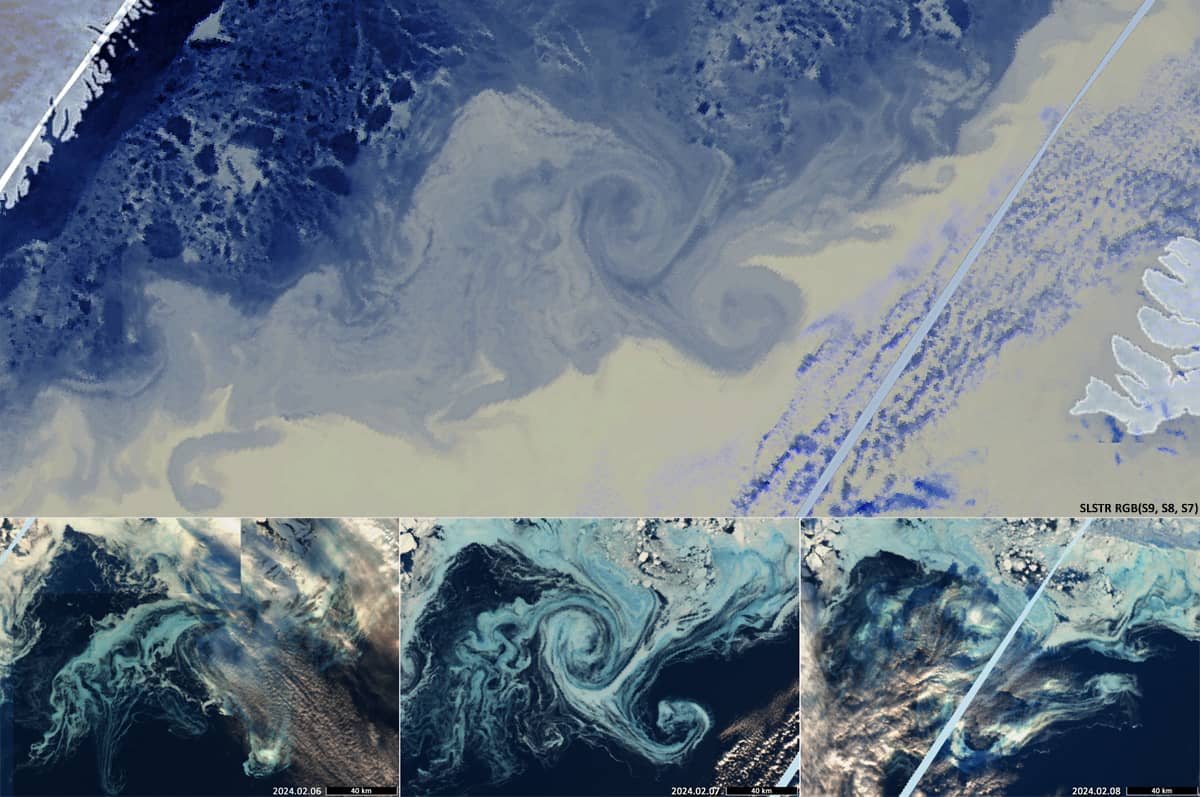
As shown in Figure 4, this situation did not last long, less than a day.
There is also a picture of the distribution of sea surface temperature: yellow indicates warmer water, light blue cooler, dark blue the coldest.