Tonle Sap Arrows
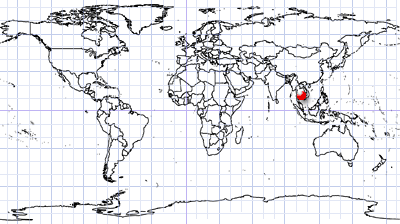
Centre West Cambodia | Indochinese Peninsula
Date of acquisition: February 27th, 2024 | 03:44:32 UTC
Sensor: Sentinel-2A L2A
Coordinates: ca. 12.9°N, 104.1°E
It is no rain of arrows from warring parties firing at each other. And they are no clues for finding a pirate treasure.
The image shows the south-western part of Cambodia’s Tonle Sap Lake, the largest body of water on the Indochinese Peninsula. The lake is drained by the Tonle Sap River, which flows into the Mekong River.
For most of the year, the lake has a relatively small surface area of about 3,000 km² and a depth of 1–2 meters. However, during the rainy season, the flow direction of the Tonle Sap River changes—the waters and millions of fish that live there are pushed upstream from the Tonle Sap River and Mekong Delta into the lake, causing its surface area to reach up to 16,000 km² and its depth up to 9 meters by autumn. Therefore, the lake floods the surrounding fields and forests.
This extraordinary migration provides a rich catch for Cambodians who live on the shores of the lake. The lake is one of the richest sources of freshwater fish in the world.
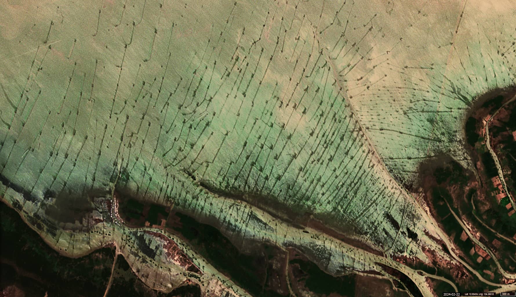
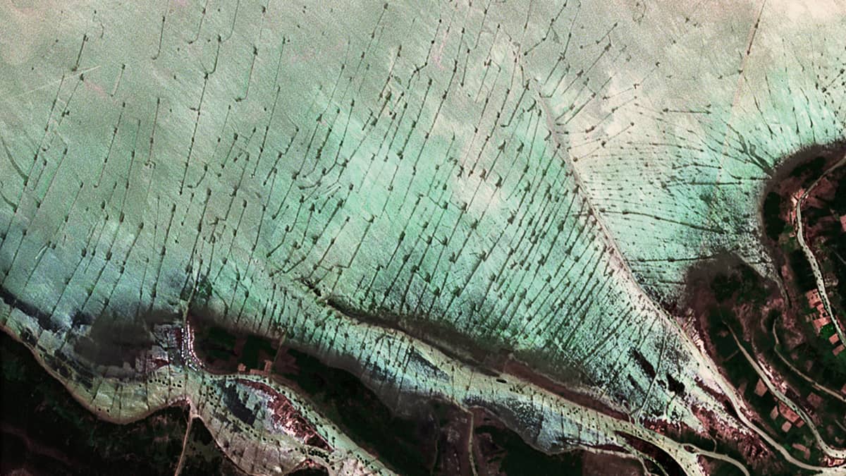
To catch the fish, the locals use traps, whose outlines resemble arrows when viewed from above. Some of these “arrows” are 700 and even 800 meters long!
The arrow-shaped trap is one of the popular fishing gears used in the Tonle Sap Lake wetland system and can be used almost all year round. The trap uses multiple chambers. First, the fish swim along the central barrier until they are inside the arrow-shaped trap fence. In this barrier, the fish still have a chance to go back the way they came. However, once they reach the trap chamber, they can only swim in one direction, towards the main trap, where they are caught.
In the past, bamboo and wood were used to make arrow-shaped traps. In recent years, restrictions on bamboo and rising prices have led fishermen to replace bamboo with nylon netting, which is much cheaper, easier to use and largely available. However, its use is harmful because the mesh size is so small that many small fish are caught as bycatch, and the plastic material does not decompose naturally and remains in the environment indefinitely.
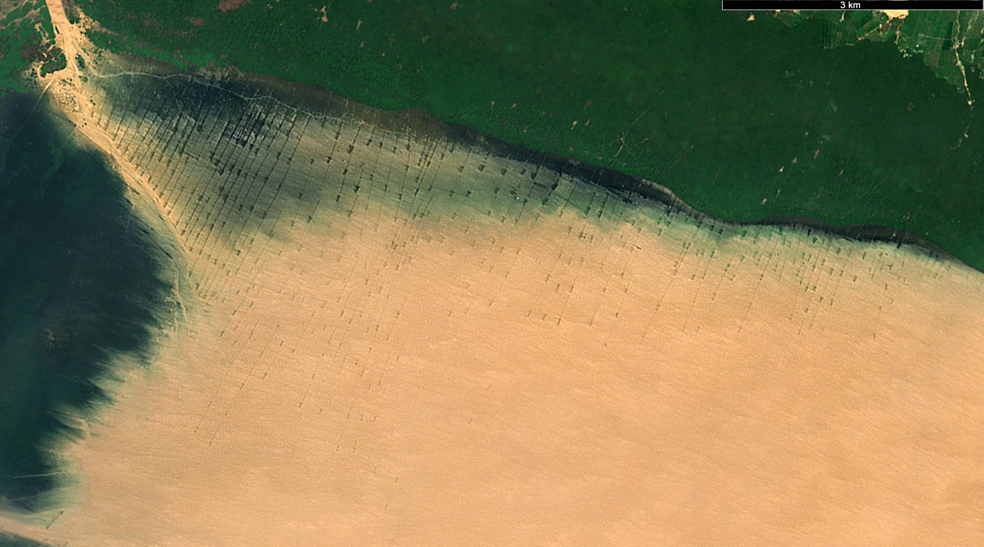
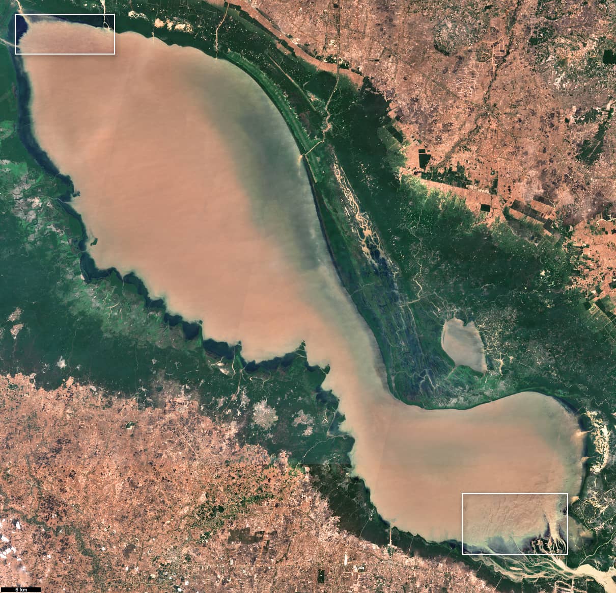
The Sentinel-2 satellite images show the southeasternmost part of the lake where it joins the Tonle Sap River (Figure 1) and the northwesternmost part (Figure 2), the area where the Sangkae, Siem Reap and Stung Sreng rivers flow into the lake.
There is also an image of the entire lake (Figure 3). Since the image was taken at the very end of February, it marks a dry period when water flows from the lake to the river, indicating the end of the fishing season.