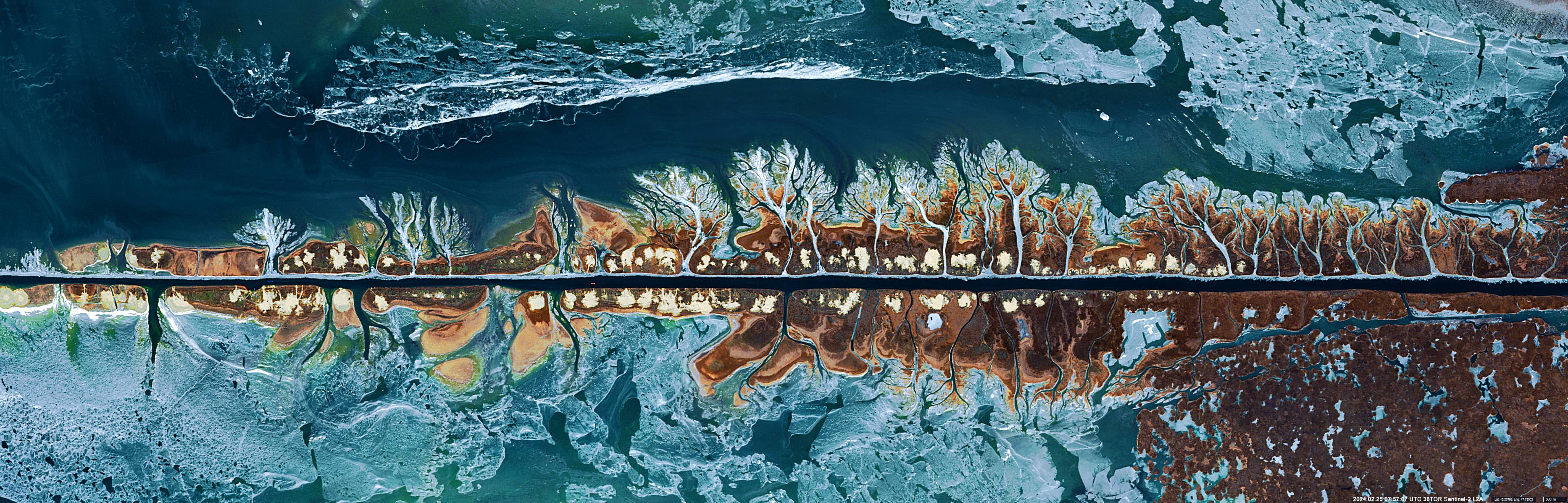
Volga-Caspian Channel
Caspian Sea | Southern Russia
Date of acquisition: February 25th, 2024 | 07:57:07 UTC
Sensor: Sentinel-2A L2A
Coordinates: ca. 45.3°N, 47.7°E
The Volga-Caspian Channel lies in the western part of the Volga delta (north of the Caspian Sea). It is a continuation of the Bakhtemir River—the westernmost branch of the Volga River. The construction of the channel began in 1874.
Most of the channel, which runs along the seacoast, is embanked with parallel sand dams to protect the channel from the effects of wind waves from the west and east. The width of the channel is about 120m.
The accumulation of river sediments, especially to the west of the channel, is a consequence of the changed hydrological and morphological conditions of the coastal zone in the channel area and the effect of the Coriolis force, which deflects the flow in the northern hemisphere to the west. As a result, the drainage beds, along which the sediment-laden water from the Volga-Caspian Channel flows, expand and grow.
The waves from passing ships and the sediments stirred up by ship propellers also affect the formation of drainage channels and contribute to their persistence.
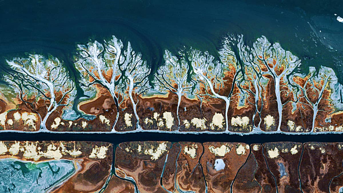
When the temperature drops enough to create the right conditions, these shallow side stream beds freeze.
The Sentinel-2 satellite image—RGB (8, 4, 3)—shows an impressive picture of such a rare situation, which looks like a landscape painting of an avenue full of trees with intertwined crowns when viewed from above.