Solar power plant in China
Gobi Desert | Inner Mongolia – Northern China
Date of acquisition: March 19th, 2024 | 03:56:59 UTC
Sensor: Sentinel-2B L2A
Coordinates: ca. 40.43°N, 106.55°E
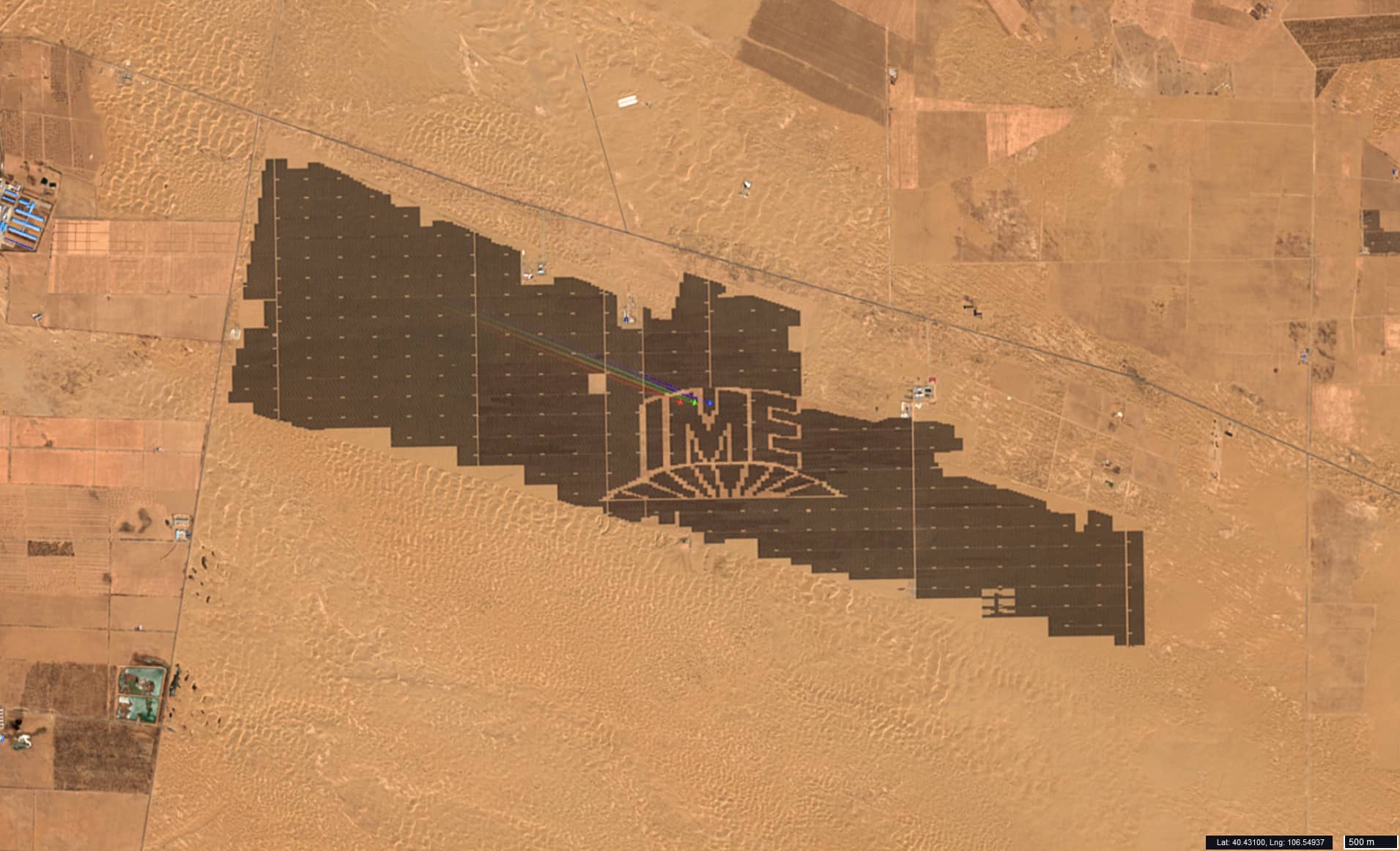
As I flew over the southern Gobi Desert in the Inner Mongolia Autonomous Region west of the Yellow River, I looked out the window… and for a moment it seemed as if I had opened an old, yellowed newspaper to the “Advertising” section (Figure 1).
But no. I’m still in the spaceship, all the instruments are fine, and below me is a photovoltaic solar power plant under construction, with the IME Logo in the middle, strictly aligned with the cardinal points and covering an area of 1.5 square kilometres. Letters written on the surface of the earth can hardly ever be read by a satellite: these letters are 650 metres high; the entire logo measures 2.25 × 1 km. And it is worth noting that this object is still not visible on Google maps, for example.
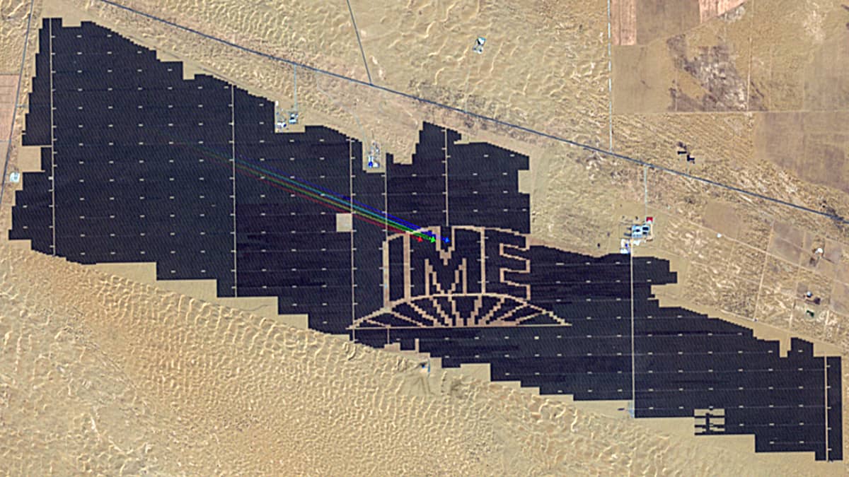
The plant itself, located ~45 km northwest of the Chinese city of Dengkou, currently covers an area of about 15 square kilometres, which is one and a half times the size of, for example, Bergedorf, a district in the southeast of Hamburg. As the station is apparently not yet in operation, it is impossible to find any information on its design capacity, what the letters mean and which company they stand for. But, using images from last year, the process of its construction can be reproduced, which took only one year from the ground up (Figure 2).
- Siteclearing and levelling: February 2023
- Site marking: July 2023
- Start of construction: August 2023
- Completion: February 2024
The image illustrates the solar energy boom in China. The Gobi Desert is ideal for the development of photovoltaic projects, with many sunny days and high levels of solar radiation. There are no significant human settlements nearby, the construction does not disrupt animal life and migration nor take up space for plants. There are hardly any similar places in the territory of the European Union.
The image of 19 March shows an aeroplane flying over the IME Logo in synchronisation with the satellite.
As there is a slight delay between the acquisition times for each channel on board the satellite, a fast-moving object (such as a jet plane) has time to move several tens of metres during this delay. In a three-channel RGB image (in this case B04, B03, B02) three aircrafts in the colours red, green and blue are therefore visible at a distance of 130–150 metres.