Solar Eclipse 2024
South-west of Mexico | Northern Pacific
Dates of acquisition:
- April 3rd, 2024 | 17:59:09 UTC
- April 8th, 2024 | 17:42:42 UTC, 17:59:11 UTC
Sensor: Sentinel-3B OLCI, Sentinel-2A, B L1C
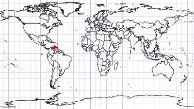
Coordinates: ca. 16.3°N, 112.4°W
On April 8, 2024, a solar eclipse took place.
The Moon’s shadow moved across the central Pacific Ocean, then across North America – from Mexico, across the USA to Canada and across the northern part of the Atlantic Ocean. The total eclipse spanned a band about 185 kilometres wide, with the Moon completely covering the Sun’s disk (except for the thin corona).
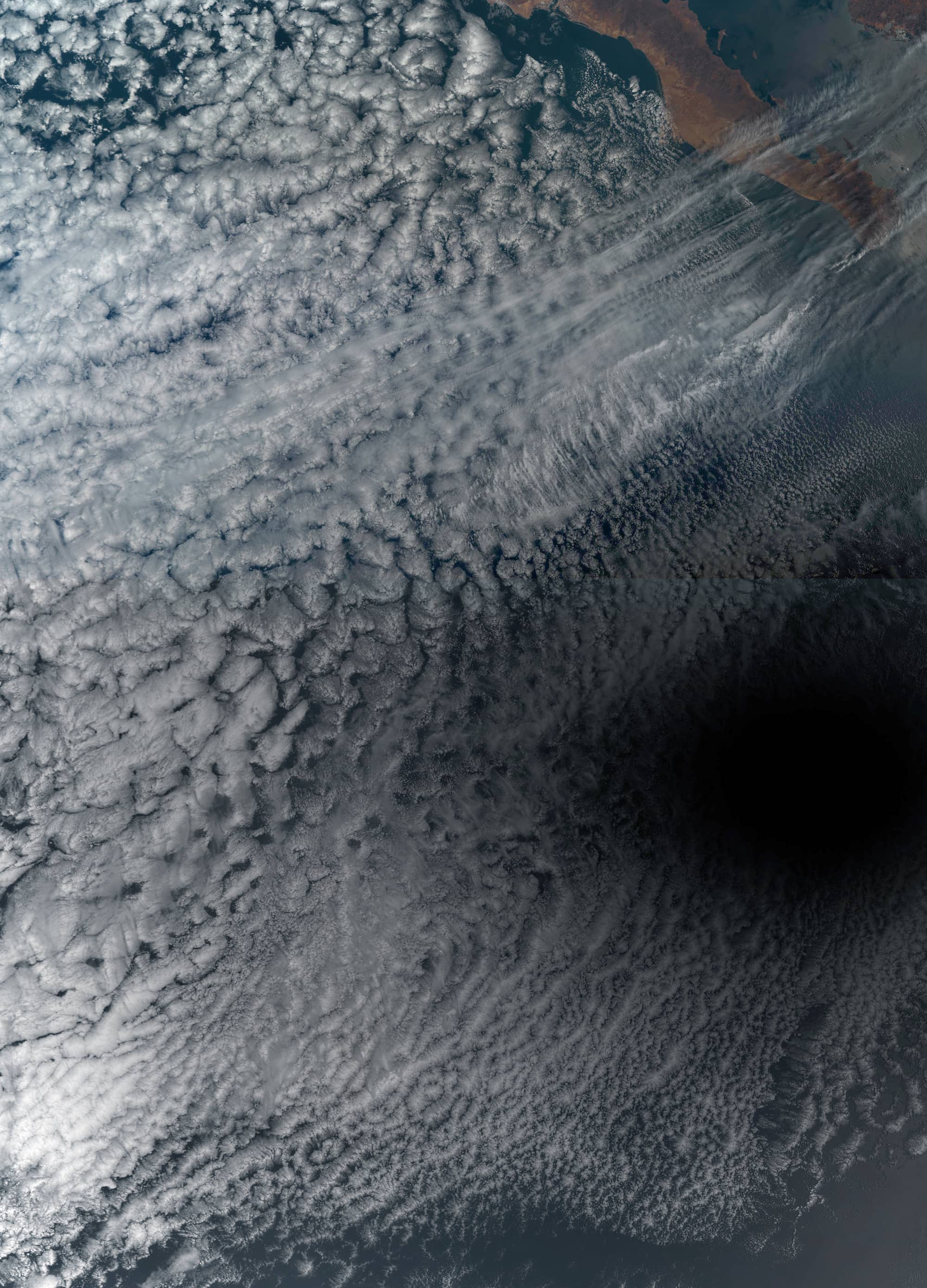
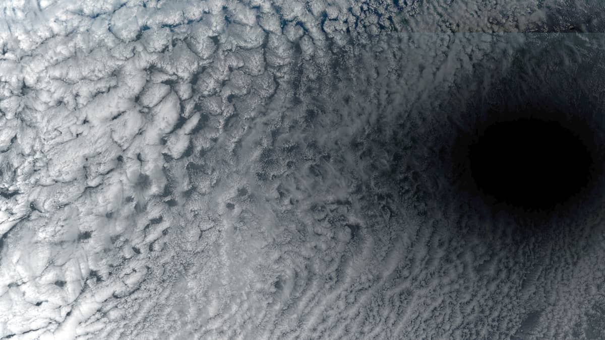
Sentinel-3 “caught” the moment of total eclipse at about 17:47 UTC, when the shadow centre was located over the Pacific Ocean about 300 kilometres southwest of the Mexican island of Socorro, above a field of closed convective cloud cells at an altitude of 2-3 km (Figure 1).
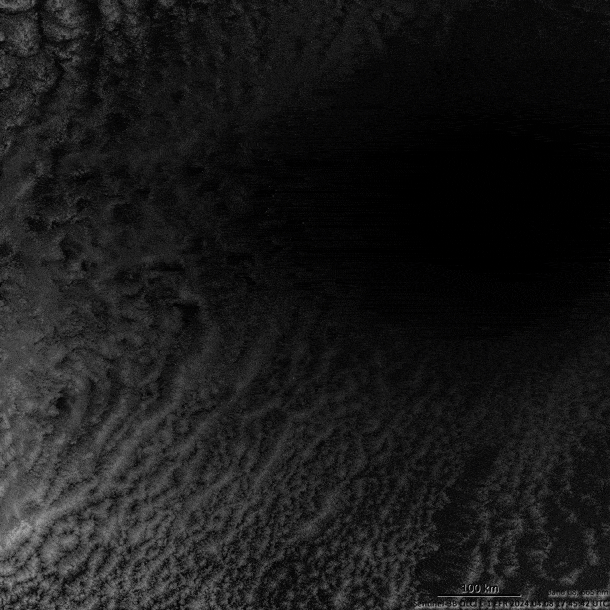
The small animation (Figure 2) shows the shape and size of the absolute eclipse shadow (in Mercator projection) and the coordinates of its centre using image contrast.
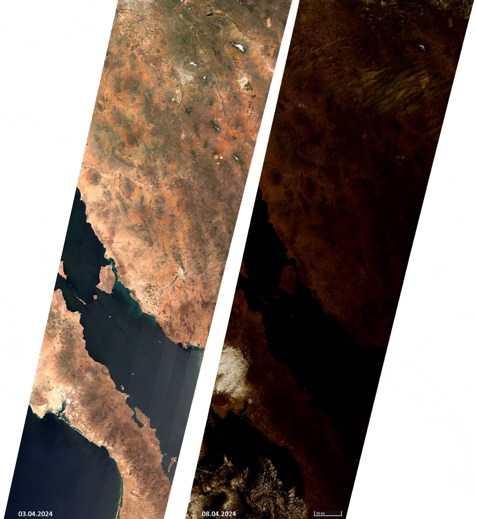
Sentinel-2 missed the moment of total eclipse, but captured an image (Figure 3) of part of the Baja California Peninsula, the Gulf of California and the western part of Mexico with 75-85% eclipse.
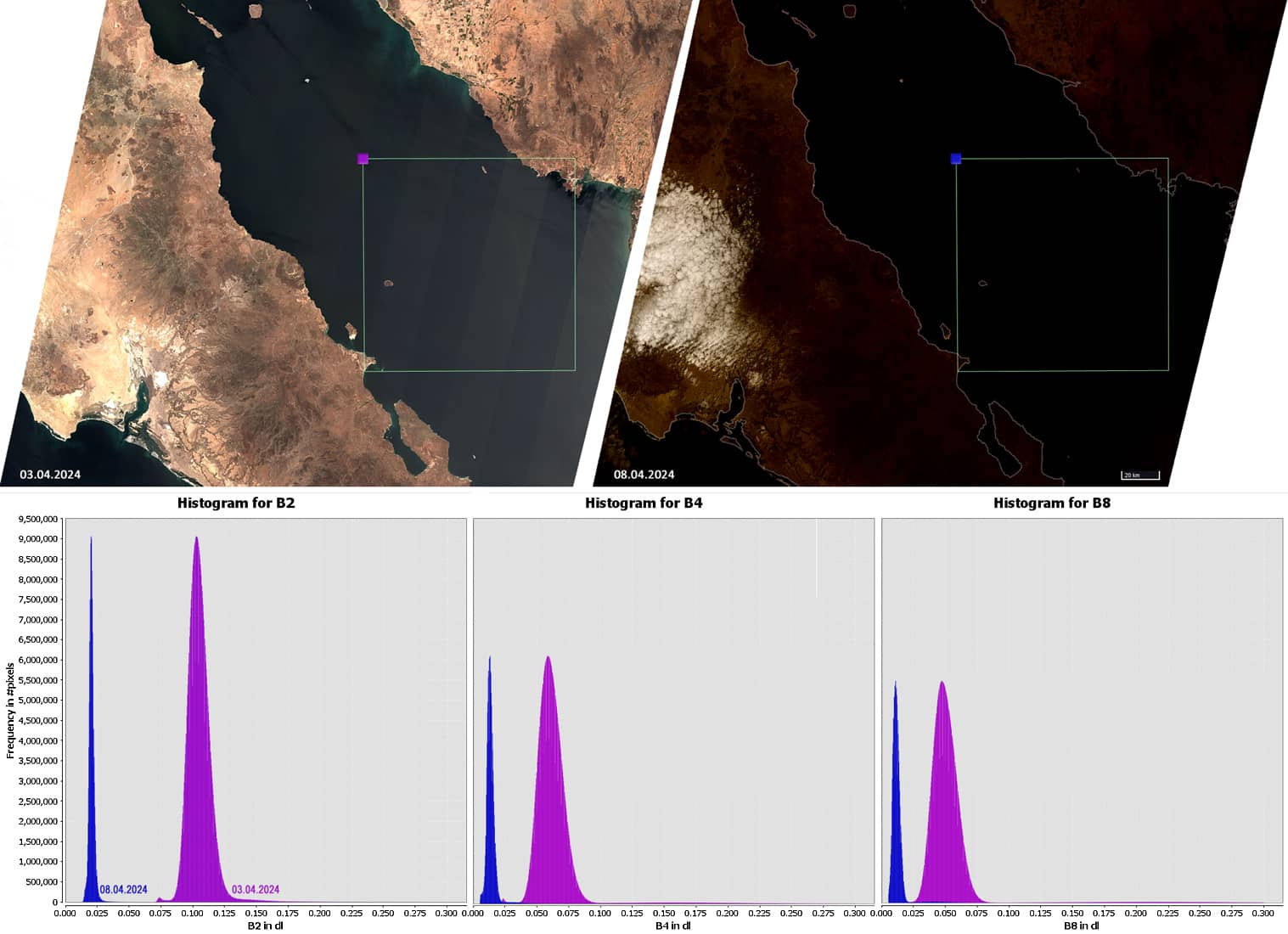
Included is a Sentinel-2 image showing the part of the Gulf of California that is mostly covered by water. Based on the light reflectance data of this relatively homogeneous surface, reflectance histograms are shown in channels B2, B4, B8 for the case of a sunny cloudless sky and during obscuration during the eclipse (Figure 4). Histograms show that darkening in these channels is 55-80%.