Sims Island
West of the foot of Antarctica
Dates of acquisition:
March 20th, 2023 | 13:43:31 UTC
September 16th, 2023 | 13:43:31 UTC
Sensor: Sentinel-2B L2A
Coordinates: ca. 73.27°W, 78.54°S
Sometimes it is a real challenge to find out the names of geographical objects: islands, peninsulas, rivers, lakes, mountains, etc, especially when these objects are very small, insignificant, or located in places that are very far from civilization. And it is very satisfying to overcome these challenges.
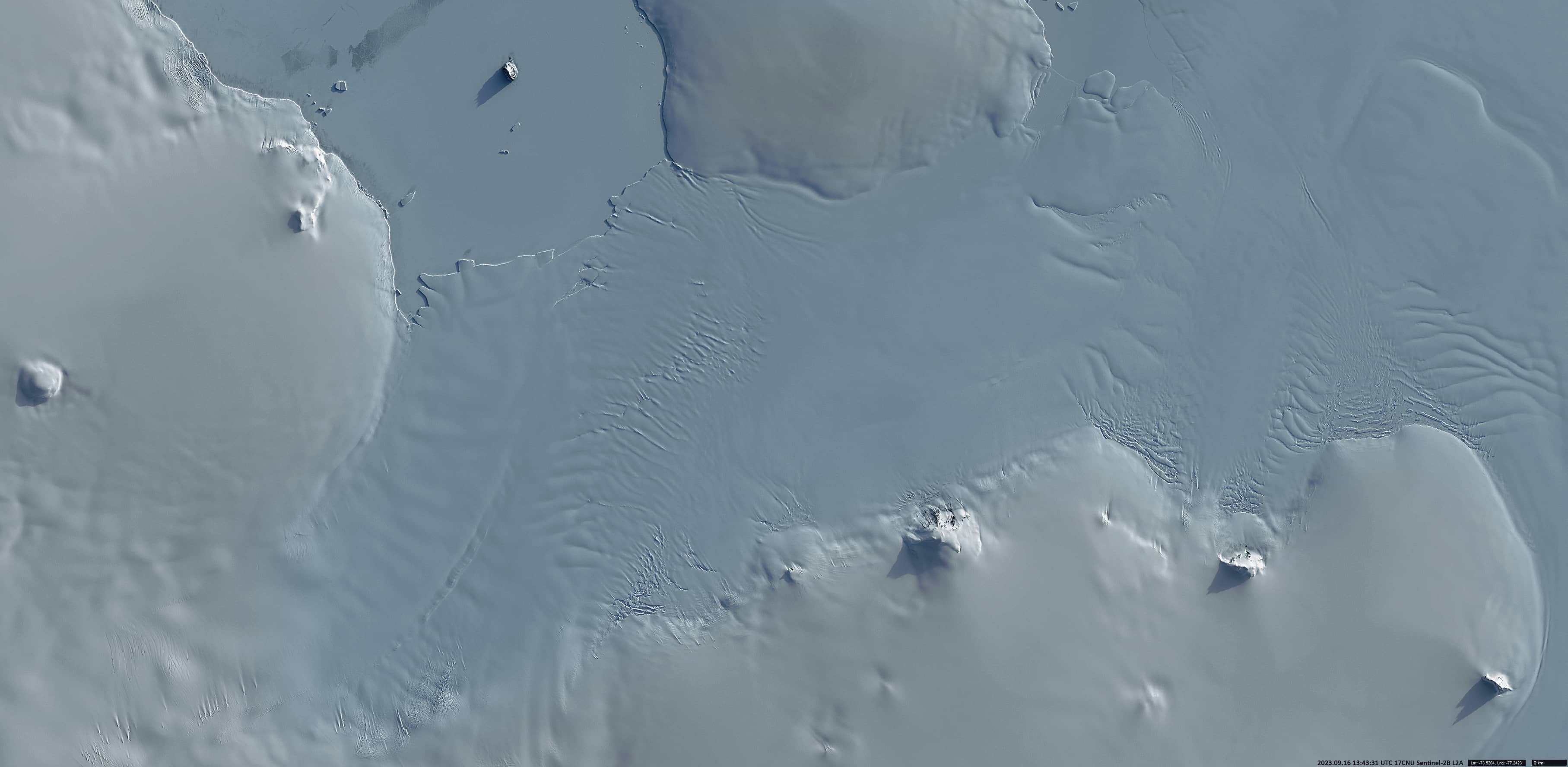
Such a case was a rock formation lost in the waters of the Bellingshausen Sea off the coast of Ellsworth Land, west of the foot of the Antarctic Peninsula.
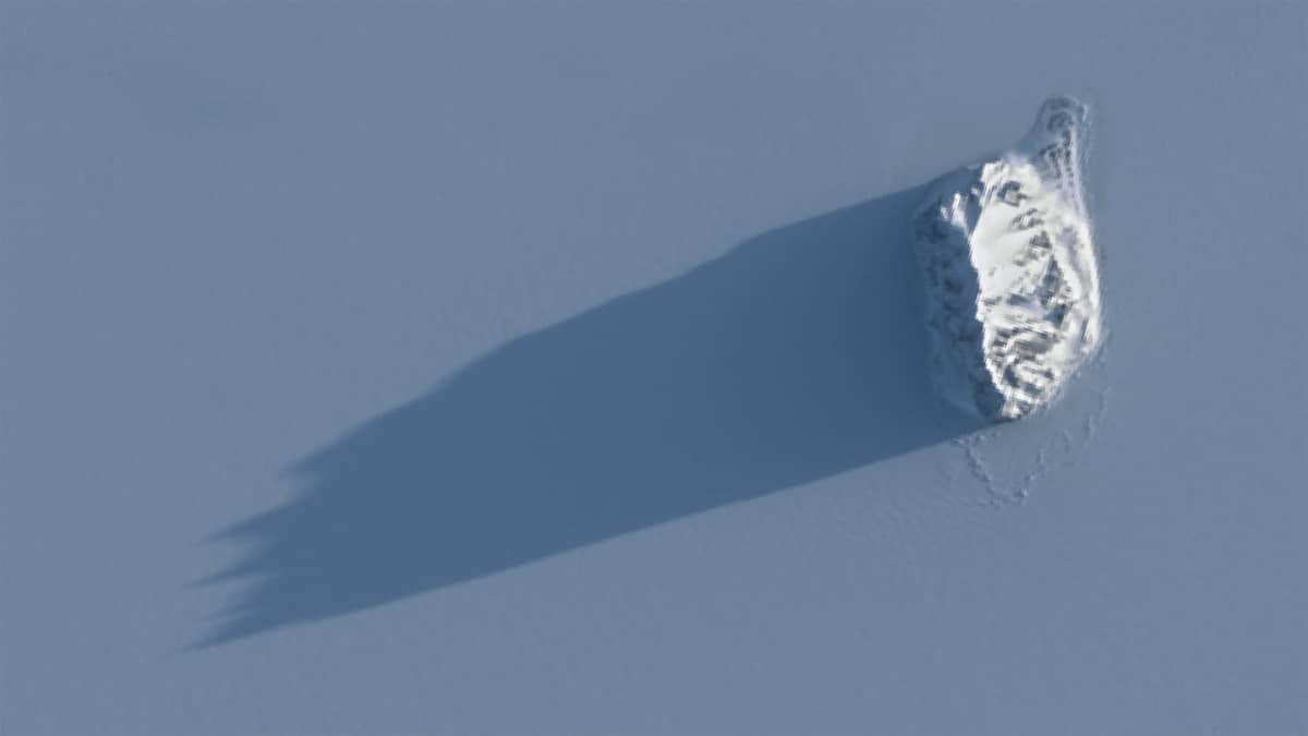
Partially free of snow, the rock protrudes from the surrounding pack ice and casts a long shadow towards the southwest. In fact, it was this long sharp shadow, clearly visible from space, which attracts the attention (Figure 2).
It is Sims Island (73.277°W, 78.54°S), a small but prominent, partly ice-free volcanic island south of Smyley Island, between the Rydberg Peninsula and Case Island, in the southern part of Carroll Inlet. It was discovered from an aircraft by the US Antarctic Survey expedition in December 1940 and named after Lieutenant L.S. Sims, the expedition’s doctor.
The island is 1.5 km long, 0.8 km wide and 380m high.
From April to August – winter in Antarctica – the light conditions do not allow satellite imagery in the visual wavelength range. One of the very last cloudless images before the dark period (Figure 1) and one of the very first after the end of the polar night (Figure 2) are presented here.
Using the sun zenith angle from the satellite auxiliary data and the calculating the length of the shadow cast by the island on the ice, allows a rough estimate of the island’s height. So, at the point with coordinates (73.28°W, 78.54°S), its elevation above the sea ice is about 360m,.
Further southeast of Sims Island, on the coast of Palmer Land, a line of four separate nunataks can be seen in the satellite image (Figure 3). These are the so-called Snowy Nunataks, consisting of volcanic outcrops that are likely several small subglacial volcanoes. From west to east these are Espenschied Nunatak (500m, 73.53°W, 78°S), Mount McCann (700m, 73.5°W, 77.8°S), Mount Thornton (700m, 73.53°W, 77.24°S) and Mount Benkert (700m, 73.6°W, 76.8°S).
A nunatak (Greenl. “nunataaq”) is a rocky peak, mountain ridge or hill completely surrounded by ice, rising above the surface of an ice sheet or mountain glacier.
Fig. 1
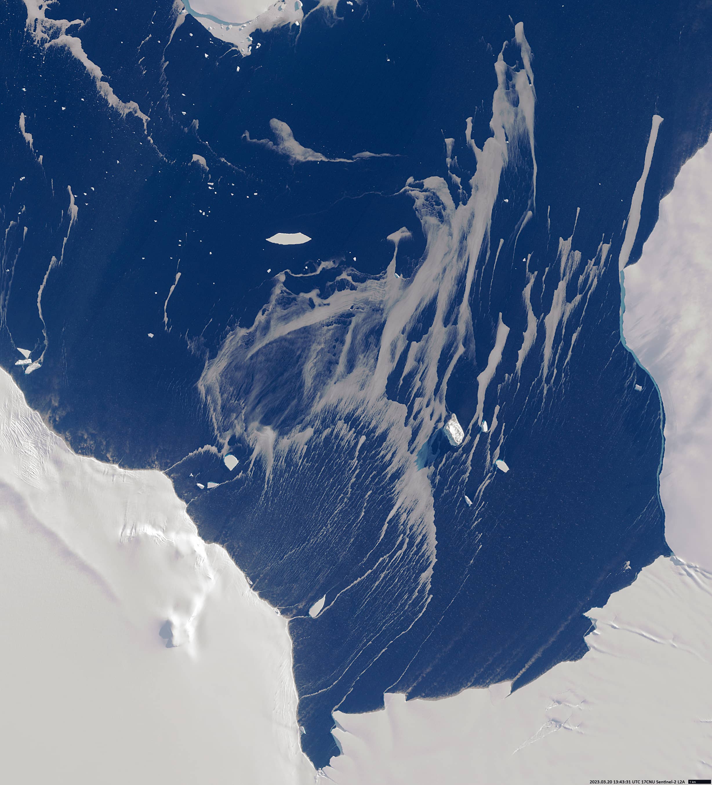
Fig. 2
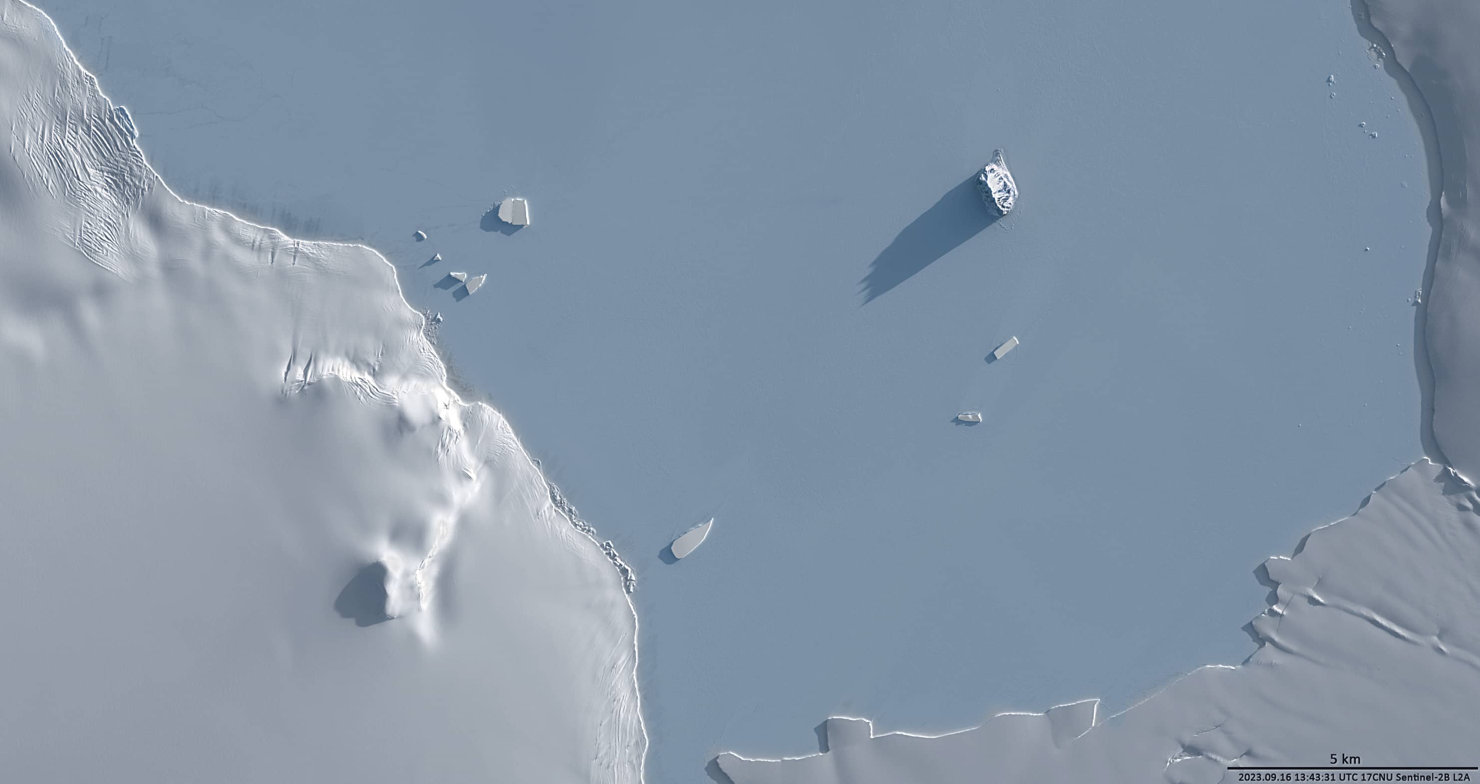
Fig. 3