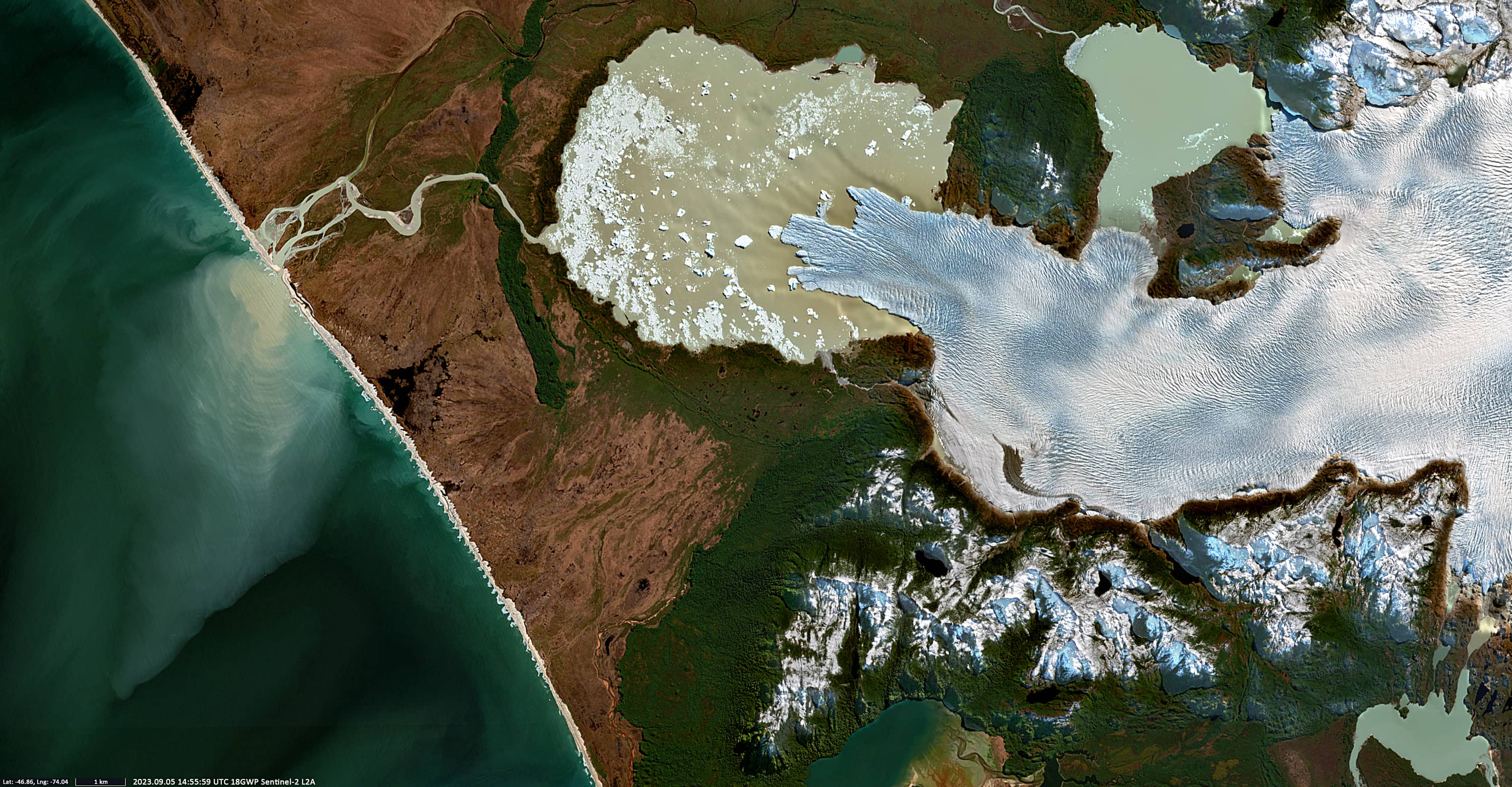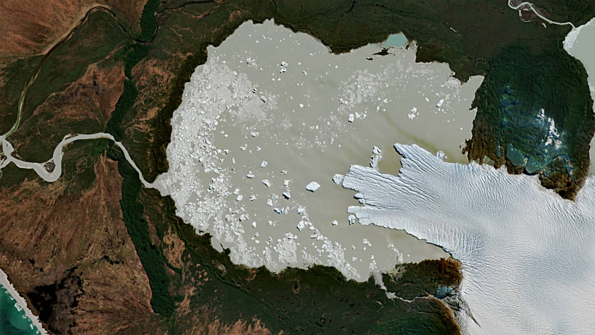
San Quintín Glacier
San Rafael National Park | Southern Andes, Chile
Date of acquisition: September 5th, 2023 |14:55:59 UTC
Sensor: Sentinel-2A L2A
Coordinates: ca. 46.86°S, 74.05°W
San Quintin Glacier, also known as San Tadeo, is the largest of all the glaciers that calve from Campos de Hielo Norte in Laguna San Rafael National Park in the southern Andes, in the province of Aysen, Chile, covering 790 km². The glacier is 57 km long. San Tadeo drains westward from the Patagonian Glacier Plateau to the swampy lowlands of the Isthmus of Ofqui, where it feeds a proglacial lake. The lake is formed as a result of the significant loss of the glacier ice masses after the collapse of part of its main front. The lake is connected to the Gulfo San Esteban of the Pacific Ocean by the Nevado River.
The Sentinel-2 image shows a plume of cold fresh water heavily loaded by sediments being carried out into the sea at up to 11km, with a total plume area of ca. 80km2.
The regular, sawtooth-like structure created by waves breaking on the shore is also interesting. Based on this image, it is possible to make a qualitative assessment of the topography of this strip of coastal seabed. It stretches on both sides of the river mouth, reaching a total length of about 14 km; the distance between the “teeth” is within 170-200 m; their amplitude reaches 100 m. On land, immediately behind the beach, there is a low coastal cliff, 2-4 m high, which also has a jagged outline.