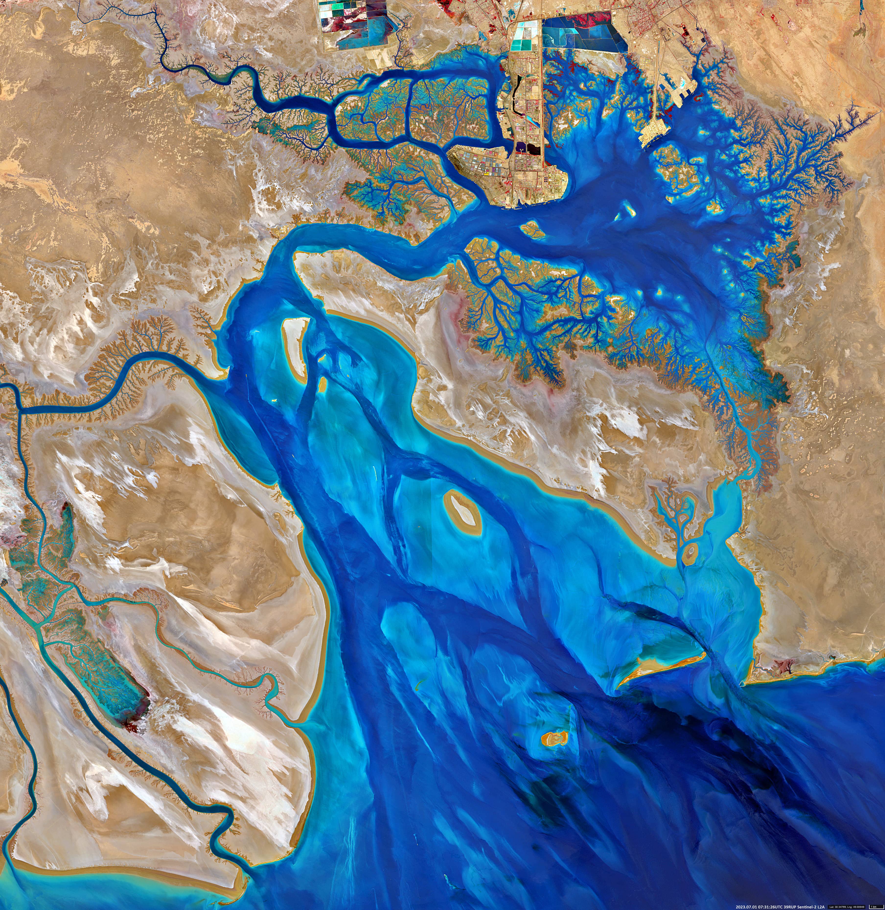
Musa Bay
Bandar-e Emam Khomeini | Iran
- July 1st, 2023 | 07:31:26 UTC
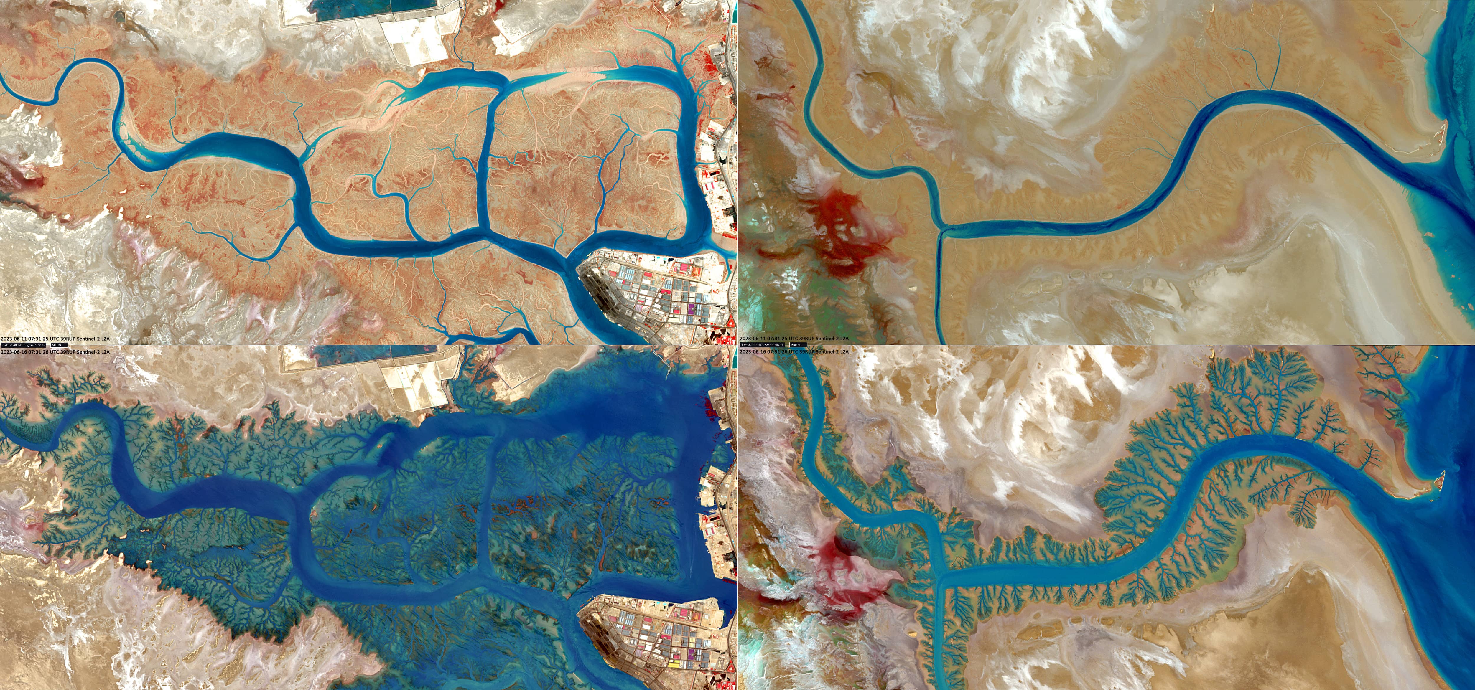
- June 11th, 2023 | 07:31:25 UTC
- June 16th, 2023 | 07:31:26 UTC
Sensor: Sentinel-2A L2A
Coordinates: 30.4°N, 49.13°E
The image from the Sentinel-2 satellite shows the southwestern tip of Iran (جمهوری اسلامی ایران – Jomhuri-ye Eslɒmi-ye Irɒn) as a false colour composite based on the bands 8, 4 and 3. In the upper part of the image, the port city of Bandar-e Emam Khomeini and the petrochemical special economic zone of Mahshahr, located in the north of Musa Bay, Khuzestan province, can be seen. Musa Bay is a shallow estuary with a depth of 20 – 50 m, reaching 73 m in places. It is located east and southeast of the port city. The land around this bay and in the wider area is muddy and 2 – 4 m above sea level. To the west are the marshes and mudflats of the Shadegan Reserve. It is the largest wetland in Iran. Further south is the northern part of the Persian Gulf.
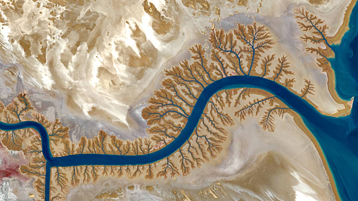
The dendritic structures of the waterways are of scientific interest and attract with their aesthetic beauty. This typical branched fractal shape is formed when water flows over a relatively flat and uniform erosion-resistant surface. These structures can be observed around the Gulf of Musa as well as along the banks of rivers and channels that flow into the Persian Gulf, which is shallow in this area (left side of the image). During low and high tide, these areas can be almost free of water or, on the contrary, completely flooded, as the images from June 11th and 16th respectively show.