New South Wales | Australia
Date of acquisition: 2026.03.23 | 00:26:59 UTC
etc. (animations)
Sensors: Sentinel-2B L2A
Coordinates: ca. 32.3°S, 142.4°E
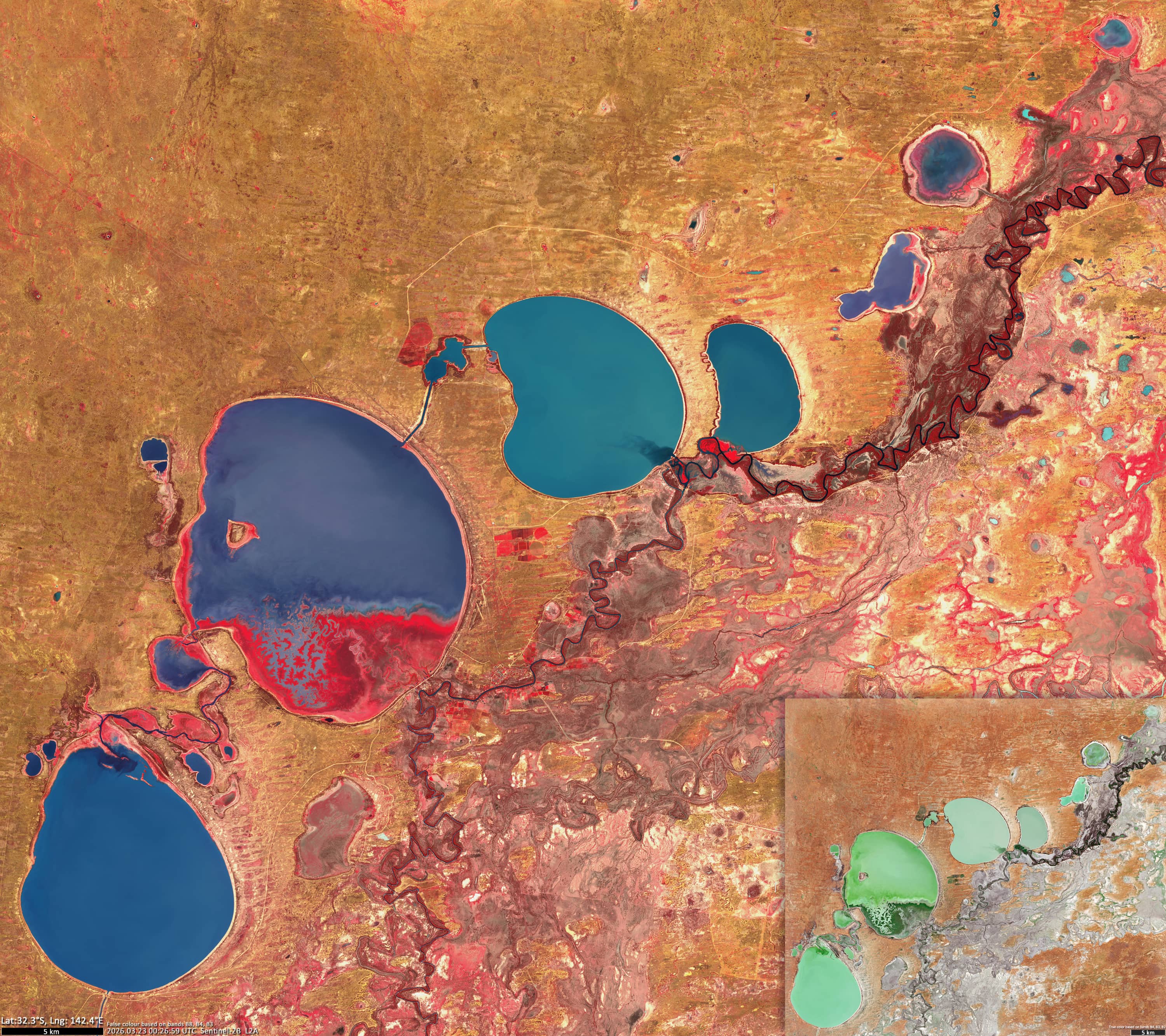
The Menindee Lakes are a series of shallow basins located in the southwestern region of New South Wales, Australia. They are next to the Darling River, approximately 200 kilometres upstream from its confluence with the Murray River. The system comprises several major lakes, including Menindee, Cawndilla, Pamamaroo and Wetherell, as well as smaller associated basins.
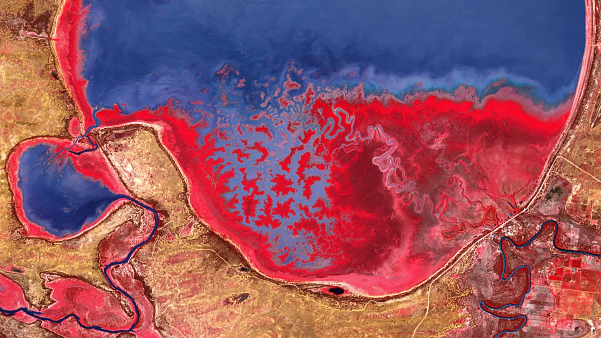
Geomorphologically, these lakes are natural depressions within an arid floodplain, formed by sedimentary processes and surrounded by aeolian sand dunes. Many of the lakes are ephemeral, filling and drying out depending on the flow of the river.
Their hydrology is driven by the Darling River’s episodic flooding, which typically follows heavy rainfall in the upstream catchment area. These flooding events often occur in late summer or winter and recharge the lakes, sometimes with considerable delay. During the dry periods, inflow can cease entirely, causing the lakes to shrink or dry out.
A prolonged drought beginning in 2016 led to the system almost completely drying up. However, substantial refilling of the lakes occurred following above-average rainfall in 2020 and 2021.
Satellite observations reveal significant spatial and temporal variations in water colour and dry-falling areas. These can change significantly within weeks or months. If the water level frees parts of the lake, vegetation can grow and is reflecting the light intensively in the near infrared wavelengths.
The accompanying imagery shows the current state of the lake system in the NIR spectral range. Time-series animations illustrate its evolution over the past six months, as well as the detailed spectral changes that occurred in Lake Menindee and smaller basins such as Balaka and Bijijie between early 2025 and March 2026.
All datasets are based on multispectral Sentinel-2 observations.
Further reading
Menindee Lakes (Wikipedia)
Menindee – Gateway to the Menindee Lakes, Blue Heart of the Outback
Water management (Australian Government)
Die Menindee Lakes laufen endlich wieder voll (NASA Earth Observatory, German)
Menindee Lakes Finally Refilling (NASA Science)
Figure 1: Menindee Lakes System using NIR