Groningen gas field
North Sea | North-west of Texel
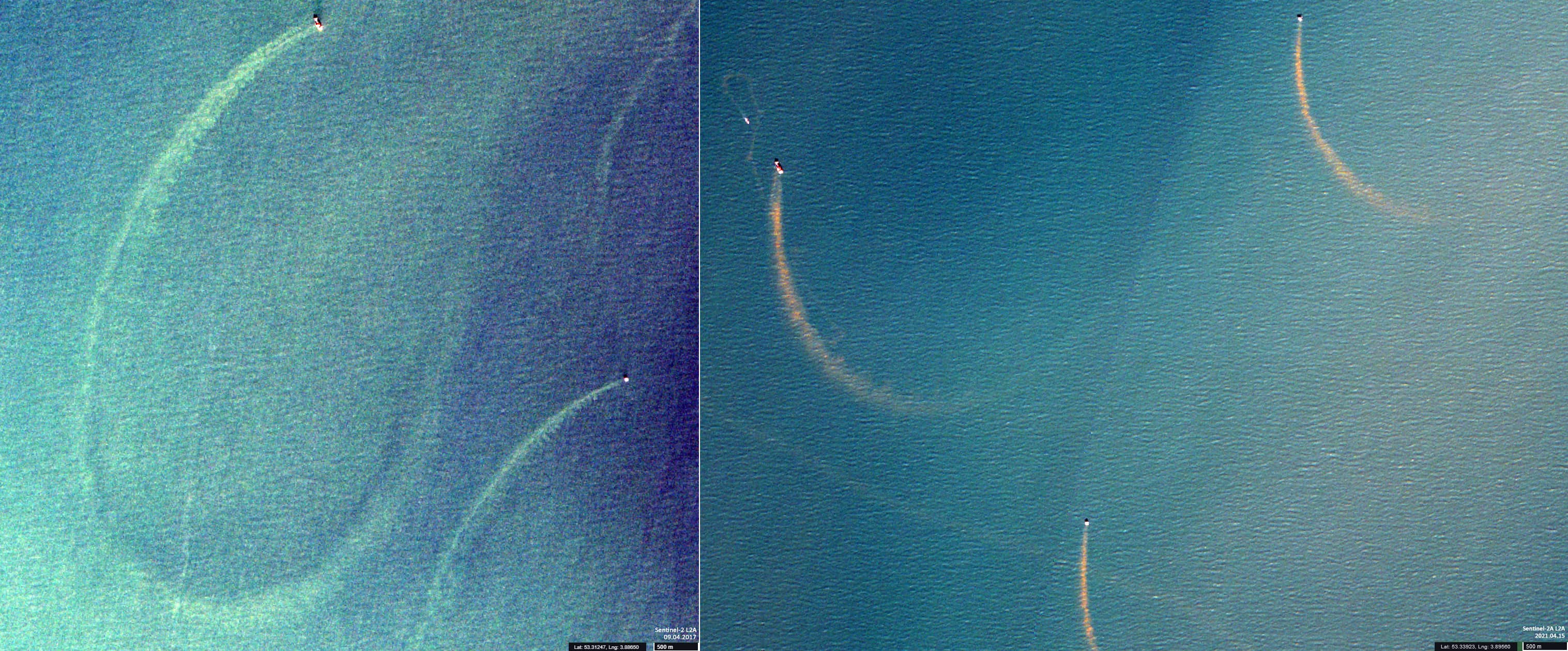
Date of acquisition: April 15th, 2021 | 10:56:06 UTC
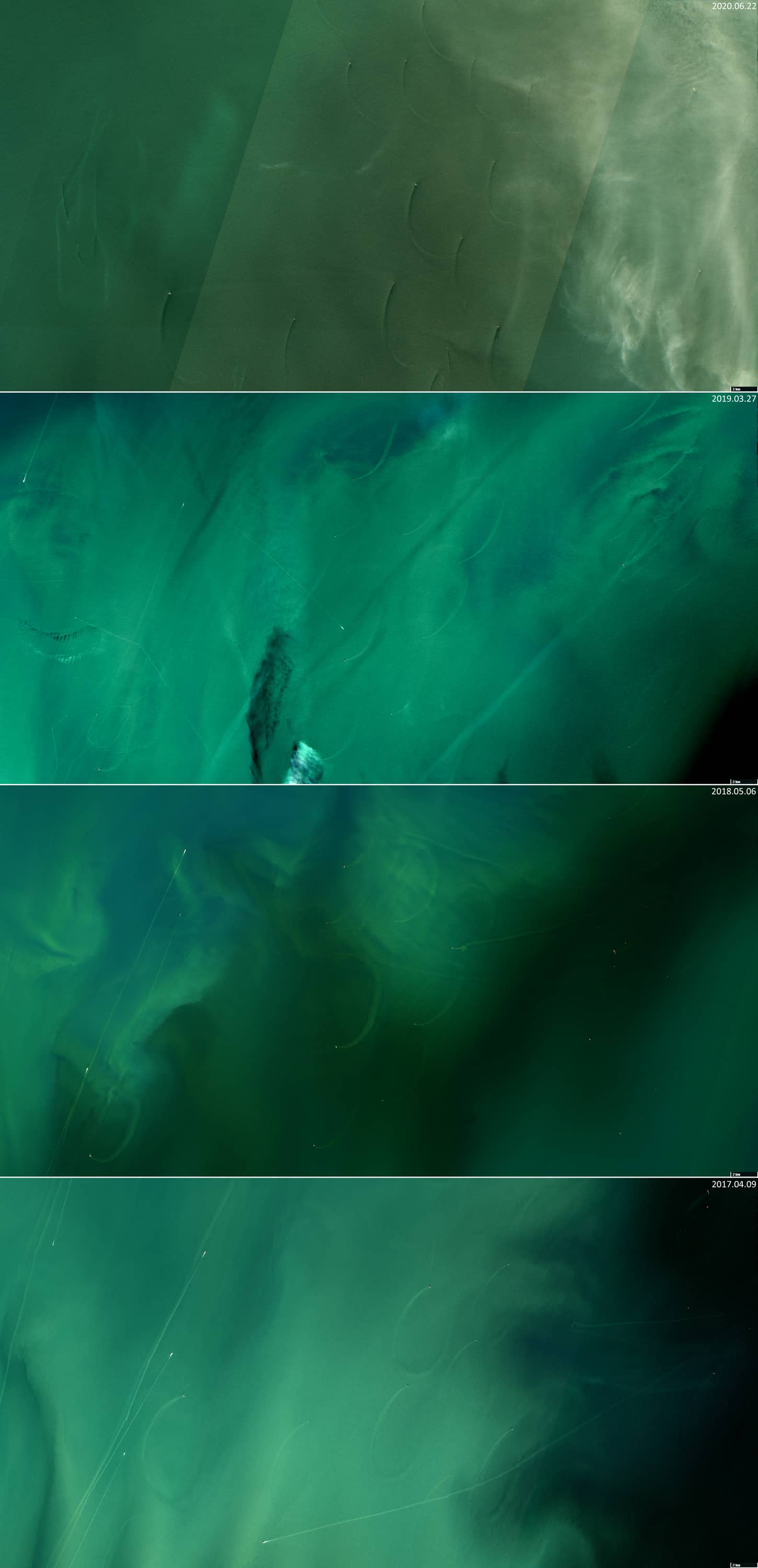
April 9th, 2017 | May 6th, 2018 | March 27th, 2019 | June 22nd, 2020
Sensor: Sentinel-2A L2A
Coordinates: ca. 53.3°N, 3.9°E
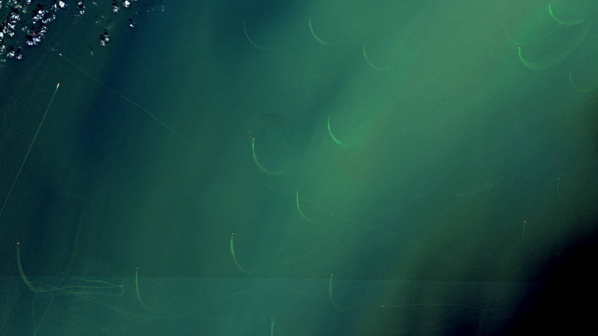
The satellite image shows an area in the North Sea, 50 – 70 km north-west of the West Frisian island of Texel. The Groningen gas field is located there. Several gas platforms can be seen in the satellite image as small bright spots. There are lighter-coloured structures spread out from these platforms towards the south. They are approximately the same length (3 – 4 km) and behave in the same manner: in the image they all bend counter-clockwise.
These are most likely turbulences caused by the gas platforms and they can occur in the atmosphere as well as the water. In water, it promotes a higher concentration of suspended matter within these plumes compared to the surrounding water. The combination of current, tide and wind cause the resulting formations to twist. Plumes may have different lengths, directions, and radii of curvature as shown on different acquisition dates below. However, the direction of curvature – counter-clockwise – remains the same.