Bach Ice Shelf
Bellingshausen Sea | Antarctica
Date of acquisition: February 09th, 2026 | 13:29:19 UTC
Sensor: Sentinel-2B L1C
Coordinates: ca.72°S, 71°W
The Bach Ice Shelf, named after the renowned composer, is situated along the southwestern edge of the Antarctic Peninsula on the southern coast of Alexander Island, in the Bellingshausen Sea. Its surface consists of firn over denser glacial ice, and meltwater channels, lakes and fracture networks have shaped its appearance, particularly during the Australian summer (Figure 1).
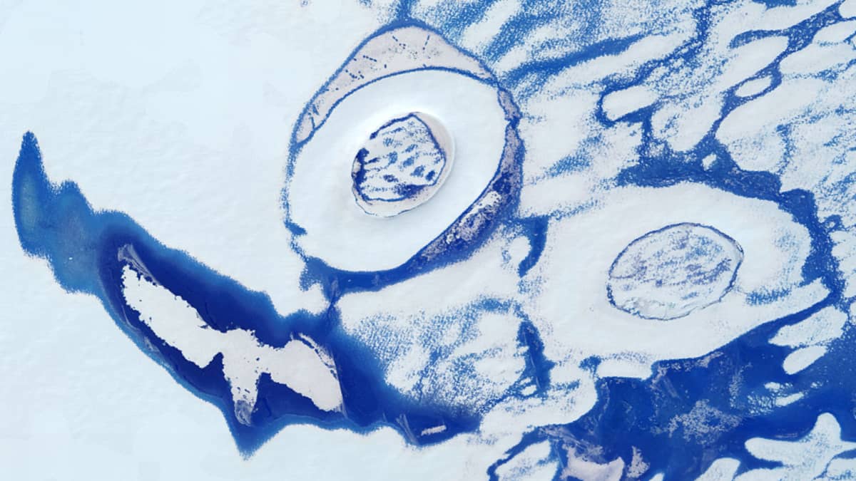
In recent years, satellite imagery of this region has frequently revealed meltwater features, such as supraglacial lakes and slush. Here, we focus on a less well-described phenomenon: large, ring-shaped structures embedded within these meltwater environments (Figures 1 and 2).
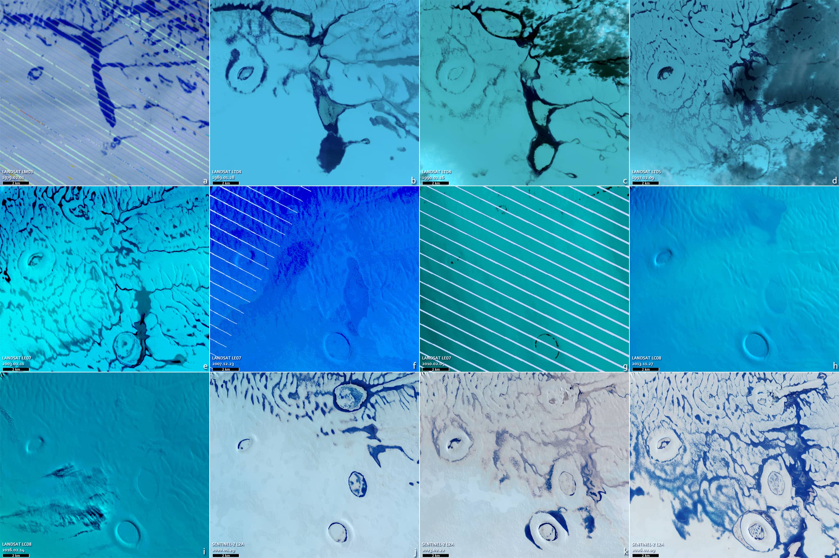
These oval-to-circular formations, referred to here as ORS (oval ring structures), consist of a raised rim of snow and ice surrounding a partially melted internal lake. In summer, they resemble bagels, while in winter they appear more like elongated craters. Individual ORSs typically range from 4 to 10 km² and are clearly visible in high-resolution satellite imagery (Figures 2 and 3-1 to 3-3).
Features of this scale are relatively rare, and they appear to have a lifespan of several decades. Multiple examples can be observed in the northern sector of the ice shelf, often at different stages of development (see Figures 2 and 3-1 to 3-3).
Despite gaps in the observational record, the evolution of selected structures can be reconstructed using satellite data from 1972 to 2026. One structure was well developed in the early 1970s, suggesting an age of over 50 years, with only minor changes in shape over time (Figure 1, No. 5).
Another structure appears to have formed around 1979, likely originating from a meltwater channel (Figure 4a). Over time, the system evolved into a more stable oval structure, while the surrounding rim gradually became more pronounced (Figures 4d–j).
The formation of this elevated rim is probably related to seasonal variations in the water level. During the melting season, rising water promotes lateral melting along the lake margins and facilitates heat exchange between the water and the ice. At the same time, water can migrate into the surrounding firn layers and refreeze, thereby strengthening the structure. In winter, declining water levels and renewed snow accumulation contribute further to the growth of the rim.
By 2026, the overall morphology of the structure had remained stable, although the internal lake had gradually decreased in size, suggesting a slow loss of water over time.
More broadly, recent satellite observations indicate an increase in the presence of meltwater, enhanced slush formation and the development of fractures across the ice shelf (see Figures 4k and 4l). Many of the ring-shaped structures are now surrounded by water, giving them an island-like appearance (see Figures 2 and 3-1 to 3-3).
The table summarises the key characteristics of the most prominent structures, including their size, orientation and the extent of their internal lakes.
|
ORS number |
Ring size | Lake size | Ring width | Azimuth | Lake area |
|
1 |
3.2 × 2.2 km | 1.6 × 1.2 km | 450 – 790 m | ≈ 320° |
Slake ≈ 1.4 km2 |
|
2 |
2.3 × 3.7 km | 1.2 × 1.9 km | 560 – 880 m | ≈ 342° |
Slake ≈ 1.5 km2 |
|
3 |
2.5 × 2.5 km | 0.8 × 1.2 km | 540 – 810 m | ≈ 315° |
Slake ≈ 0.9 km2 |
|
5 |
2.2 × 2.6 km | 1.2 × 0.65 km | 570 – 890 m | ≈ 50° |
Slake ≈ 0.6 km2 |
Further reading
Antarctic ice shelves are prone to slush (Physics Today)
Ice circle (Wikipedia)
Bach Ice Shelf (Grokipedia)
Antarctic Slush (University of Cambridge)
Doppelt so viel Schmelzwasser: Schneematsch auf antarktischen Eisschelfen wurde unterschätzt (Polar Journal)
Slushy Snow Affects Antarctic Ice Melt (FYFD)
Large Ring formations (Lake Ice)
Very Large Ice Rings (Lake Ice)
Fig. 1
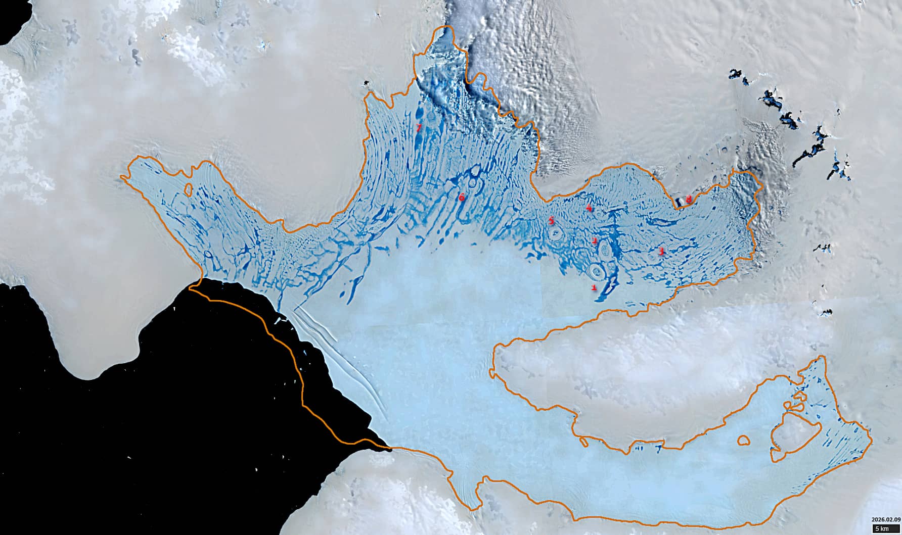
Fig. 2
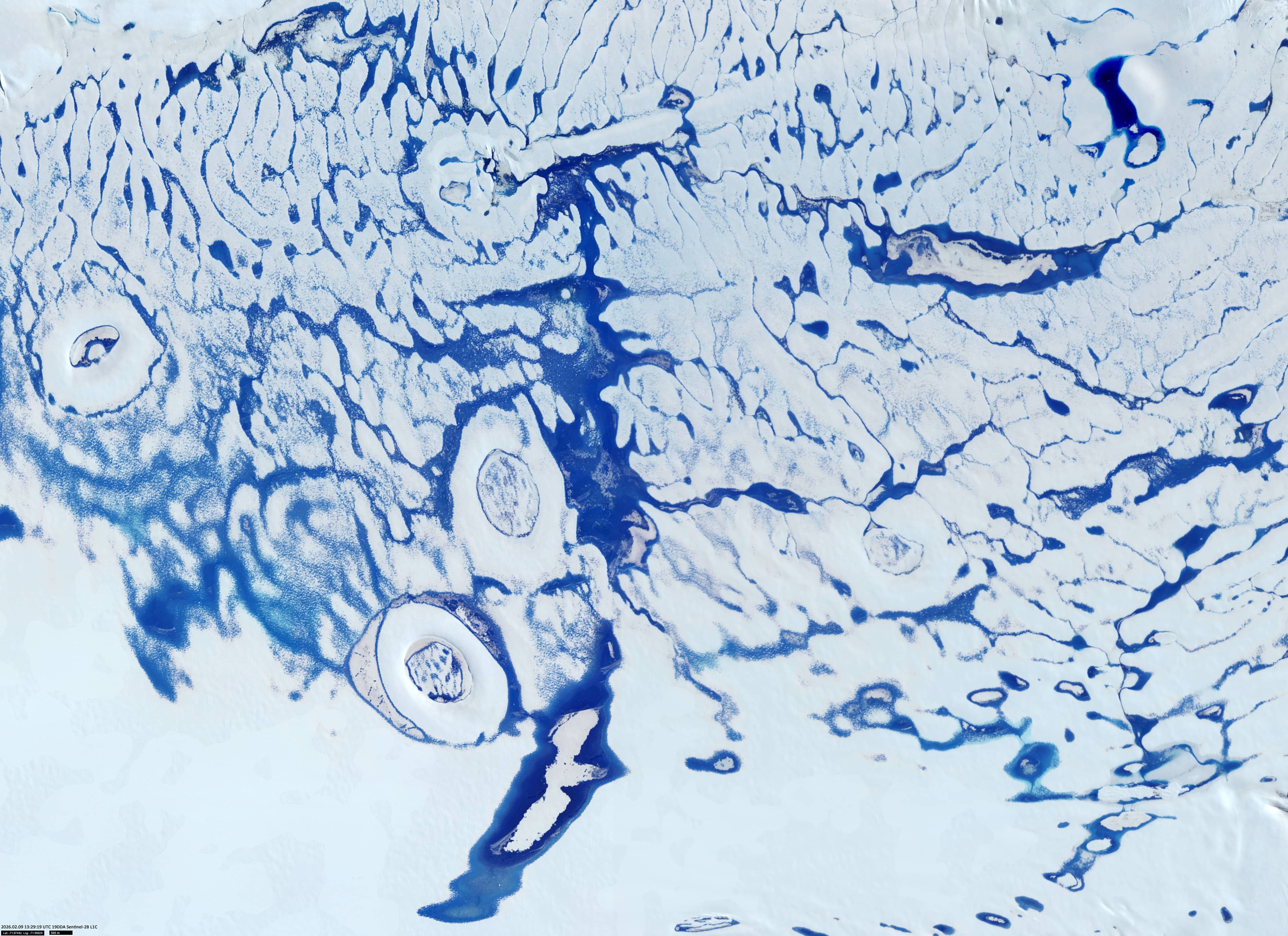
Fig. 3-1
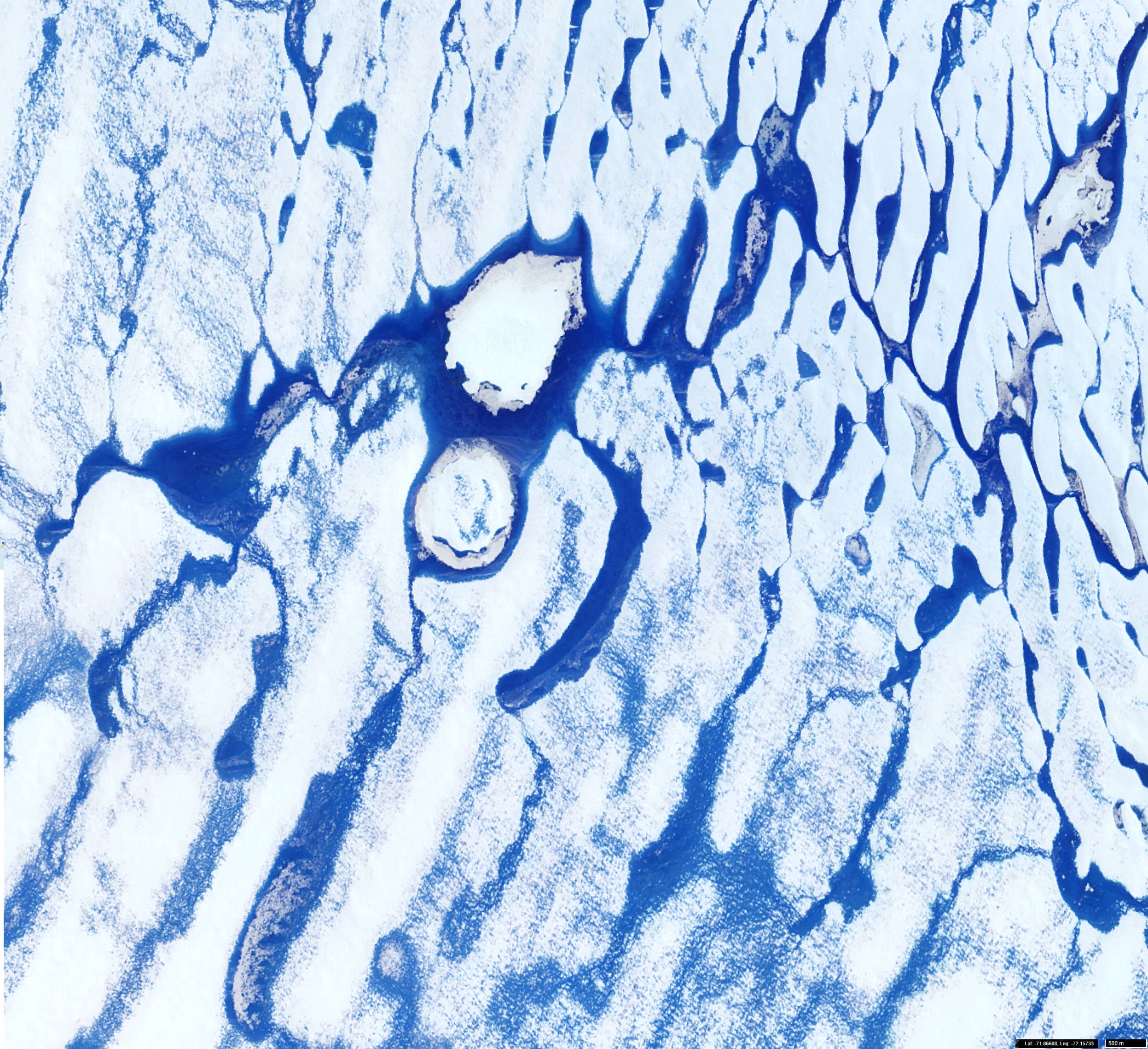
Fig. 3-2
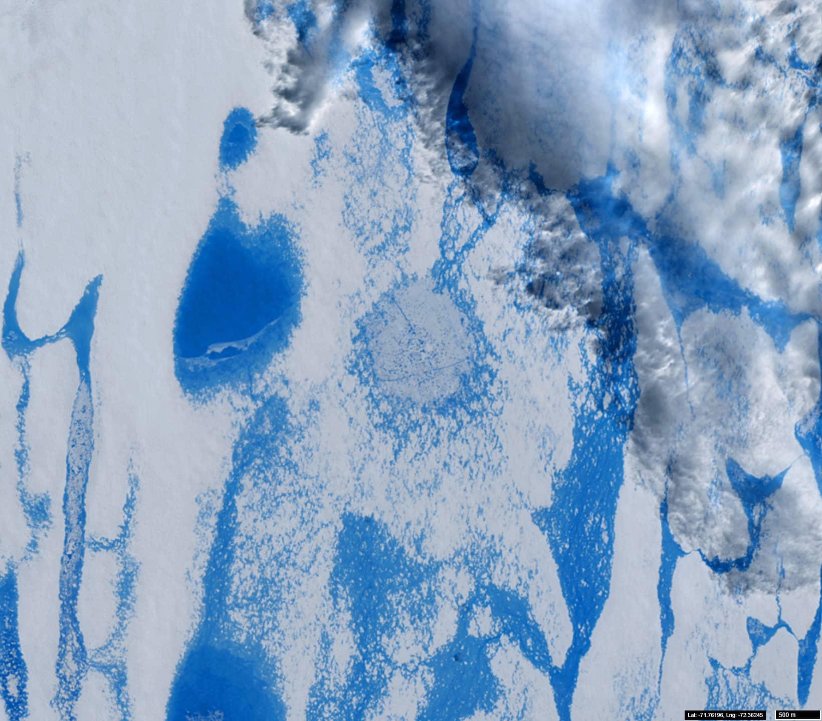
Fig. 3-3
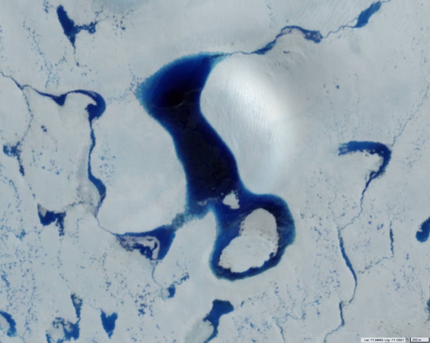
Fig. 4