
Geikie Peninsula
Eastern coast of Greenland
Dates of acquisition:
• 2026.07.26 | 13:27:21 UTC
• 2026.07.27 | 13:51:21 UTC
• 2026.07.29 | 13:37:21 UTC
• 2026.07.30 | 13:57:29 UTC
• 2026.08.03 | 13:52:31 UTC
Sensors: Sentinel-2A,B,C L1C, L2A
Coordinates: ca. 70°N, 25°W | MGRS: 26WNC 76 67
The Geikie Peninsula, the world’s largest fjord system, extends for approximately 350 km and is located on the eastern coast of Greenland, south of Scoresby Sund (Greenlandic: Kangertittivaq). It is a remote, ice-covered region known for its basalt plateaus, formed during the development of the Kangerlussuaq Dome approximately 61–45 million years ago. Some of these plateaus rise to more than 2,000 m.
The Geikie Plateau is an ice-covered highland on the peninsula. It forms the northeastern extremity of a region characterized by steep, sharply dissected basalt cliffs created by successive lava flows. Its volcanic history is associated with the initial rifting of the lithospheric plates and the opening of the North Atlantic. The mountain ridges exhibit pronounced stratification, with many peaks showing distinctive pyramidal forms and remarkably regular basalt layers exposed by glacial erosion.
Studying this region is extremely difficult because of its remote location. It is farther from any air base in Greenland or Iceland than virtually any other location in the region. The Icelandic Low frequently brings relatively warm maritime air masses into the area, contributing to persistent unfavourable flying conditions along the southeastern Greenland coast. Extreme remoteness and severe weather make the region difficult to access even for aerial photography.
Nevertheless, the peninsula has a remarkably distinctive appearance.
“Greenland’s hidden treasure” – Margie Turrin
As Margie Turrin described it in her account of an expedition to Geikie:
When the peaks of Geikie appeared from the snow I was captivated. Line after line, row after row pyramid like peaks rose with a certain regal proudness through the ice sheet. Chiseled points with finely leveled layers stood 1500 ft. and higher through the ice, surrounding the plane, while below us the radar showed the ice thickness to be 1.5 miles. These are towering features. Buried millions of years ago by the ice sheet this truly must be Greenland’s hidden treasure. Sheared edges formed perfect pyramids where competing ice flows had crossed, working in opposition to carve away the rock.
…
Large crouching shapes appeared trailing down to rounded blocks of rock emerging like the toes of an Egyptian sphinx standing guard over this magnificent treasure for all these years.
…
If they fly to Geikie, get on that flight!
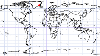
We have the great opportunity, however, to observe this remote region from space and see the fascinating patterns and phenomena created by natural processes. The following satellite images show several areas of the Geikie Peninsula; their locations are indicated in Figure 1.1.
Further reading
Kangertittivaq (Wikipedia)
Greenland’s Geikie Peninsula.jpg (Wikimedia Commons)
Blosseville Coast (Wikipedia)
The Sphinx of Greenland (Margie Turrin, Lamont-Doherty Earth Observatory)
Volcanic history of the Lower Tertiary plateau basalts in the Scoresby Sund region, East Greenland (PDF)
When Land Ice Meets Sea Ice (NASA Science)
Fig. 1 – General view of the Geikie Peninsula.
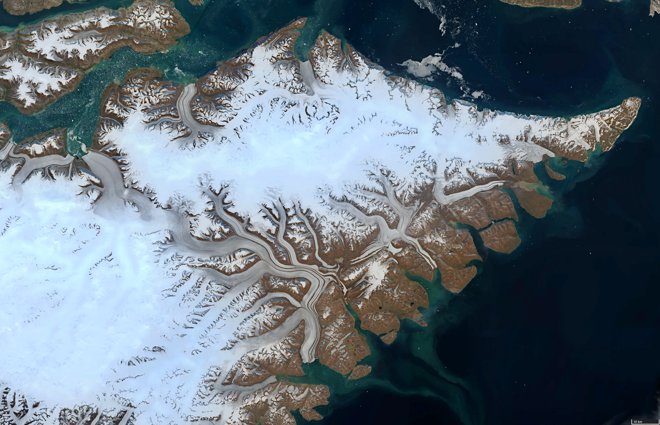
Fig. 1.1 – Locations of the images below.
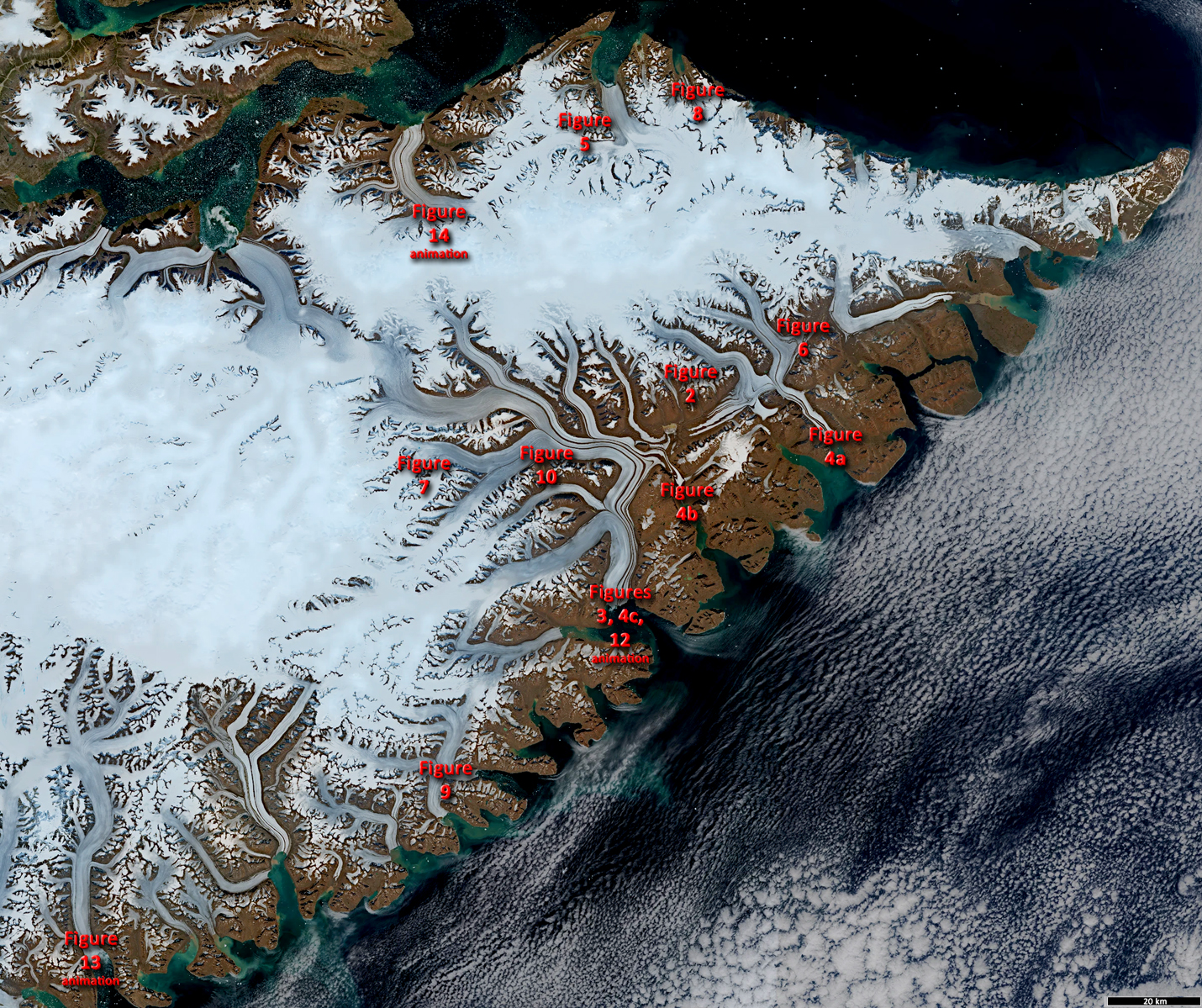
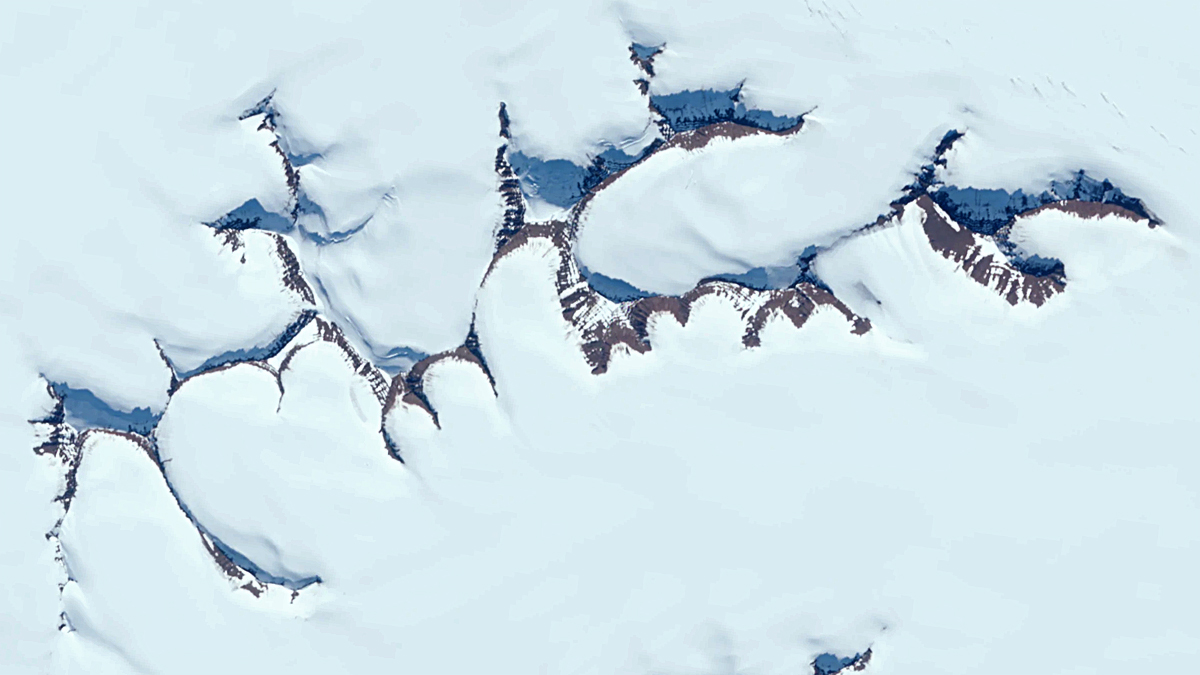
Fig. 2 – Mountain massif south of the Geikie Plateau. Its peaks resemble a group of Opuntia microdasys cacti when viewed from above.
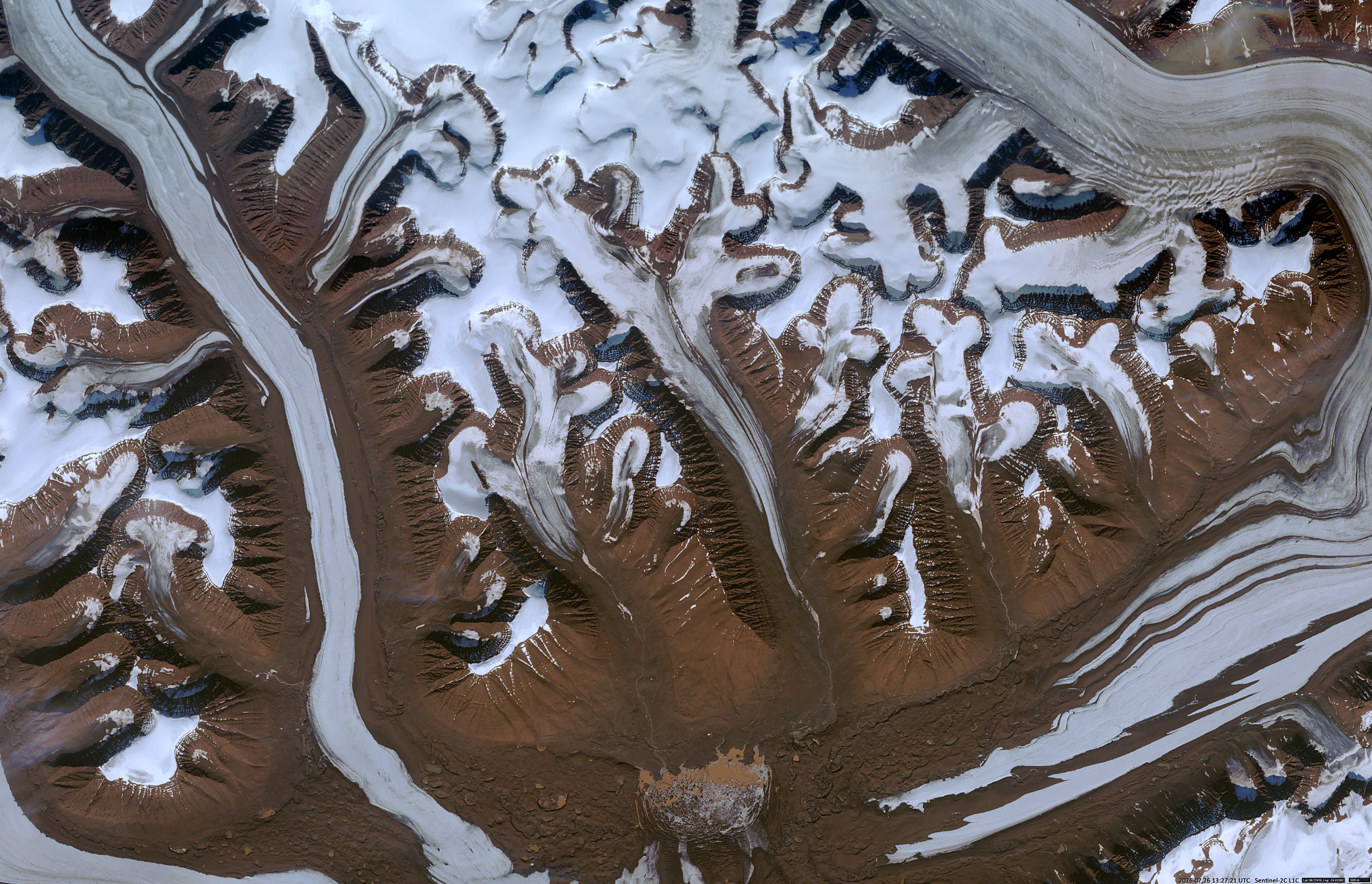
Fig. 3 – Glacier terminating in Barklay Bay, with a prominent sediment plume and a long-lived supraglacial lake.
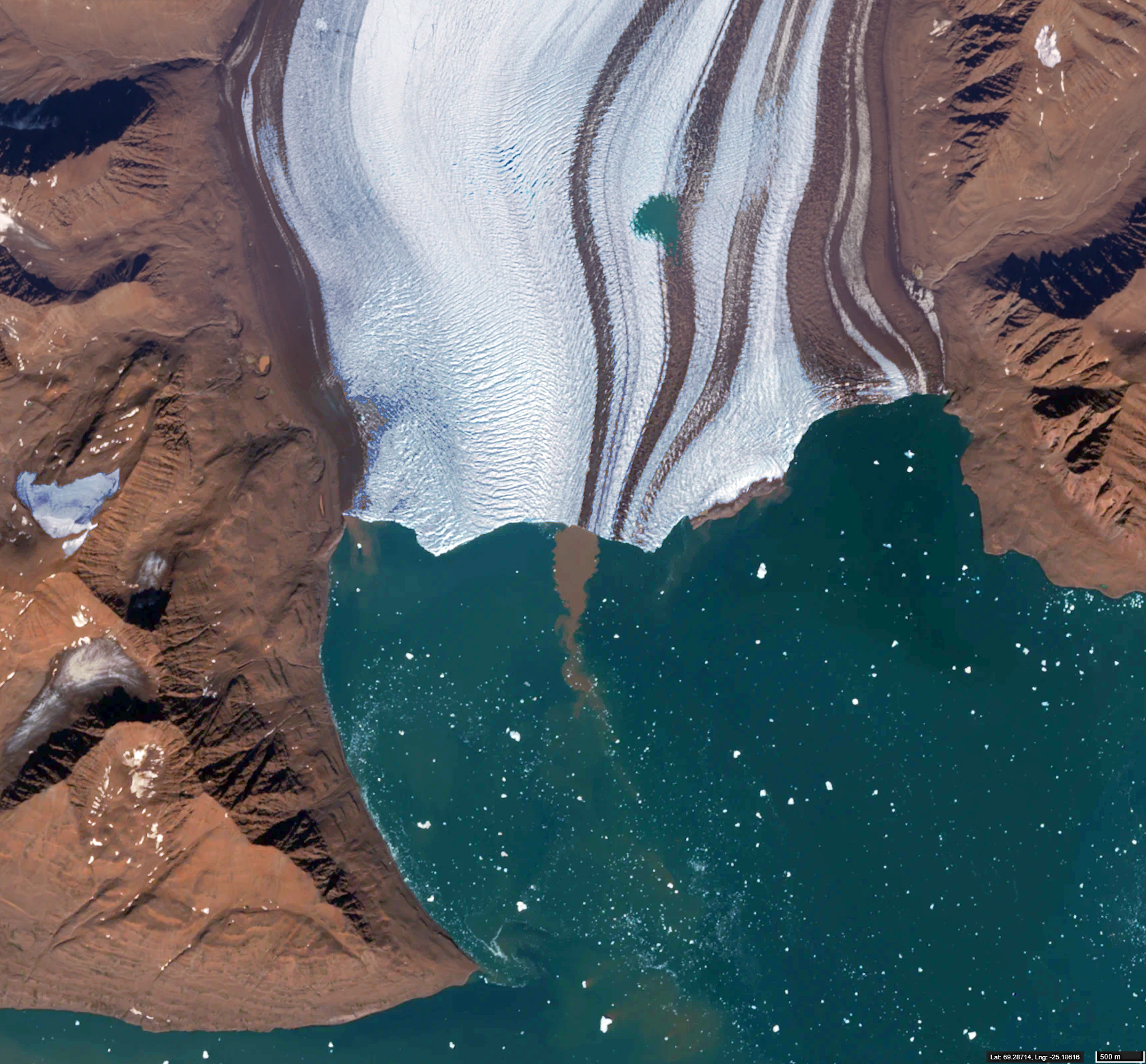
Fig. 4 – Stages of iceberg and ice-fragment calving from the glacier into the sea.
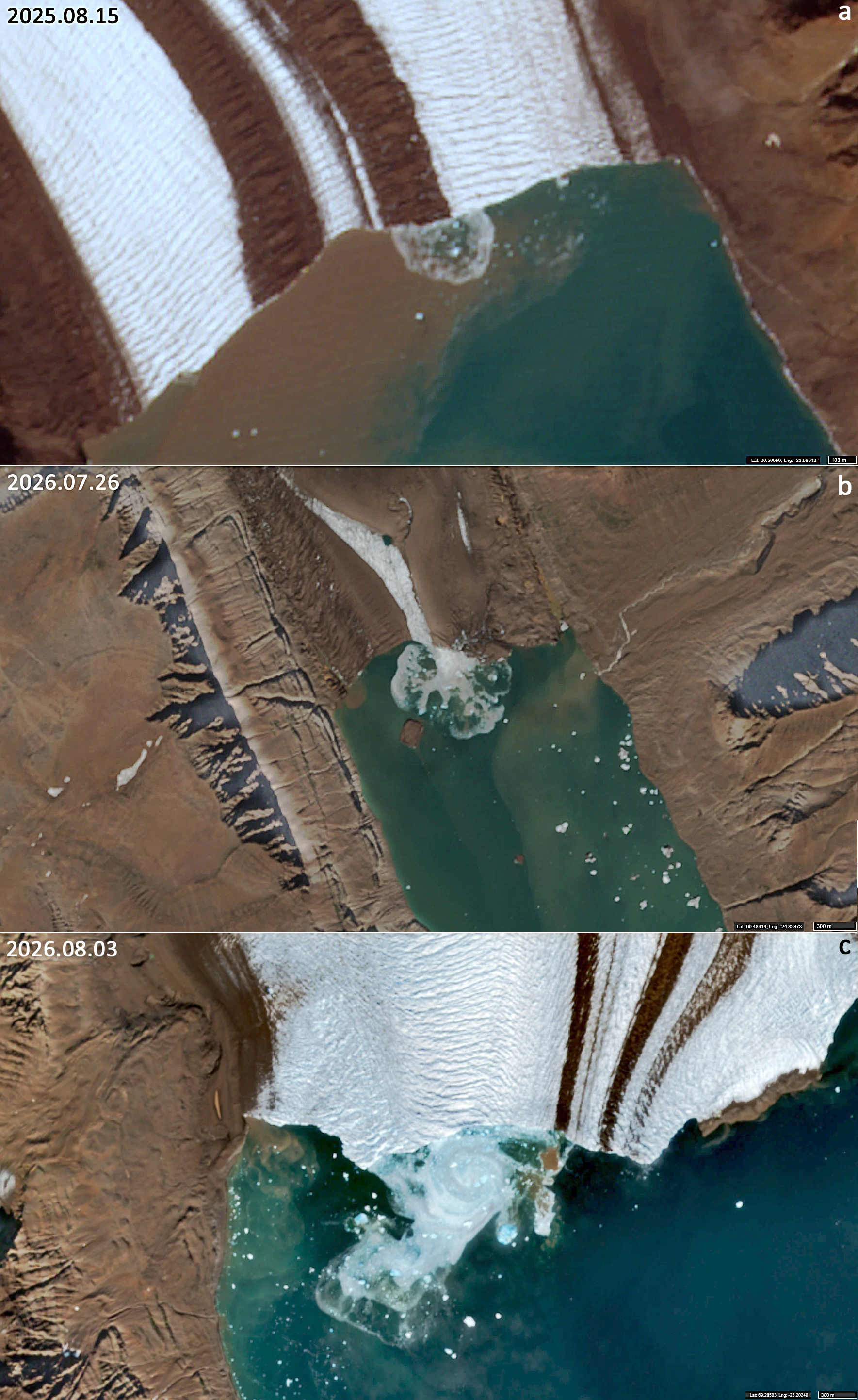
Fig. 5 – Mountain massif north of the Geikie Plateau. Several peaks resemble pairs of slippers when viewed from above.
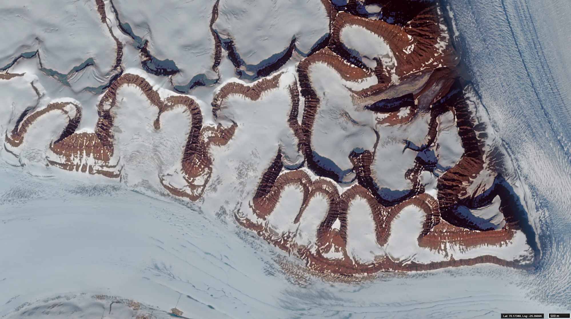
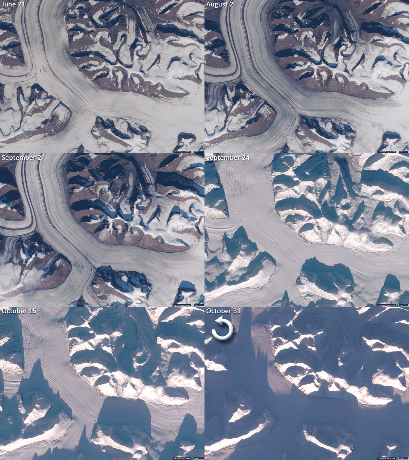
Fig. 6 – Confluence of medial moraines, with several small meltwater lakes visible in the upper right.
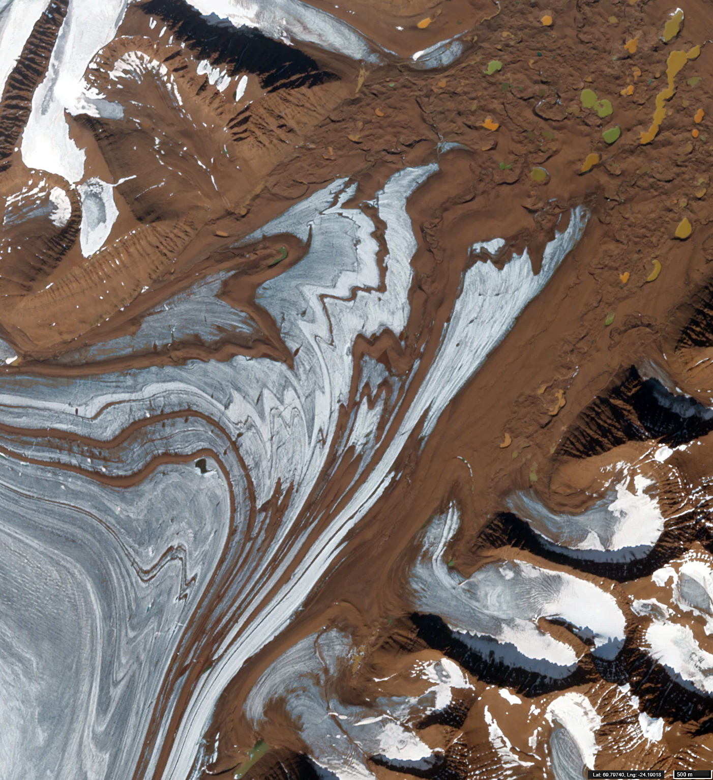
Fig. 7 – Mountain ridges protruding through the ice sheet of the plateau.
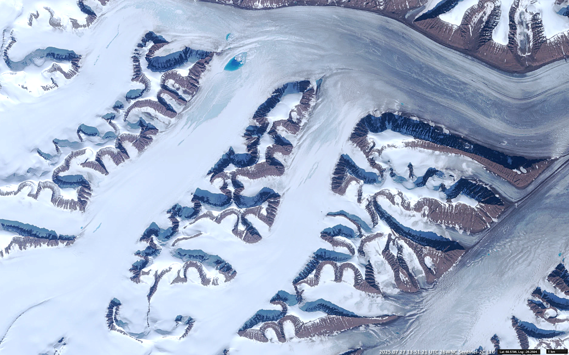
Fig. 8 – Crevassed and folded ice of the ice sheet transitioning into a glacier flowing northward toward Scoresby Sund.
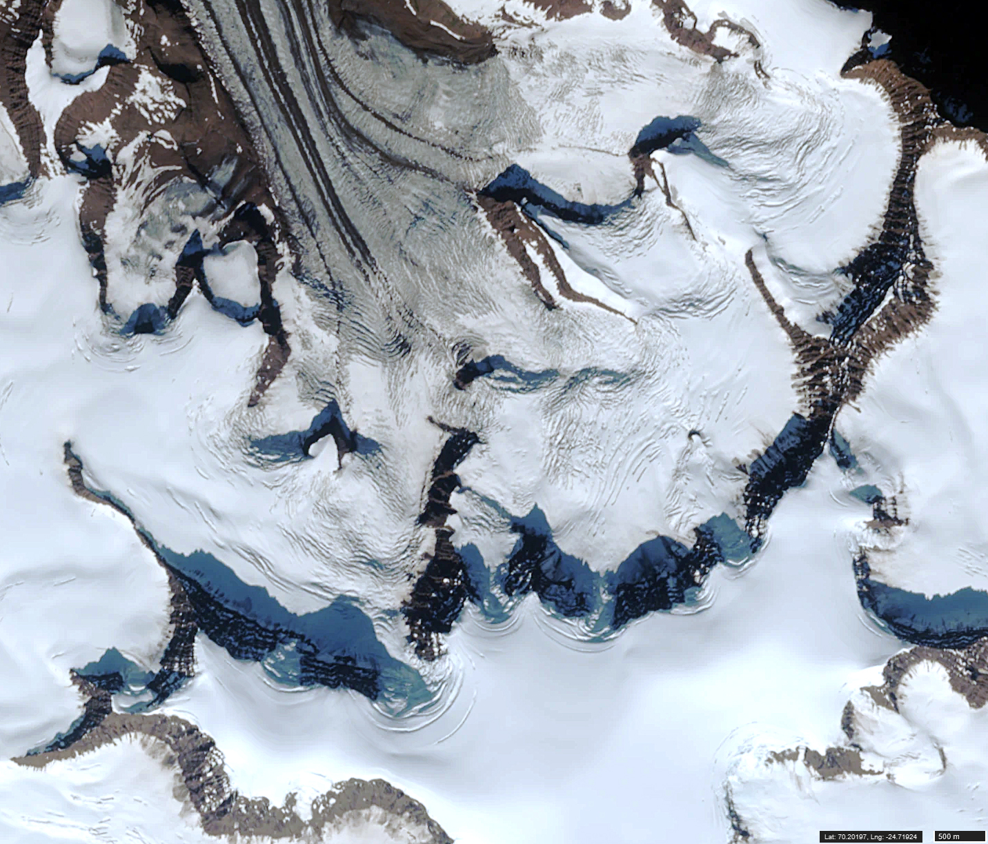
Fig. 9 – Two glacier flows collide and subsequently diverge toward their respective fjords.
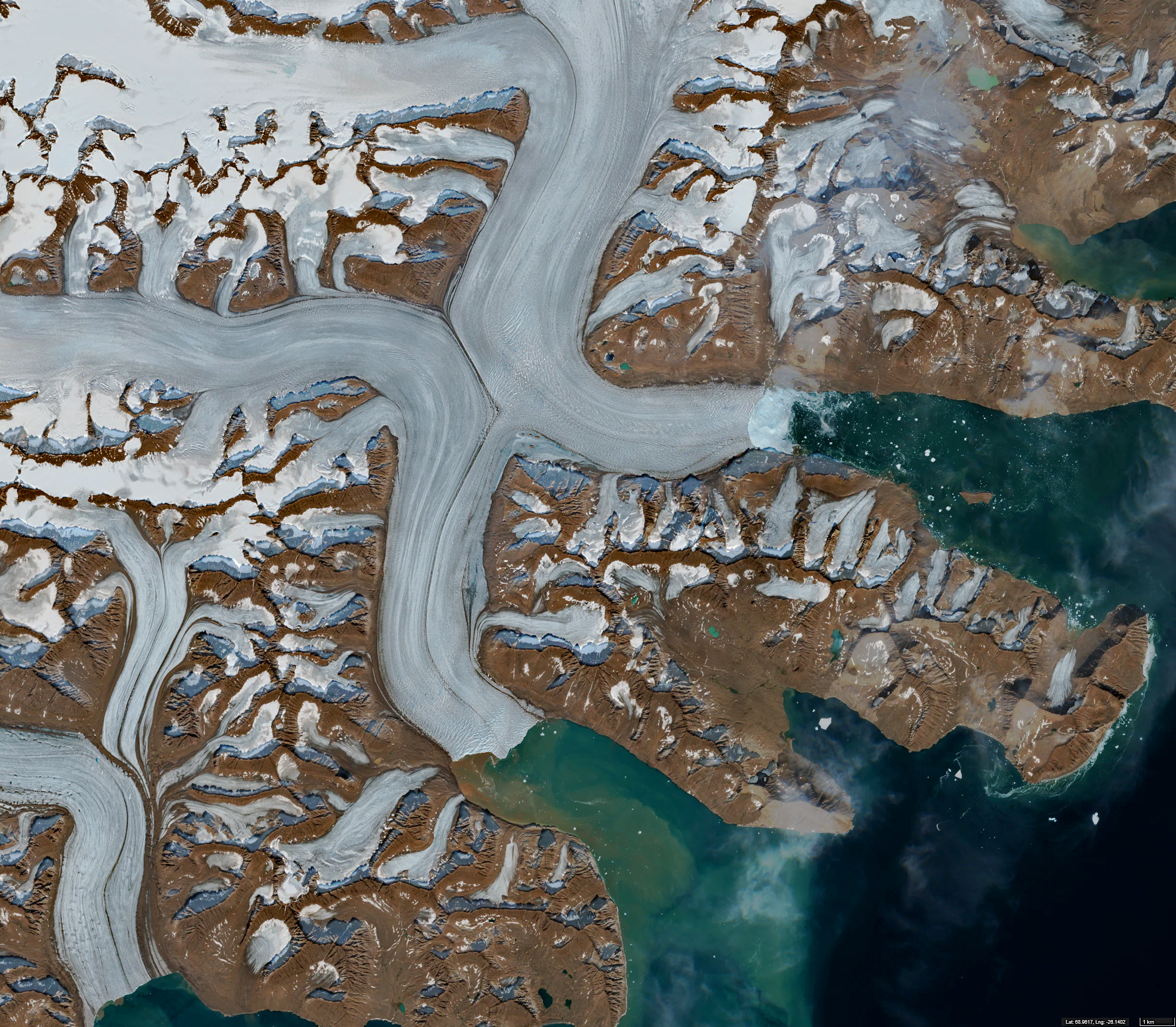
Fig. 10 – Top: a glacier with numerous small supraglacial ponds. Bottom: a meltwater lake containing floating ice fragments and muddy debris.
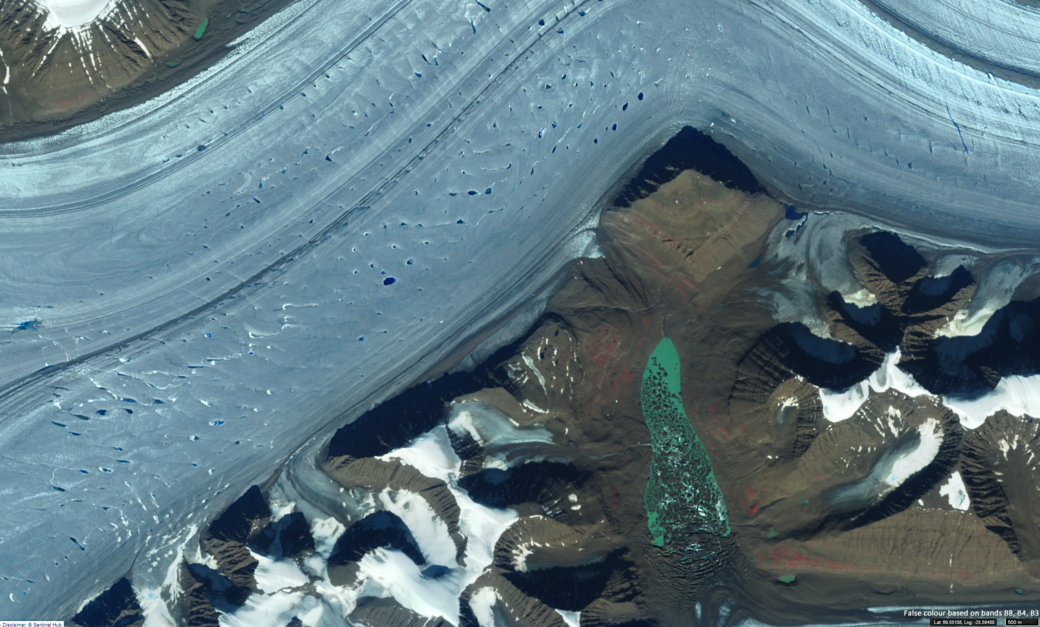
Animation 1 – Barklay Bugt Glacier Lake: 10-year animation.
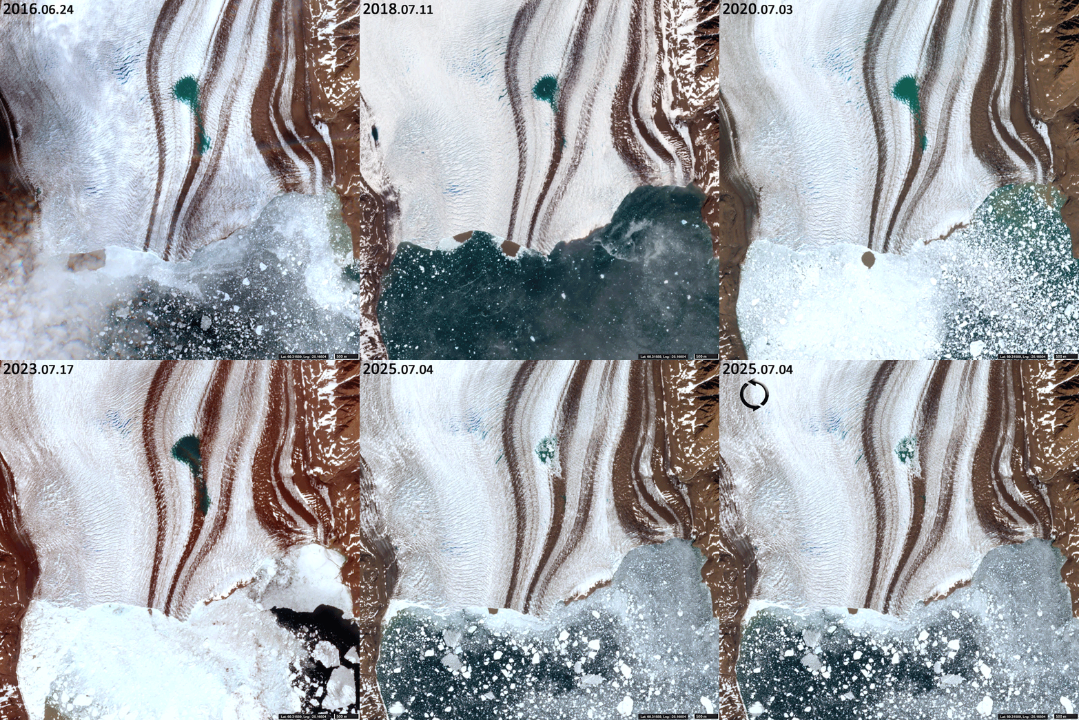
Animation 2 – Borggrauen Glacier: rapid movement in Vedels Fjord, including the detachment and southward movement of a fragment approximately 0.3 km² in area.
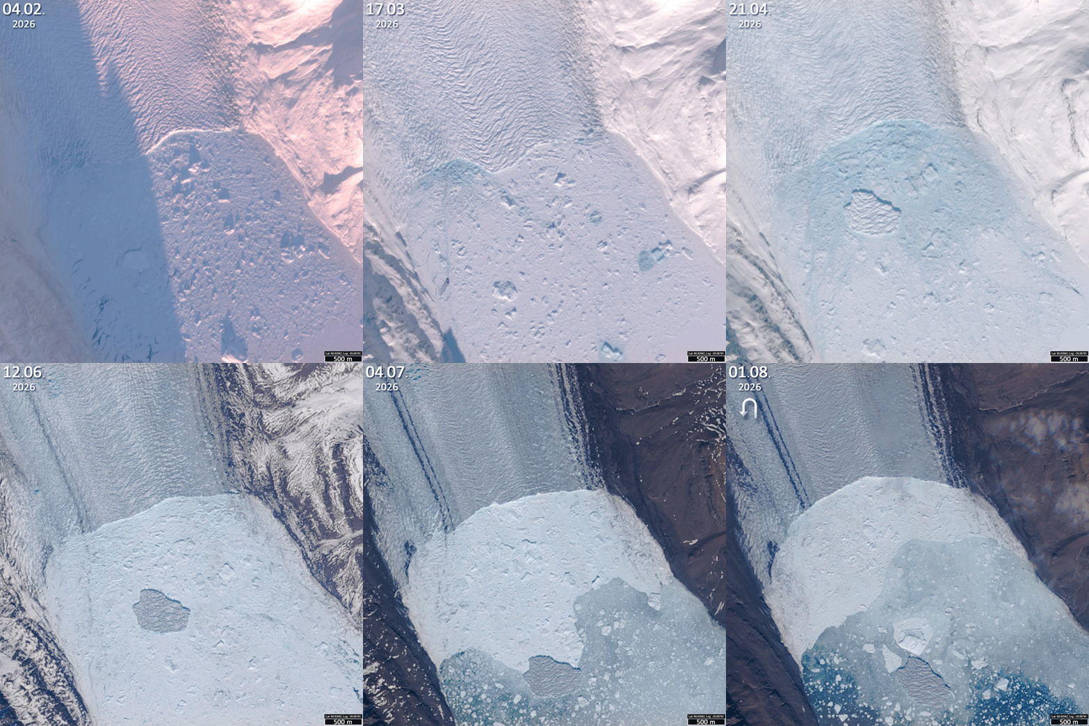
Animation 3 – Syd Brae: seasonal changes in shadows as the glacier flows into Gaase Fjord along the northern coast of the Geikie Peninsula.