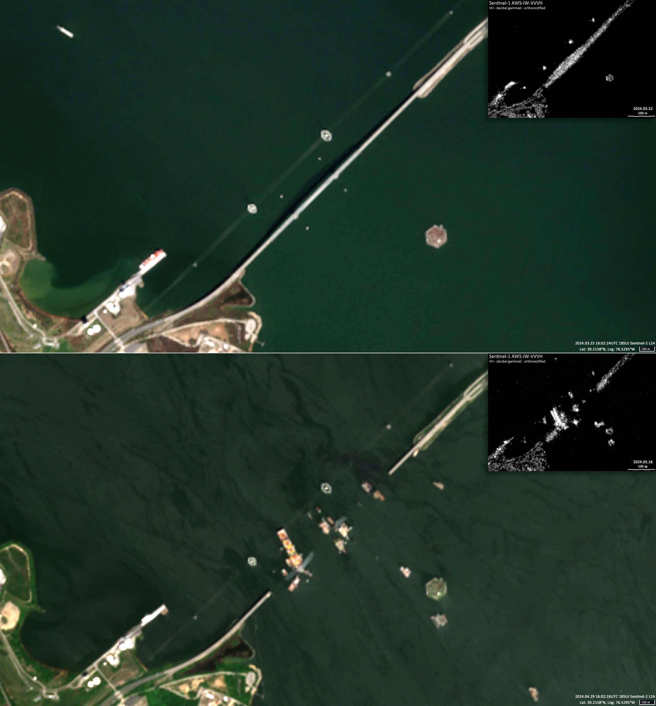

Francis Scott Key Bridge Collapse
Patapsco River | Baltimore, Maryland, USA
Dates of acquisition:
- March 25th, 2024 | 16:02:24 UTC
- April 29th, 2024 | 16:02:26 UTC
- March 22nd, 2024 | 23:07:34 UTC
- May 16th, 2024 | 22:59:08 UTC
Sensors: Sentinel-2 L2A, Sentinel-1 AWS-IW-VVVH
Coordinates: ca. 39.2158°N, 76.5295°W
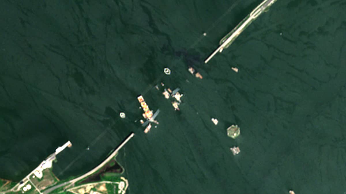
In the middle of the night, at around 1:30 a.m. on 26 March 2024, the huge cargo ship ‘Dali’ lost power, veered off course and collided with the Francis Scott Key Bridge in Baltimore. The ship slammed into one of the bridge’s piers, knocking much of the four-lane span into the water. Several vehicles on the bridge at the time of the collapse also fell into the river. According to the crew, there were electrical problems on board shortly before the cargo ship collided with a pier of the bridge.
The damaged container ship Dali, owned by Singapore-based charterer Synergy Marine Group, was carrying cargo from Baltimore to Colombo, Sri Lanka.
The bridge is about 2.57 kilometres long and was built in 1977. Interstate 695, known as the Baltimore Beltway, runs through it. The bridge connects the banks and areas separated by the Patapsco River.
Baltimore is considered the busiest port in the United States for road traffic.
The Sentinel-2 images show the position of the bridge before the collision (25 March 2024) and after the collision (29 April 2024) – the latest cloud-free image. Two Sentinel-1 radar images are also shown to confirm the latest available Sentinel sighting date for the position of the cargo ship and the bridge. It can be seen that the damaged vessel is still in the vicinity of the broken pier on 16 May and that the bridge has not yet been repaired.