Floods in Lower Saxony, Germany
Lower Saxony | Northern Germany
Date of acquisition: December 30th, 2023 | 17:17:24 UTC
Sensor: Sentinel-1A AWS-IW-VVVH, Sentinel-2 L2A
Coordinates: ca. 52°N, 9°E
During the last ten days of December, the jet stream crossed Western Europe, and in particular over the territory of Germany from west to east at an altitude of about 10 km. This jet stream sent numerous low pressure systems from the North Atlantic to Europe. This phenomenon is considered typical for such mild winters.
On December 21, low pressure system “Zoltan” brought heavy rain, frequent thunderstorms, strong gusts and hurricane-force wind, up to 140 kilometers per hour to the coast. The storm also brought large amounts of water to the German North Sea coast. Shortly after, on December 25, the low pressure system called “Abdul” caused a new storm surge in the Elbe, Weser, and North Frisia.
The low pressure systems led to heavy and prolonged precipitation resulting in saturation of the ground which led to floodings in many regions.
In addition, the beginning of December brought a lot of snow. As the temperatures raised, the snow melted, increasing the amount of water in the river basins.
Moreover, as stated above, strong northwestern winds “trapped” the flow of rivers into the North Sea, creating a surge of water, and the full moon on 27 December intensified this effect with a spring tide.
As a result, river levels rose rapidly in many parts of northern Germany between 27 and 30 December, especially in Lower Saxony, but also in Saxony-Anhalt, Thuringia and North Rhine-Westphalia.
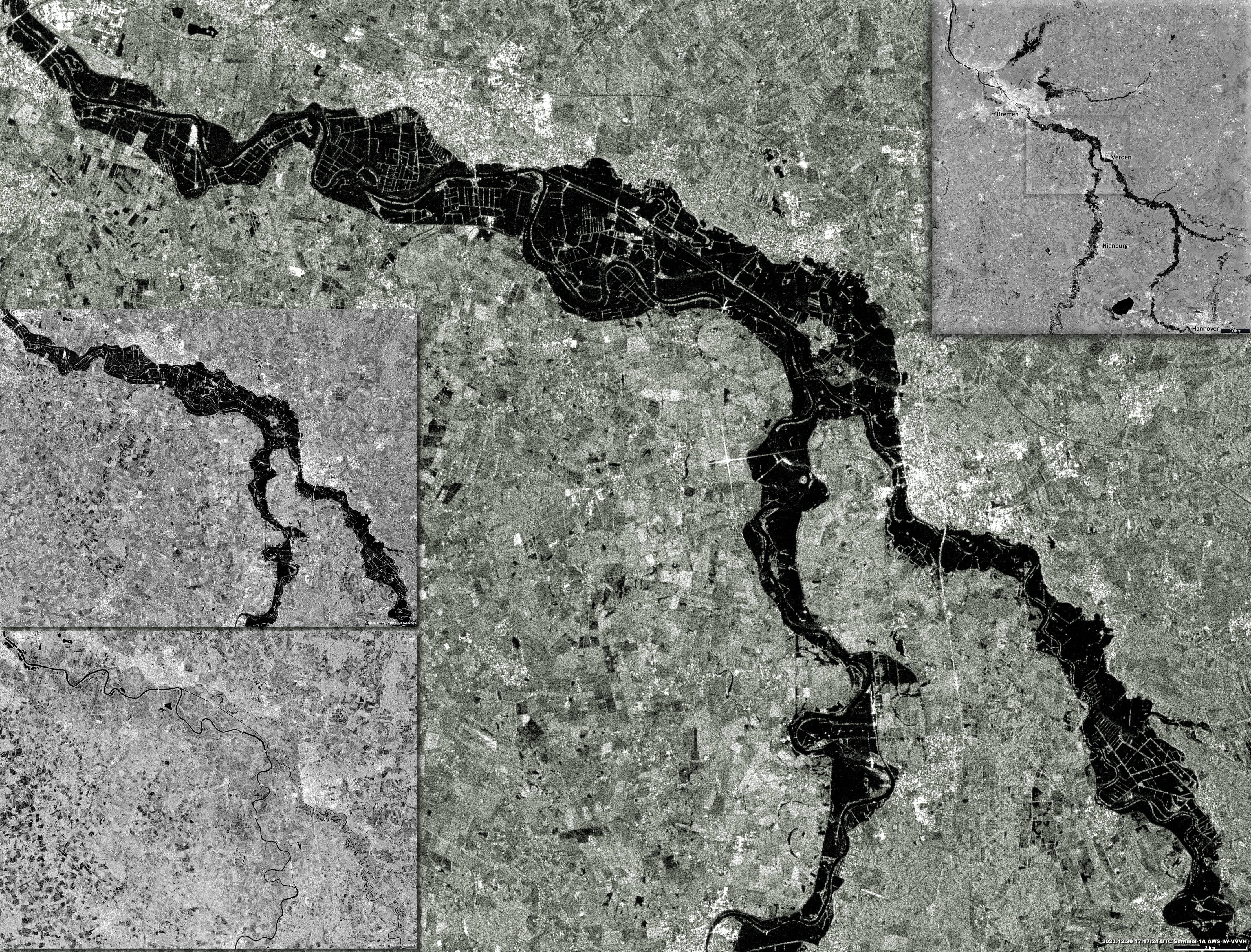
In Lower Saxony, the rivers Weser, Aller, Leine and Oker were particularly affected. Water levels at the Intschede gauge (52.9642°N, 9.1258°E) rose by 4.25 meters since the beginning of December (monthly minimum: 293-295cm, 6-7 December, 2023 || maximum: 720cm, 30 December, 2023 ). Then it began to decrease very slowly.
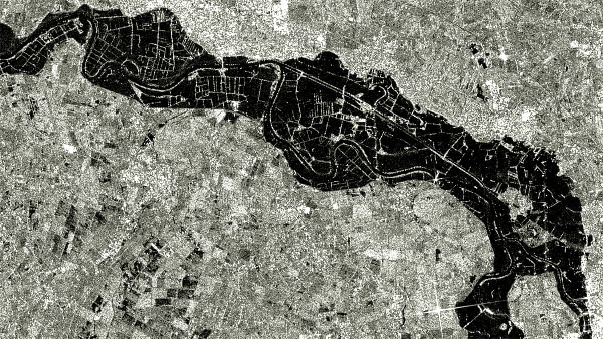
As the sky over Northern Germany was mostly cloudy during this period, we present a radar image from the Sentinel-1 satellite taken on 30 December, 2023. The image (Figure 1) sshows the situation in the region around the riverbed of the Weser, south of Bremen. The dark color represents flooded areas; while the light color represents areas free of water. For comparison, an image of the same area before the flood (6 December 2023) is also shown.
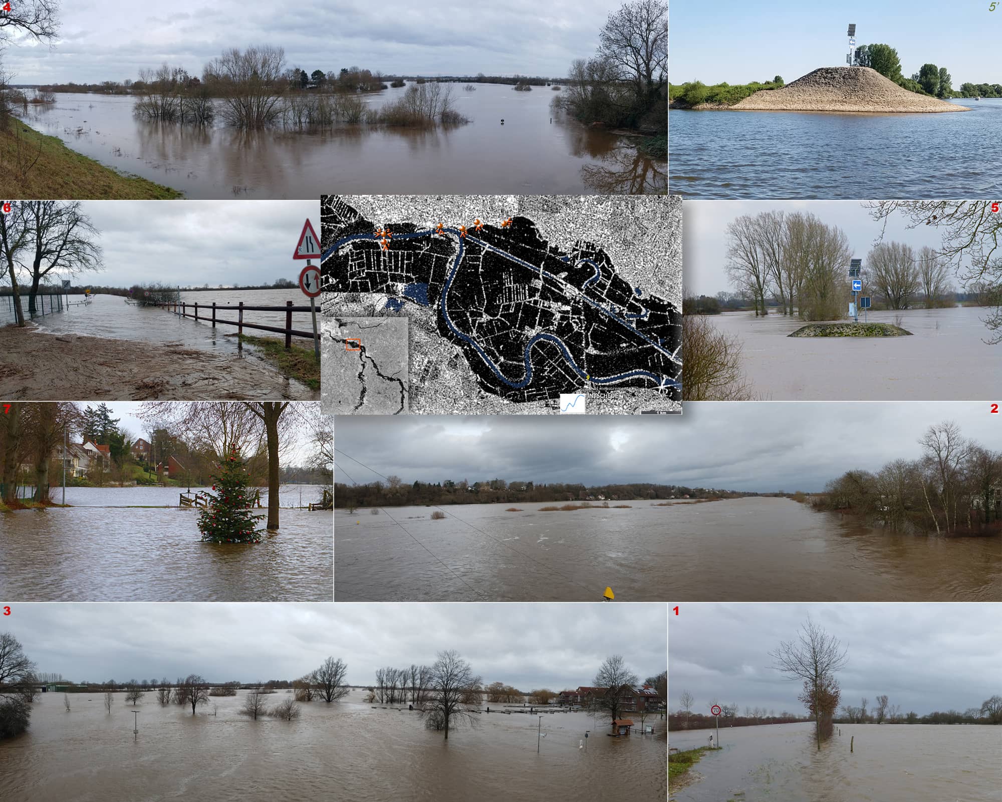
It is interesting to see how certain locations taken at the same time as the satellite images appear from the perspective of an observer on the ground. Figure 2 shows a number of such photos with reference to points on the satellite image and direction in which they were taken on ground. In one case, the summer image is shown for comparison.
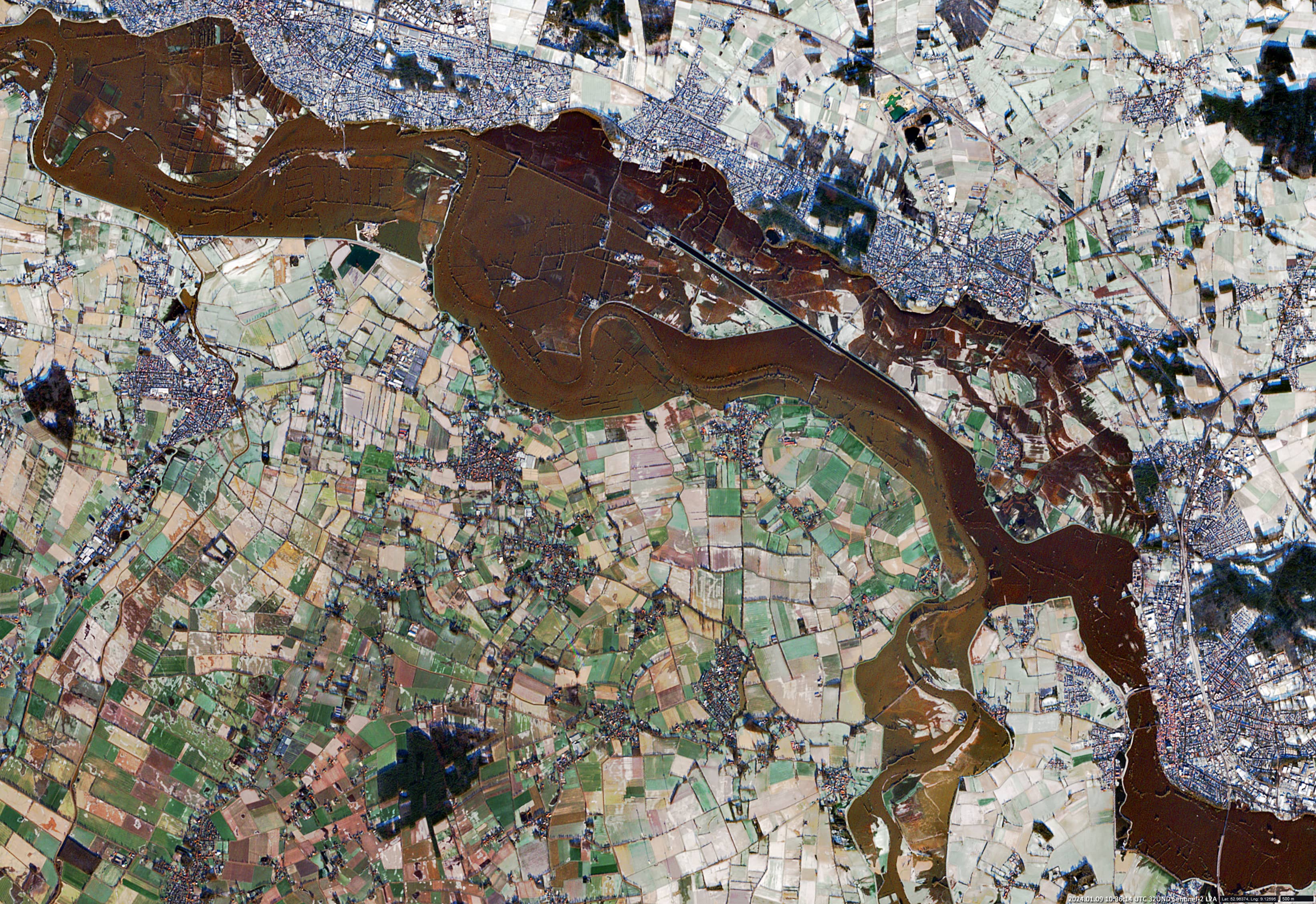
Finally, an image taken by the Sentinel-2 satellite on January 9, 2024, is shown (Figure 3). The water level in Intschede has fallen to 677 cm, which is 43 cm below the maximum of 720 cm reached on 30 December 30.