
An Unusual Sand Formation in Bynoe Harbour
East of Cox Peninsula | Northern Territory, Australia
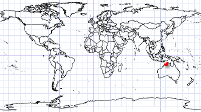
Coordinates: 12.46482°S, 130.51157°E | MGRS: 52LFM 64 21
Middle Reef Figure 1) is a coral shoal covering approximately 5-6 km², together with a sand spit, in Australia’s Northern Territory. It forms the northern boundary of Bynoe Harbour. At low tide, the reef emerges up to approximately 6 m above the surrounding water level (Figure 2). Middle Reef is classified as a sacred and protected Aboriginal site.
A sinuous patch of bright yellow sand at its southern extremity forms a prominent visual landmark.
It extents from the southern part of the reef and is approximately 1.5 km long. Its exact nature and formation mechanism remain unclear. The feature appears to be relatively stable, with its morphology influenced by the local seafloor topography, tidal dynamics, and currents. Interestingly, it can already be identified on a 1935 nautical chart.
A comparison of Landsat 8-9 imagery acquired over the past 11 years (Figure 3) shows that the overall position and shape of the sand spit have remained remarkably stable. While its detailed morphology varies, no consistent direction of migration can be identified. Additional observations from 2026 (Figure 5) illustrate how strongly its apparent shape and visibility can vary with water and observation conditions.
The predominantly silty and muddy surface of the reef and surrounding seabed contrasts clearly with the bright, clean sand of the spit. This suggests that the feature may represent a zone of selective sand accumulation. It may therefore be dynamically stable: individual sediment grains can be continuously transported and reworked while the overall geometry of the sand body remains largely unchanged. The exposed parts of the spit may also be affected by wind-driven sediment transport.
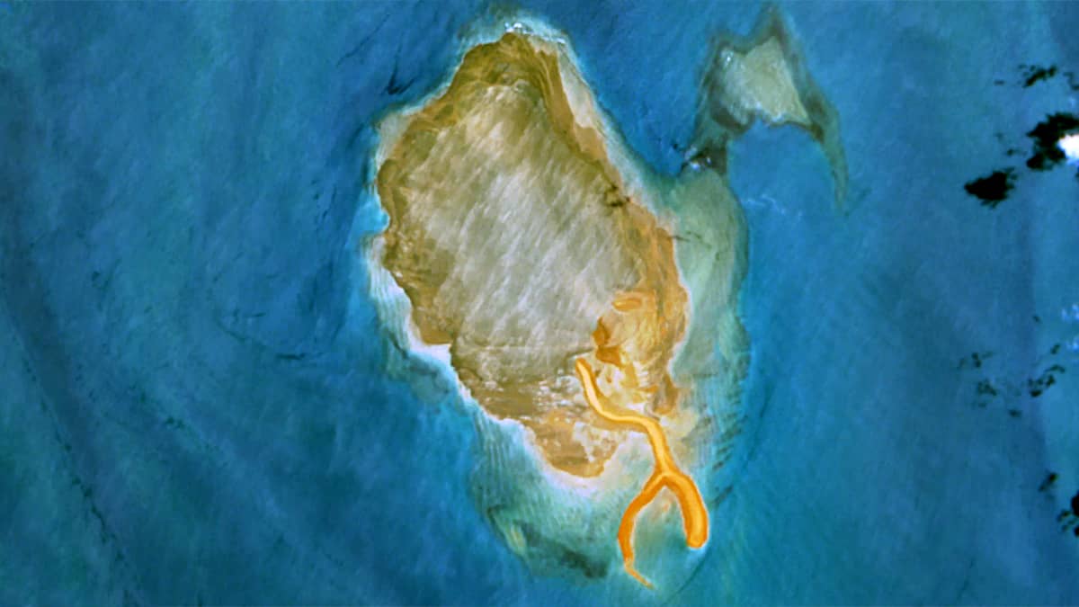
In bird’s-eye view, the resulting structure resembles a crab claw (Figure 4). From its main stem, a second narrow arm extends to the southwest before bifurcating into a long, narrow branch that gradually disappears beneath the water. The entire sand feature is approximately 1.5 km long.
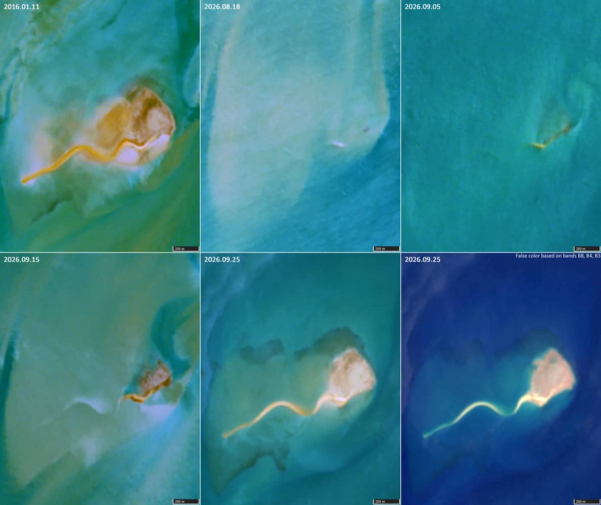
An intriguing comparison can be found approximately 13 km to the southwest, within Bynoe Harbour. Simms Reef (12.567°S, 130.453°E; Figure 6), traditionally known to local Aboriginal people as Tjimbi, also possesses a long wavy sand spit, approximately 1.2 km long. Viewed from above, this formation resembles a tadpole.
Like Middle Reef, Simms Reef is regarded by local Aboriginal communities as a sacred site.
Further reading
Characterising Marine Abiotic Patterns in Darwin-Bynoe Harbour region (ResearchGate)
Benthic sediment surveys of inner Darwin Harbour and shallow water areas in and around Bynoe Harbour (ResearchGate)
Exploring the marine secrets of Northern Territory’s Bynoe Harbour (Australian Government)
Cox Peninsula and Bynoe Harbour – Use and Access Map
Fig. 1
Middle Reef in Bynoe Harbour. The unusual sand formation is visible at the southern end of the reef.
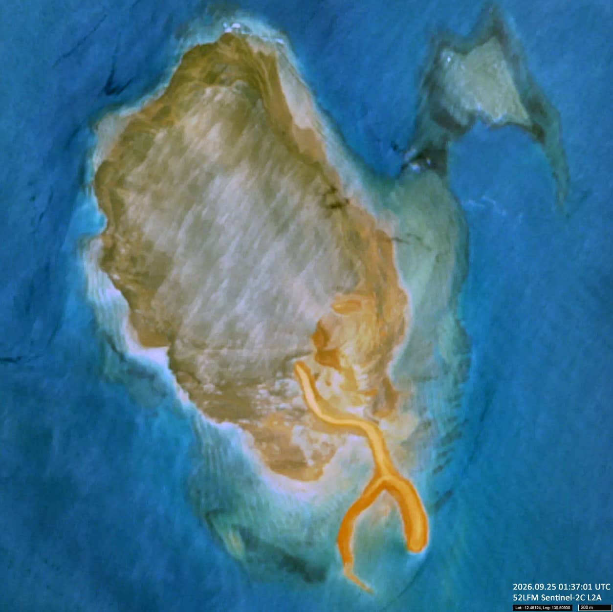
Fig. 2
Middle Reef at high and low tide. At low tide, large parts of the coral shoal emerge above the surrounding water.
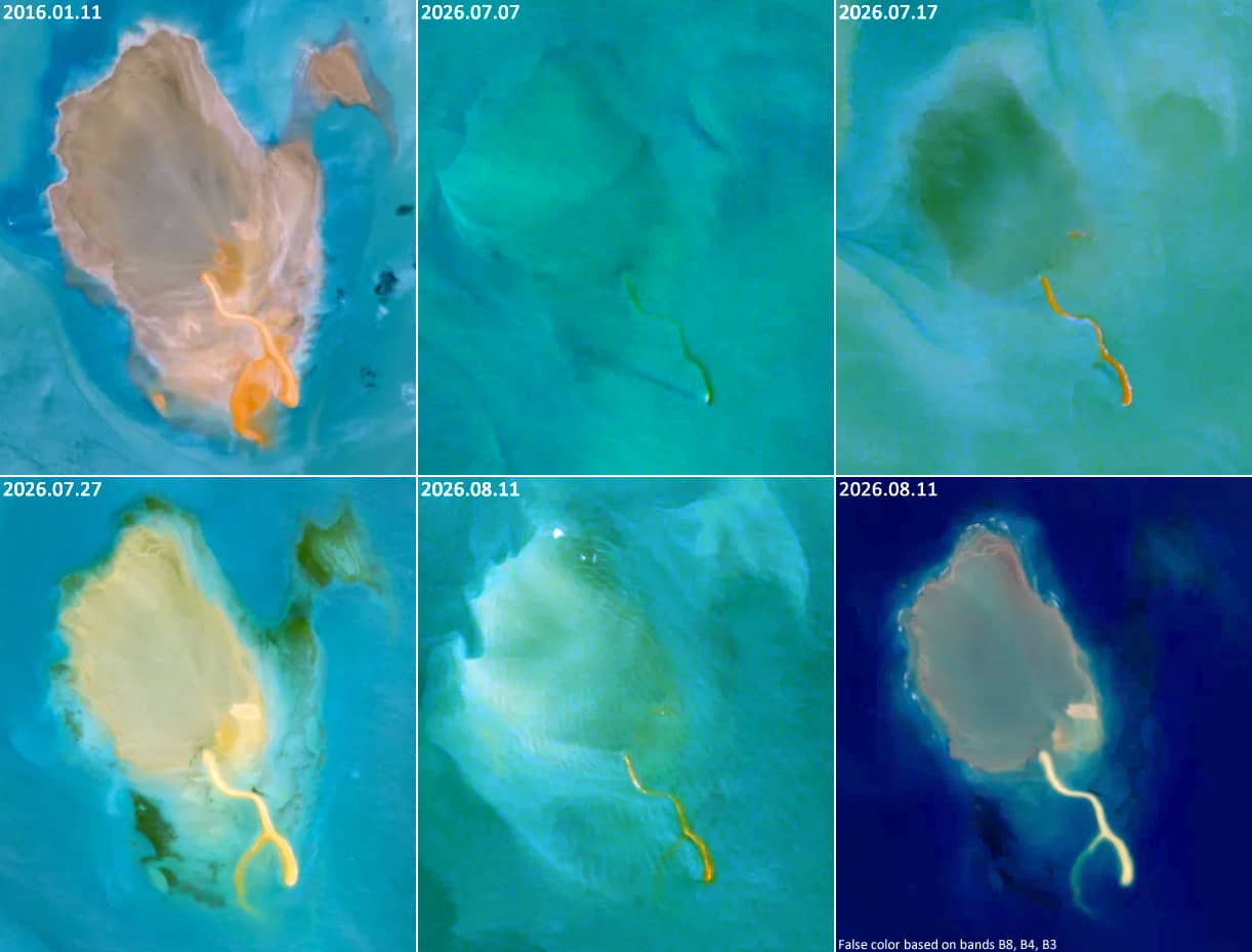
Fig. 3
Changes in the shape of the Middle Reef sand spit over 11 years. Landsat imagery from 2015, 2020 and 2026 shows that its overall position and shape have remained remarkably stable.
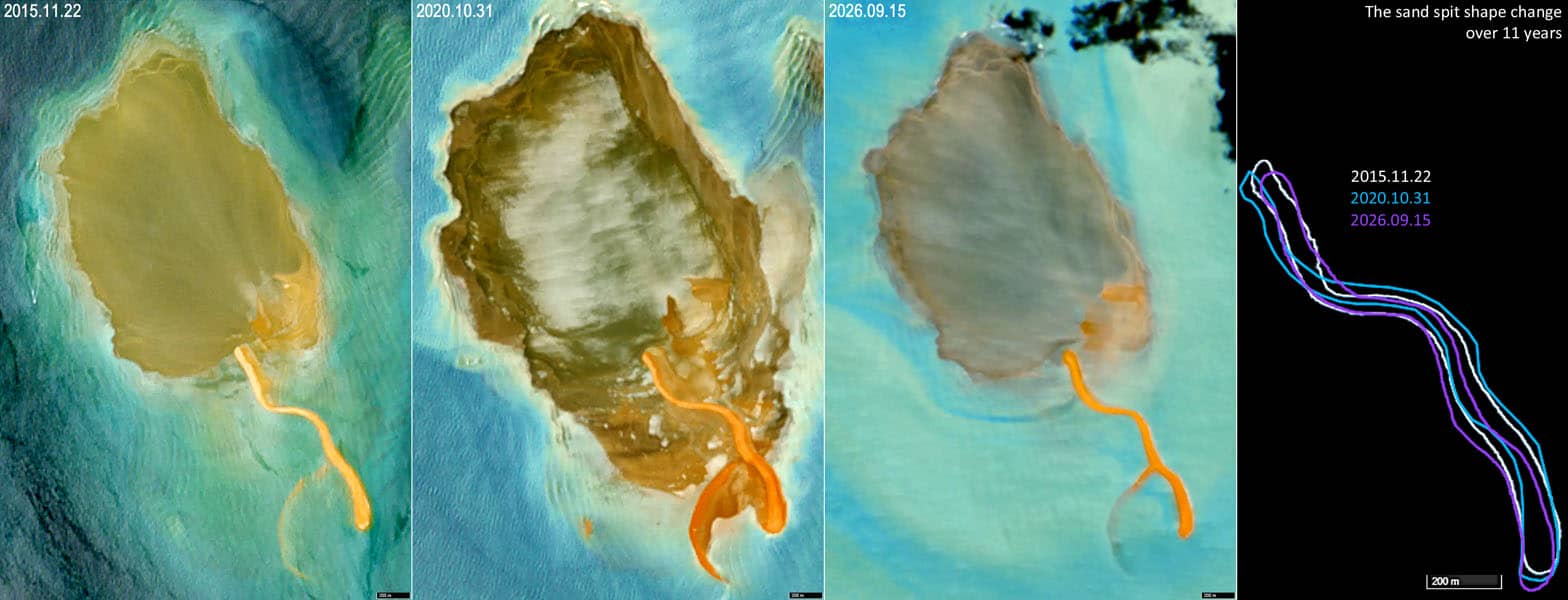
Fig. 4
Comparison of the sand spit’s bathymetry and surface appearance. The branching structure of the sand formation gives it a characteristic crab-claw-like shape.
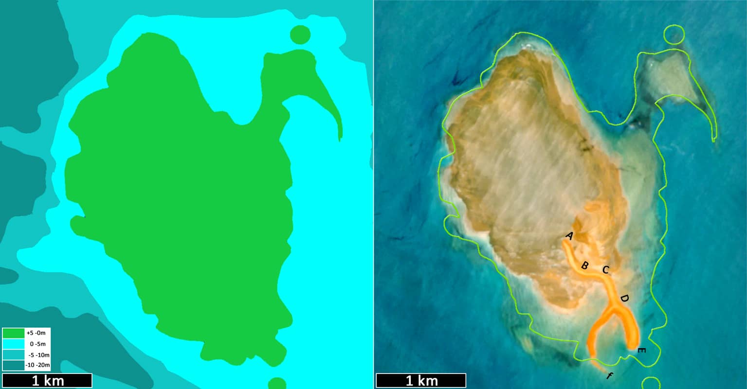
Fig. 5
Landsat 8–9 observations of the Middle Reef sand spit from 2015 to 2026. The animation illustrates variations in its appearance and visibility over time.
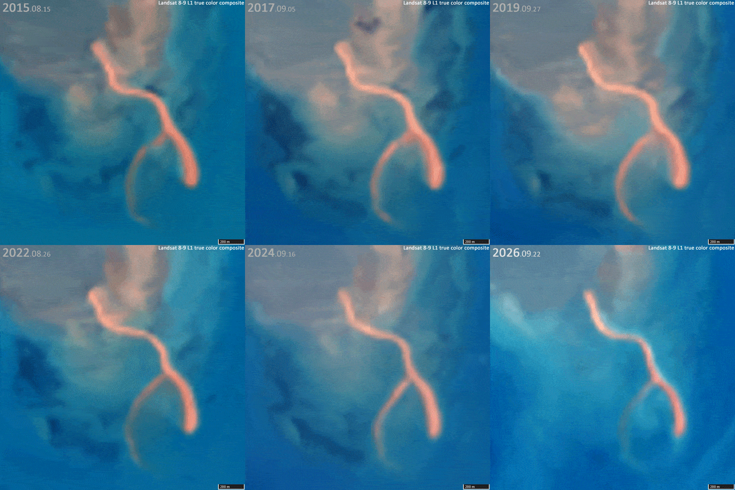
Fig. 6
Simms Reef, approximately 13 km southwest of Middle Reef. Its long, wavy sand spit gives the formation a characteristic tadpole-like appearance.