Roebuck Bay
Kimberley Coast | North-Western Australia
Dates of acquisition:
• 2026.04.02 | 02:03:09 UTC
• 2025.08.02 | 02:05:01 UTC
• 2025.05.12 | 02:03:31 UTC
Sensor: Sentinel-2B L1C, Sentinel-2A L2A, Sentinel-2C L1C
Coordinates: ca. 18.07°S, 122.27°E
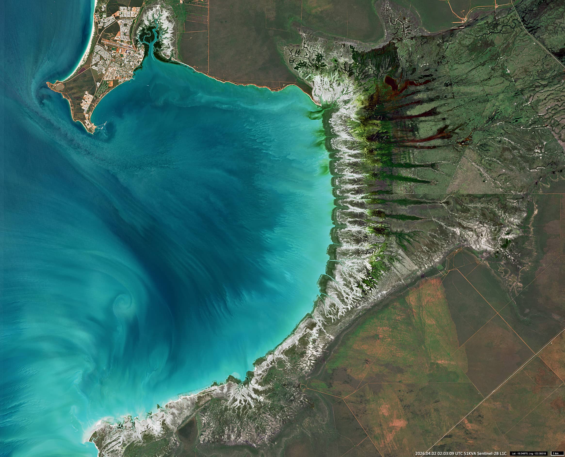
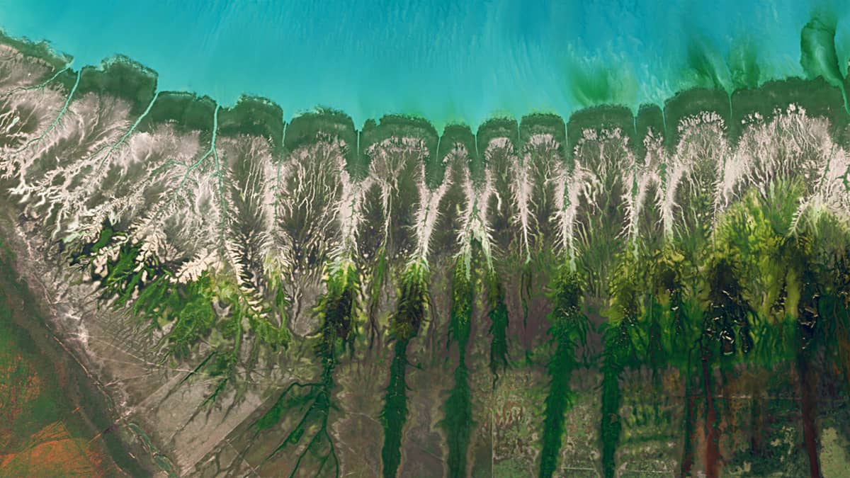
Situated along the Kimberley coast of Western Australia, Roebuck Bay is a tropical bay covering an area of approximately 550 km². It is characterised by red sandy beaches and mangrove swamps. The town of Broome is located at the northern edge of the bay.
The eastern boundary of the bay is formed by linear, mangrove-lined tidal creeks grasslands and forests growing on the region’s characteristic red soils (see Figure 1).
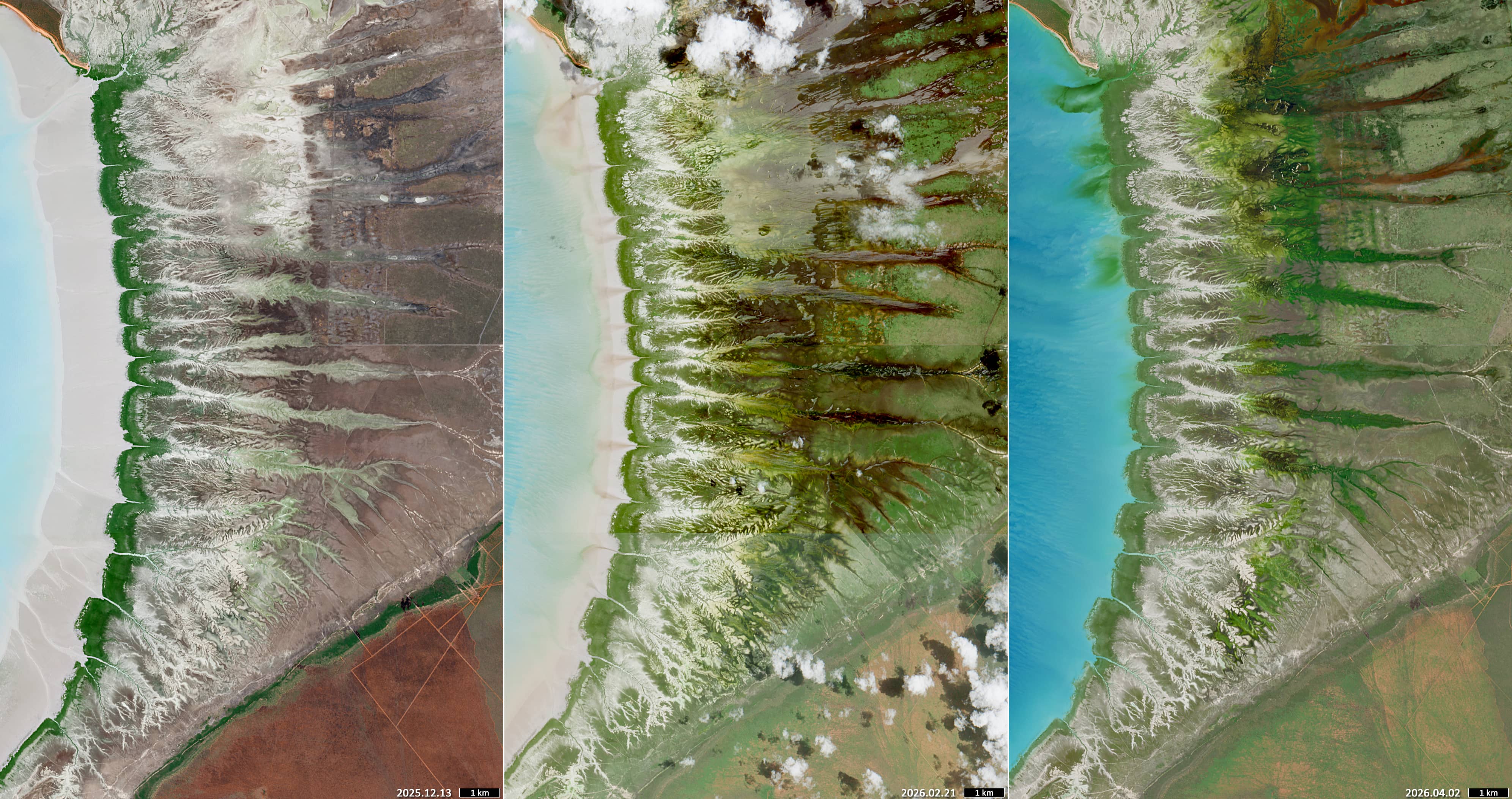
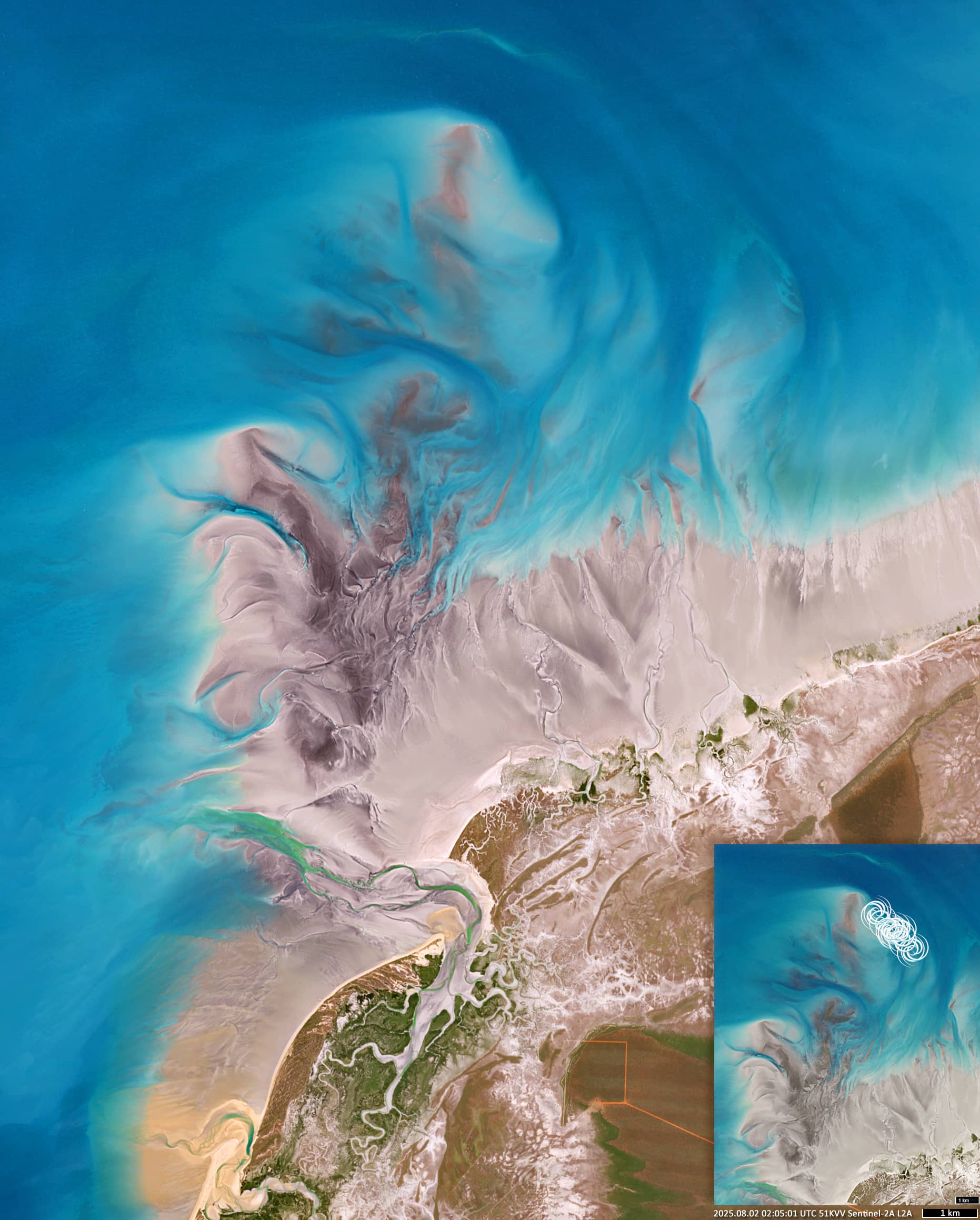
The bay is characterised by an exceptionally large tidal range (Figure 2). Most of the extensive tidal mudflats are flooded during each tidal cycle, with the semi-diurnal tidal amplitude reaching up to 10.5 m at spring tides. Figure 3 shows a large mudflat in the southern part of the bay at low tide.
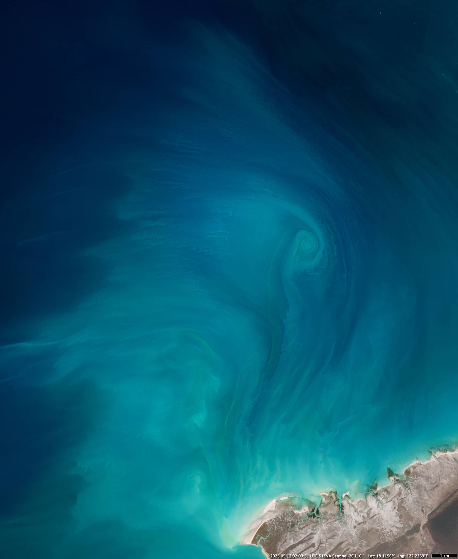
Of interest are the frequent eddy structures that form in the water (predominantly at high tide) within a very limited area at the edge of this mudflat (Figure 4). These structures form over a shallow sandbank when the tidal current flows around the northern tip of the mudflat (see inset in Figure 3, bottom right).
Tidal dynamics play a crucial role in shaping the local ecology. The bay is one of the most important resting places for significant proportions of Australian bird populations during migration and upon arrival. The bay is also home to dugongs and several species of sea turtles, and humpback whales pass through the area. Commercial pearl diving also takes place there.
Further reading
Roebuck Bay (Wikipedia)
Broome, Western Australia (Wikipedia)
Roebuck Marine Park (Australian Marine Parks)
Roebuck Bay (Australian Government)
Roebuck Bay (Australias North West)
Our Bay (Roebuck Bay Working Group)