

Rare Cloud Structure over Baltic Sea
Southeastern Baltic Sea
Dates of acquisition:
• 2026.06.22 | 09:50:41 UTC
• 2026.06.22 | 09:39:14 UTC
• 2022.04.12 | 02:17:29 UTC
Sensors: Sentinel-2A L2A, Sentinel-3B OLCI, Sentinel-3A OLCI
Coordinates: ca. 55.5°N, 20.1°E | MGRS: 34UDG 43 50
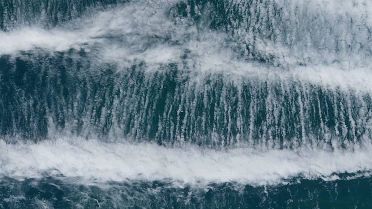
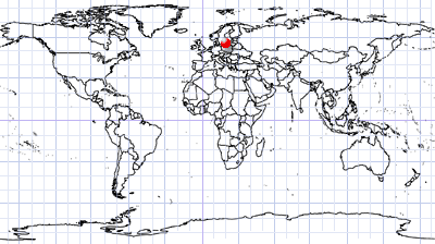
Of the many gravity-wave cloud patterns observed in satellite imagery, this case is notable due to an unusual network of thin, hair-like cloud filaments embedded within the wave field. This remarkable cloud structure was observed on 22 June over the south-eastern Baltic Sea, just north of the Curonian Lagoon (see Figure 1).
A compact packet of gravity waves is visible in the scene, while the filamentary cloud bridges can only be seen in the high-resolution Sentinel-2 imagery (Figures 2 and 3). They appear to connect adjacent gravity-wave bands and exhibit several striking characteristics. Their number and density vary between neighbouring wave troughs, suggesting that the processes operating within individual inter-wave regions evolve at least partly independently. The filaments are widest near the wave crests and progressively narrow towards the centres of the wave troughs. They also appear slightly darker than neighbouring cloud bands, which may indicate a lower ice crystal content and lower cloud-top altitude than the wave crests (Figures 3 and 5).
Unlike many gravity-wave events, this trapped gravity-wave system was not generated by orographic forcing, but by an as yet unidentified mechanism.
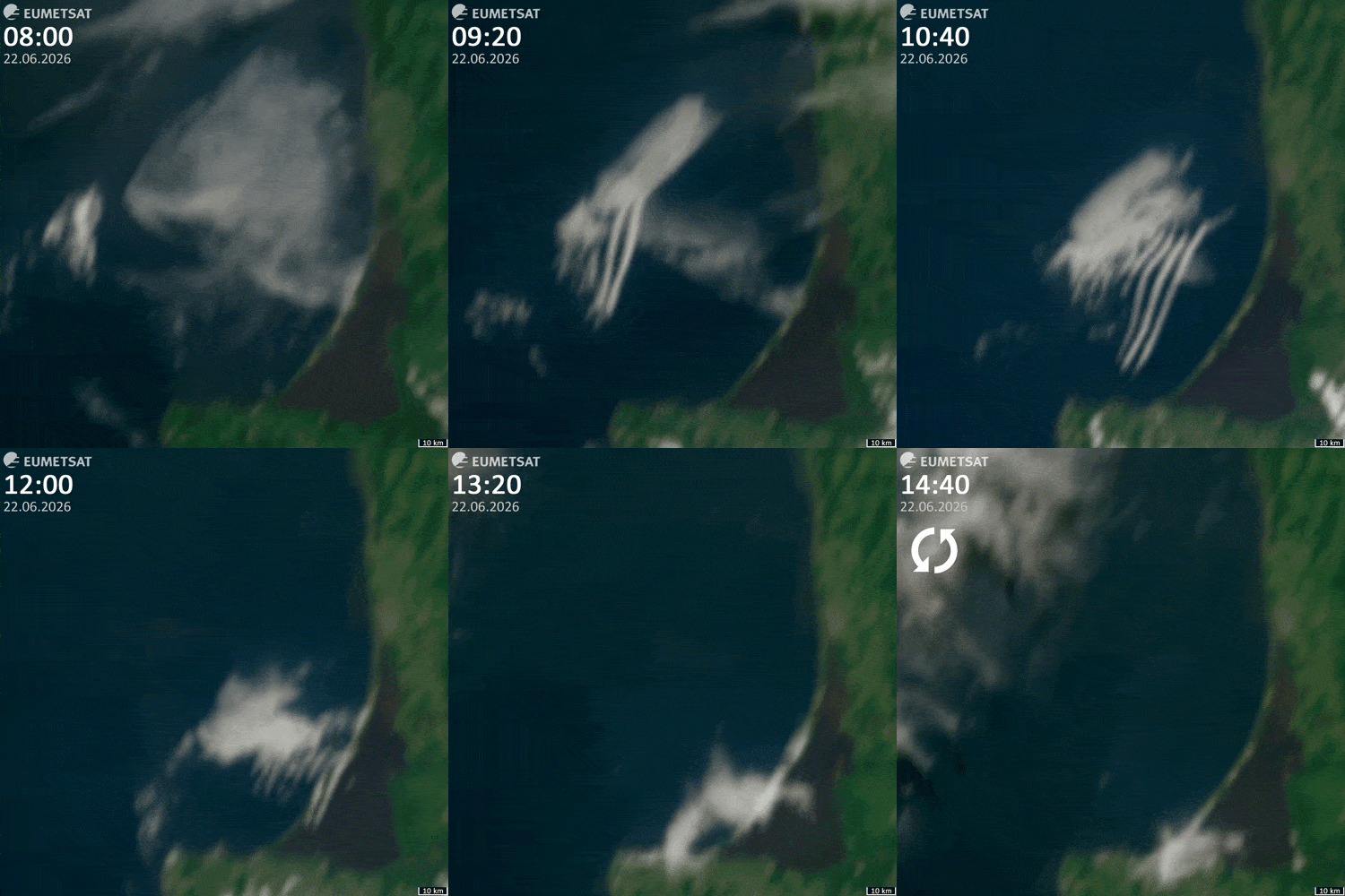
Geostationary satellite observations (see Figure 7 – animation) provide insight into how it evolved. Initially, a field of closed-cell convection occupied the southeastern Baltic Sea, to the north of the Curonian Lagoon. A newly formed gravity-wave packet then developed around 30–35 km northwest of this field and propagated southeastward. This packet appeared to be located at a somewhat higher altitude and expanded rapidly once it overlapped the convective cloud field. It is unclear whether the two cloud systems physically merged or remained vertically separated. Nevertheless, the gravity-wave packet appeared to entrain the convective cloud field, transporting it towards the Curonian Spit at approximately 28 km/h — roughly twice the near-surface wind speed. Both cloud structures dissipated after reaching the coastline.
Figure 4 shows how the cloud field evolved during this process. Within the warmer wave troughs, the closed convective cells progressively evaporated and became deformed and laterally separated, while remaining comparatively thick near the colder wave crests. As the gravity-wave packet developed, the density of the closed convective cells gradually decreased.
These observations suggest that the filamentary cloud bridges were produced by the interaction between a field of closed-cell convection and a propagating, trapped gravity wave system. The gravity waves appear to restructure the cloud layer by deforming and partially dissipating the original convective elements.
A comparable system of filamentary cloud bridges has been observed in the framework of our work only once before, in Sentinel-3 imagery acquired on 12 April 2022 over the northern Yellow Sea. In this case, a trapped gravity-wave system propagated across an extensive field of stratiform and stratocumulus clouds (see Figure 6).
Further reading
Three-dimensional vortex structures under breaking waves (Hokkaido University, PDF)
See Delicate Rib Vortices Encircle Breaking Ocean Waves (Scientific American, PDF)
Vortex structures and microfronts (AIP Publishing)
Fig. 1
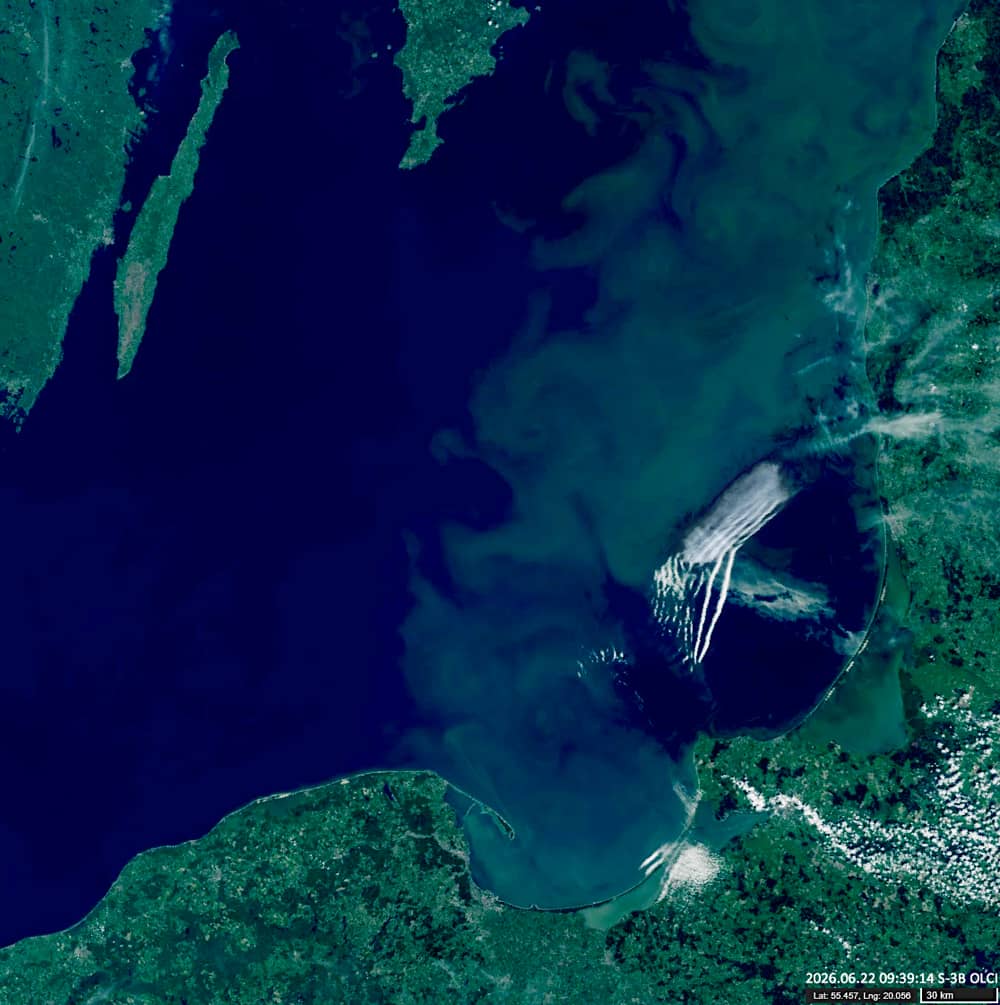
Fig. 2
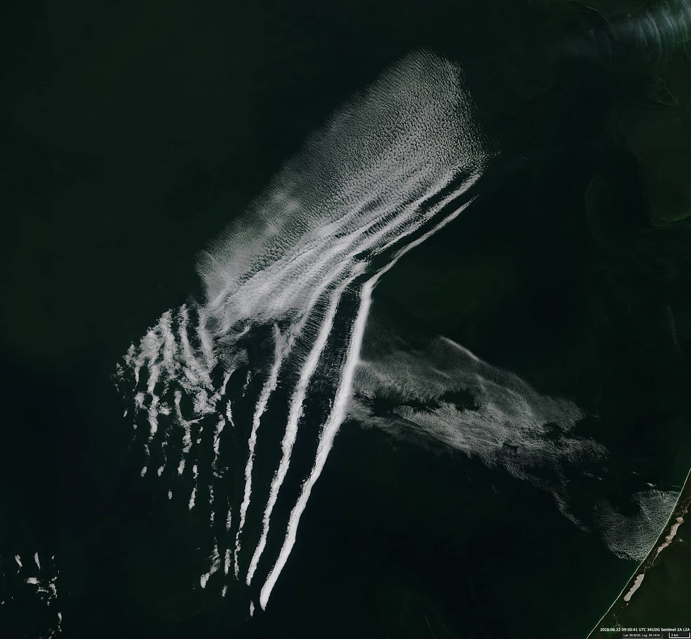
Fig. 3
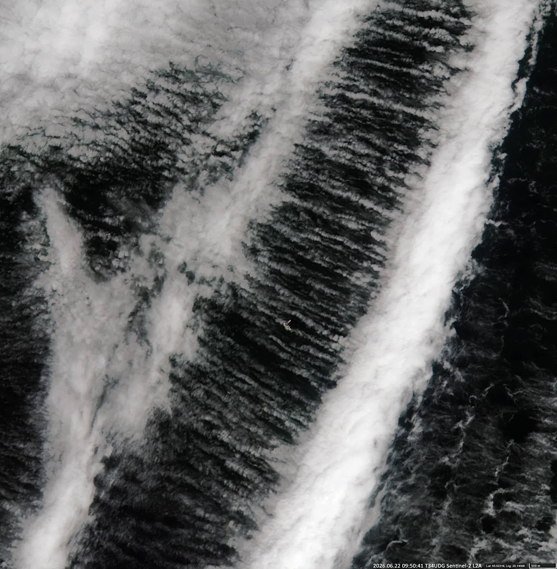
Fig. 4
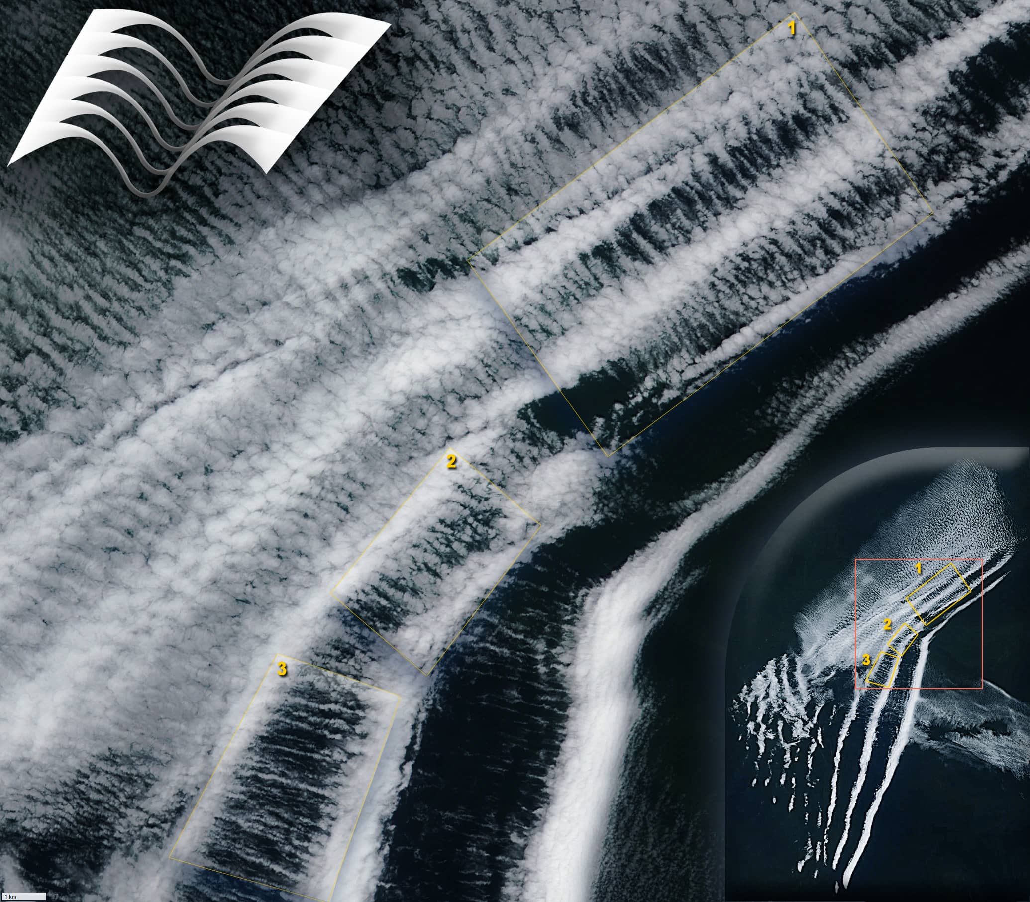
Fig. 5
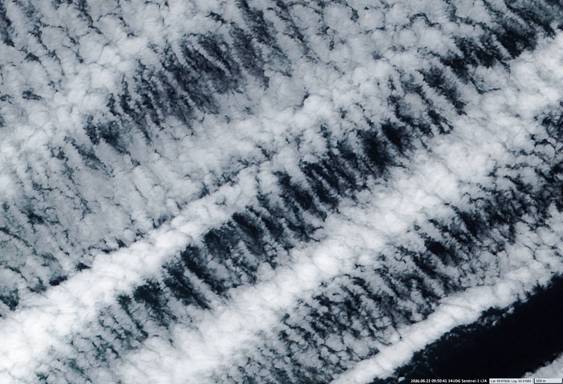
Fig. 6
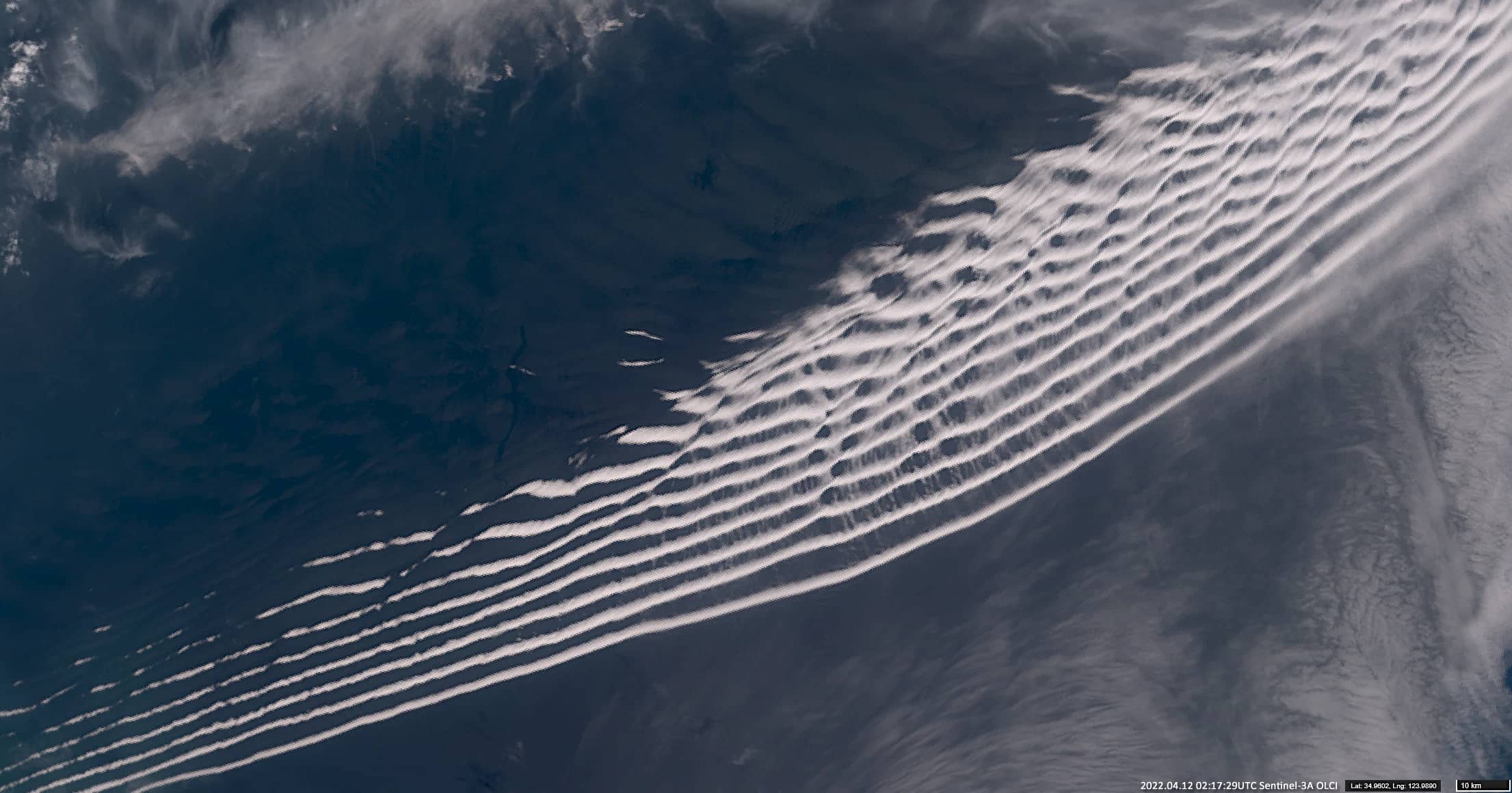
Fig. 7
Contains modified EUMETSAT data [2026].