Baram River Delta
Sarawak | Island of Borneo
Date of acquisition: December 9th, 2023 | 02:56:27 UTC
Sensor: Sentinel-2 L2A
Coordinates: ca. 4.6°N, 113.9°E
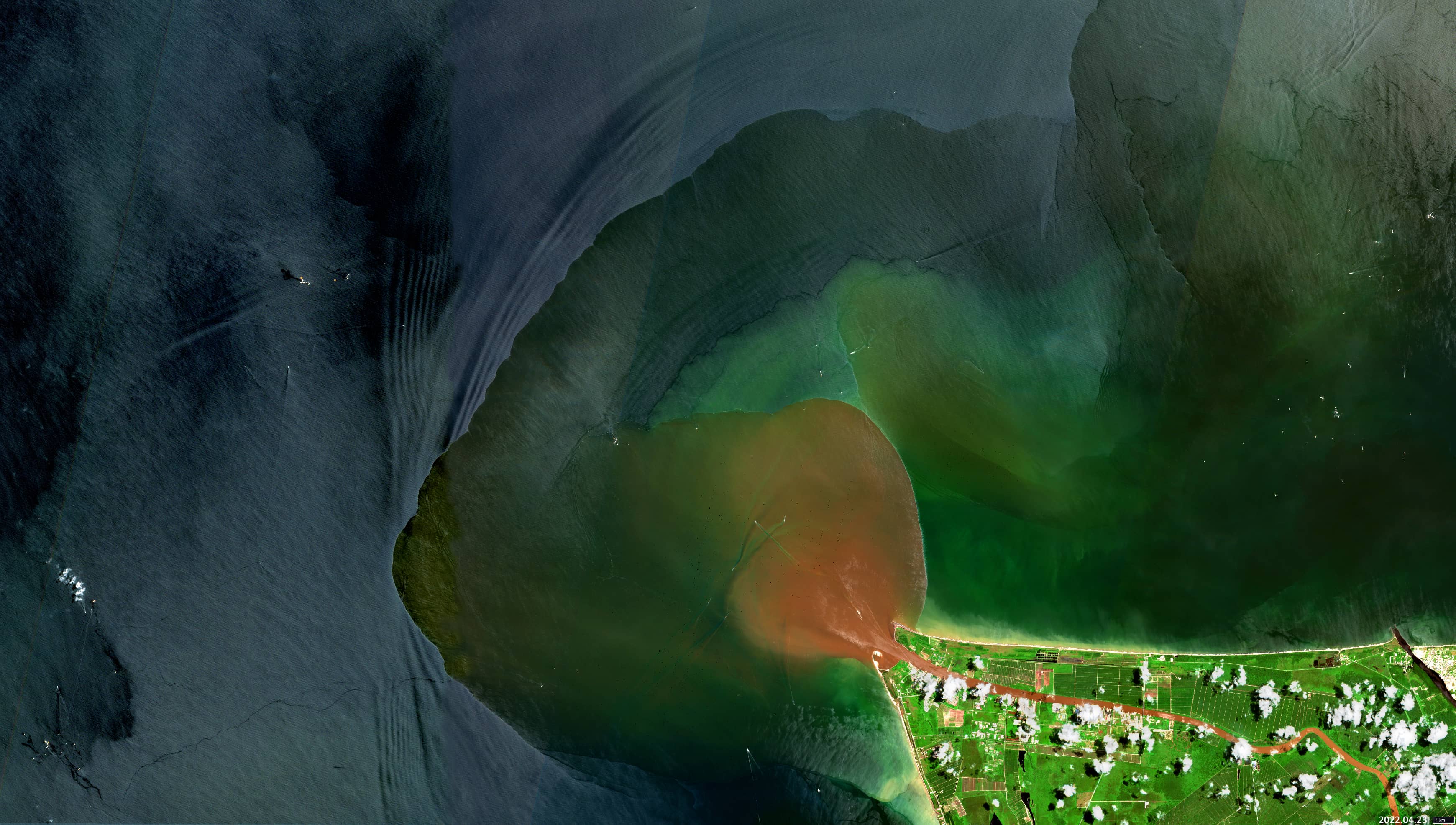
The Baram River (Malay: Sungai Baram) is a river in Sarawak on the island of Borneo. At 400 km, it is the second longest river in Sarawak. The river rises in the Kelabit Highlands, which forms a natural border with Sarawak. It flows westwards through tropical rainforest to the South China Sea, where it forms a delta. As the river loses energy while it flows into the sea, the estuary is raised by the sediments of the delta, which spread out in a west-north-west direction, forming the characteristic claw-shaped mouth.
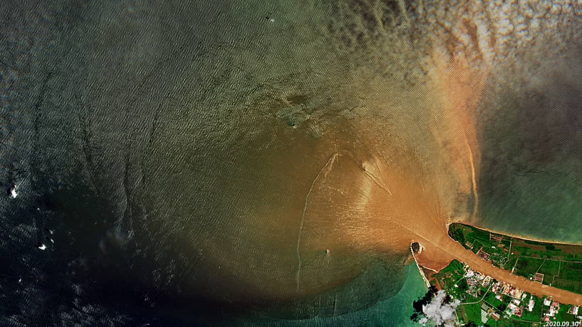
The course of the river is characterised by the development of swamps, mostly covered with peat deposits. As a result, the river carries a lot of organic matter into the ocean. The Baram River is therefore a “blackwater” river, a slow flowing river with a brownish colour, due to the large amount of dissolved humic and fulvic acids.. The plume of the Baram River is often characterized by sharp, distinct boundaries indicating the presence of water fronts (Figures 1-3).
The formation of whitecaps (foam wings) in the ring area near the tip of the mouth is very interesting (Figures 4-6). It can be seen that all whitecaps have the same triangular shape and their tips are radially directed from the centre to the periphery (Figures 2-6).
The wave fronts coming from the South China Sea circumnavigate the cape where the river mouth is located. If the roughness of the river has a higher frequency than the roughness of the ocean (with approximately the same amplitude), the river water in the contact area is forced to release excess energy, which is reflected in the formation of whitecaps on the crests of the waves (Figures 3-6). In the same area, a belt of the light fraction of the discharged material can also be observed near the surface. This phenomenon is particularly common during the northeast monsoon, when cold winter winds blow across the South China Sea due to high atmospheric pressure over the continent, and somewhat less common during the southwest monsoon. This rare phenomenon can be observed more frequently in the north-eastern part of the area of contact between the water masses. That is due to the pattern of local ocean currents and the topography of the seabed in this region.
It should be noted that the front of organic matter plume of the river often does not coincide with the area where the whitecaps form (Figure 3).
The diagram “Figure 7” shows the sea depth around the estuary, the statistically frequent location of some sea wave fronts around the estuary cape and the statistical location of the contact area between the river and the sea waters in the last 5 years.
Around the Baram delta, there are significant oil and gas reserves on the shelf (Figure 8). Fossil fuels are extracted underwater.
Fig. 1
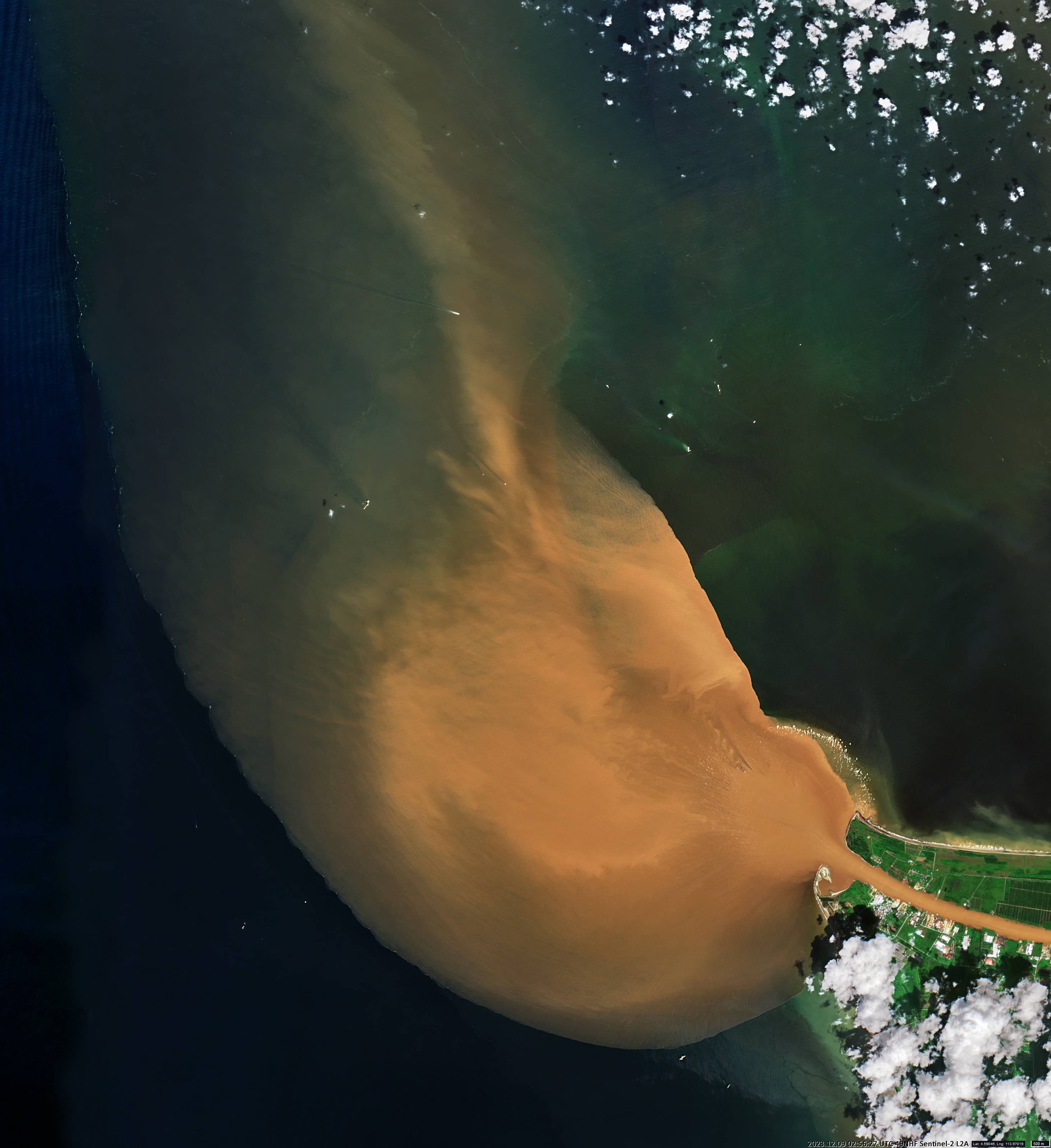
Fig. 2
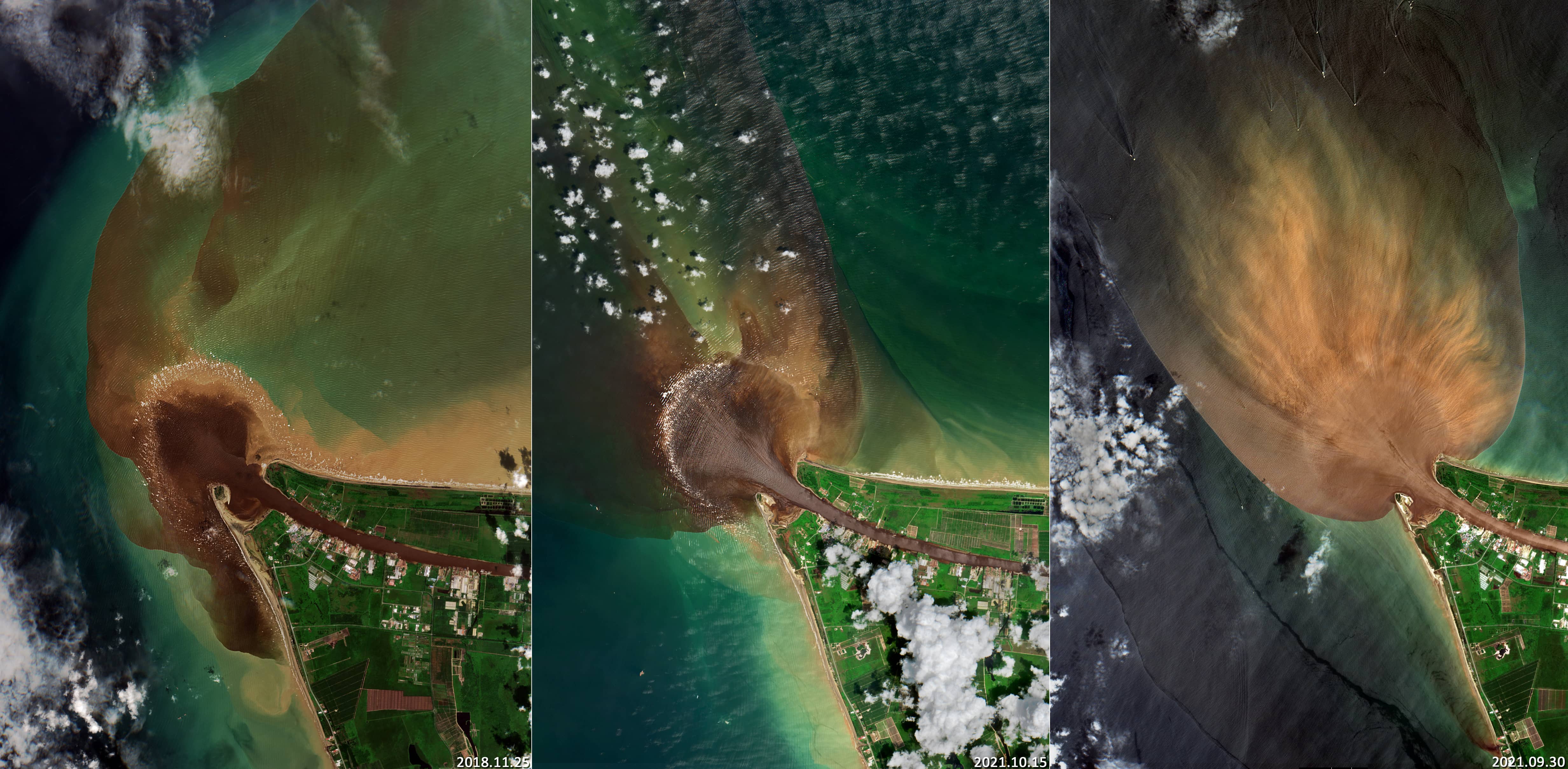
Fig. 3
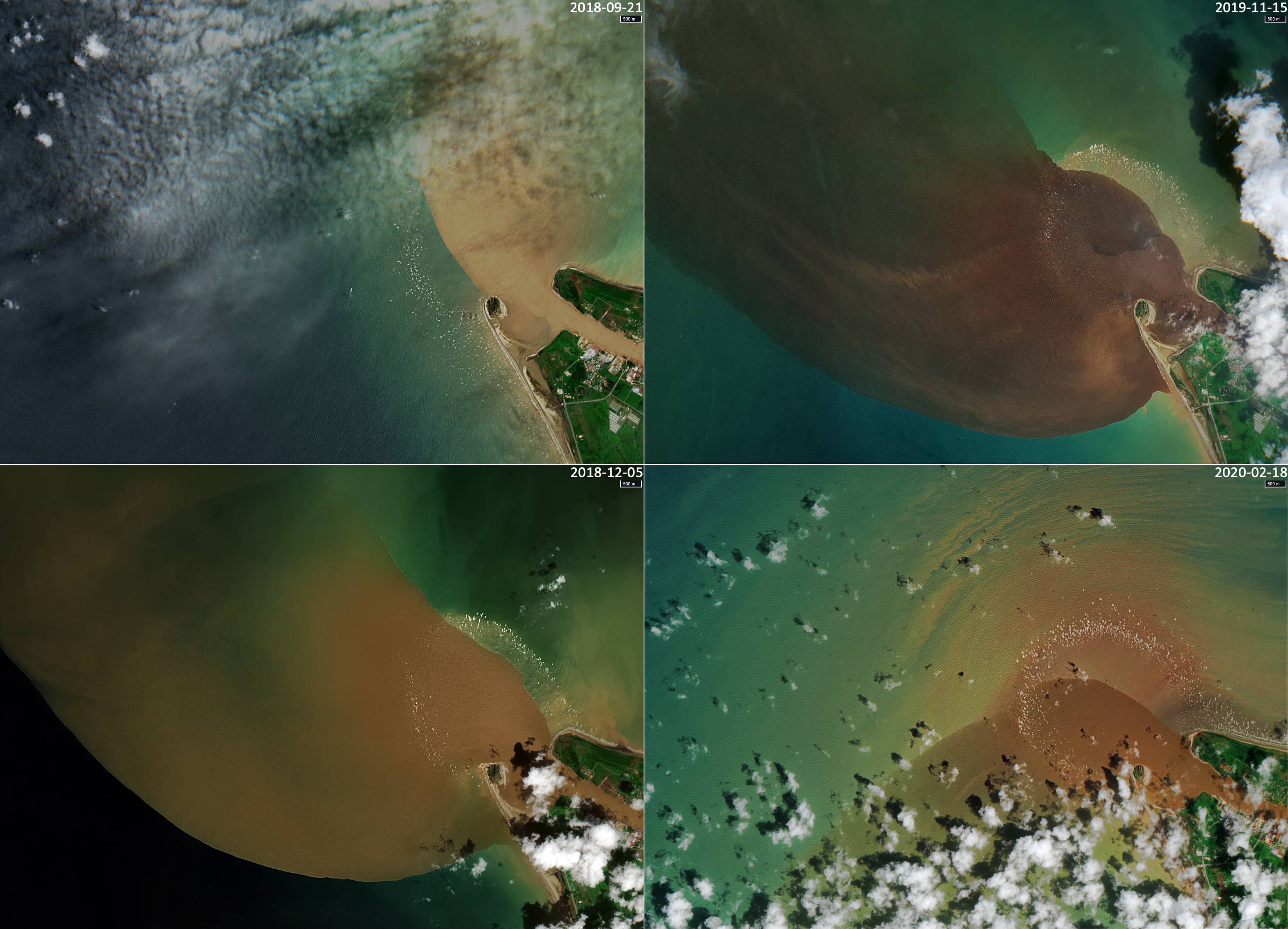
Fig. 4
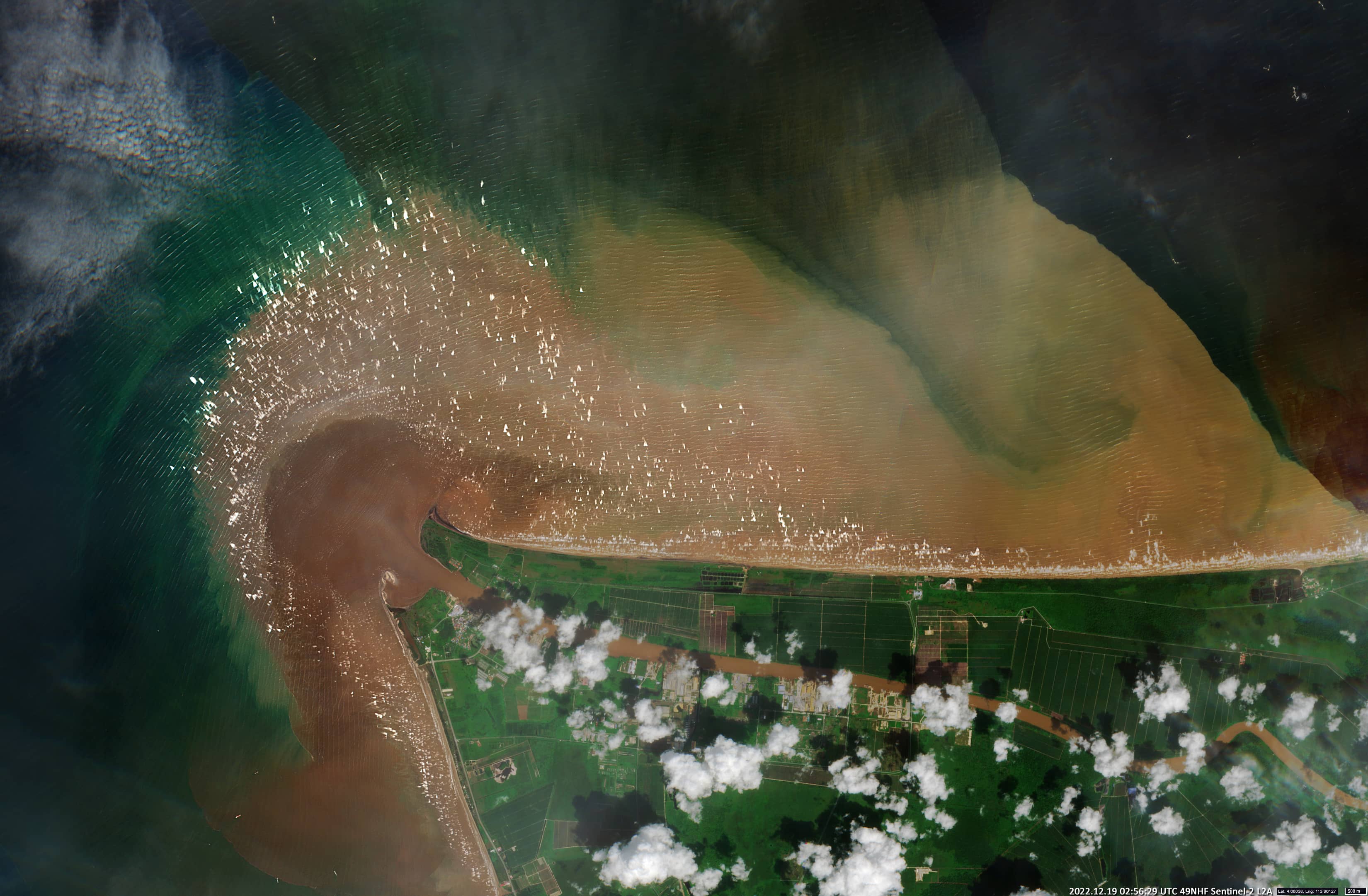
Fig. 5
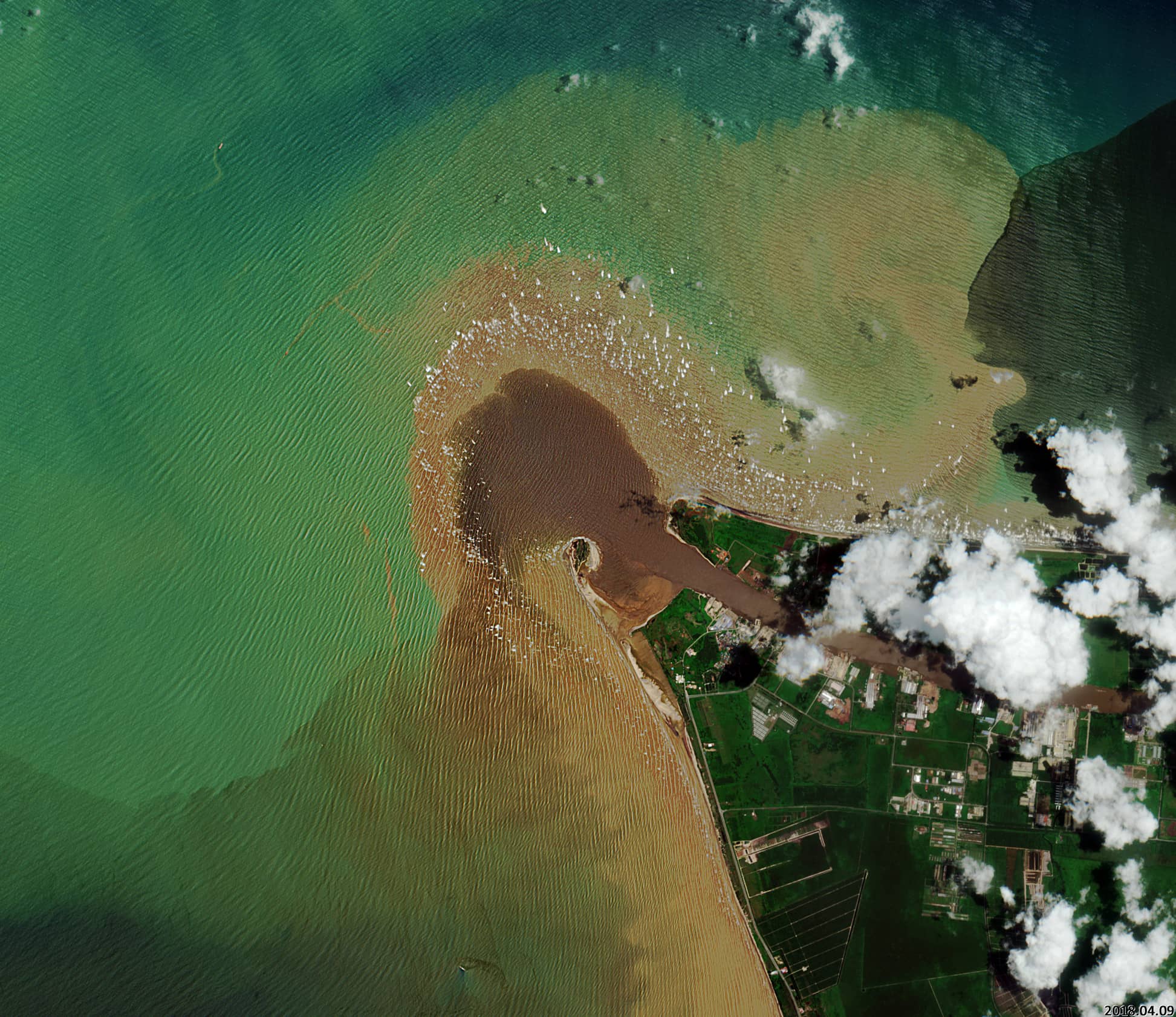
Fig. 6
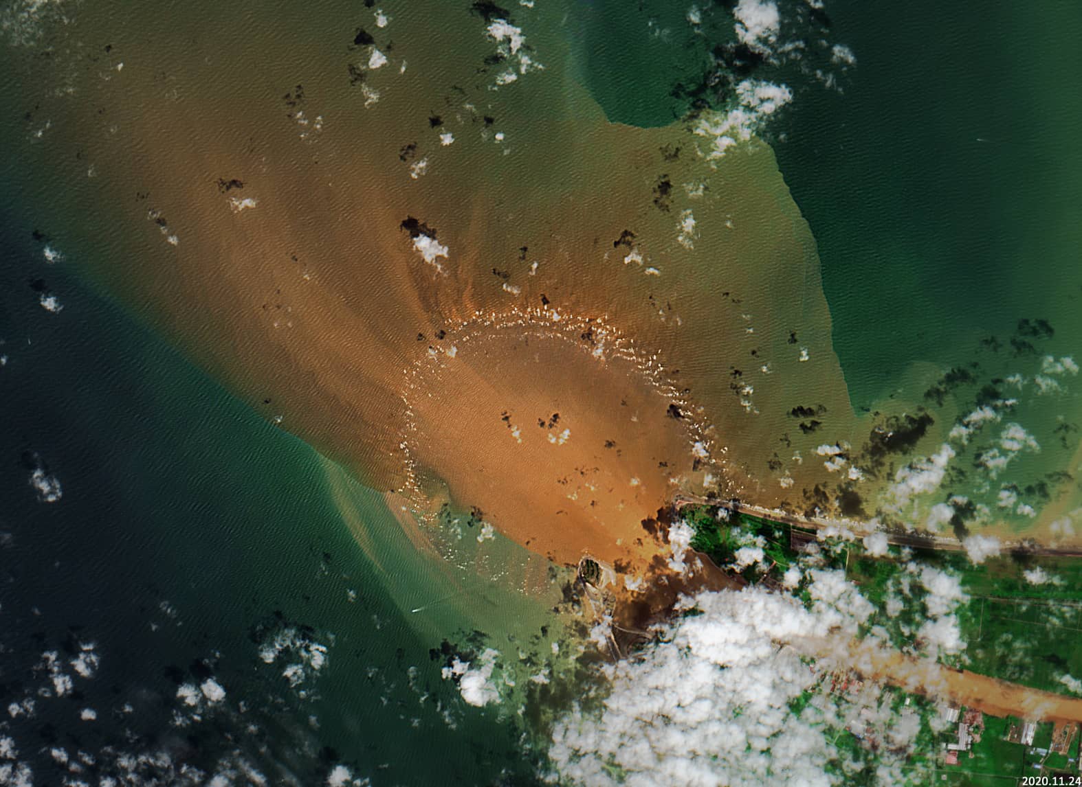
Fig. 7
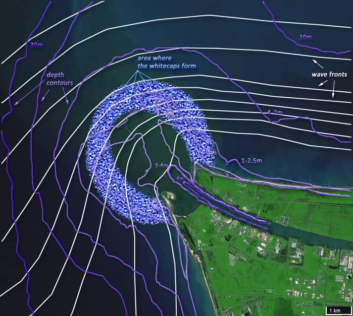
Fig. 8