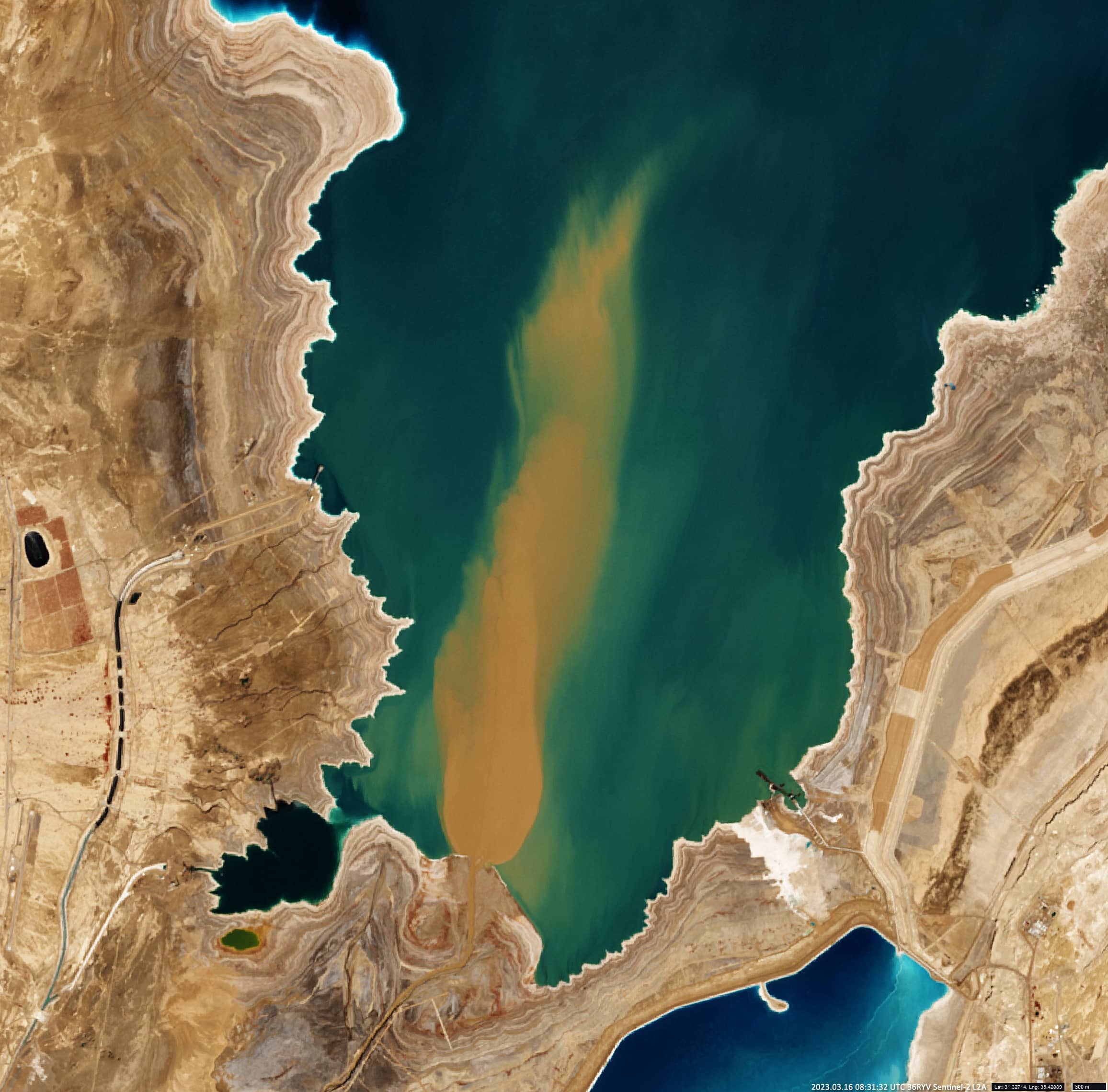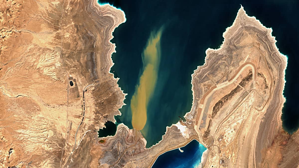
Arava Stream Plume
Arava desert | Israel & Jordan
Date of acquisition: March 16th, 2023 | 08:31:32UTC
Sensor: Sentinel-2B L2A
Coordinates: 31.33°N, 35.43°E
The 89 km long “Arava Stream” (Hebrew: Nahal HaArava) is a stream, that flows from the approximate mid-point of the Arava desert in Israel’s Southern District northward. The special thing about the Arava is that it is a so-called intermittent stream (occasionally flowing in the rainy winter season). Despite inconsistent water flow, intermittent rivers are considered land-forming agents in arid regions, as they are agents of significant deposition and erosion during flood events. The combination of dry crusted soils and the highly erosive energy of the rain cause sediment resuspension and transport to the coastal areas.
The Arava stream originates on the crest of the Notza Ridge, which forms the watershed between the Dead Sea and the Red Sea. The stream flows into the southern end of the Northern basin of the Dead Sea and serves as the actual border between Israel and Jordan. The water surface of the Dead Sea is the deepest continental point (- 420 m) on the Earth’s current terrestrial surface. This salt-encrusted depression is 80 km long and 20 km wide. The declining water level of the Dead Sea in recent decades has led to the basin being physiographically divided into two adjacent, separate water bodies: the northern and southern. In the southern part there are saline, anthropogenic basins, so that the actual sea is now only about 50 km long. This depression is surrounded by mountain ranges to the east and west. They create an orographic rain shadow that increases the aridity of the adjacent desert. Precipitation is extremely rare in this area and does not exceed 45 – 90 mm per year.
The sediment plume visible in the Sentinel-image emerging from the river mouth is a very rare event, apparently related to sporadic rainfall in the river catchment. Over the period of the satellite since 2017 (taking into account the cloud cover that sometimes occurs and the fact that the overflight of the same area occurs only every 5 days) intensive sediment erosion has only been observed twice, on March 16th, 2023 (see image) and on March 7th and 27th, 2019. There is information that it rained with an intensity of 13 mm in the area on March 14th, 2023. Single weak sediment plumes were also observed on Dec. 3rd, 2017, March 17th, 2019, March 16th, 2020, and Feb. 2nd, 2023.