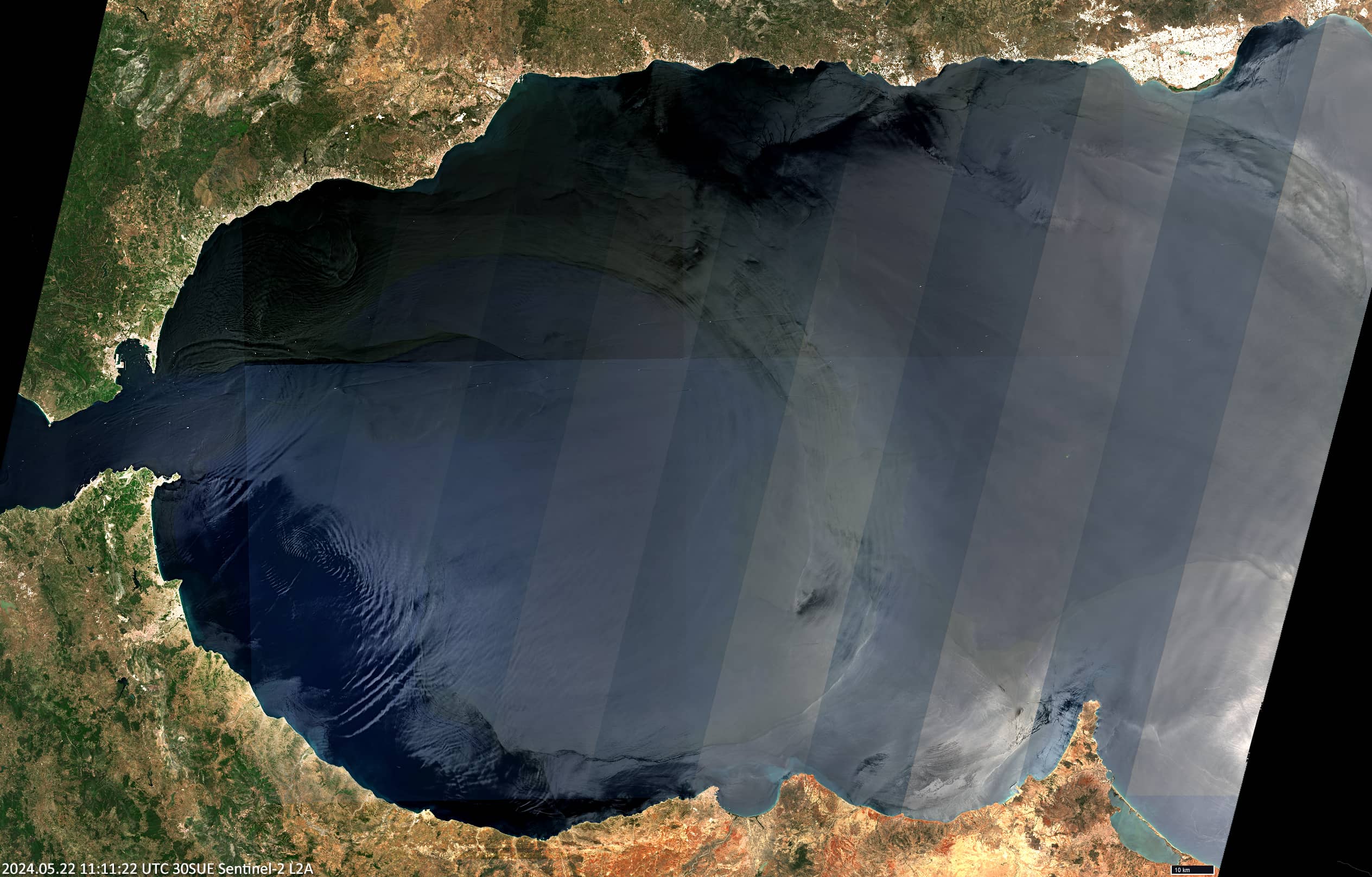
Alborán Sea
Western Meditarrenean Sea
Date of acquisition: May 22nd, 2024 | 11:11:22 UTC (S-2), 10:53:37 UTC (S-3, SLSTR)
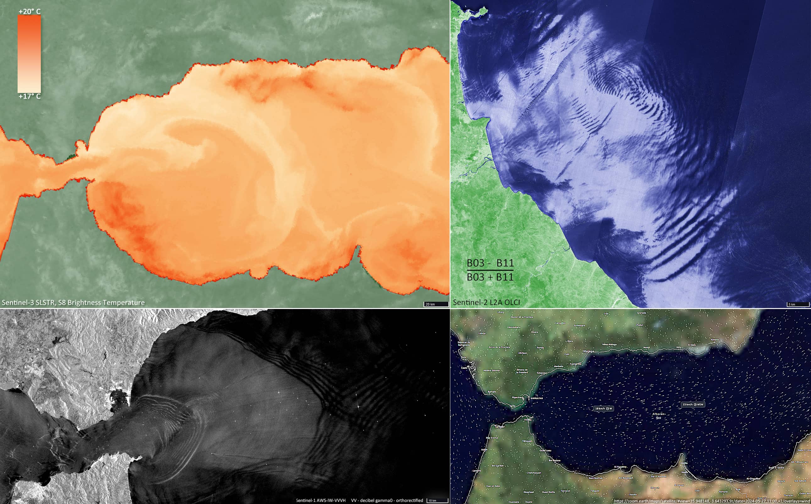
Sensor: Sentinel-2 L2A, Sentinel-3 SLSTR
Coordinates: ca. 35.8°N, 4.3°W
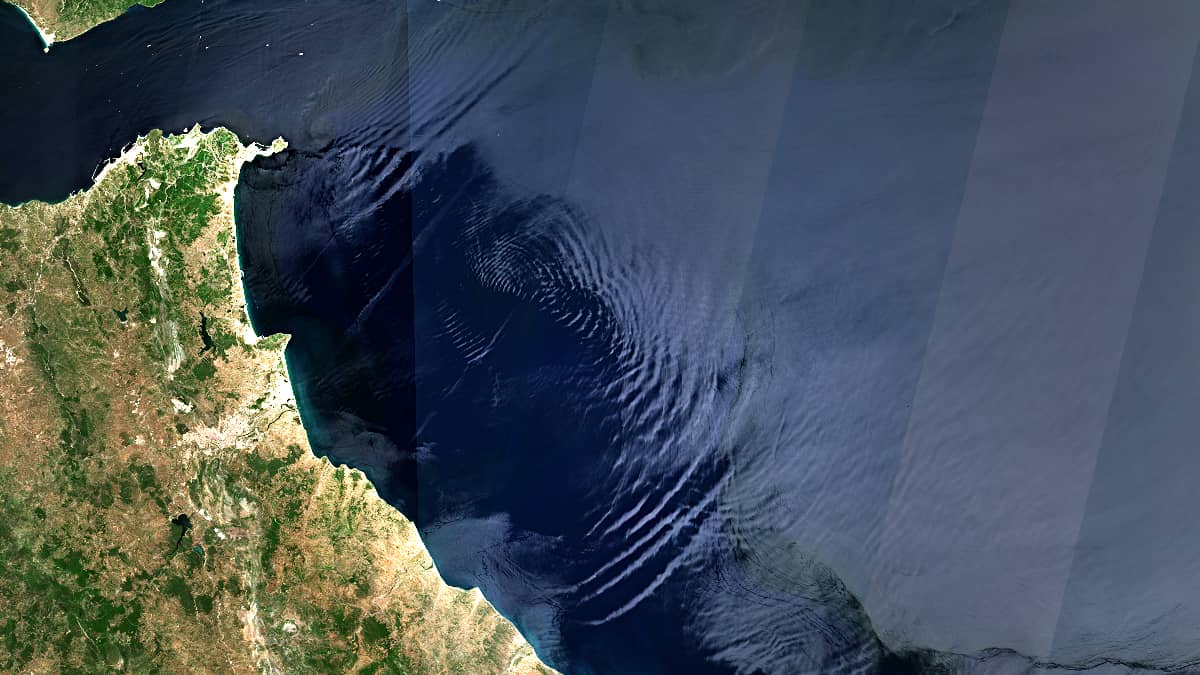
The Sentinel-2 image shows the Alborán Sea, the westernmost part of the Mediterranean Sea. Due to the sun glint effect, the situation on the water surface is already clearly visible in the visual wavelength range.
Figure 1 (centre) shows the outline of the ocean current, which flows in an almost clockwise direction from the north to the south of the sea .
Within this current, the sea surface temperature decreases slightly (by 1-2°C) (Figure 2, upper left), and the wind over the sea to the east of it begins to increase slightly (Figure 2, lower right).
In the southwestern part of the sea, an interference wave pattern can be observed (Figure 2, upper right), probably caused by winds from the Strait of Gibraltar and influenced by the African coast in this area.
It is not uncommon for winds to “blow” from the Atlantic through the Strait of Gibraltar into the Mediterranean. Figure 2, bottom left, is a radar image from Sentinel-1 taken a few months ago, which shows a very impressive pattern of waves and ripples.