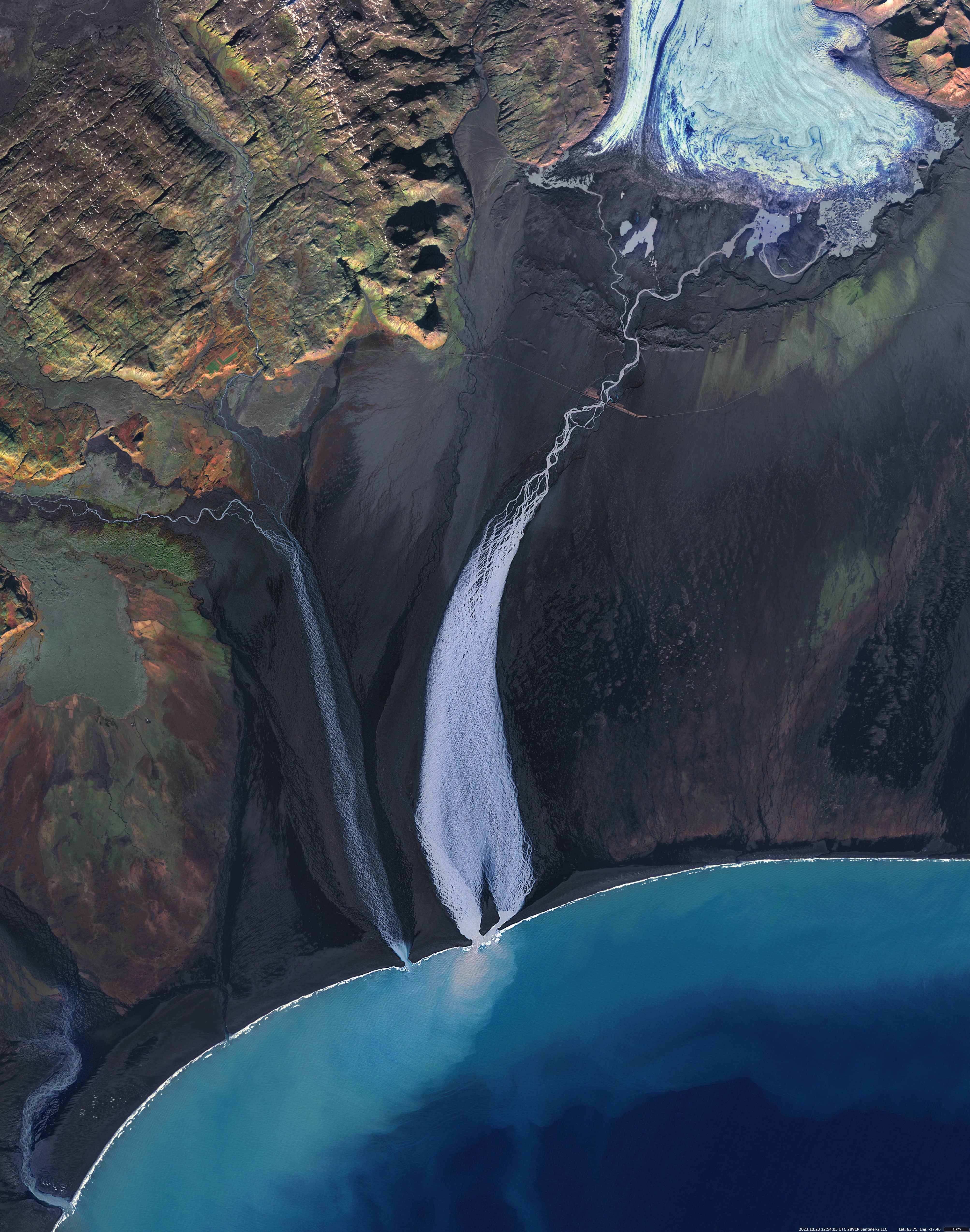
Hverfisfljót og Sandgígjukvísl
South Iceland
Date of acquisition: October 23rd, 2023 | 12:54:05 UTC
Sensor: Sentinel-2 L1C
Coordinates: ca. 63.8°N, 17.5°W
To be reviewed:
The Sentinel-2 satellite image shows how two Icelandic rivers flowing from different directions join at their mouths.
Left: Hverfisfljót is a glacial river in southern Iceland. It rises from Síðujökull on the southwest edge of Vatnajökull. In the lower reaches the river has many rapids and waterfalls. One of these waterfalls is the famous Lambhagafoss, below which the river flows over the Skaftáreldahraun lava field. During the 1783 Laki eruption, the main eastern branch of the Laki lava flow passed through the Hverfisfljot canyon. Now the river is constantly trying to change its course, flowing between deposits of solidified lava and sediments the glacier and surrounding mountains. There is a 60 meter long bridge between Kirkjubæjarklaustur and Lómagnúpur. The Hverfisfljót is a right tributary of the meandering Núpsvötn.
Right: Gígjukvísl or Sandgígjukvísl is a glacial river near the western end of the Skeiðarársandur sands, south Iceland. The melting of the Vatnajökull glacier because of subglacial eruptions of the Grímsvötn volcano causes flooding on the river. A huge quantity of melting bursts out from under the glacier’s edge and rushes to the sea. This, as well as frequently changing volumes of flowing water carrying sediments from the mountains, numerous inflows of rainwater and lava deposits on a flat valley, leads to the fact that the river has many channels and changes them. The river was bridged in 1973 with a 376 m long bridge and again in 1996 after a volcanic eruption.
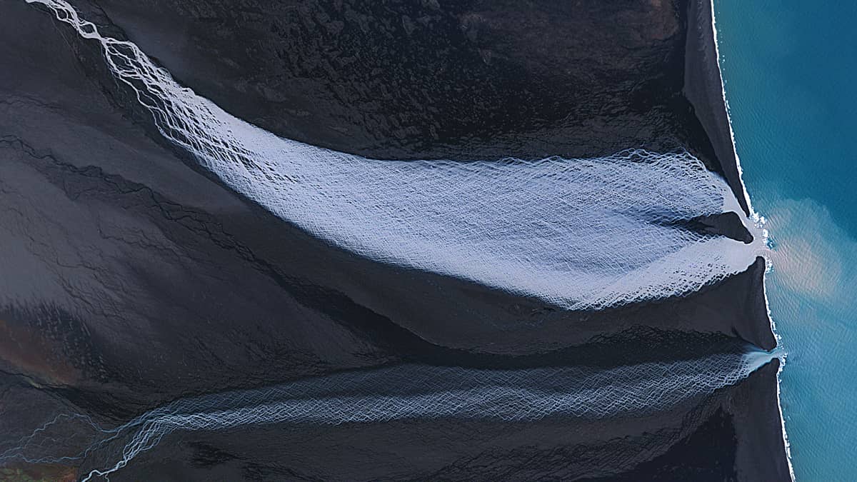
The rivers look spectacular in the presented Sentinel-2 satellite image; the old river beds and their currently non-existent tributaries around them can be observed as well.