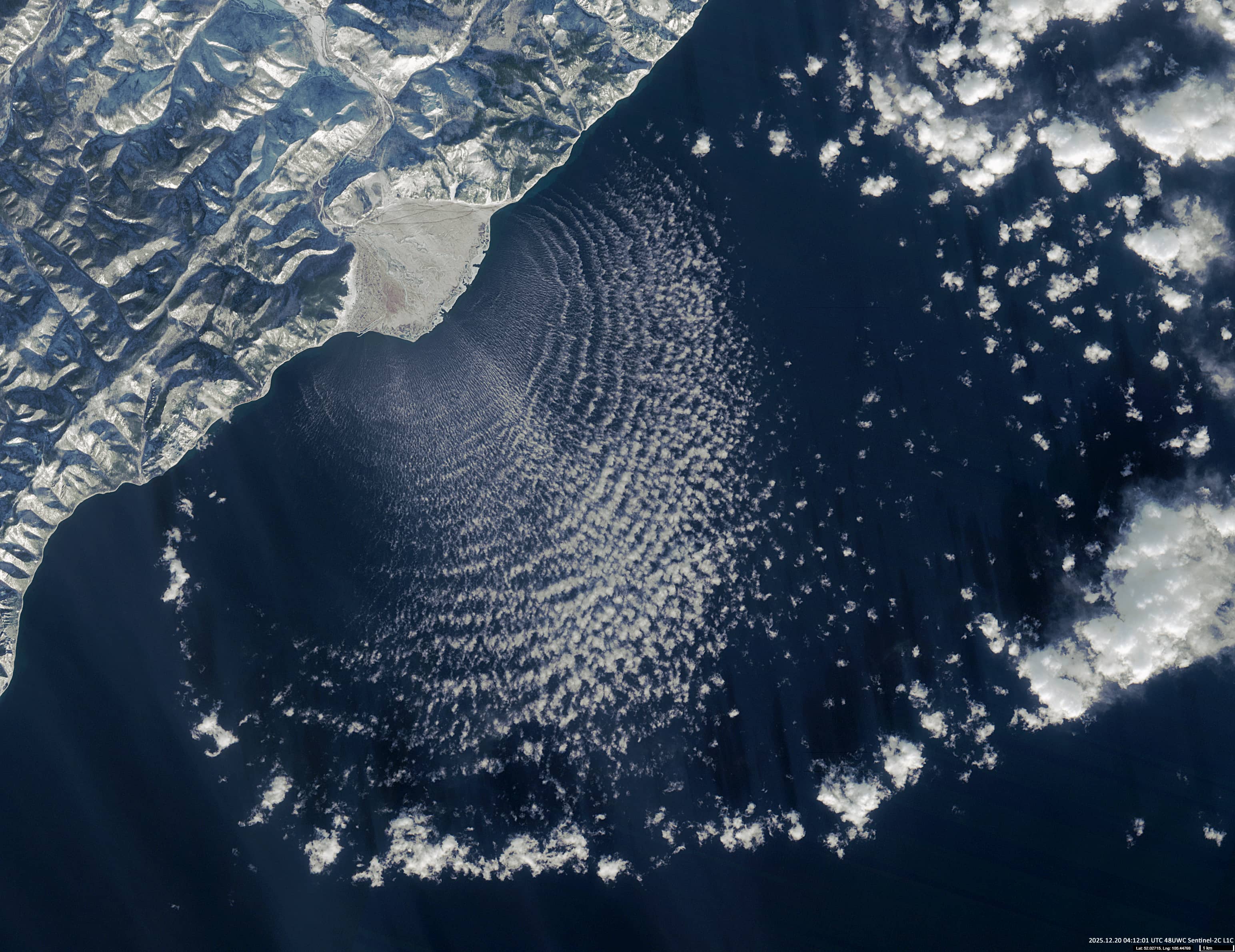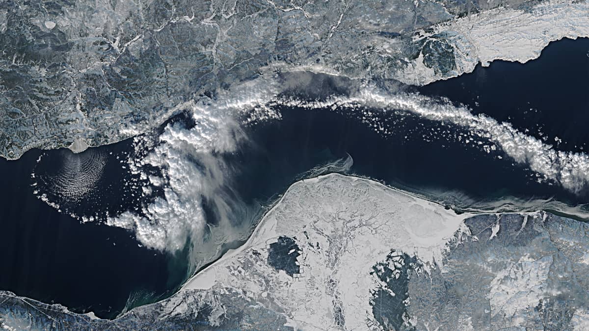
Cloud Structure over Lake Baikal
Between Irkutsk Oblast and the Republic of Buryatia | Russian Far East
Date of acquisition:
• 2025.12.20 | 04:12:01 UTC
Sensor: Sentinel-2C L1C
Coordinates: ca. 52.02°N, 105.45°E
Figure 1 shows a Sentinel-2 satellite image of the cloud field over the southern part of Lake Baikal, to the southeast of the marshy delta of the Aedehen Gol River (called Эдеэн Гол in Buryat and Голоустная in Russian).
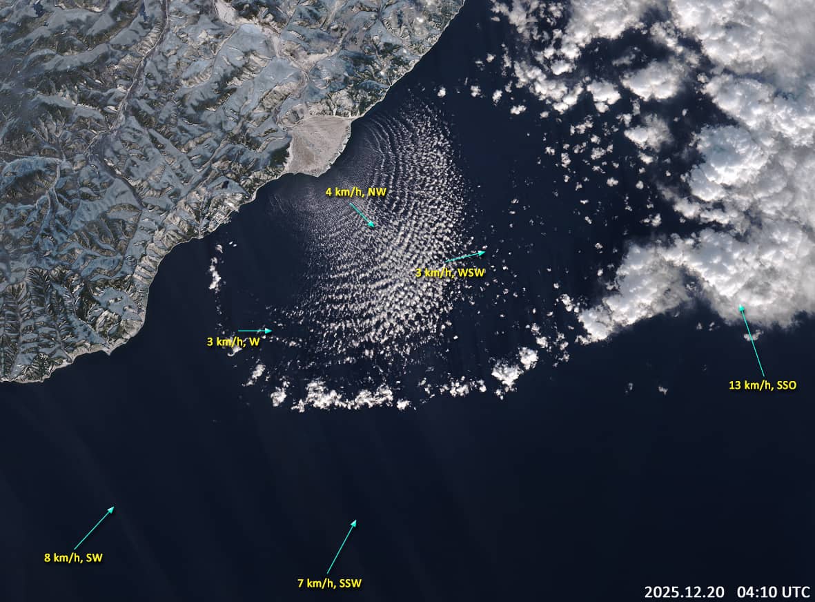
The orographic features around the river valley form a wind channel. At the time of image acquisition, a weak and relatively cold air mass was flowing out of the valley towards the lake. At the same time, a stronger, warmer, and more humid air mass was flowing in the opposite direction across the lake towards the coast (see Figure 2).
The convergence and subsequent interaction of these air masses led to wave-like oscillations in the lower troposphere. This resulted in the formation of a coherent, visually distinctive cloud structure whose morphology is reminiscent of a fluffy dandelion.