Baie de Somme
Côte Picarde | Hauts-de-France
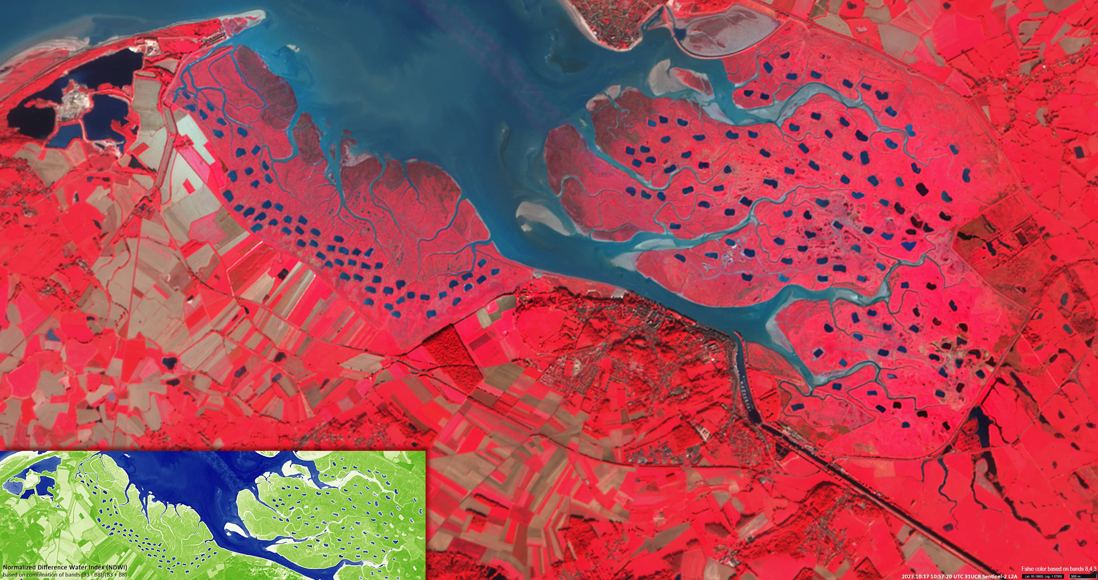
Date of acquisition: October 17th, 2023 | 10:57:20 UTC
Sensor: Sentinel-2B L2A
Coordinates: ca. 50.2°N, 1.6°E
The Baie de Somme is located on the Côte Picarde in the Hauts-de-France region.
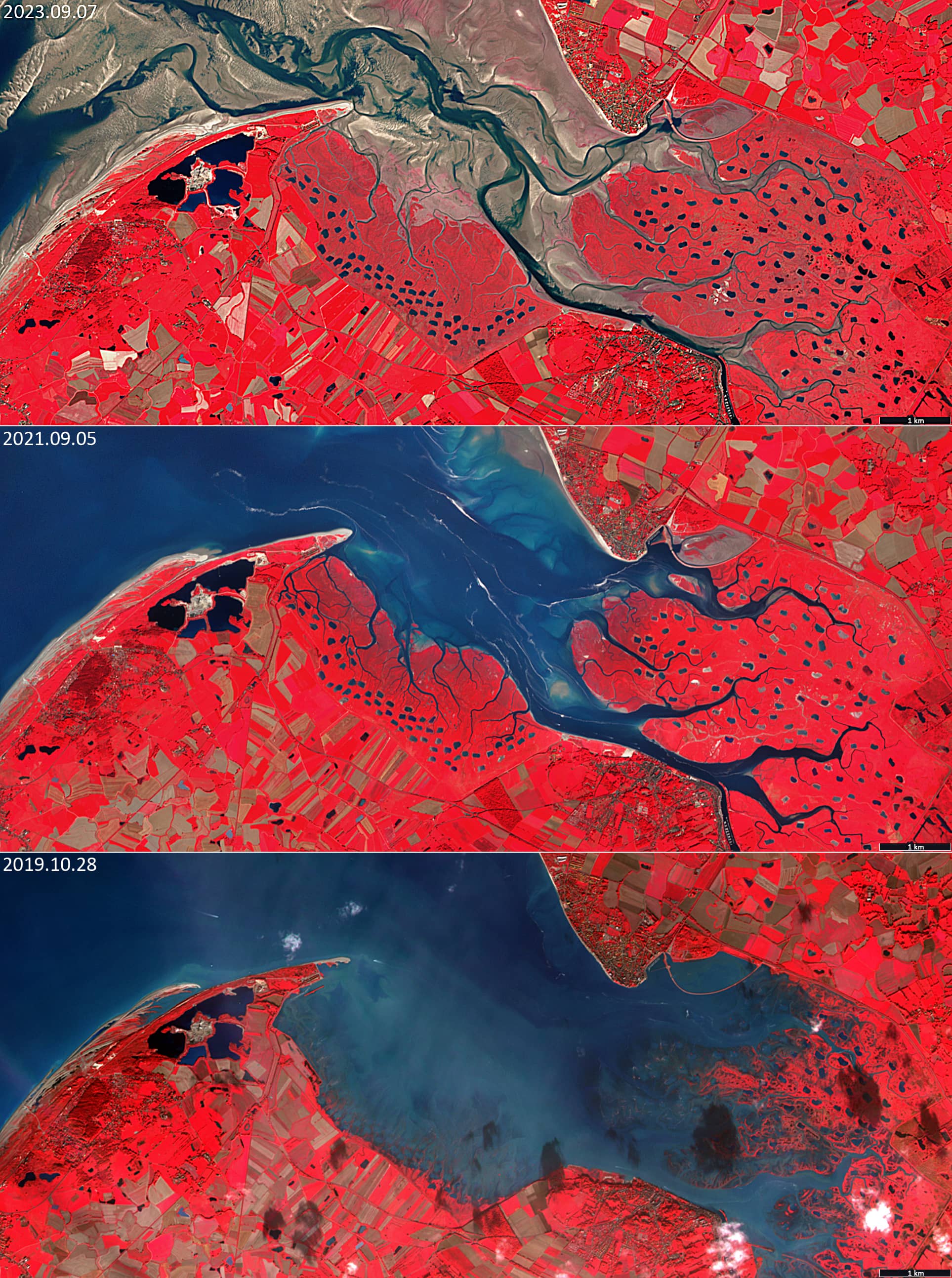
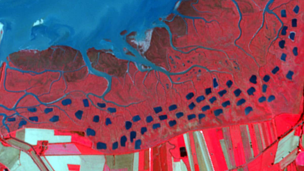
Geologically, the bay is the largest estuary in northern France, covering 7,200 hectares and overlooking the English Channel (La Manche). The constantly changing terrain consists of a series of long sandy beaches and is one of the main migration and wintering areas formigratory birds in France. The area is divided into three zones: the lower part of the estuary – which is almost always covered with water; the “vasières” or mudflats – which are covered at high tide and exposed at low tide, and the “mollières” – a vast grassy plateau consisting of layers of sand and mud. The Mollières form with their salt resistent vegetation (salt marshes) the transition between the marine and terrestrial environment.
In the Mollières there are artificial ponds to attract migratory birds for hunting. Most ponds have a hunting observation hut on the shore.
In the Sentinel-2 image, particularly in the false-colour image, these ponds are clearly visible (Figure 1).
Viewed from above, their position strongly resembles the tracks of a large animal, that may have been pursued by hunters.
On the left bank of the bay, no fewer than 60 ponds can be counted. On the right bank, there are about 120.
The area where the ponds are located is relatively rarely flooded, only a few times a year. The maximum water level observed by cloudfree Sentinel-2 on 28 October 2019 is shown in Figure 2.