Winter in Jonglei Region of South Sudan
Jonglei State | North-eastern South Sudan
Dates of acquisition:
• 2025.12.27 | 08:12:49 UTC
• 2026.01.16 | 08:11:59 UTC
• 2026.01.18 | 08:02:51 UTC
Sensors: Sentinel-2B L1C, Sentinel-2B L2A, Sentinel-2C L2A
Coordinates: ca. 8°N, 32°E
The Greater Pibor Administrative Area (GPAA) is a semi-autonomous administrative region located in the eastern part of South Sudan’s Jonglei State, close to the border with Ethiopia. The landscape is characterised by flat savanna plains interspersed with extensive seasonal floodplains. The regional climate is characterized by a rainy season from around May to October, followed by a long dry season, which often brings drought conditions.
The area is mainly inhabited primarily by the Murle ethnic group, who speak the Surmic language. The local population engages in semi-sedentary and partially nomadic pastoralism, supplemented by slash-and-burn agriculture, seasonal river fishing, hunting, and gathering wild fruits and honey.
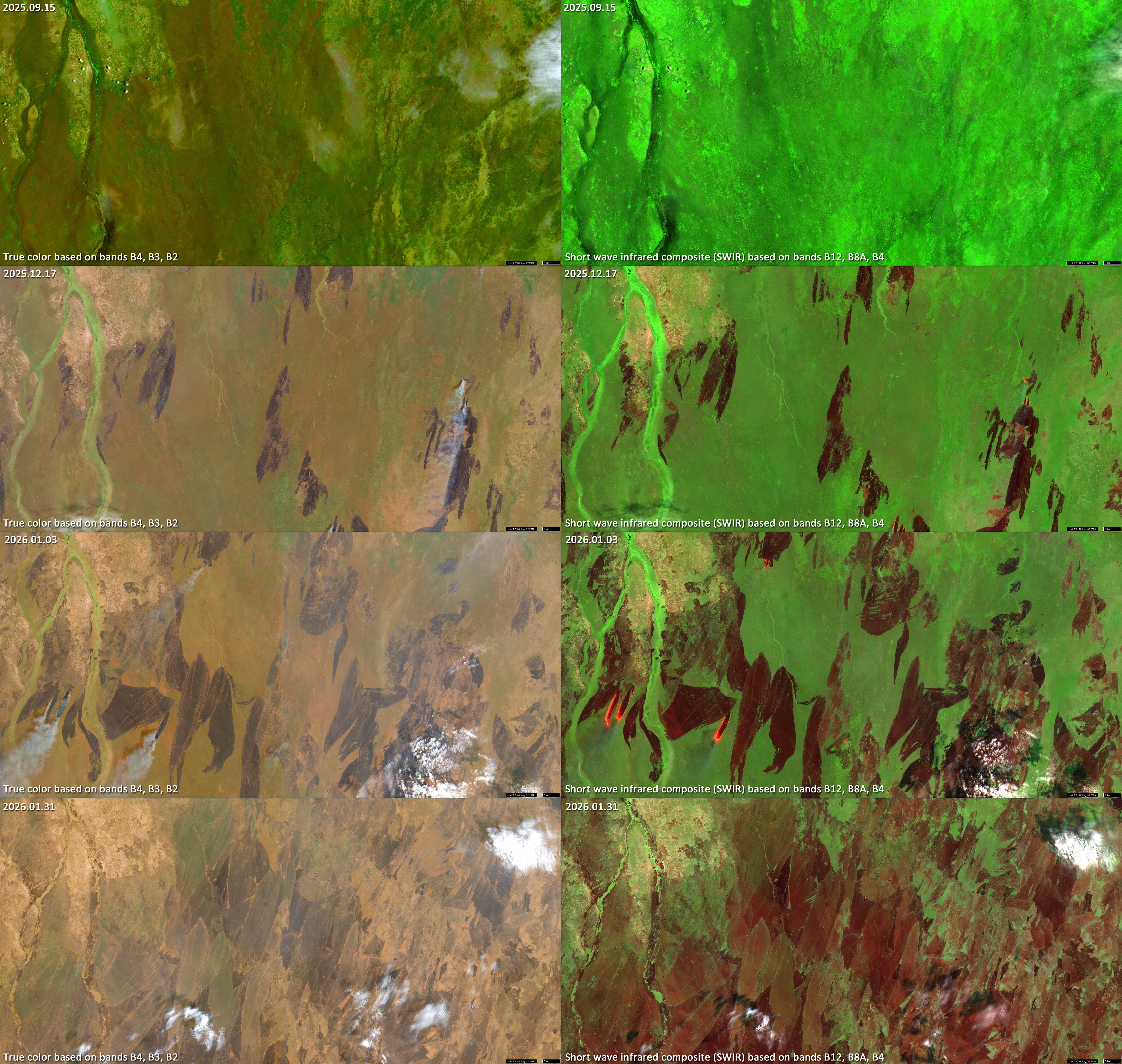
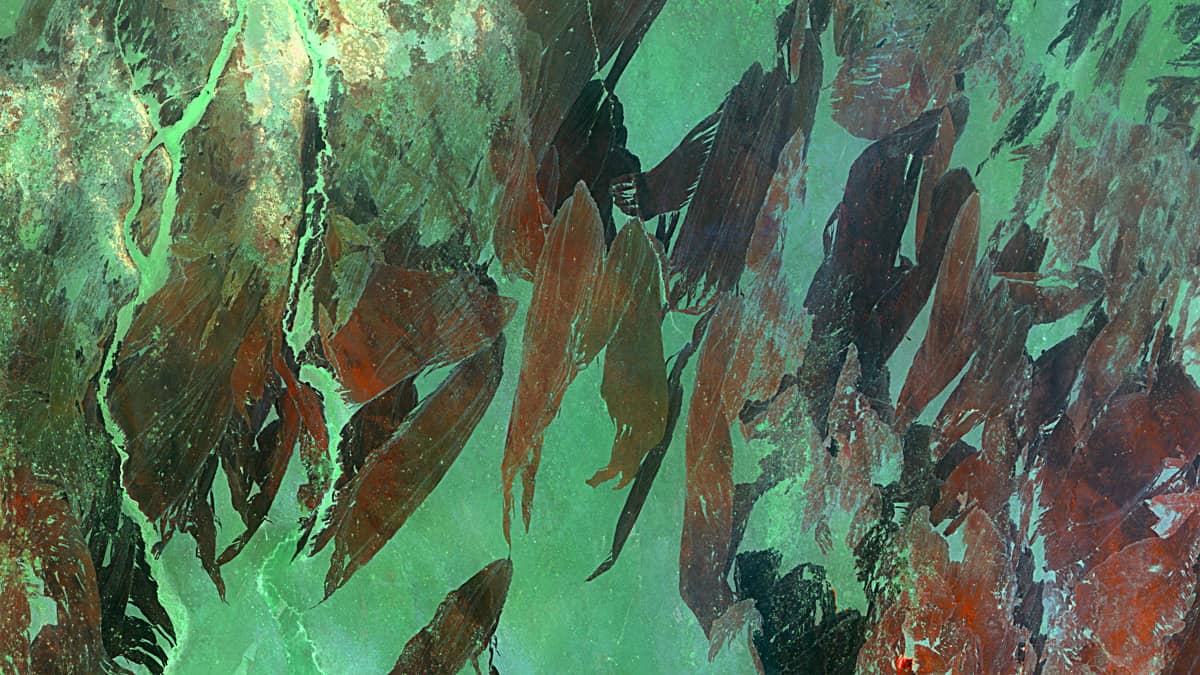
Satellite observations acquired in December and January reveal strange, irregular sharp-edged patterns that gradually spread across the entire region, eventually merging with each other (see Figures 1 and 2). These shapes are the visible traces of slash-and-burn agriculture. In this farming system, dried grasses and low shrubs are intentionally burned (Figures 3 and 4), leaving ash behind which increases the availability of nutrients in the soil, especially nitrogen, – and promotes plant growth during the next rainy season.
The man-made fires are clearly visible in Sentinel-2 images (Figures 1–6) and are particularly distinguishable in shortwave infrared (SWIR) composites based on bands B12, B8A, and B4 (Figures 2–3 and 5–6).
With the onset of the rainy season, burning activity ceases, and by autumn, the savannah is densely vegetated again (Figures 5, 6). This vegetation cover may consist of a variety of crops, such as cereals, legumes, and root vegetables, as well as regenerated pasture for livestock farming.
Further reading
Greater Pibor Administrative Area (Grokipedia)
Jonglei/Greater Pibor Administrative Area Protection Response (Protection Cluster South Sudan, PDF)
Slash-and-burn agriculture (Wikipedia)
Fire Burned Area (Brockmann Consult Portfolio)
Fire burned area from 2001 to present derived from satellite observations (C3S Burned Area Climate Store )
FireCCI project (ESA Climate Office)
Fig. 1
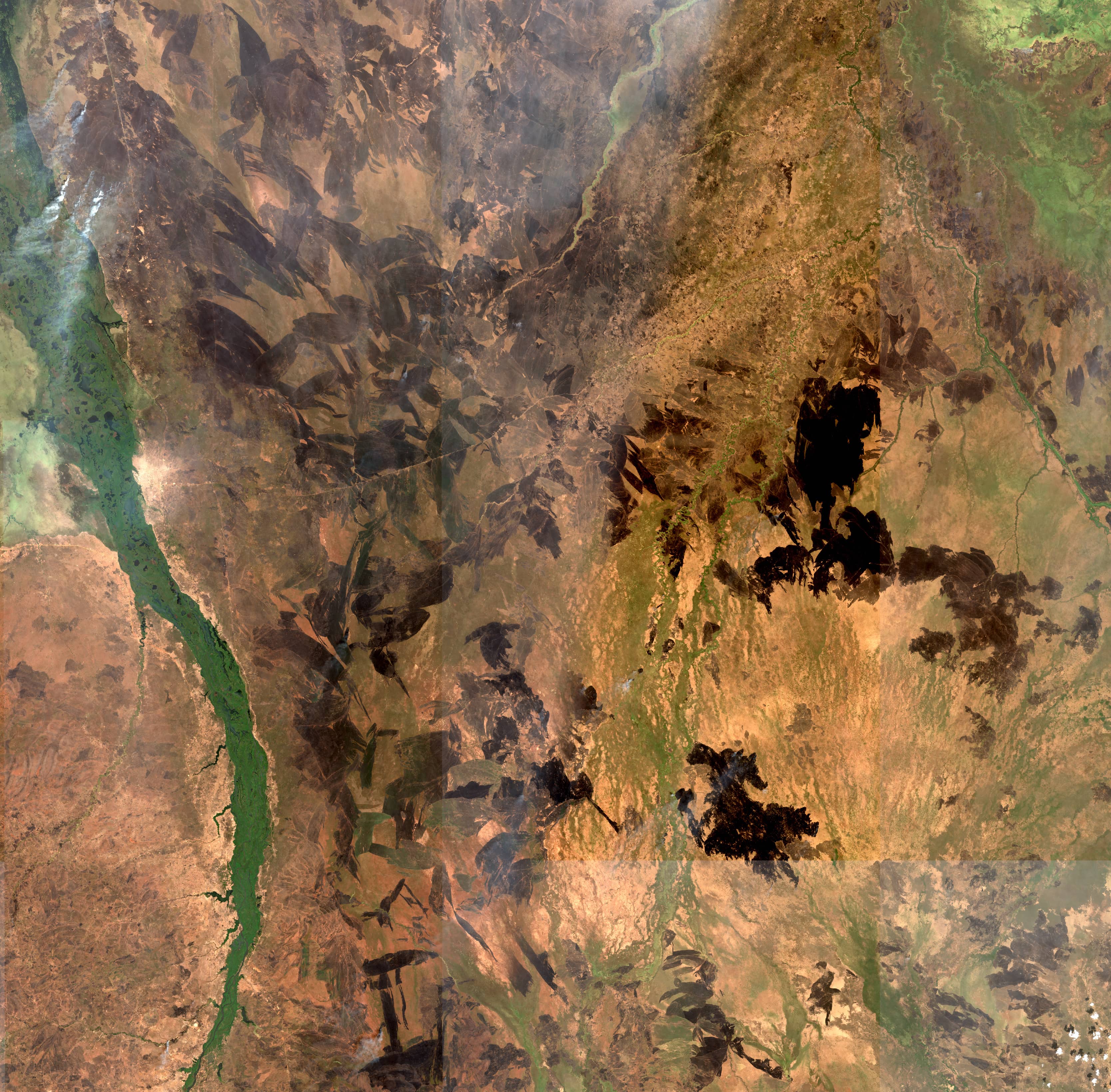
Fig. 2
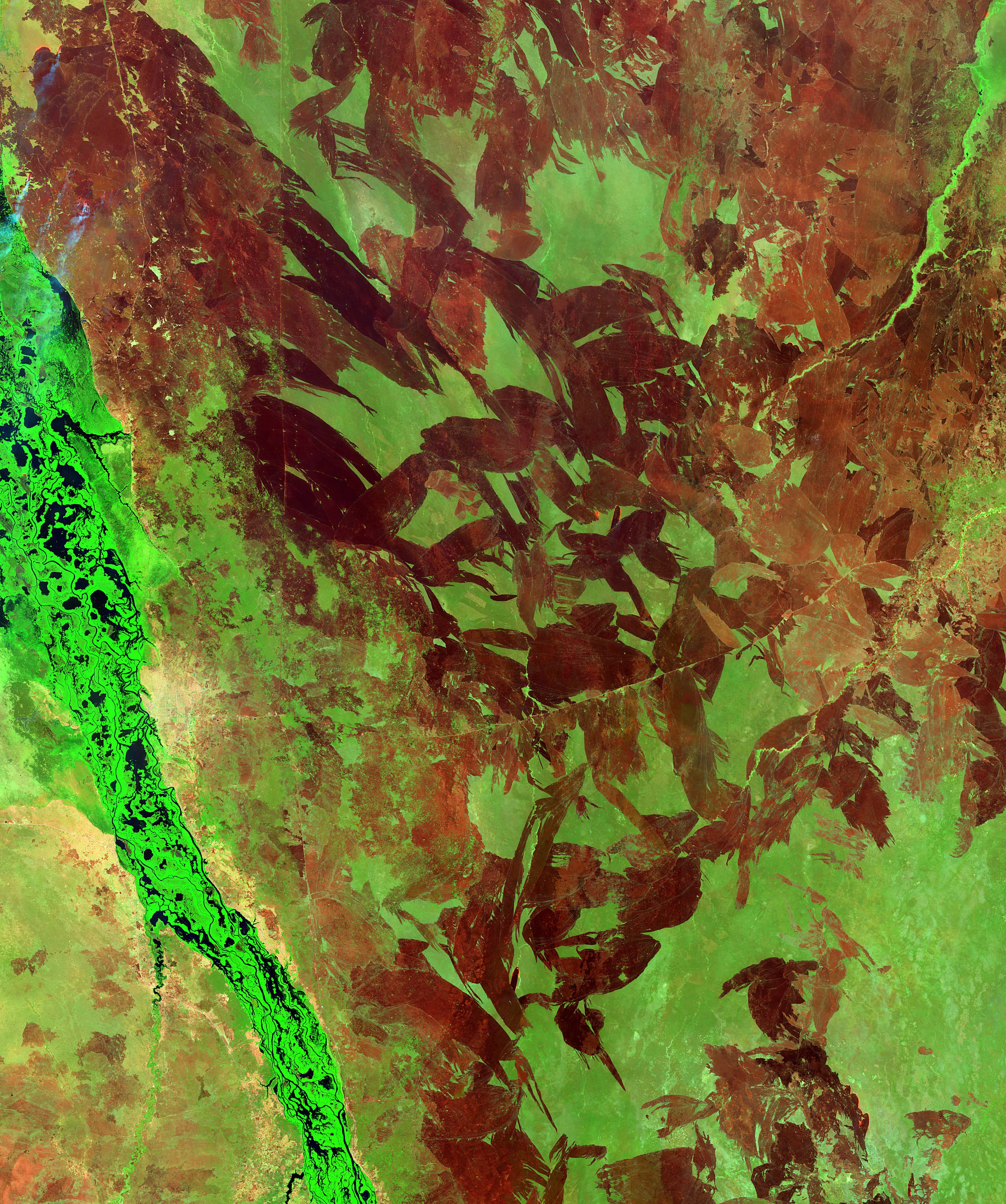
Fig. 3
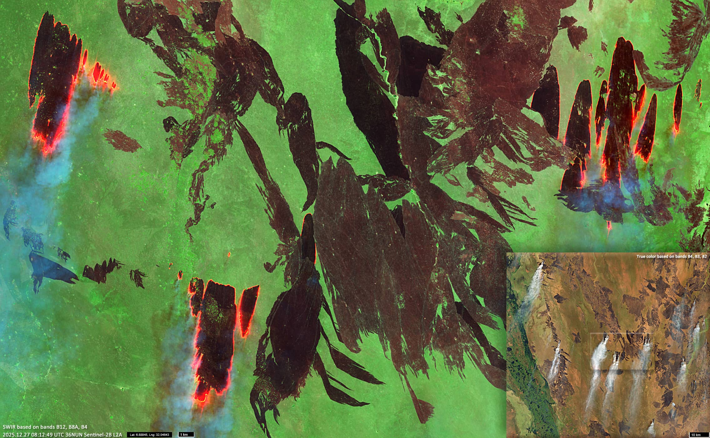
Fig. 4
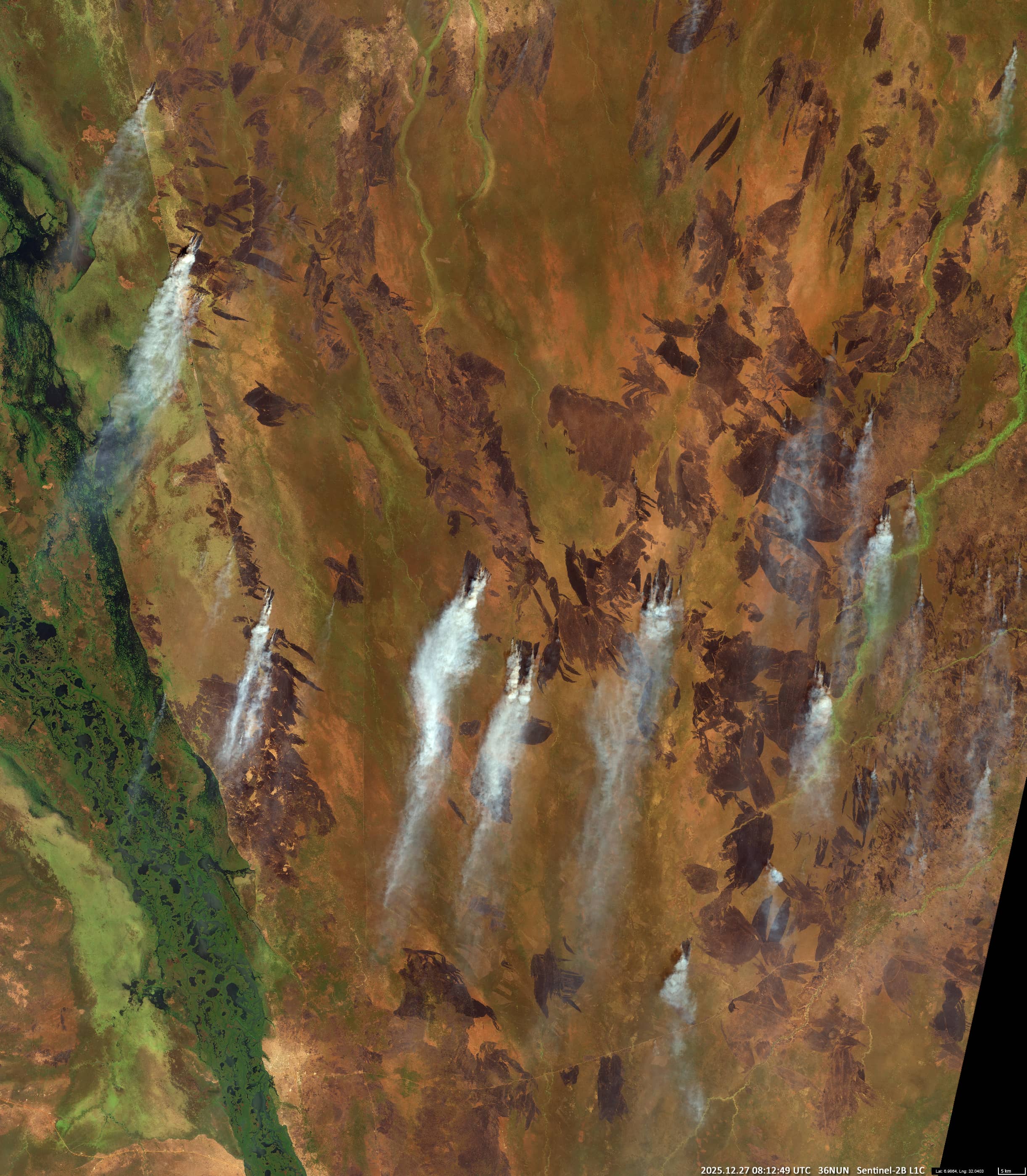
Fig. 5
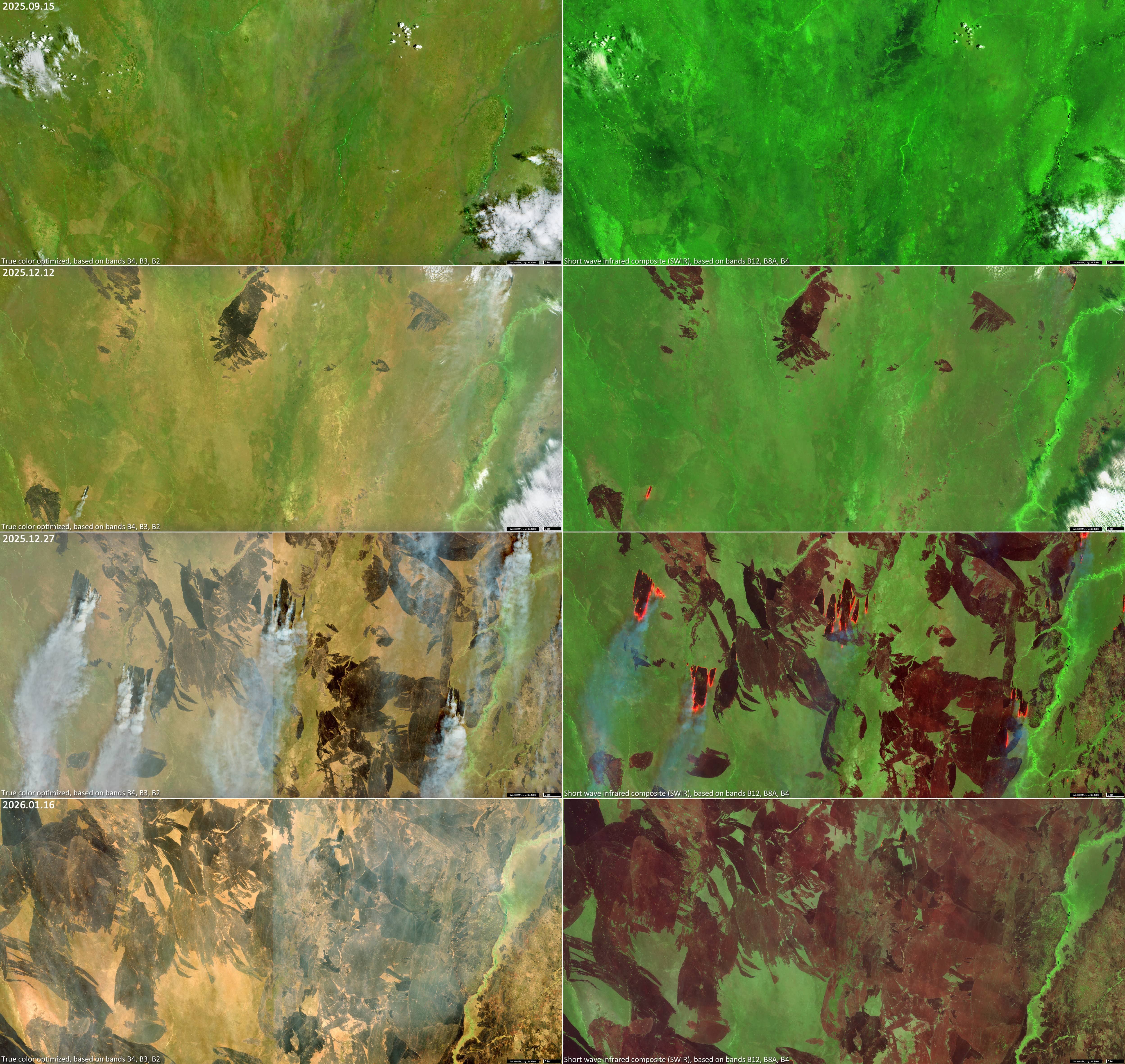
Fig. 6