Outflow Boundary over Sahara
Eastern Niger | Sahara
Dates of acquisition:
• 2025.08.04 | 08:58:43 UTC
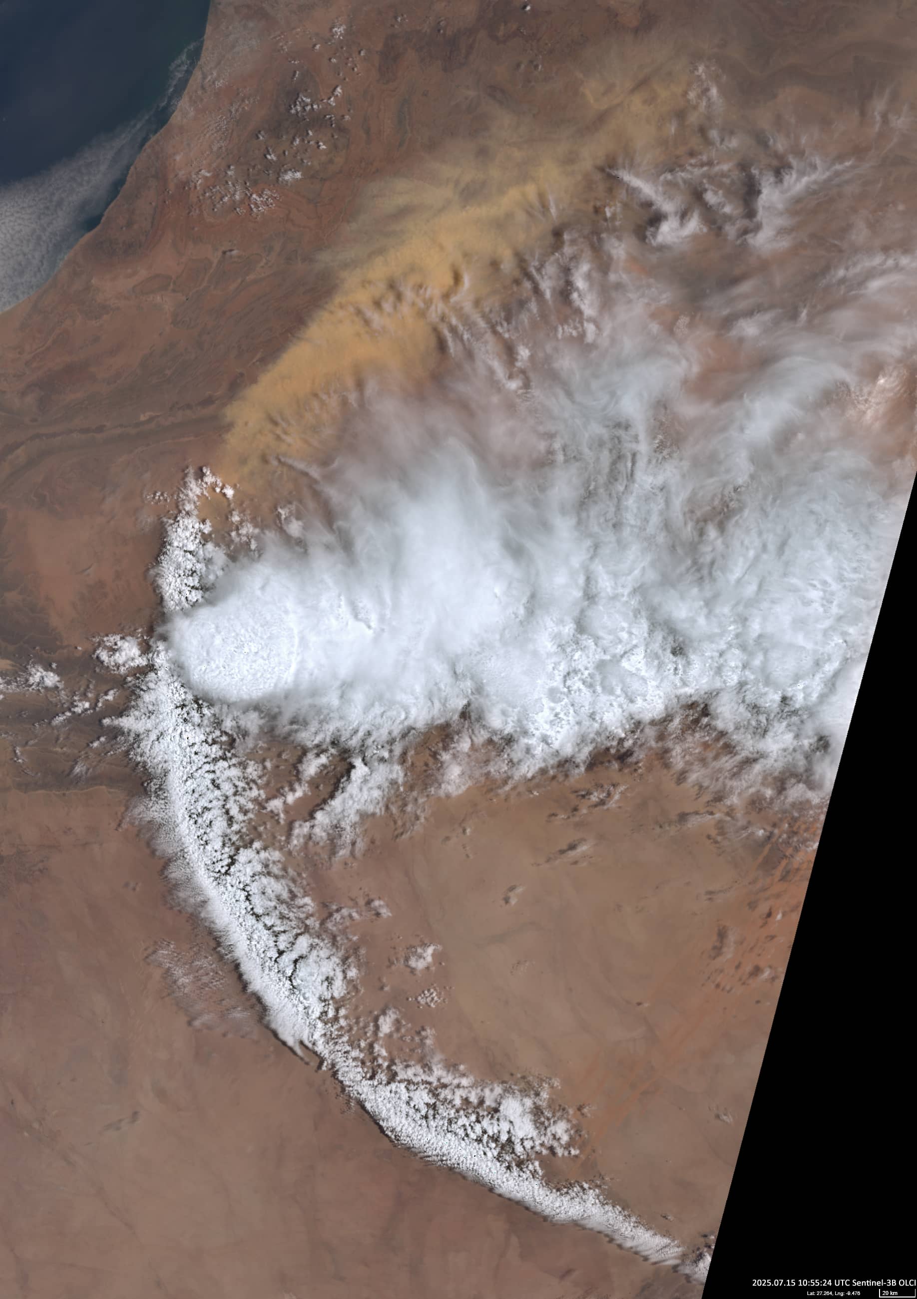
• 2025.07.15 | 10:55:24 UTC
Sensors: Sentinel-3B OLCI
Coordinates: ca. 18.6°N, 12.3°E
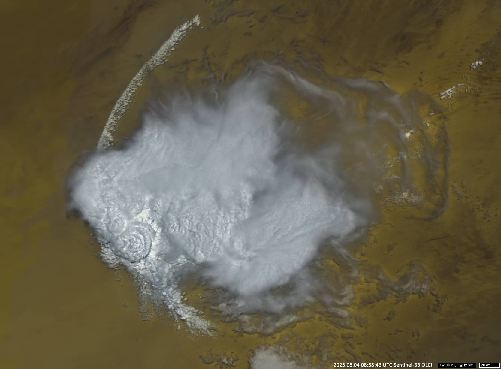
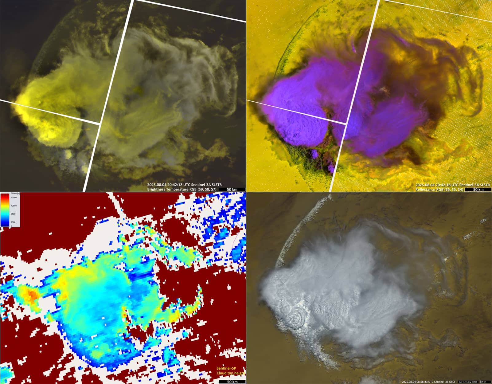
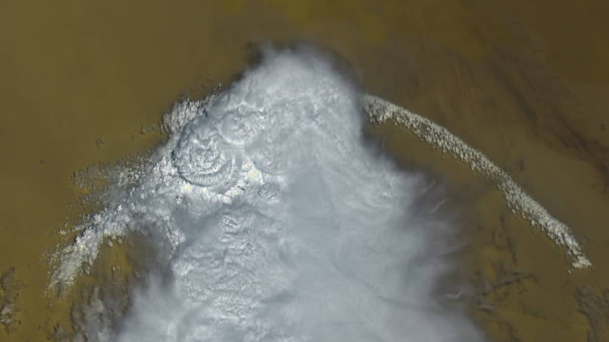
The Sentinel-2 image shows a complex of cloud structures over eastern Niger in the Sahara, consisting of a “mesoscale convective system” and the resulting “Outflow Boundary” cloud structure (see Figures 1a, 1b). The former covers an area of approximately 42000 km2 (almost the size of the Netherlands), while the length of the outflow boundary on both sides of the mesoscale system is around 380 km (slightly more than the distance from London to Amsterdam in a straight line).
A mesoscale convective system is usually associated with a low-pressure area and consists of thunderclouds that are significantly larger than a single thunderstorm. They typically last longer than a day. Consisting of convective clouds of varying sizes and at different stages of the development, they form over the tropics when the humidity and air temperature are sufficiently high to provide strong vertical currents.
Outflow boundary clouds form when a cold front wedges into a warm environment. The warm updraft cools and reverses direction, causing cold air to accumulate at the surface and form clouds. This relatively low layer of cold air moves forward, lifting warm, moist air that was heading toward the thunderstorm together with the convective system.. This results in in the formation of the typical arc- or crescent-shaped clouds. These clouds consist mainly of lower-level cumulus, stratus, and stratocumulus clouds, which have a relatively high albedo and an altitude of about 1 to 3 km.
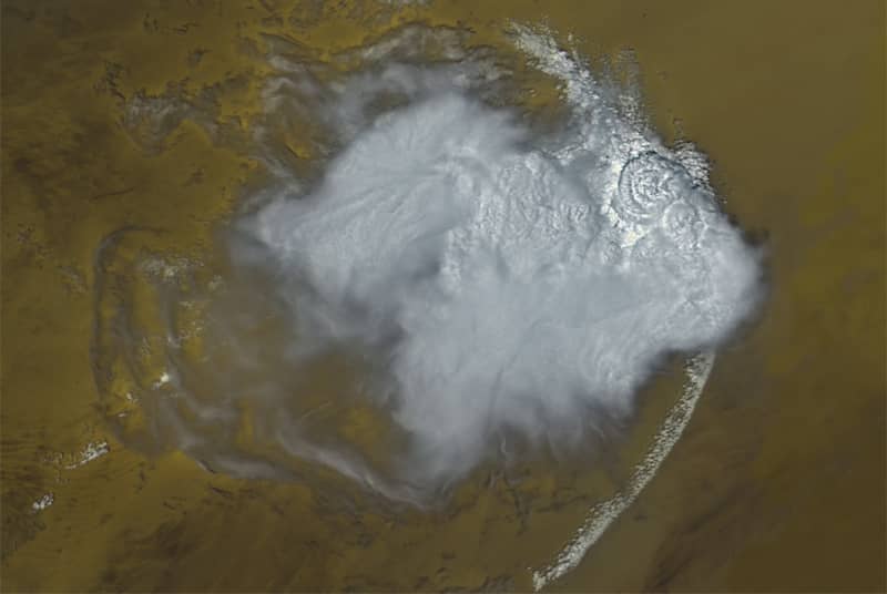
Incidentally, rotating the observer’s position by 180° (with south at the top and north at the bottom), the image looks very much like a fish (Figure 1c).
When outflow boundary conditions occur over arid areas, strong winds can whip up dust from the desert ground, creating a dust storm known as a haboob. For example, this happened, on 15 July 2025, when a strong haboob occurred over Western Sahara (see Figure 2). To the south of the mesoscale convective system, outflow boundary clouds can be seen, while a dust storm, or haboob, is clearly visible in the north, as a continuation of the arc.
Further reading
Outflow boundary (Wikipedia)
Haboob (Wikipedia)
An Outflow Boundary—Not a Jellyfish—Over Africa (NASA Visible Earth)
Outflow Boundary (Cloud Structures, Brockmann Consult)