Over the North Sea
North Sea between the UK and Denmark
Date of acquisition: March 20th, 2025 | 10:57:51 UTC
Sensor: Sentinel-2A L1C
Coordinates: ca. 55.1°N, 3.4°E
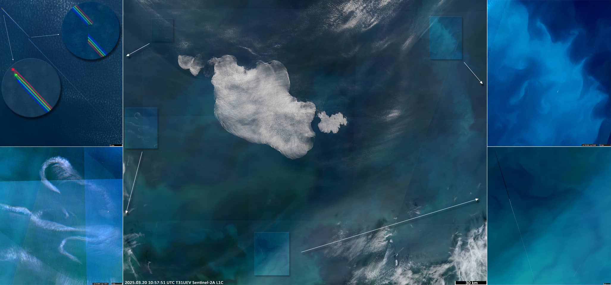
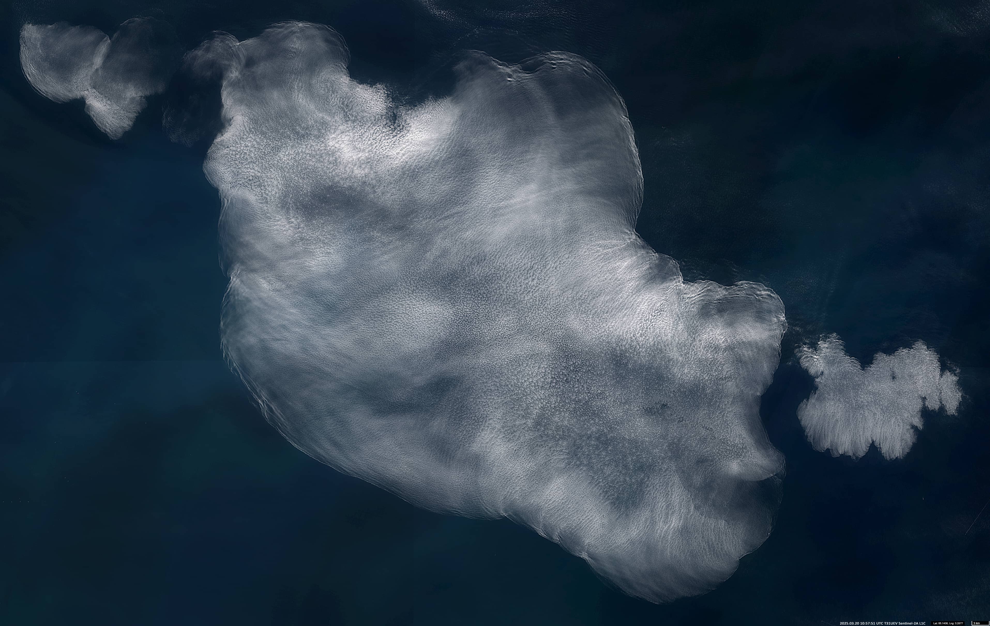
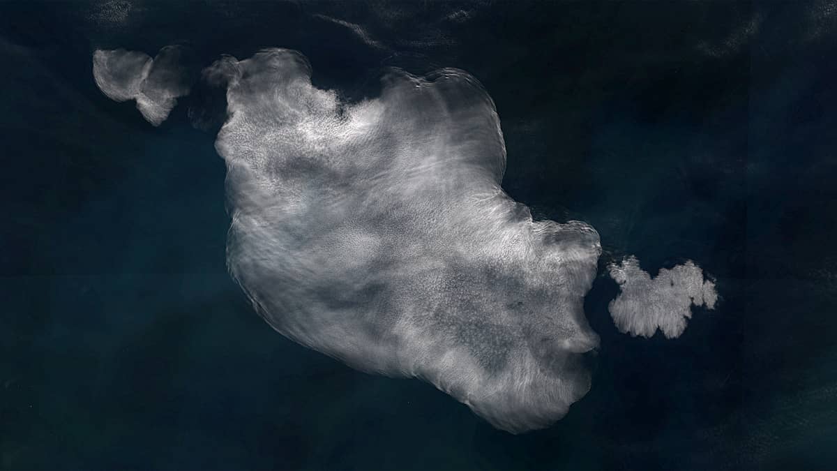
In the Sentinel-2 image from March 20, we can see a beautiful lace-like cloud located about 300 km north of the English Channel (Figures 1, 2). It flies over a flow of sediment from the Thames estuary spreadingeastward. Further east, fields of phytoplankton blooms can be seen. We also see two planes flying north and south of the cloud, and their contrails (a visible trail of condensed moisture in the air that forms in the atmosphere behind moving aircraft, Figures 1, 3.
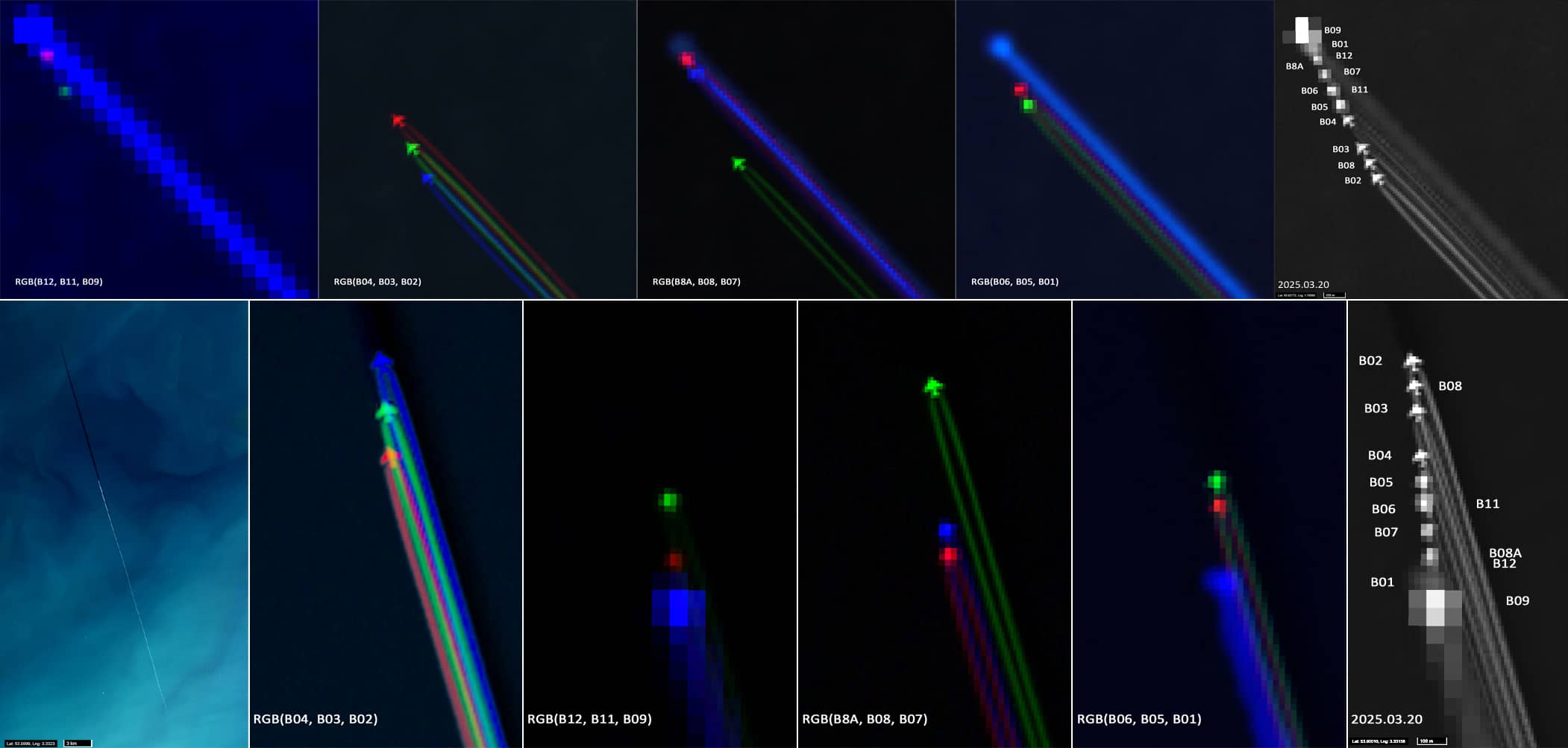
The images of these aircrafts provide an opportunity to briefly examine the design features of the imaging sensor on board the satellite.
The Multispectral Instrument (MSI) operates passively, collecting image data sets across a 290 km wide orbital swath using the translational motion of the satellite along its orbital path. Light reflected from the Earth’s surface and atmosphere is collected by a three-mirror telescope and split by a beam splitter that focuses itonto two separate focal planes within the instrument: one for ten wavelengths of the visible and near infrared (VNIR) and one for three wavelengths of the shortwave infrared (SWIR).
Due to the design of the detector arrangement on the focal planes, each spectral band of MSI observes the Earth’s surface at slightly different times, and parallax angles arise between the detectors, resulting in a spatial shift in the registration image of each spectral channel sensor.
The temporal offset between bands ranges from 0.030s (for B12/B8a) to 2.586s (for B09/B02). These shifts are corrected and removed using equalisation calculations.
However, this correction only works for stationary or relatively slow moving objects on the planet’s surface or in the atmosphere. For objects that change their position quickly, such as aircraft, this correction does not work.
Figure 3 shows two such cases.
The bottom row of pictures shows the images of the aircraft visible in different bands of Sentinel-2; the aircraft is located ~100 km south of the cloud. The difference in the position of the aircraft and the resolution of its image in the different bands (some bands provide different spatial resolution) is clearly visible.
Knowing the time delay (2.586s) and measuring the distance (~810m) between the images of the aircraft in bands B09 and B02, we can determine its speed; in this case, ~1100 km/h. And since we know the value of the solar zenith and the length of the contrail’s shadow, we can also determine the approximate altitude of the flight: 11.2 km. Both numbers are quite reasonable.
The top row of Figure 3 shows an image of an airplane about 40 km northwest of the cloud. The arrangement of the channels appears here in reverse order. This is also seen in the reversal of the contrail arrangement in Figure 1, top left.