
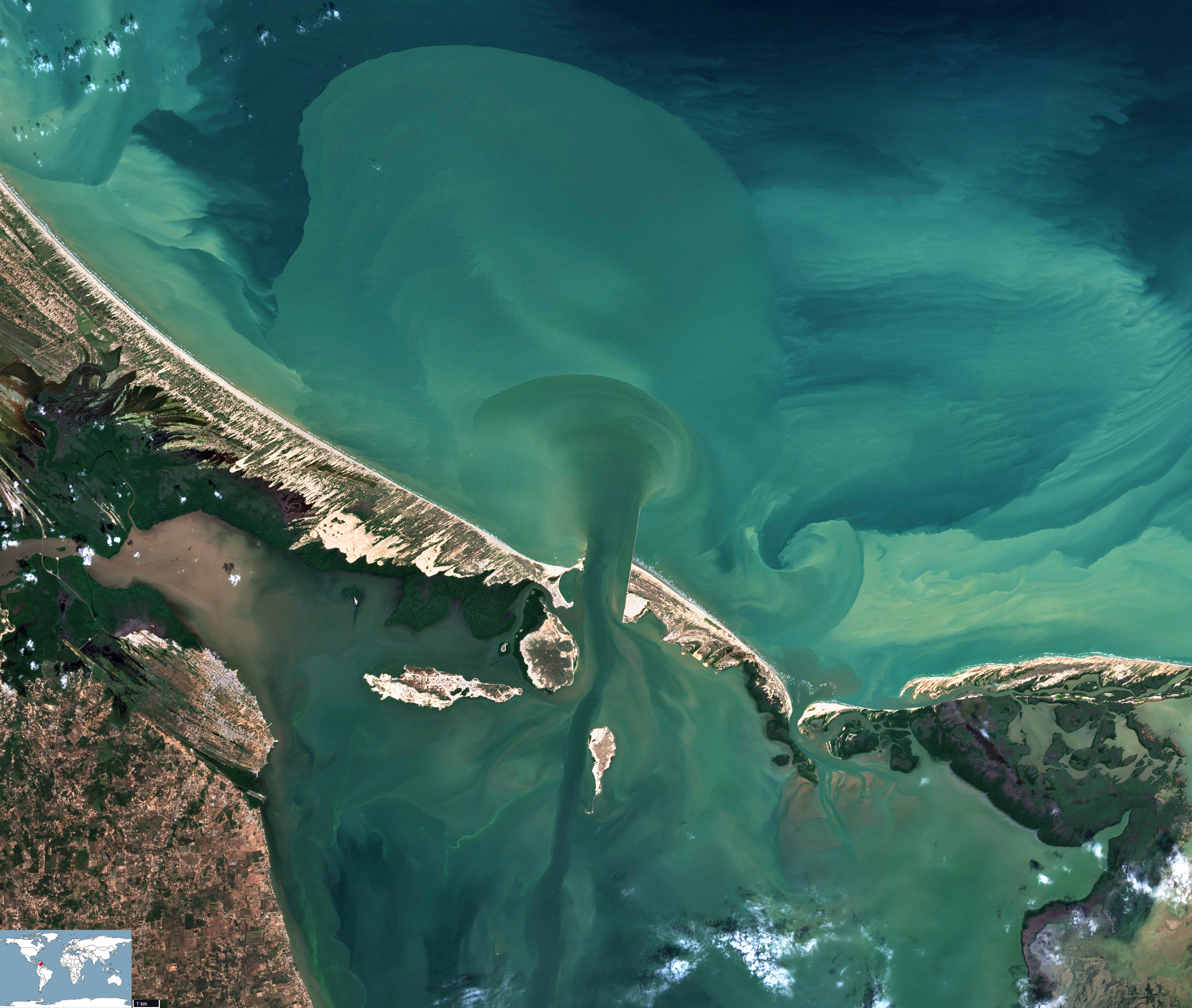
Lake Maracaibo
Canal de San Carlos | Gulf of Venezuela
Date of acquisition: January 15th, 2021 | 15:19:56 UTC
Sensor: Sentinel-2 L2A
Coordinates: ca. 11.05°N, 71.6°W
The “ejection” of waters with suspended sediment and dissolved organic material from Lake Maracaibo through the narrow neck of Canal de San Carlos into the Gulf of Venezuela can be usually observed at spring tide (ebb). Such a blowout into the not yet vanished waters of the previous ejection, which took place two weeks ago, can be observed in this image acquired on January 15th, 2021. Freshly running water masses from the river seem to “push” the old ones, and a sharp frontal boundary is visible at the line of their contact.
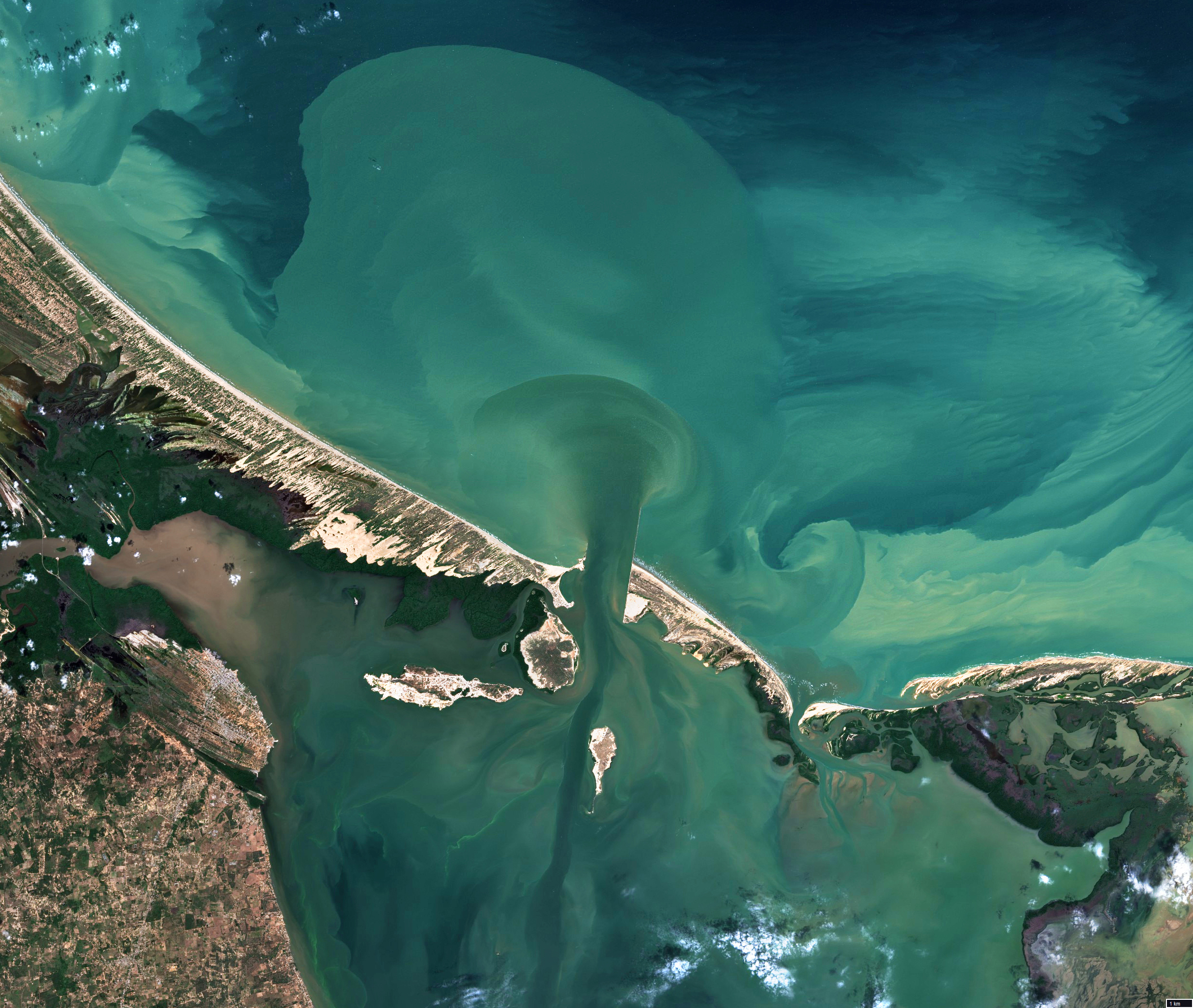
Images contain modified Copernicus Sentinel data [2021].