Phytoplankton bloom around Chatham Island
Chatham Islands | South Pacific Ocean
Dates of acquisition:
• January 10th, 2026 | 21:16:51 UTC
• January 10th, 2026 | 21:47:49 UTC
Sensor: Sentinel-3A OLCI, Sentinel-2B L2A
Coordinates: ca. 44°S, 176.5°W
After January 10, numerous online resources covering satellite remote sensing reported an intense phytoplankton bloom around New Zealand’s Chatham Island. These resources referred to an image captured by the VIIRS instrument on board the NOAA-20 satellite and published by NASA.
However, the Sentinel-3 OLCI sensor also captured this ring-shaped structure when it flew over the area about an hour and a half earlier, while it was still partially obscured by clouds from the south.
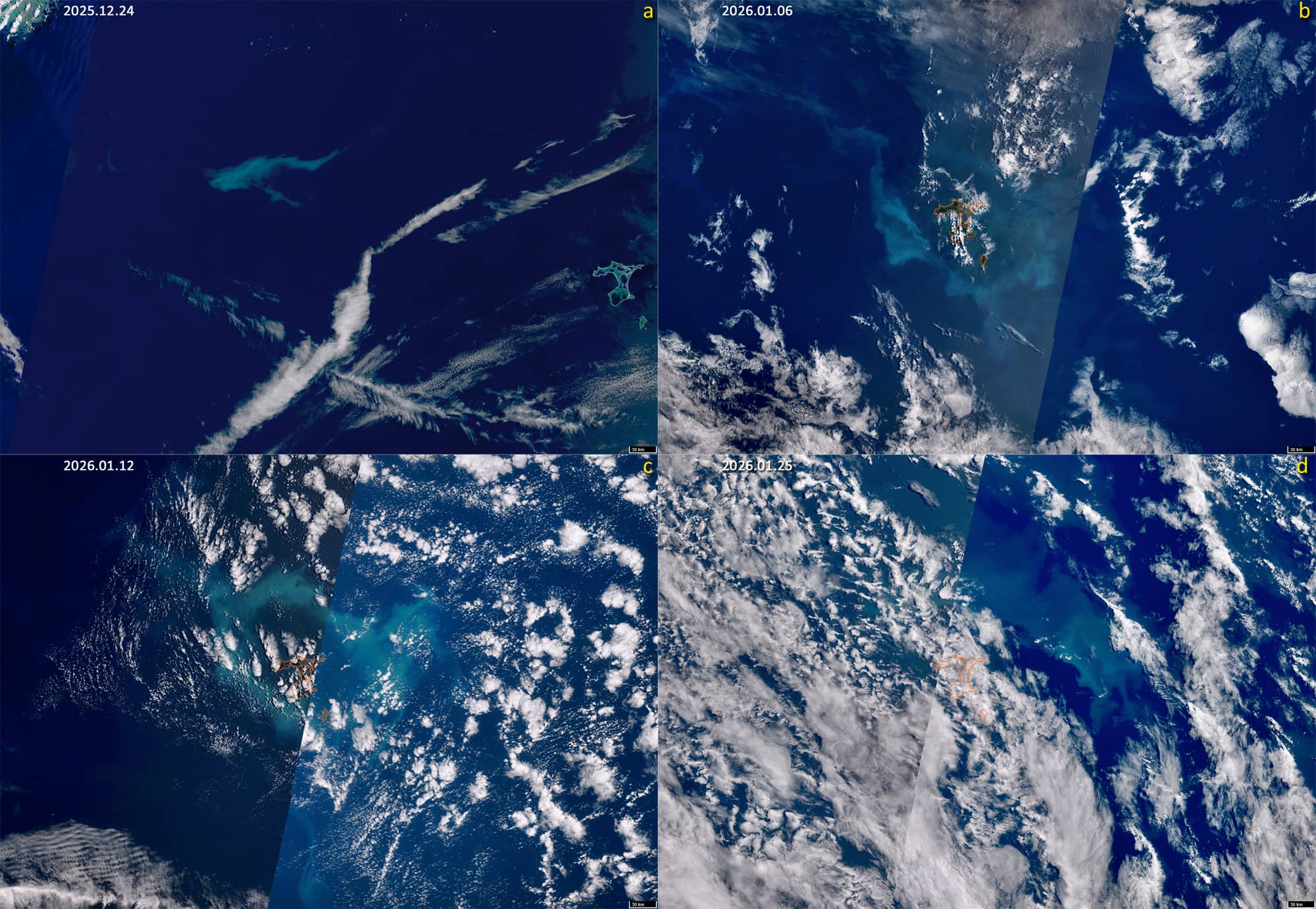
The phytoplankton bloom east of New Zealand typically occurs at southern hemisphere late spring to early summer. During the second half of December 2025, an intense phytoplankton bloom was observed near 42.8°S, 178.5°E, around 400 km east of Chatham Island and 280 km east of the North Island of New Zealand (Figure 3 a).
This location is above the Chatham Rise, a broad, relatively shallow underwater mountain range extending eastward from New Zealand.
The Chatham Islands are a small volcanic archipelago also located on the Chatham Rise. Chatham Island is the largest of the islands. The productivity of the surrounding oceans is strongly influenced by the seabed’s topography and the associated circulation patterns. The water depth to the north and south of the plateau is significantly larger. To the north, warm subtropical waters prevail, which are characterized by low concentrations of macronutrients but a relatively high iron content. To the south, cold Antarctic waters flow in the same general direction, rich in macronutrients but low in iron.
The interaction between the cold, nutrient-rich deep water and the warmer surface water above the plateau creates a combined water mass that provides both macronutrients and bio-available iron. The combination of this nutrient regime and extended summer photoperiods creates favourable conditions for increased phytoplankton growth around the Chatham Islands.
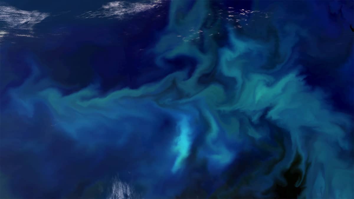
Such blooms occur almost annually, with their intensity varying from year to year. Particularly strong blooms were observed in the 2019-20, 2022, and 2024-25 seasons. In the current 2025-26 season, the bloom reached its highest intensity in at least a decade, corresponding to the operational period of the Sentinel-3 satellite mission. On 10 January 2026, atmospheric conditions permitted imaging, revealing the bloom as an elliptical ring surrounding the island, with major and minor axes of approximately 200 km and 120 km, respectively (Figure 1). On the same day, Sentinel-2 sensors imaged part of this structure (Figure 2), revealing its internal spatial structure in detail.
Overall, the phase of highest bloom intensity lasted for approximately three weeks (from 6 January until the start of the third ten-day period of the month), after which the bloom weakened and drifted eastward (Figure 3 b, c, d).
Further reading
Chatham Islands – Phytoplankton Bloom on the Chatham Rise (Clarity UPSC)
Bloom around the Chatham Islands, New Zealand (NASA Science)
Blooming Seas Around the Chatham Islands (NASA Science)
Phytoplankton Bloom Over Chatham Rise, South Pacific (NASA Science)
Ocean currents and tides (The Encyclopedia of New Zealand)