
Hayli Gubbi Eruption
Afar Region | Ethiopia
• 2025.06.16 | 07:36:31 UTC
• 2025.07.21 | 07:36:19 UTC
• 2025.12.08 | 07:42:19 UTC
Sensor: Sentinel-2B, C L2A
Coordinates: ca. 13.51°N, 40.7164°E
Haili-Gubbi (Amharic: ሃይሊ-ጉቢ) is a shield volcano located in Ethiopia’s Afar Region. As of November 2025, there were no known records of eruptions of this volcano during the Holocene. Anyway, the volcano has been insufficiently researched.
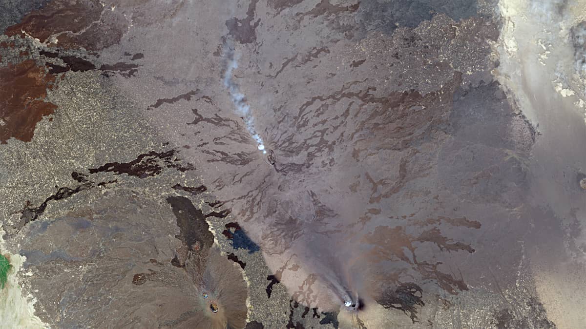
On 15 July 2025, the Erta Ale volcano, located just over 12 kilometres northwest of Haili-Gubbi, experienced a significant eruption. This eruption was characterized by explosive activity, crater collapse, and lava flow. Analysis of geological data and numerical modelling suggests that this event contributed to the formation of an underground channel — an intrusive body, or magma-filled dyke — through which lava of the Erta Ale volcano flowed southeast towards Haili-Gubbi. This process is interpreted as having created a magmatic connection between Erta Ale and Haili-Gubbi. The Sentinel-2 image taken on 7 August shows hot lava and lava flows erupting already 6 km from the Haili Gubbi crater (see Figure 1, Animation).
Until this event, no visible activity that could be detected by remote sensing methods was observed at the Haili-Gubbi crater. An analysis of Sentinel-2 satellite images taken over a nine year period (2017–2025; >500 observations) shows that the crater remained dormant throughout this time (illustrated by Figure 2). The first signs of change in the behaviour of Haili-Gubbi crater were observed on 26 July 2025, when a cloud of gas and steam covered the interior of the crater floor and became visible from space. Subsequently, the crater alternately filled with volcanic emissions and then appeared to be free of them again.
From 26 July to mid-September, gas and steam emissions were clearly visible. They ceased during the last week of September. They then became active again until 8 November, ceased for a week and then continued until the eruption of Haili-Gubbi.
Figure 3 shows a sequence of phases during which the crater filled with gas. Initially, the crater was only partially filled with gas and steam. However, as the moment of eruption approached, this increased significantly. On the day of the eruption (the Sentinel-2 image was taken at about 07:55 UTC, roughly 40 minutes before the eruption began), the crater of Haili-Gubbi had completely cleared. It is assumed that rising magma blocked the existing degassing pathways.
The eruption began between 08:30 and 08:40 UTC (Figure 4, animation**) and was possibly triggered by a phreatic or phreatomagmatic explosion, which occurs when magma heats groundwater or surface water. This intense but short-lived eruption corresponds to Plinian volcanic activity — the most energetic class of volcanic activity — and produced an ash cloud up to 14 km high. As a result of the eruption, two smaller craters formed southeast of the main crater (Figure 5b).
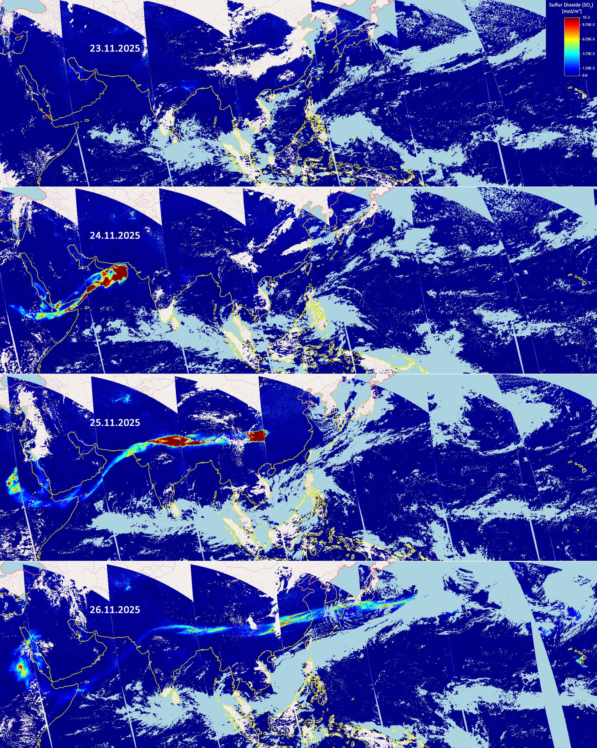
Images from Sentinel-5 show that the SO₂ cloud spread around 19,000 km eastwards over three days (see Figure 6). This is almost half the circumference of the Earth at the equator.
The explosive phase ended by 20:00 UTC on the same day, and volcanic activity at Haili-Gubbi had subsided by 25 November.
Fig. 1
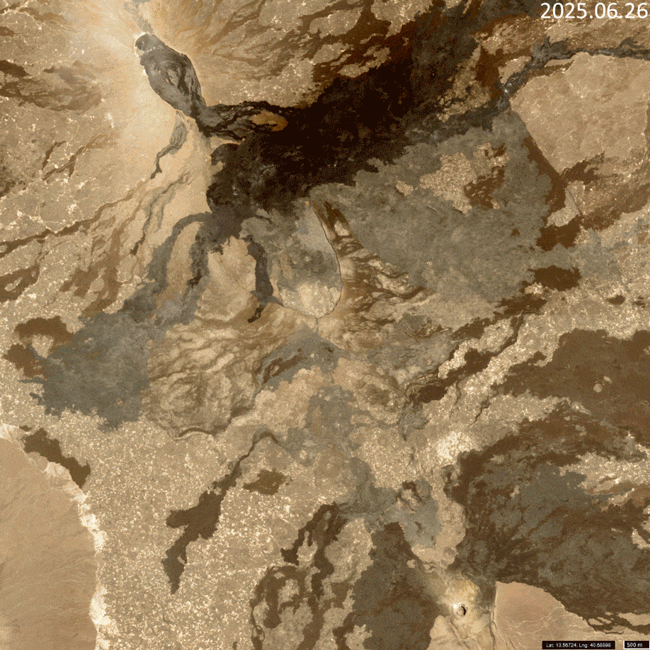
Fig. 2
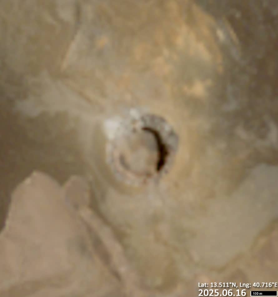
Fig. 3
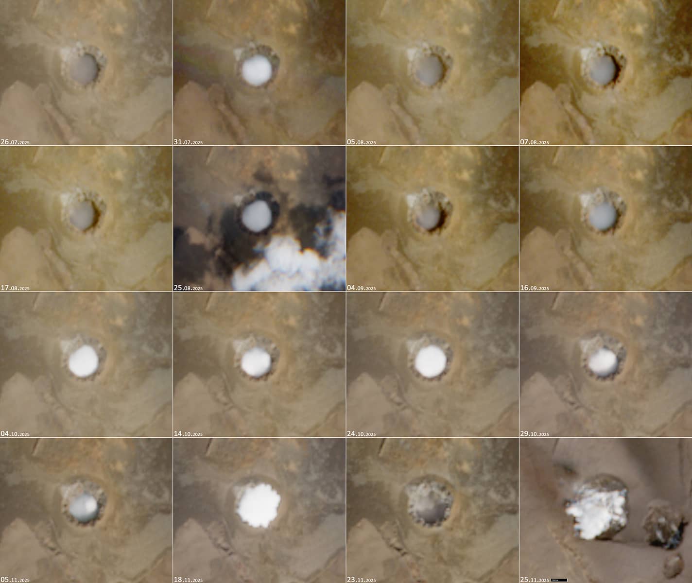
Fig. 4
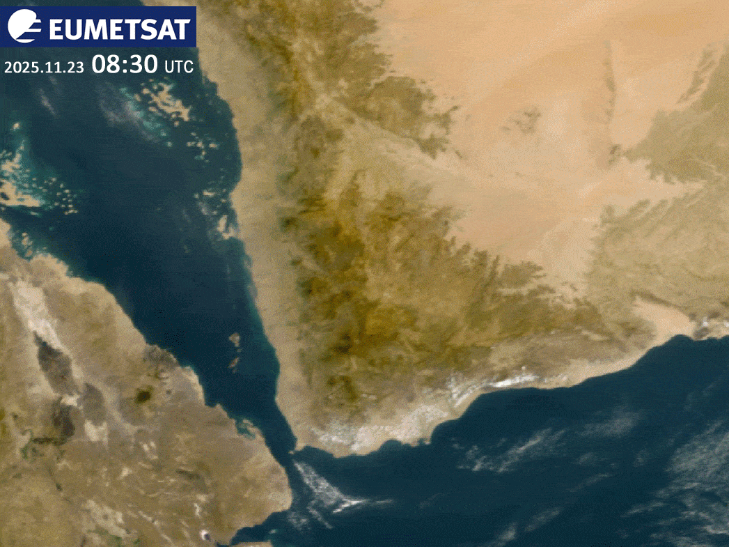
Fig. 5
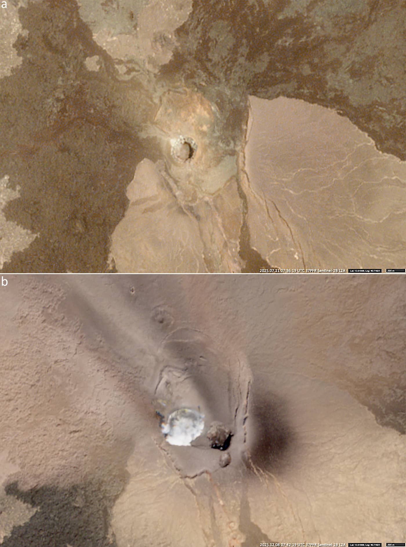
Fig. 6
Contains modified EUMETSAT data [2025].