Wyoming Sand Dunes
Wyoming | USA
Date of acquisition: September 5th, 2025 | 17:59:09 UTC
Sensor: Sentinel-2B L2A
Coordinates: ca. 41.982°N, 109.078°W
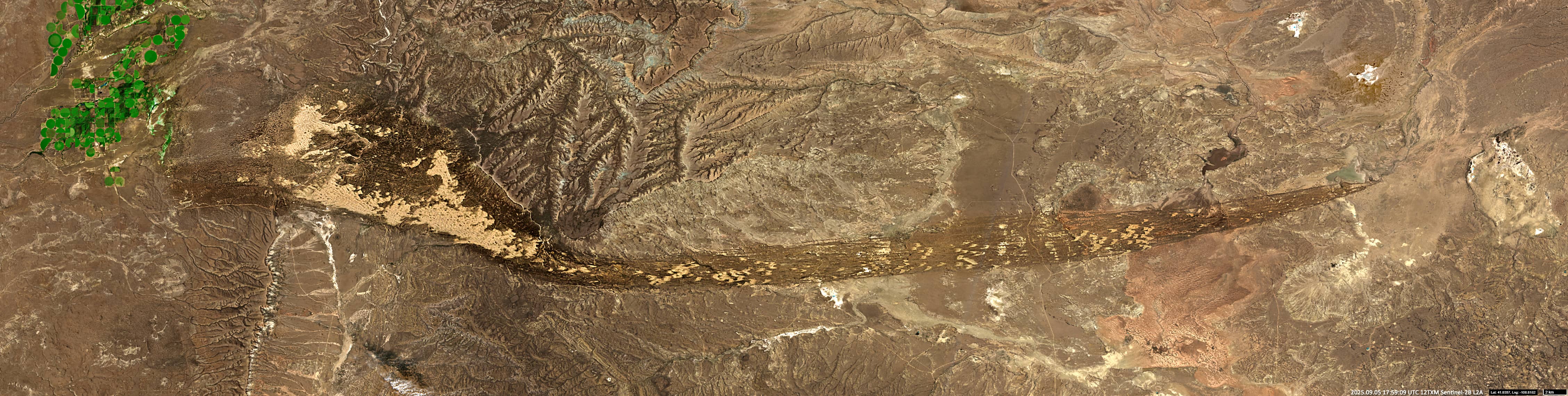
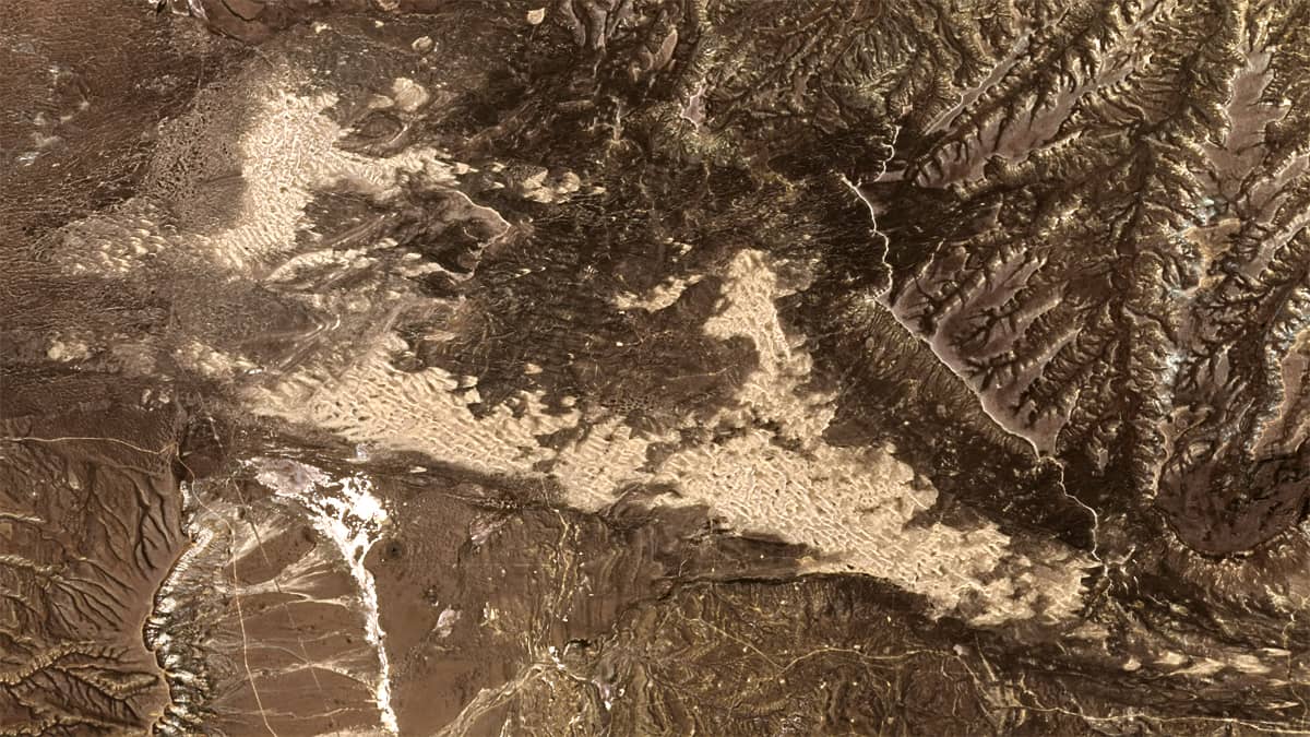
To the southwest of the Wind River Range (part of the Rocky Mountains) in the U.S. state of Wyoming, lies a long, narrow arc-shaped band of low sand dunes stretching 100 kilometres from east to west.
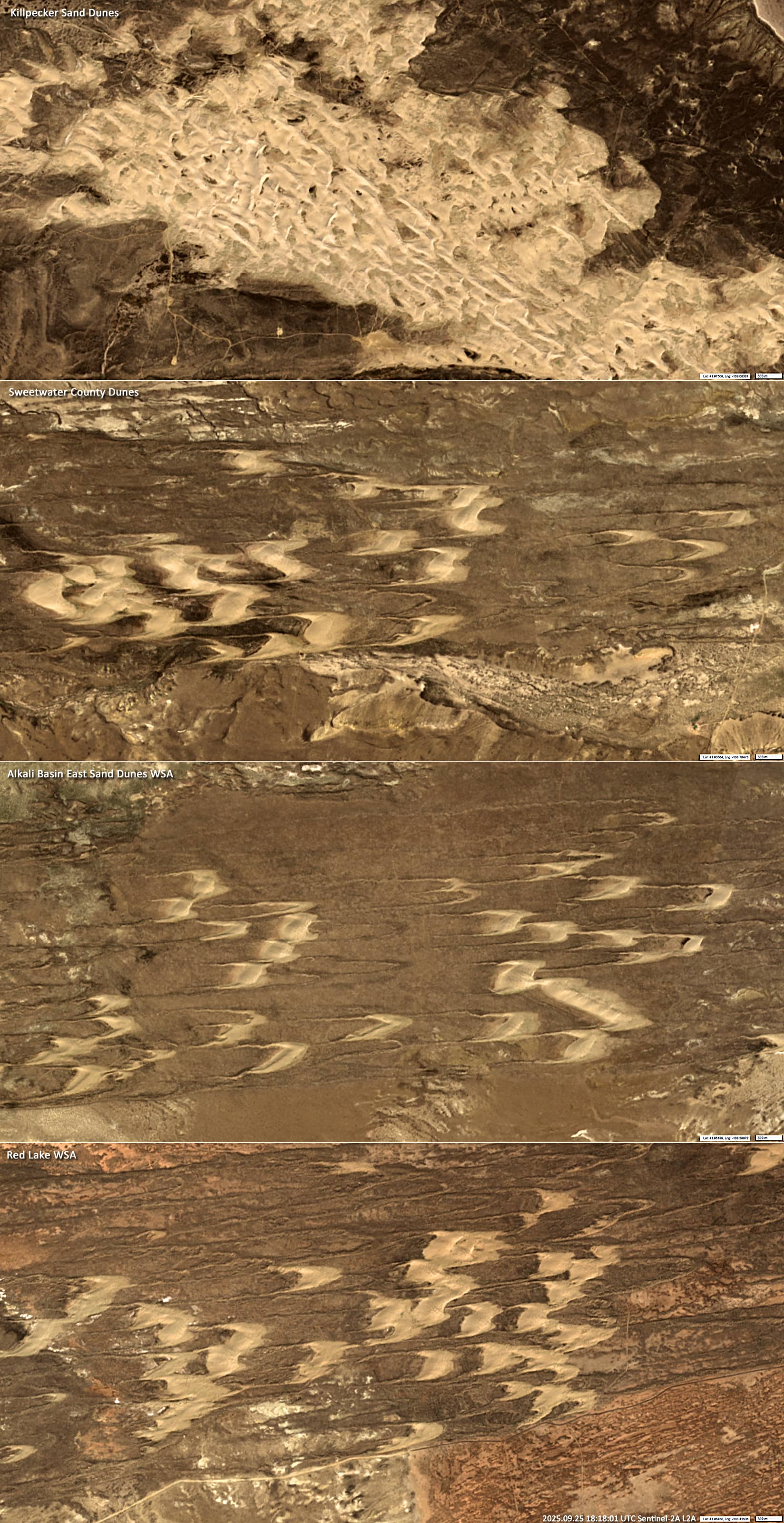
This band is divided into the following areas from east to west: Little Sand Dunes, the Red Lake Wilderness Study Area (WSA), the Alkali Basin East Sand Dunes WSA, the Killpecker Sand Dunes, and the Buffalo Hump WSA. WSAs comprise undeveloped areas that have retained their original character and natural conditions without significant human influence.
The dunes are generally unidirectional due to the region’s prevailing westerly and south-westerly winds and do not exceed a height of 45 meters. Some of these dunes are active, while others are dormant (stabilised).
The dune belt is estimated to be around 20,000 years old. During the Quaternary period, the climate changed frequently, alternating between dry and wet conditions. Prevailing westerly winds eroded sections of the banks of a river that flowed through this area, forming the sand dunes.
The Sentinel-2 images presented in this article show the entire dune strip (Figure 1), as well as some detailed sections (Figure 2).
Further reading
East Sand Dunes WSA | Wyoming (Bureau of Land Management)
Killpecker Sand Dunes Open Play Area Campground (Bureau of Land Management)
Killpecker Sand Dunes Open Play Area | Wyoming (Bureau of Land Management)
A guide to the Killpecker Sand Dunes in Wyoming (Travel Wyoming)
Red Desert (Wyoming) (Wikipedia)