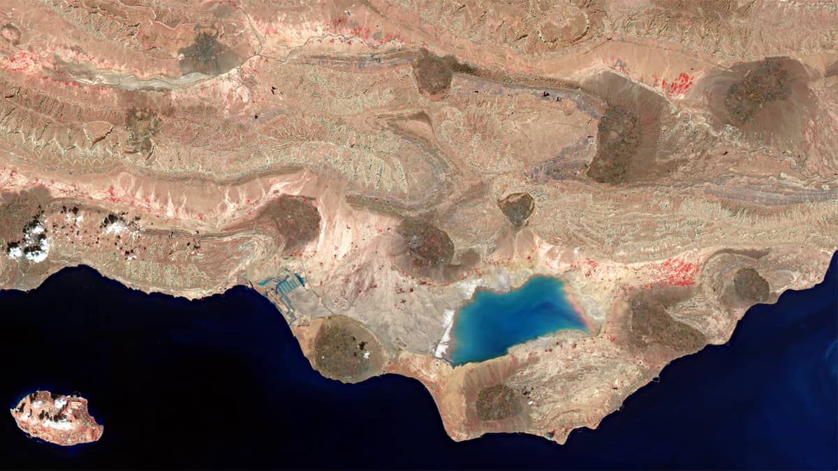
Lake Shūrehzār-e Mehragān
Hormozgan Province | Southern Iran
Dates of acquisition:
- October 6th, 2025 | 20:03:31 UTC
- July 28th, 2025 | 19:59:21 UTC
Sensor: Sentinel-2C L2A
Coordinates: ca. 68.5°N, 119.4°W
The Iranian salt lake, Shūrehzār-e Mehragān (شوره زار مهرگان), is located in Hormozgan Province in the Bandar Lengeh administrative district (بندرلنگه), along the northern coast of the Persian Gulf in a coastal desert strip. The lake usually completely dries up in summer and is episodically replenished after heavy autumn and winter rainfall, which does not occur every year.
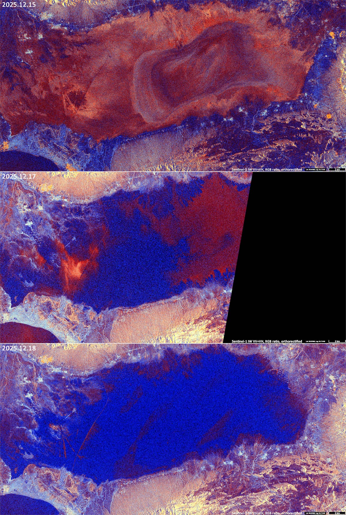
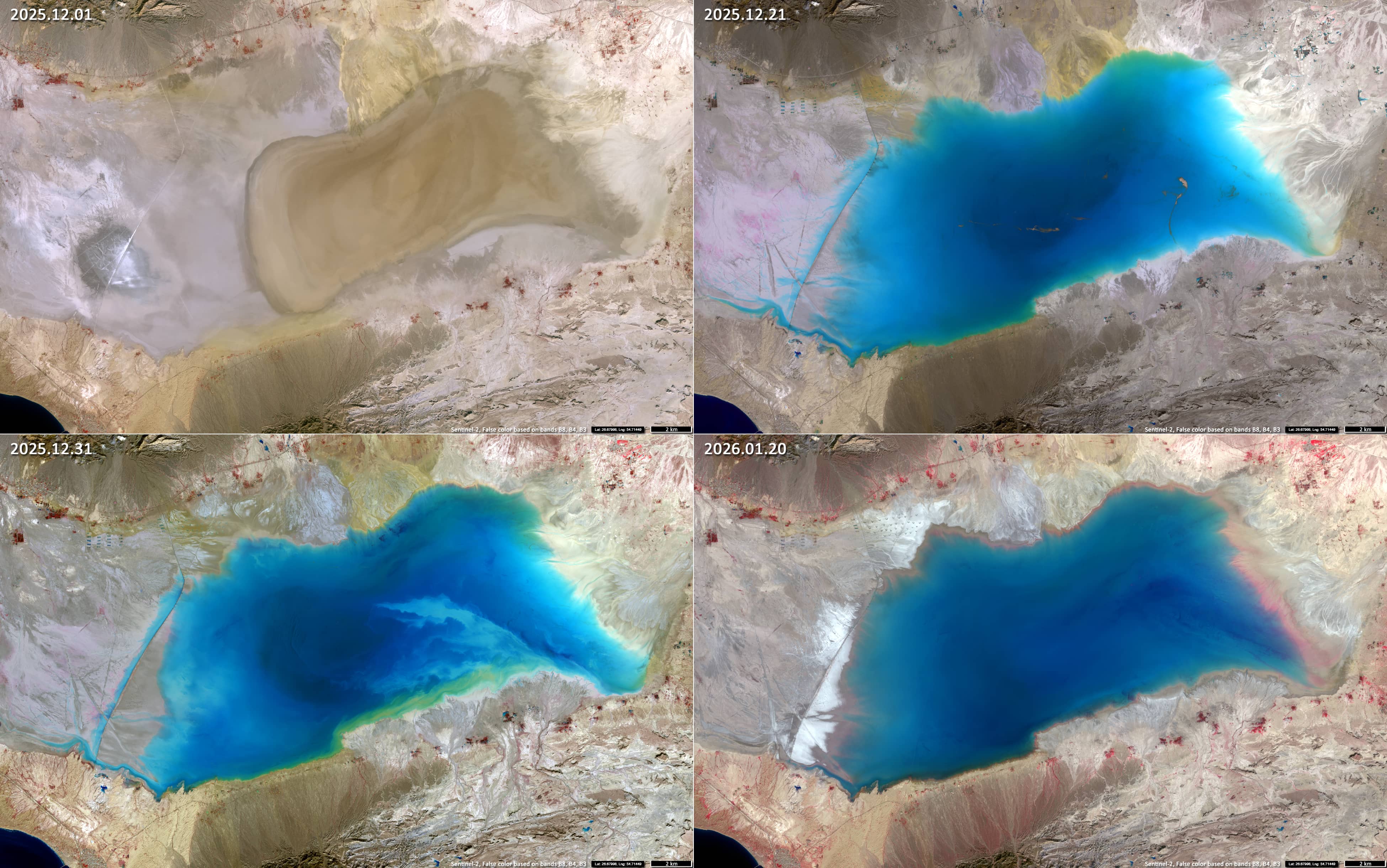
During the 2025-2026 hydrological season, the lake overflowed on 16 and 17 December 2025, following heavy rainfall accompanied by southwesterly moisture transport from the Persian Gulf (see Sentinel-1 image in Figure 1). The Sentinel-2 image taken on 21 December (Figure 2) show the lake after the clouds had cleared. At this point, the water surface area had expanded to approximately 190-200 km².
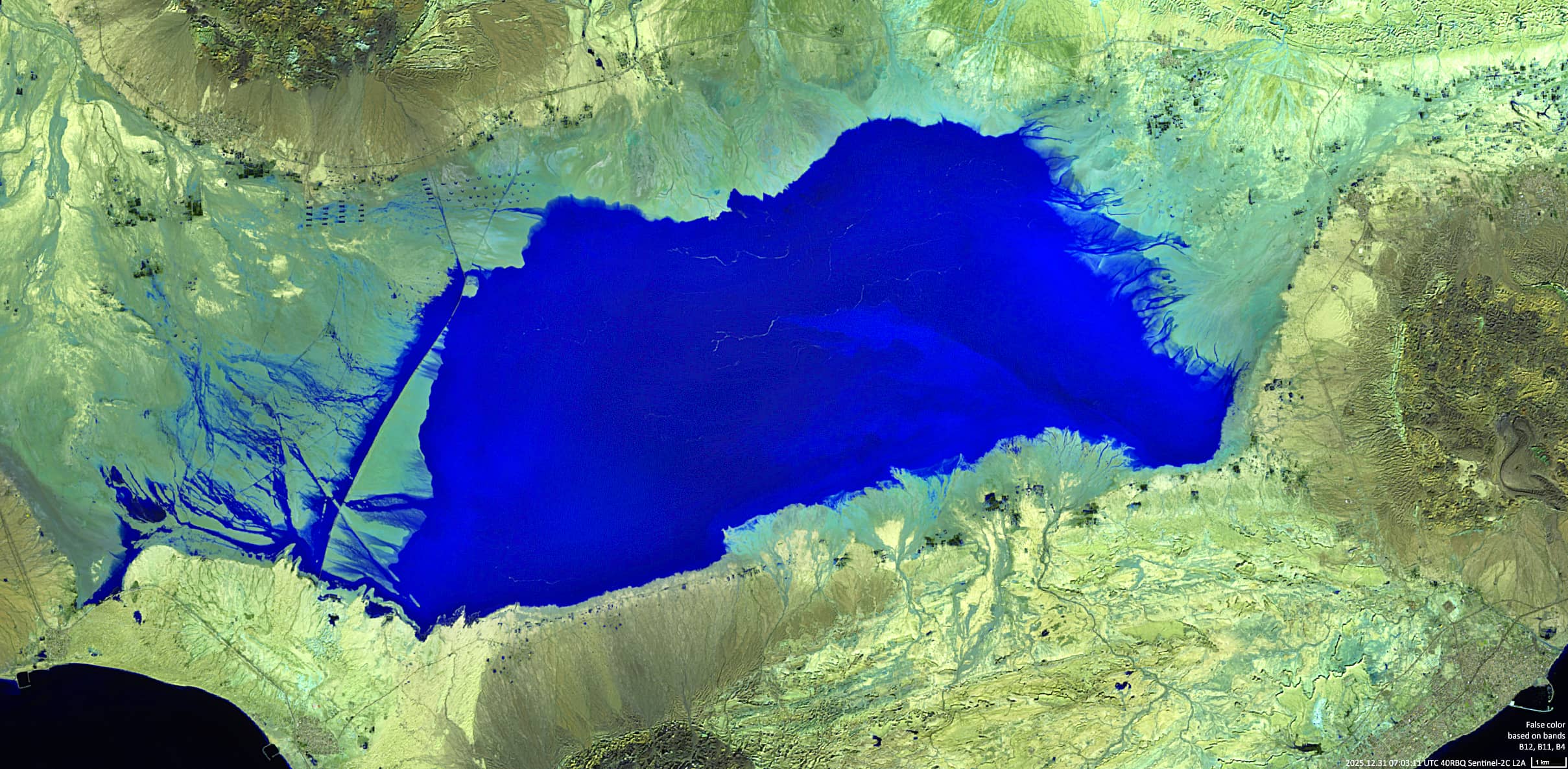
The near-infrared spectral range allows for a better assessment of the situation and, in particular, shows the rapid development of an algae bloom in a recently flooded basin. Analysis of the false-color composite (B12, B11, B04), which enhance discrimination of moist substrates (Figure 4), shows that the total wetted area reached around 230 km² by 31 December.
Over the past two years, the maximum extent of the lake has been significantly smaller. The largest expansions of Shūrehzār-e Mehragān over the last ten years were recorden in 2016, 2023, and the current season. On 20 January 2026, approximately one month after the flooding began, the size of the flooded basin remained roughly the same.
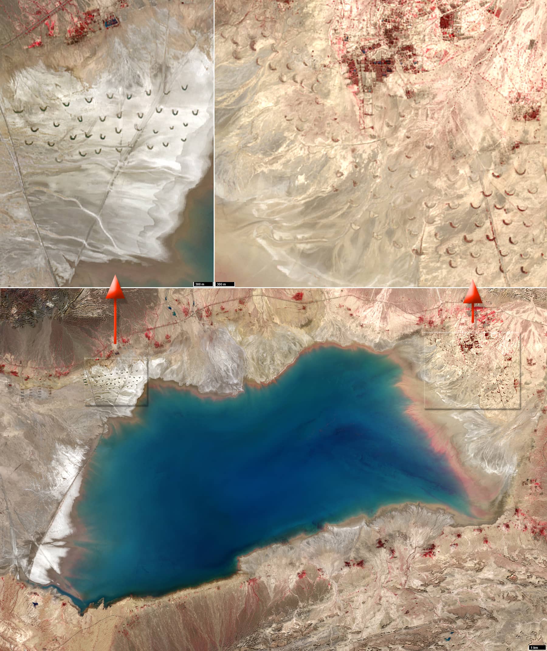
Crescent (or sickle) -shaped anthropogenic structures, which are probably related to the cultivation of agricultural land, can be found along the north-western and north-eastern edges of the lake (see Figure 3).
More than 80 structures located east of the lake, south of the Mehregan palm grove (نخلستان مهرگان) and Mehrkan caravanserai (کاروان سرای مهرکان), are identical regular semicircular structures with a diameter of 150±5 m have been identified (“east” site). These features were already present in 2016.
In contrast, the structures west of the lake were built at the end of October 2020, with 36 units erected within a period of around two weeks. These structures exhibit substantial morphological variability (“West” site), suggesting less systematic building practices.
Further reading
NG_40-5_Bandar-e_Lengeh,_Iran.jpg (Map)
“East” site (Google Earth)
“West” site (Google Earth)