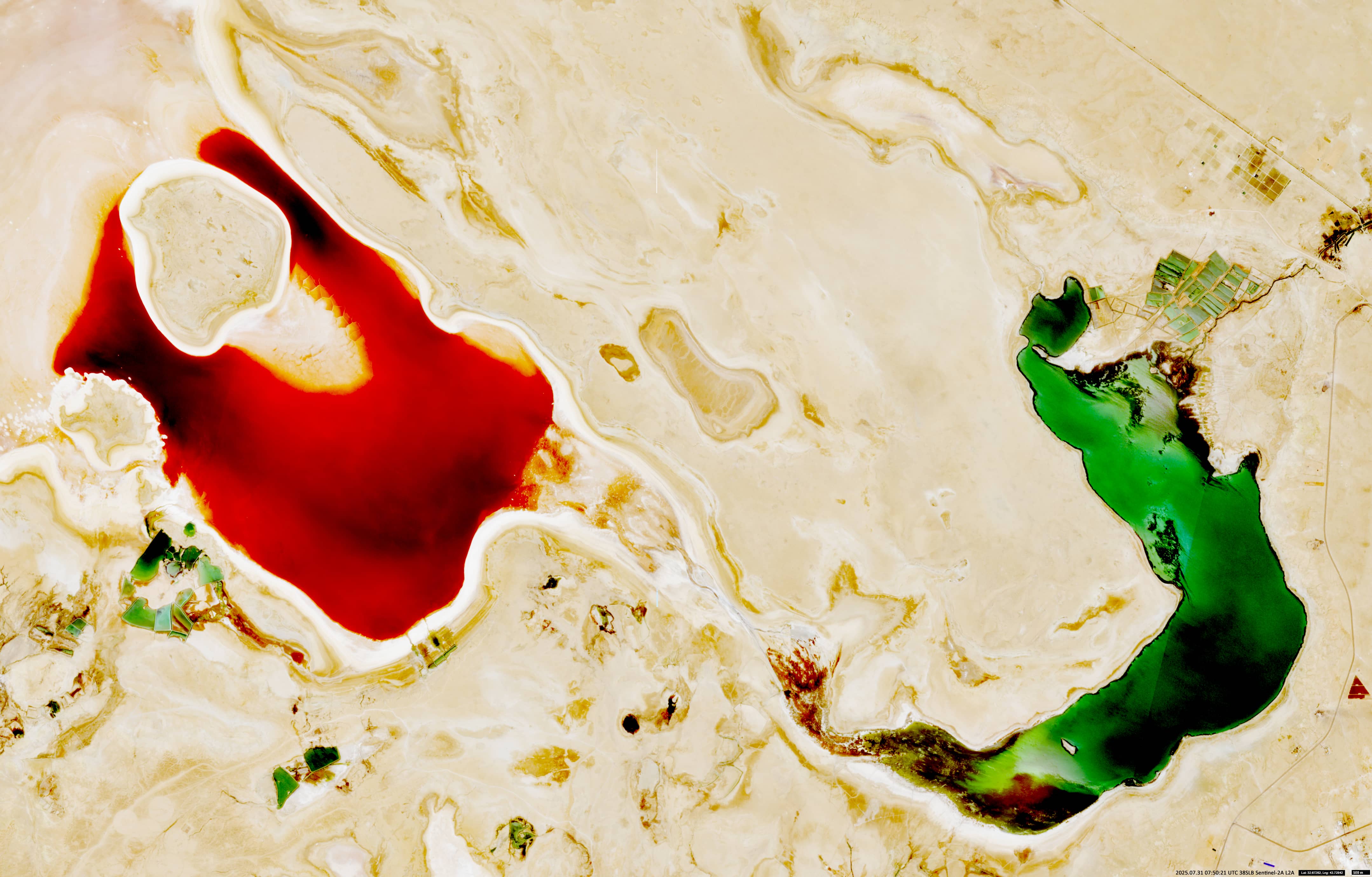
Lake Razzaza
Central Iraq
Dates of acquisition:
• 2025.07.31 | 07:50:21 UTC
• 2018.09.04 | 07:46:11 UTC
etc. (animation)
Sensors: Sentinel-2A L2A
Coordinates: ca. 32.76°N, 43.61°E
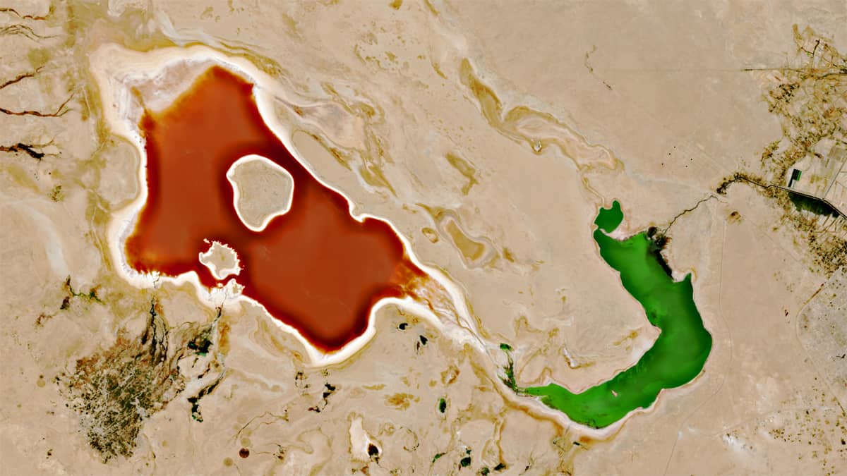
The Sentinel-2 image shows the remains of Lake Razzaza (also known as بحيرة ملح Baḩr al-Milḩ (“Salt Sea” in Arabic)), an artificial lake created around 55 years ago and located near the Iraqi city of Karbalā’ (كربلاء). Lake Razzaza lies in a depression that drains excess water from Lake Habbaniyah (بحيرة الحبانية) and covers an area of around 1,560 km².
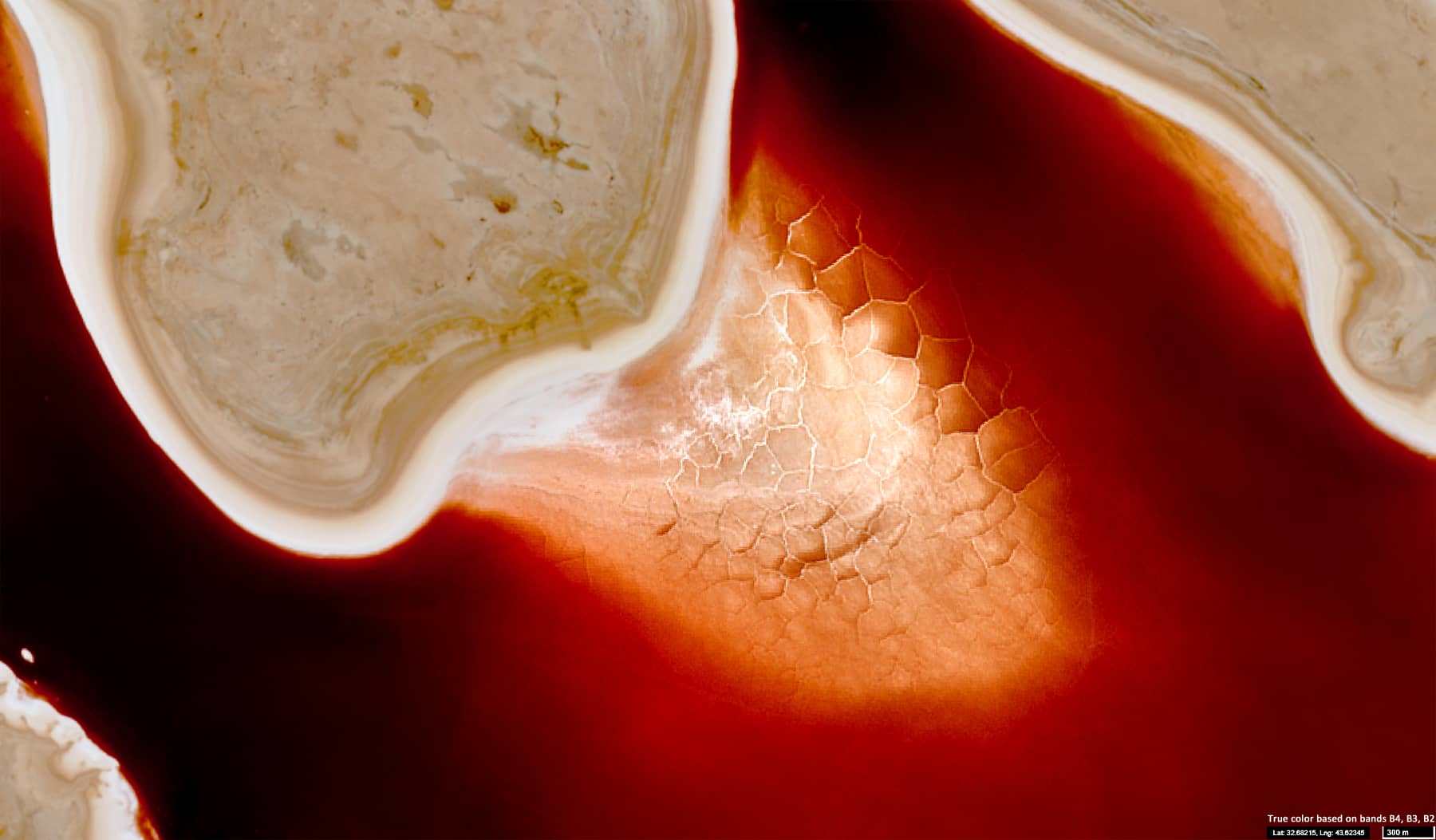
At different times of the year, the lake takes on emerald–green, ruby–red, or yellow colour. This is a rather rare phenomenon on our planet.
The lake’s water is characterised by the total amount of dissolved salts, mainly chlorides (Cl⁻) and sulphates (SO₄²⁻). The difference in water colour is due to the variety of algae that grow in the lake, which depends on the temperature and salinity of the water. Green areas have lower salt concentrations than red areas. During periods when the lake does not receive water from Lake Habbaniyah, much of the Razzaza bed is exposed, revealing the yellowish sand and silt.
We also present an animation showing how the shape and colour of the lake have changed from early 2023 to the present day. You can see how these characteristics vary depending on the season.
Further reading
Razzaza-See (Wikipedia, German)
Lake_Milh (Wikipedia, English)
A shrinking oasis shaped by salinity (Earth.com)
Hydrochemistry of Razaza Lake (Journal of Environment and Earth Science, PDF)